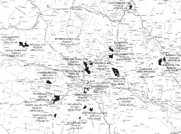
MAPs OF BALLARAT REGION SHOWING HANCOCK and PRIVATELY OWNED HARDWOOD AND SOFTWOOD PLANTATIONS.
HANCOCK PLANTATIONS WERE ESTABLISHED BY THE STATE GOVERNMENT OF VICTORIA, WHO THEN CORPORATISED THEM WITH THE ESTABLISHEMENT OF THE VICTORIAN PLANTATIONS CORPORATION IN 1993. THE PLANTATIONS WERE EFFECTIVELY PRIVATISED WHEN HANCOCK GAINED THE RIGHTS TO LOG THE PLANTATIONS UNDER A 99 YEAR LEASEHOLD AGREEMENT STARTING IN 1998. THE HARDWOOD PLANTATIONS HAVE BEEN ESTABLISHED BY MACQUARIE BANK, PRIMARY YIELD (AMONGST OTHERS).
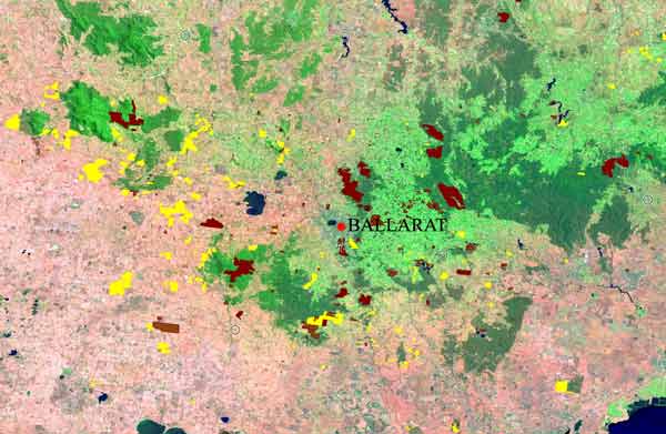
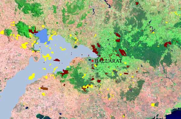
Ballarat Region Plantations: Yellow = hardwood (planted mostly since 1996). Brown = Pinus Radiata. Hancock pine are generally the larger plantations. Most new hardwood has been targeting land west of Ballarat.
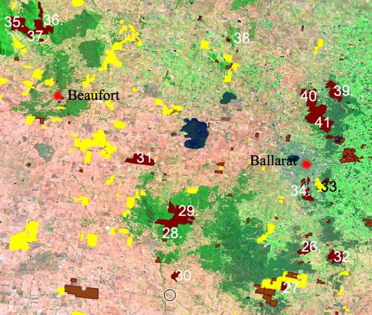
December 2006: Rough Guide to Hancock's and other plantations in the Ballarat region 1. Brown = pine, Yellow = hardwood. Each of the Hancock plantations can be viewed by clicking onto these links; 26 Wylies, 27 Mount Mercer, 28 Happy Valley, 29 Scarsdale, 30 Cape Clear, 31 Carngham, 32 Shepherds Flat, 33 Canadian, 34 Yarrowee, 35 Douglas, 36 Avoca River, 37 Red Hill, 38 Mt Beckworth,39 Creswick, 40 Cobblers Gully, 41 Glen Park, *Bradvale.
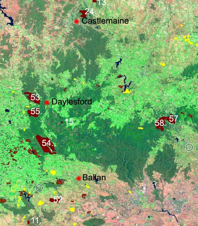
December 2006: Rough Guide to Hancock's and other plantations in the Ballarat region 2. Each of the hancock plantations can be viewed by clicking onto these links; 11 Ballarat FD, 13 Mt Alexandra, 15 Stewarts Creek, 24 Castlemaine, 52 Bungal, 53 Basalt, 54 Spargo, 55 Bells Reef, 57 Railway, 58 Macedon.
Ballarat Plantation map with Mount Emu Creek and Trawalla Creek (darker blue)/Hopkins River system. For details of Fiery Creek catchment (west of Beaufort) see here.
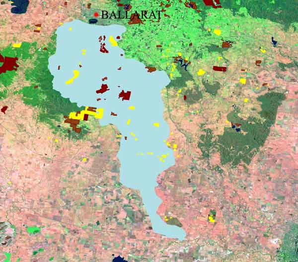
December 2006: Plantation map for Ballarat Region. Woady Yallock Catchment. Hancock's Scarsdale Plantation can be viewed here.
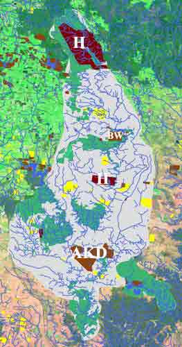
May 2008: Plantation map for Geelong Water Supply. She Oaks proclaimed water supply catchment, providing drinking water to Geelong - highlighted in blue. Polluted by Hancock 2004-2007. Barwon River system. H= Hancock plantations, BW = Barwon Water plantations, AKD= AKD plantations established mainly in 2007/8 in southern portion of the catchment. Yellow = various bluegum plantations. Green-native veg. The pine herbicide Hexazinone has been detected in this catchment since December 2004.
December 2006: Plantation map for Ballarat Region. Leigh River/Yarrowee Creek. Barwon River System.
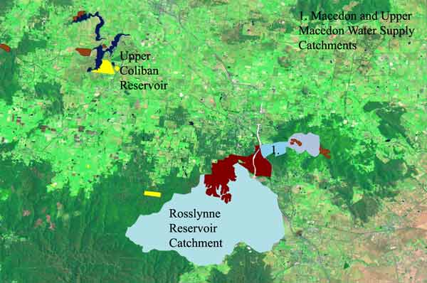
December 2006: Plantation map for Ballarat Region. Macedon Region with domestic water supplies marked in blue. Hancock are the major pine plantation owner in these catchments.
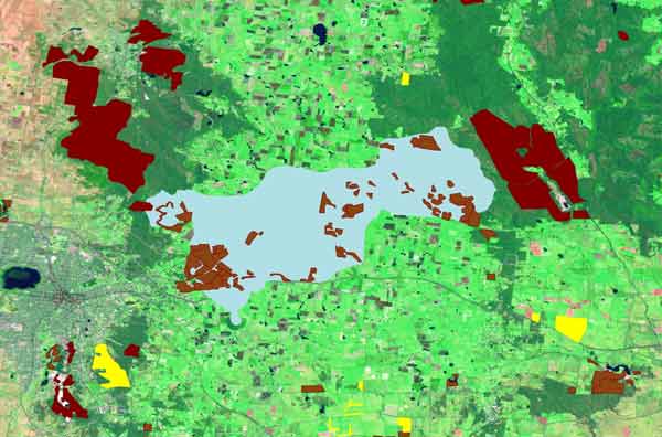
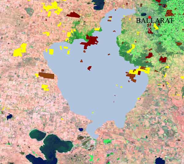
December 2006: Plantation map for Ballarat Region. Ballarat Domestic Water supply marked in blue. Almost all of the plantations in this water supply are owned by Central Highlands Water. There is also widespread horticultural activity in this catchment.
Extent of plantations surrounding reservoir managed by Central Highlands Water.
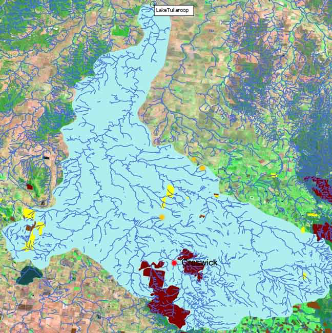
December 2006: Tullaroop Water Supply Catchment which provides drinking water to the town of Maryborough. Note Hancock pine in the headwaters.