Region: BallaratLegal Number: 94-11Plantation: Ballarat FD
Conservation Priority: LowPlantation within AKD Softwoods area of supply. Plantation within SPE Exports (Geelong) area of supply.
Click here for map of Hancocks' Ballarat region plantations. Declared Water Catchment Area: Plantation lies within Moorabool River (Sheoaks) Proclaimed Water Catchment Area. Proclaimed 24/5/78.Click here for map of Ballarat/Corangamite region water supply catchments.This plantation was very likely to be aerially sprayed with 2,4,5-T between 1968 and 1977. The Dioxin TCDD may still exist in soil in this plantation. For more historical data on 2,4,5-T click here. For more information concerning the continuing health crisis concerning 2,4,5-T please forward to here.Herbicides Used by Hancock in Pine Plantations - Ballarat Region Victoria
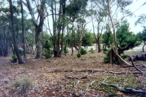
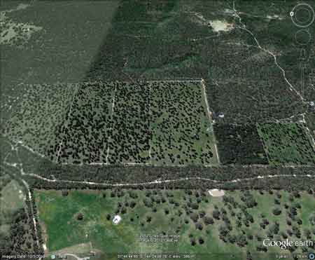
THREATENED FISH NOTES - MOORABOOL RIVER: Good Blackfish population with Australian Grayling in the lower reaches. Responsible Authority: Moorabool Shire Council Plantation Catchment: Creek flowing into Dolly Creek/West Branch Moorabool River/Moorabool River. Catchment Managment Authority: Corangamite Catchment Management Authority Hancock Watch Site visit Feb 01: Looks like an experimental plantation in the border of the Lal Lal forest. It appeared that many of the pines had been cut half way up the trees. Land is flat and trees were widely spaced. Observed that many wildings were growing on the north and western boundary of the plantation. Low priority. PROCLAMATION OF THE MOORABOOL (SHEOAKS) WATER SUPPLY CATCHMENT. Soil Conservation Authroity 1978. “p3 In the early 1960’s the Geelong Waterworks and Sewerage Trust requested that the catchments to Korweinguboora and Bostok Reservoirs be proclaimed as water supply catchments . . . Catchment Description (a) General: The catchment area to the offtake weir at Sheoaks is approximately 460km2 and runs from the Great Dividing Range to within 25 km of Geelong. The catchment is approximately 50km long and 10 km wide and runs North - South . . . (b) Geology: In the north part of the catchment, the predominant rock types are Ordovician sandstone, mudstone and siltstones, with a couple of volcanic flows down old river beds. Twin stream development can be seen along these southerly moving flows. The central part of the catchment and along the Eastern edge are dominated by Quaternary basalt flows from some half dozen volcanic cones. Tertiary sands and gravels are the main feature in the South of the catchment, but also occur in the centre and along the western boundary . . . (c) Physiography: The Great Dividing Range in the North part of the catchment reaches an elevation of over 800m above sea level, and the area to the north of the Western Hwy is dominated by the foothills below the Range. South of the highway, there is mainly a basalt plain at about 500 m elevation, often with twin stream development deeply dissecting the underlying Ordovician or Tertiary sediments . . . (d) Climate: Rainfall varies from 1000mm in the north to 600 mm in the south. Average summer rainfall varies from 140mm to 105 mm, and average winter rainfall varies from 300mm to 150 mm . . . Average annual evaporation would be approximately 1100mm. Winds are predominantly from west to north west . . . Soils and Vegetation: . . . both grey duplex and red gradational soils are found on the basalt material, gradational red and yellow soil are found on Tertiary sands and gravels . . . It is sufficient to note that most of the original vegetation has been removed from the basalt plains, but not from the Ordovician sediments or Tertiary deposits. Recent large scale clearing of the mixed species forest on the Northern Ordovician sediments has taken place for softwood conversion. Land Use: Most of the northern part of the catchment is Reserved Forest, particularly on the Ordovician sediments . . . Hazards to the Water Supply The erosion hazard in the catchment is fairly low, but
areas of steep Ordovician sediments, basalt escarpments, and steeper
Tertiary derived soils should be protected from intensive development
. . . overclearing has led to increasing salinity within the catchment
and forest management (particularly softwood conversion) needs to be
more strictly controlled . . ." |