1400ha of pine surrounds this reservoir. Geelong residents as of March 2012 paid $1981.7 for a Megalitre of drinking water. This plantation would probably consume more than 9 ML of water per hectare per year (12,600ML/yr). This would equate to $24.97 million worth of drinking water per year. Hancock have 99 year leases meaning $2,472,030,000 worth of water over that time (at March 2012 water prices). Hancock paid $3000/ha when they purchased the logging rights of the Victorian Plantations Corporation from the Kennett Government in 1998. Korweinguboora plantation would have cost the company $4,200,000 for 99 year licence - $30 a hectare over 99 years. In August 2012 Geelong residents pay $2150.00 for a Megalitre of drinking water. (Plantation now sucking up $27.09 million worth of drinking water per year - That's $2,681,191,000 over 99 years. [$2,120,000 increase in 180 days - $11,778 per day, $490.74 per hour).
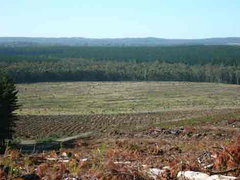
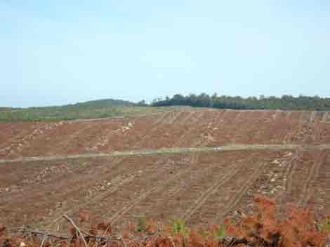
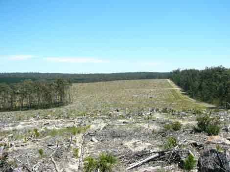
Image of plantation early 2012: Mostly clearfelled over almosta decade. Image Source Nearmap
Click here for map of Hancocks' Ballarat region plantations.
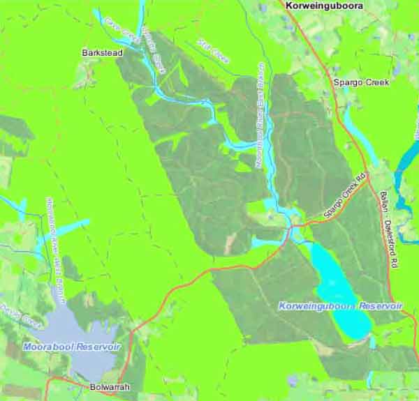
Northern half of Plantation lies within Daylesford Mineral Springs Recharge Area.
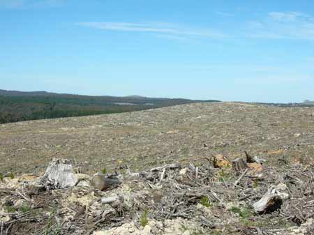
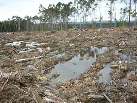
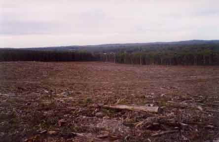
May 2005: Massive clearfells in this catchment, including lowlying swampy country.
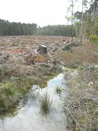
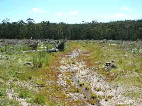
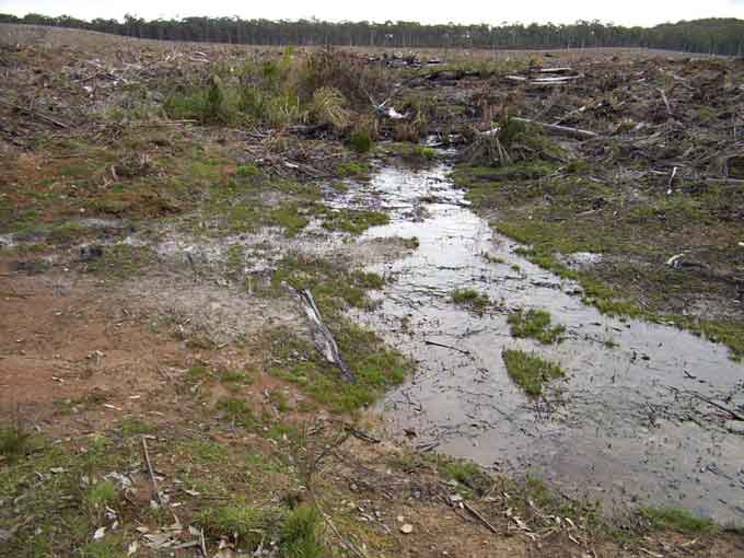
September 2008: Drainage line Geelong's Water Supply
September 2008: Drainage line Geelong's Water Supply after logging.
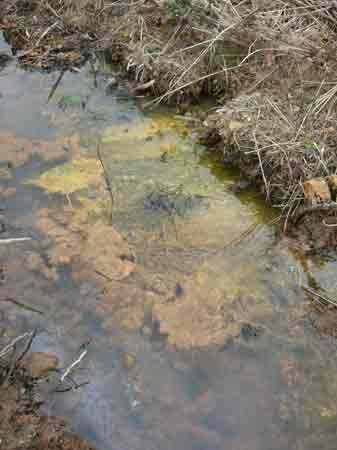
September 2008: Algal proliferation in Geelong Water Supply
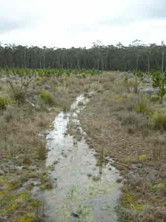
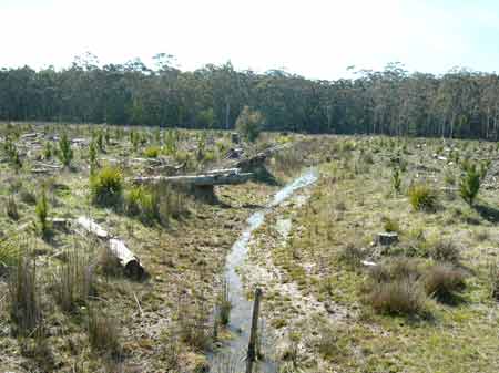
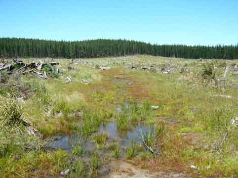
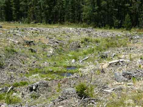
Sep 2008: Poor drainage inside plantation Herbicides Used by Hancock in Pine Plantations - Ballarat Region Victoria
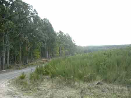
May 2005: Large clearfells in Geelongs drinking water catchment. Note the car travelling on the road.
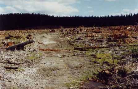
April 04: Geelongs' water supply catchment near Float Track inside the plantation. Note natural drainage line and lack of buffers from recently logged pine plantation.
November 2004: same drainage line, 7 months later.
August 2007: Same drainage line 3 years and 4 months after logging. Note lack of buffers with pines planted within metres of drainage line.
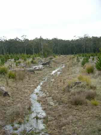
September 2008: Same drainage line 4 years and 5 months after logging. For other photos of this important plantation click on the following link and scroll down to almost the bottom of the page: http://www.hancock.forests.org.au/docs/oct02.htm
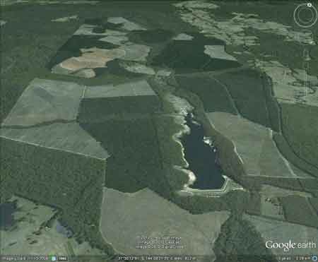
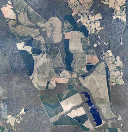
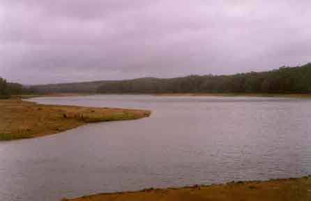
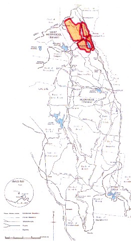
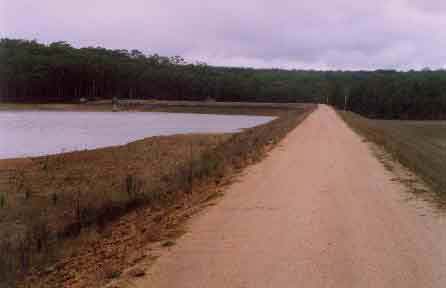
Korweinguboora Reservoir looking north. This plantation catchment is surrounded by 1400 hectares of pine plantations. Geelongs' water supply. Declared Water Catchment Area: MOORABOOL RIVER (SHEOAKS) CATCHMENT - PROCLAIMED 24/5/78. POTENTIAL DRINKING WATER FOR GEELONG, ANAKIE, LARA, BATESFORD. Declared Water Catchment Area: Pykes Creek Reservoir & Werribee River Catchment 1989. Pykes Creek supplies drinking water to the community of Myrniong
Above - map of Moorabool River (Sheoaks) Water Supply Catchment. Hancock plantation land in orange with red outline. This plantation was very likely to be aerially sprayed with 2,4,5-T between 1968 and 1977. The Dioxin TCDD may still exist in soil in this plantation. For more historical data on 2,4,5-T click here. For more information concerning the continuing health crisis concerning 2,4,5-T please forward to here. According to Harvesting prescriptions for water catchments in the Midlands FMA Winter harvesting in the Korweinguboora catchment is supposed to be suspended between June 1 and 31 October. Maximum Coupe Size (Ha) is supposed to be 15 ha. (see http://www.rfa.gov.au/rfa/vic/west/raa/consult/Westp2.pdf)
Sept 2002: Large scale pine logging in Geelong water supply catchment. No buffer on this drainage line and wetland to protect water quality from the impacts of both herbicide/fertiliser residues and sedimentation. �The Geelong Water Board (Barwon Water) takes water from the Korweinguboora and Bostock Reservoirs (both on the East Branch of the Moorabool River). The water is carried by channel to a series of four storages at the upper end of Stony Creek. These storages have only a very small catchment of their own; from them, the water is piped to Geelong� Water Quality in Victorian Streams. Basin 32. Moorabool River Basin 1986. Department of Water Resources Victoria. "There is an earthen dam built across the Eastern Moorabool River and is situated 80km north of Geelong and 20 km east of Ballarat. The holding capacity is 2100 ML, which is relatively small and approximately only one-third of the average run-off from the catchment. The purpose of the dam is to control floods and to allow water to be drawn off from the catchment area in quantities which can be controlled. In other words, water enters the reservoir at rates which vary and are dependent on the rainfall and in quantities which may fill the reservoir in a few days. It leaves the reservoir, for transmission to the Trust's main reservoirs, at a regular rate throughout the winter months. In this way, the reservoir is sometimes filled and emptied several times during one year." http://www.users.bigpond.com/abcmaps/services.htm
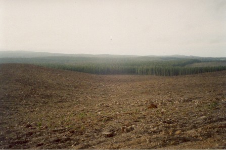
July 2003: Recent plantation clearfelling on the western side of the Korweinguboora Reservoir. This shot is facing east. This is a massive clearfelling exercise in a water supply catchment for the city of Geelong. Plantations surrounding this reservoir could be using between 12,600 13,500 million litres of water each year - given that the annual rainfall amounts to about 1000mm per year. Much of the area seen in the photo will be treated with herbicides. Hancock Watch estimates that many tonnes of Hexazinone could be used in the catchment within the next few years. Application rates for Hexazinone in pine plantations in Victoria vary from 3kg/ha to 19 kg/ha. Given these figures, the total amount of Hexazinone applied in this 1500 ha plantation over the next 5 years could be between 4.5 tonnes and 28.5 tonnes!
September 2008: English Broom infestation inside plantation.
September 2008: English Broom infesting plantation and in close proximity to native forest. 'The supply from the Eastern Moorabool River is the oldest of Geelong's water supply systems (Korweinguboora was completed in 1910). . . the river generally flows for about 7 months each year and is dry for 5 months. The greatest part of the run-off from the area occurs during floods which follow the periods of the heaviest rainfall and these floods are controlled primarily by the Korweinguboora Reservoir.' The reservoir has a nomimal capacity of 2091ML. Ex Gold Mine Area: The Moorabool River above and below the existing reservoir was extensively mined for gold during the 19th Century. Alluvial gold workings 8'-30' sinking through clay and sandy quartz breccia along with angular quartz pieces, overlying a coarse wash of semi-rounded quartz boulders. Lots of terrace wash occurred on the Moorabool upstream of Korweinguboora almost to Barkstead. Mines would have included Bread and Fat, Bradford, Northern Parker. According to Mining Surveyor's Reports (Sept 1883): "In 1883 machinery was installed at two recently discovered gold fields, ie The Great Northern Parker and Jones-Bradford Companies erected a steam-powered plant at Korweinguboora; . . . Auriferous reefs were also discovered 1 mile south east of Barkstead, which gave some rich but very small parcels of ore. This field did not develop passed the prospecting stage". Plantation Catchment: Numerous creeks draining into Korweinguboora Reservoir?/Railway Weir/Bolwarrah Weir/Bostock Reservoir/Bostock Channel/Eclipse Creek/Moorabool River. East side drains into Werribee River.
April 04: Large clearfell in the Werribee River side of the plantation. Catchment Managment Authority: Corangamite Catchment Management Authority/Port Phillip Catchment and Land Protection Board. THREATENED FISH NOTES - MOORABOOL RIVER: Good Blackfish population with Australian Grayling in the lower reaches. Hancock Watch Site visit Feb 01: Drove into plantation from Korweinguboora. Saw good extent of native vegetation inside plantation, but was unsure whether this was actually in plantation or not. More work needed and better maps required. Ran out of daylight. Hancock Watch Site Visit Oct 02: Drove into plantation from east. Noticed some recent logging had been taking place in the plantation in close proximity to Korweinguboora Reservoir. Very large coupes had been clearfelled in an area only a few hundred metres from the Reservoir. It was apparent that at one location, an entire drainage line had been gutted and no riparian vegetation was present to �protect� water from entering the drainage line. A small wetland remained, however it was evident that any use of chemicals in the vicinity of this area would most likely enter the drainage line (if flowing in wetter months). Satellite images reveal almost 30 tributaries/drainage lines have no buffer protection within the Korweinguboora Reservoir catchment.
July 2003: This recent clearfell inside Korweinguboora catchment extends for about 1km. This photo was taken facing west. Plantations are very thirsty meaning that as the young plantation trees grow, they suck up large amounts of water. The plantations surrounding Korweinguboora continually use up many many millions of litres of water per year. Hancock pays nothing for this water that is managed by Barwon Water. Barwon Water has also expressed concerns at this site and the Geelong Media was also notified by Friends of the Earth Melbourne. Geelong Advertiser p7 11/10/02; �Friends of the Earth fear Geelong�s water supply could be contaminated by pesticides they claim are being used in the East Moorabool catchment. But Barwon Water yesterday said there was no chance of contamination as aerial spraying of pesticides would not be used around the Korweinguboora reservoir. The Friends of the Earth environmental group had raised concerns logging would include the use of toxic chemicals which could reach drinking water. But Barwon Water�s executive Manager Carl Bicknell said any spot fertilising of new seedlings or weed control would be used by hand�. In a letter to Friends of the Earth from Barwon Water dated October 30, 2002 �...Barwon Water aims to keep itself fully informed of activities within water catchment areas that may impact on water quality. With the commencement of HVP�s 5 yr harvest proposal, a water quality monitoring program has been developed. Sediment load and salinity of the water entering the reservoir will be continually monitored whilst key components of the herbicides and fertilsers used in plantation re-establishment will be tested at 3 monthly intervals (ongoing). Barwon Water will be closely monitoring the logging operations of HVP including regular checks on the condition of roads, drainage lines and buffer strips. . .�
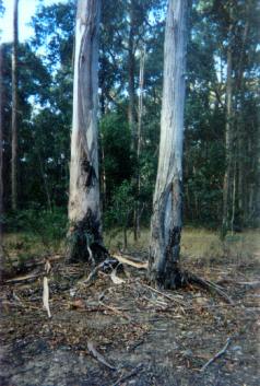
April 04: Gutted and ripped drainage line in Geelong water supply - this probably breaches the Code of Forest Practice. PROCLAMATION OF THE MOORABOOL (SHEOAKS) WATER SUPPLY CATCHMENT. Soil Conservation Authroity 1978. �p3 In the early 1960�s the Geelong Waterworks and Sewerage Trust requested that the catchments to Korweinguboora and Bostok Reservoirs be proclaimed as water supply catchments . . . Catchment Description (a) General: The catchment area to the offtake weir at Sheoaks is approximately 460km2 and runs from the Great Dividing Range to within 25 km of Geelong. The catchment is approximately 50km long and 10 km wide and runs North - South . . . (b) Geology: In the north part of the catchment, the predominant rock types are Ordovician sandstone, mudstone and siltstones, with a couple of volcanic flows down old river beds. Twin stream development can be seen along these southerly moving flows. The central part of the catchment and along the Eastern edge are dominated by Quaternary basalt flows from some half dozen volcanic cones. Tertiary sands and gravels are the main feature in the South of the catchment, but also occur in the centre and along the western boundary . . . (c) Physiography: The Great Dividing Range in the North part of the catchment reaches an elevation of over 800m above sea level, and the area to the north of the Western Hwy is dominated by the foothills below the Range. South of the highway, there is mainly a basalt plain at about 500 m elevation, often with twin stream development deeply dissecting the underlying Ordovician or Tertiary sediments . . . (d) Climate: Rainfall varies from 1000mm in the north to 600 mm in the south. Average summer rainfall varies from 140mm to 105 mm, and average winter rainfall varies from 300mm to 150 mm . . . Average annual evaporation would be approximately 1100mm. Winds are predominantly from west to north west . . . Soils and Vegetation: . . . both grey duplex and red gradational soils are found on the basalt material, gradational red and yellow soil are found on Tertiary sands and gravels . . . It is sufficient to note that most of the original vegetation has been removed from the basalt plains, but not from the Ordovician sediments or Tertiary deposits. Recent large scale clearing of the mixed species forest on the Northern Ordovician sediments has taken place for softwood conversion. Land Use: Most of the northern part of the catchment is Reserved Forest, particularly on the Ordovician sediments . . .
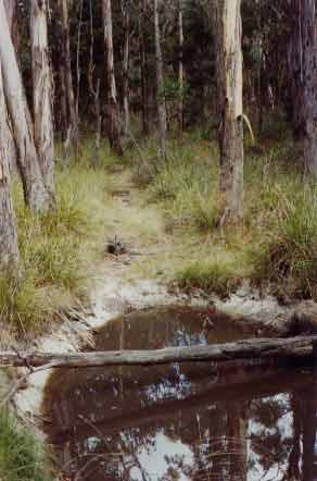
April 04: Natural wet area within the plantation. This photo shows that native trees have been destroyed during the logging of plantation surrounding this area. Note also the proliferation of Gahnia which are important food plants for caterpillers and provide habitat for small birds. The Gahnia will most likely be destroyed when the water supply is sprayed with herbicides. Hazards to the Water Supply The erosion hazard in the catchment is fairly low, but areas of steep Ordovician sediments, basalt escarpments, and steeper Tertiary derived soils should be protected from intensive development . . . overclearing has led to increasing salinity within the catchment and forest management (particularly softwood conversion) needs to be more strictly controlled . . .
Korweinguboora Reservoir - earthen dam wall. p11 The final recommendations for the Melbourne Study Area state � that all domestic water supply catchments within the study area should be investigated by the Soil Conservation Authority, and where appropriate, recommended for proclamation by the Land Conservation Council, in order to ensure a uniform procedure for land use planning within these areas�. The report states further �that in the case of the locations listed below and shown on the maps (all these locations being within catchments and for which no land use determinations have been made) the present tenure and management of public land continue for the time being and that once a land use determination has been made, the following areas: (i) the storage areas (ii) diversion works (iii) associated facilities (iv) the buffer strips around diversion works and storages, as defined in the land use determination (v) any other allotments as specified below be used for (a) water supply purposes (b) other activities permitted by the authority after consultation with the SCA and the EPA and that these areas be permanently reserved under Section 14 of the Land Act 1958 for water supply purposes, and be managed by the water supply authority named. Note: (i) the buffer should be wide enough to prevent direct pollution, to filter overland flow of water, and to control access. Its width will vary to suit differences in ground slope, soil type, vegetation cover, adjoining land use, and type of facilities available for treating the water.� . . . D53 Korweinguboora reservoir, Geelong Waterworks and Sewerage Trust (this area was to be listed under Section 14 of the Land Act 1958 by the Land Conservation Council) The area recommended for proclamation includes the catchment to the Bannockburn Diversion, Bostock Reservoir and Korweinguboora Reservoir. . .�
April 04: Geelong water supply during drought. Note destroyed native vegetation. Press Release - Friends of the Earth Melbourne October 9, 2002 Plantation Company Must Not Pollute Geelong's Drinking Water Environmental organisation Friends of the Earth today raised concerns about the possible contamination of Geelong's water supply, through the activities of US owned Hancock Victorian Plantations. Spokesperson for Friends of the Earth, Anthony Amis said today that "Hancock have been very busy logging the surrounds of Korweinguboora Reservoir in the upper East Moorabool catchment. Water from this reservoir is used by Geelong residents as drinking water." Mr Amis added " after logging, aerial application of herbicides and fertilisers is almost always carried out by the company. From information we have received, the herbicides simazine, hexazinone, metsulfuron methyl and roundup could be spayed in the reservoir surrounds. Further research by Friends of the Earth has also revealed that fertilisers used by the company could be sourced from industrial waste produced in Queensland". The risks of water being polluted by plantation companies is very possible. In 1997-8 Adelaide's water supply was contaminated by Forestry South Australia after they spayed pine plantations in the Mount Lofty Ranges. Traces of the herbicides Atrazine and Hexazinone were detected in reservoirs supplying 50,000 people with drinking water. In 1993 Ballarat and surrounding areas were accidently poisoned with hexazinone during a pine plantation spraying event. "People's health was very likely effected by these 'accidents'" said Mr Amis. "Friends of the Earth has real concerns that pollution of the Korweinguboora Reservoir could eventuate. Logging is likely to continue in this catchment for several years meaning that the possibility of overspraying or mishap is very real" said Mr Amis. "Friends of the Earth urges Hancock to publicly release all details of the herbicides and fertilisers that the company will use this year and the following years in the Korweinguboora Reservoir area. It is totally inappropriate that this company could be playing around with the health of Geelong residents" said Mr Amis. "Friends of the Earth calls for the total elimination of herbicides and fertilisers used near this reservoir" said Mr Amis. The fact that these toxics could be sprayed aerially will increase the risk of pollution" Mr Amis concluded.
April 04: Moorabool River East Branch during drought. Good buffers exist within this plantation, but are they enough to stop water pollution occurring?
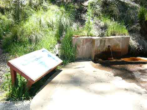
Spargo Creek Mineral Spring Reserve surrounded by plantations.
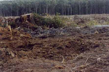
November 2004: Trashed drianage line.
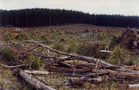
Nov 2004: Large clearcuts due to be sprayed soon. Werribee River: Above Werribee Gorge - A very small river flowing through forest. Some trout spawning occurs in the headwaters where the habitat is still suitable. A few deep pools at Ballan contain small brown trout, redfin and river blackfish. Source: A Guide to the Inland Angling Waters of Victoria by BR Tunbridge, PL Rogan, CA Barnham. Department Conservation and Environment. Arthur Rylah Institute for Environmental Research, 123 Brown St, Heidelberg, 3084. (4th ed - 1991)
|