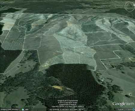
Region: BallaratLegal Number: LEGL/93-29Plantation: ScarsdaleSize: 1200ha+Conservation Priority: HighTHREATENED FISH NOTES - WOADY YALOAK RIVER: Yarra Pygmy Perch possibly found in this river. The Nationally Threatened Temperate Grassland & Grassy Eucalypt Woodland Ecological Community may occur in this plantation or in close proximity. More Information: http://www.environment.gov.au/epbc/publications/pubs/grasslands-victoria.pdf
March 13 2006: Snake Valley Bushfire A Threat |
| Herbicide | Label Rate max as kg/ha | Used to control | Notes | Application |
| Clopyralid | 2.55 | Woody Weeds | Highly Toxic/Potential Ground water Contaminant | air or ground |
| Glufosinate Ammonium | 1 | Woody Weeds | ||
| Glyphosate | 3.6 | Herbaceous and woody weeds, noxious weeds | ||
| Hexazinone | 4 | Woody Weeds | Ground Water Contaminant | Aerial, ground, spot |
| Metsulfuron-Methyl | 0.06 | Woody Weeds, Noxious Weeds | Potential Ground Water Contaminant | Aerial, ground or spot |
| Triclopyr | 3 | Woody and Noxious Weeds | Ground, spot, basal bark |
Plantation within AKD Softwoods area of supply.
Plantation within SPE Exports (Geelong) area of supply.
Responsible Authority: Golden Plains Shire Council
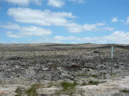
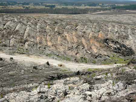
October 2006: Woady Yallock catchment. Salvage logging has recently taken place.
Plantation Catchment: Several creeks flow east into Woady Yaloak Creek/Woady Yaloak River/Lake Martin. Several creeks flow down into dam above Scarsdale/Woady Yaloak Creek/Woady Yaloak River/Lake Martin. A couple of creeks flow north through Snake Valley town/Baillie Creek/Mt Emu Creek/Hopkins River.
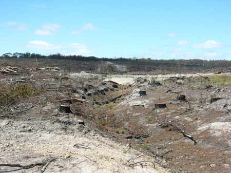
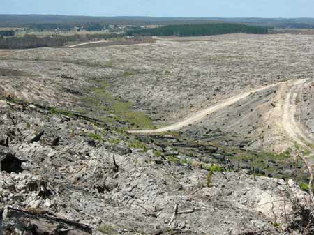
October 2006: Drainage line in Mount Emu Creek catchment, upstream of Snake Valley after fire salvage.
Ex-Gold Mining area: Gold workings most likely occurred within the plantation boundary near Scarsdale.
Catchment Managment Authority: Corangamite Catchment Management Authority/Glenelg-Hopkins Catchment Management Authority.
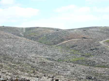
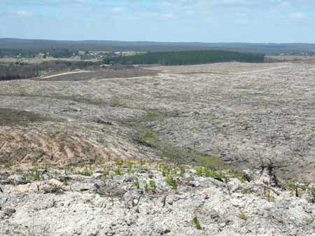
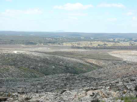
October 2006: Woady Yallock catchment.
Soils: Sourced from Geological Maps of Victoria
Csp: Cambrian - St.Arnuad Group - Pyrenees Formation: Deep marine deposits: sandstone, mudstone and black shale; dominantly sand-rich turbidite facies; moderately to well sorted, variably rounded quartz with minor feldspar and lithic grains in quartz silt or clay matrix; medium to very thick bedded; sparsely fossiliferous with phyllocarids and grapholites; weathered to partly kaolinised.
Csb: Cambrian - St.Arnuad Group - Beaufort Formation: Deep marine deposits; sandstone, mudstone and black shale; sand-poor turbidite facies tectonically modified to phyllite, quartz - mica or graphitic schist; weathered to partly kaolinised.
Qpc: Dissected colluvial deposits in active outwash fan; scree apron and alluvial-colluvial swamp deposits; polymictic gravel, sand, silt and clay; variably sorted and rounded, stratified, laminated or massive.
Qrc: Quaternary/Recent: Colluvial deposits, active outwash fans, scree aprons and colluvium, ubiquitous around hill bases and in gullies, polymictic gravel, sand, silt, clay: poorly sorted, variably rounded, stratified, laminated or massive.
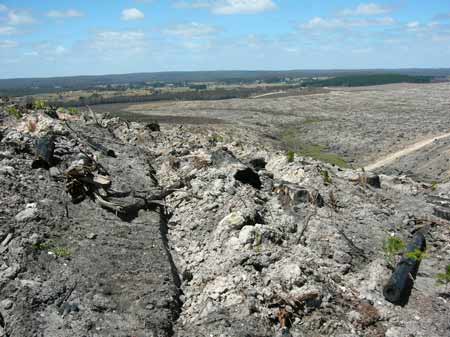
October 2006: Woady Yallock catchment. Deep ripping of soil ensures most moisture is retained on site. Native forests are not treated this way, yet this plantation has been certified by the Forest Stewardship Council.
Hancock Watch Site visit Feb 01: Entered this massive plantation from the west from Linton. Native forest to the south had been infested with pine wildings. Drove until Ridge Road. Took some photos of clearfells. Area seemed to be mostly pine, with no filter strips present. Came across large strip of native vegetation bordering north western boundary.
Hancock Watch Site Visit October 02: Further logging had taken place in plantation. Code of Forest Practices had generally been adhered to, but there are still big questions to ask about the long term sustainability of massive plantation monocultures on the Woady Yaloak catchment. For instance if plantations are established to lower water tables in salt prone areas, what happens to water tables if the plantations are logged? If plantations are to be used as carbon sinks what happens to the carbon if the plantation is logged on 30 year rotations? In terms of carbon credits, wouldn't it be far better to establish indigenous species - along restoration forestry principles - and allow these restored forests to grow indefinately, with some selective logging, rather than stripping whole hillsides every 30 years!
For recent shot of Scarsdale plantations (LEGL93-29) go to following link and scroll down page until photo 16:
http://www.hancock.forests.org.au/docs/oct02.htm
Woady Yaloak River, Cressy: Flows through forest and grazing land, mud, sand and gravel bottom. Wide fluctuation in flow. In many places the river is choked with acquatic vegetation. Also very turbid from erosion in the catchment. Some trout spawning occurs on the gravel beds in the headwaters. Other species are redfin to 750g, abundant river blackfish some to 400g, tench and goldfish.
Mount Emu Creek: Flows through forest and grazing land, (basalt country) with a rocky bottom in many sections and deep pools. Scattered red gums along banks. Considerable erosion in the upper catchment.
Source: A Guide to the Inland Angling Waters of Victoria by BR Tunbridge, PL Rogan, CA Barnham. Department Conservation and Environment. Arthur Rylah Institute for Environmental Research, 123 Brown St, Heidelberg, 3084. (4th ed - 1991)