Mining
"In Victoria, the Mines Resource (Sustainable Development)
Act 1990 (Vic) states that the Crown owns all minerals (with a few small exemptions).
The statutory definition of minerals is very broad, stating that minerals are
any substance which occurs naturally as part of the earths crust including
oil shale and coal, hydro-carbons and mineral oils contained in oil shale or
coal or extracted from oil shale or coal by chemical or industrial process.
Water, stone, peat or petroleum are not minerals in this definition. This
statutory vesting means private landowners no longer control the minerals in
their sub-surface soil, even though they continue to own the land itself. As
owner of the minerals, the Crown is legally entitled to grant exploratory or
mining licences to mining companies, allowing companies to explore for or extract
sub-surface minerals. The effect of this process upon private landholdings is
often devastating...
Compensation is available for landowners. The provisions
are broad and flexible but of course, work on the basis of an actual or expected
loss, damage or deprivation to the land. A licensee must reimburse an owner
or an occupier of private land for loss or damage that has or will be sustained
as a direct, nature and reasonable consequence of work approved or done under
a licence." Source: Not
quite The Castle: why miners have a right to whats under your land
"A stakeholder raised questions about how the FSC system
handles situations where forestry lands are explored for the purposes of mining
or Coal Seam Gas. The stakeholder cited concerns about the southern portion
of a plantation south of Mt Clear Sebastopol Road. The stakeholder also raised
questions about whether CSG explorations were compatible with FSC certification,
specifically what implications any pollution of waterways would have in terms
of FSC and what social obligations under FSC does the FME have to communities
that may be negatively impacted by CSG exploration.
With regards the mining issue in Ballarat
the FME has divested itself of the rights to the land in the northern part
of the site to the mining company. For the southern part of the site the mining
company has received their bond and therefore are understood to have rehabilitated
the site after mining. The mining company allegedly retains mining rights but
has no authority to proceed in this area. [Note: For photos of the supposed
rehabilitated site see here]
With regards CSG exploration the FME has no intentions at
this time despite approaches and expressions of interest from third parties.
The broader questions raised by the stakeholder regarding the responsibility
for the potential impacts of CSG exploration on FSC Certified land, where excision
is not deployed, are better suited for discussion by FSCs Policy and Standards
Unit and have been forwarded to FSC Australia for their consideration with the
stakeholders permission. In both cases the FSC system may allow for excision
of the lands in question and would have to demonstrate conformance with the
excision policy FSC-POL-20-001. Applications to excise lands as a result of
mining or CSG exploration would need to be further assessed by the Rainforest
Alliance. This issue was considered under Principle 2 of the standard but the
Audit Team found that it did not constitute a non-conformance under the standard."
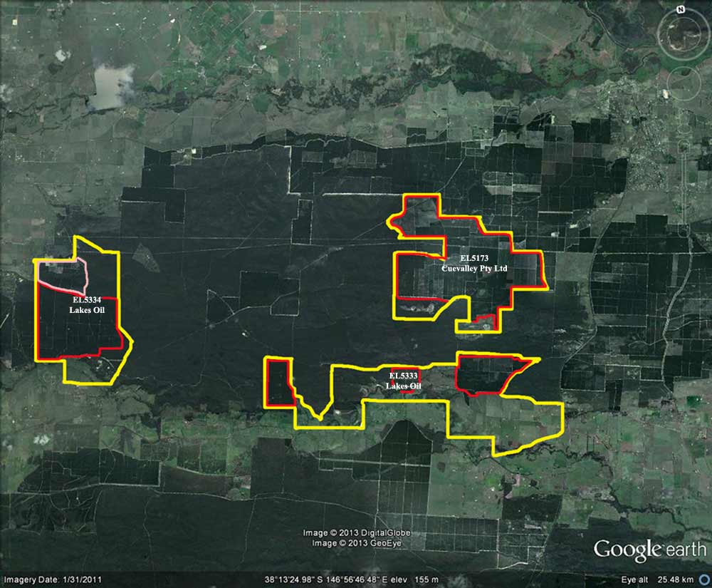
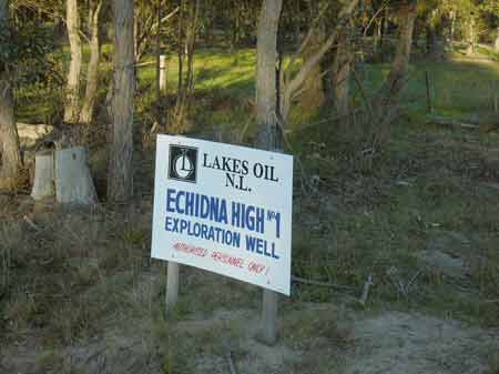
Mining Exploration Licences Central Gippsland Bordering
Holey Plains State and National Park
Yellow=Exploration Licence Boundaries. Red=Hancock Pine
Boundaries. Pink=Private Plantations
Lakes Oil EL5334 contains approximately 1000ha of Hancock pine/200ha
private pine, 250ha native forest and 50ha Merrimans Creek farmland.
Lakes Oil EL5333 contains approximately 700ha Hancock pine,
1300ha Merrimans Creek farmland, 300ha native forest.
Lakes Oil EL5334&EL5333 (3800ha) 1700ha Hancock Pine (44.7%),
200ha private pine, 550ha native forest, 1350ha Merrimans Creek farmland/domestic
water supply
Cuevalley Pty Ltd EL5173(Brown Coal licence currently for sale
$5m) contains 1800ha Hancock pine, 100ha Ben Winch Swamp, 30ha Craig Swamp.
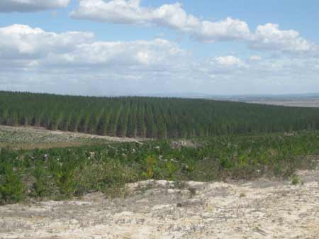
March 2013: Some of the 1000ha of Hancock pine within the EL5334
Exploration Area. Allotments 305A and 305B Parish of Rosedale. Hancock Victorian
Plantations private land.
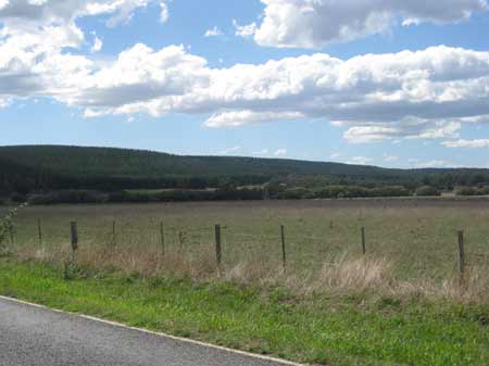
March 2013: Looking north east across the Merrimans Creek catchment
near the south western portion of EL5334. Pines in background are also under
exploration licence.
March 2013: Allotment 304 Parish of Rosedale. Hancock Victorian
Plantations land leased from the Crown since 1963 all of which is inside EL5334.
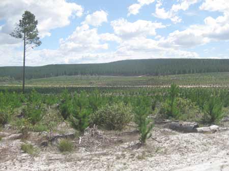
March 2013: Allotment 304 Parish of Rosedale - poorly growing
private pine plantation covering 200ha of EL5334, half of which has recently
been logged.
Under The VPC Act:
"26 Application of mineral resources legislation
(1) Operations under the Geothermal Energy Resources Act
2005, the Greenhouse Gas Geological Sequestration Act 2008, the Mineral Resources
(Sustainable Development) Act 1990 or the Petroleum Act 1998 that involve the
taking of forest produce are not to be carried out on vested land or managed
land except with the Corporation's consent and on any terms or conditions that
it imposes.
(2) A person dissatisfied with a refusal of consent or a
term or condition imposed under subsection (1) may appeal to the Premier, who
may review the matter and may confirm, vary or quash the original decision or
make a decision in substitution for it." Source: Victorian Plantations
Corporation Act 1993
South Gippsland
September 2007: Exploration has been occurring for oil and gas by
Lakes Oil in the Lacey Plantation. Interestingly, Lakes Oil also targeted
in 2007 two other (non Hancock)plantations for exploration opportunities in
2007, one about 3km south east of Longford and another about 8km north of
Seaspray. If hydrocarbons would have been discovered kiss the plantations
goodbye.
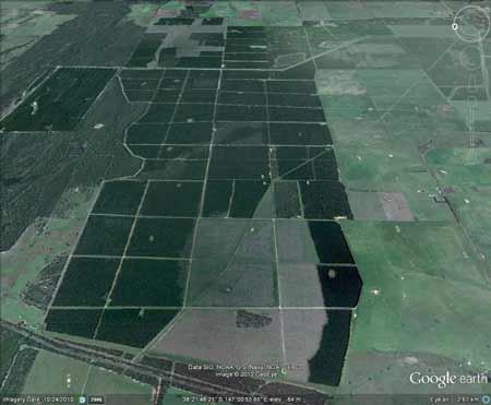
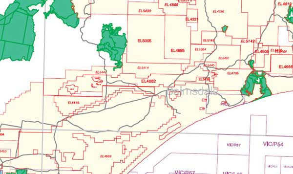
January 2013: Map showing mining exploration licences throughout the
South Gippsland region. The entire Strzelecki Ranges is under exploration
licences.
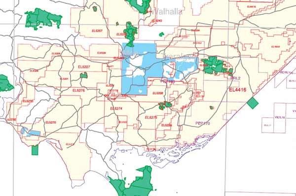
January 2013: Map showing mining exploration licences throughout the
Stratford region of Gippsland.
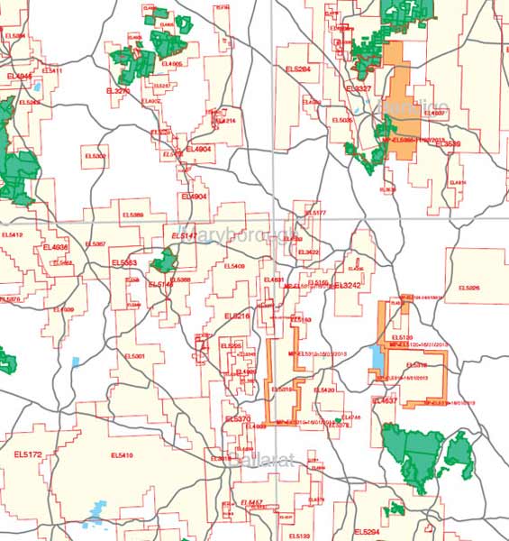
January 2013: Much of the Ballarat region is also under exploration
licences.
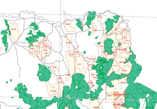
January 2013: As is North East Victoria.
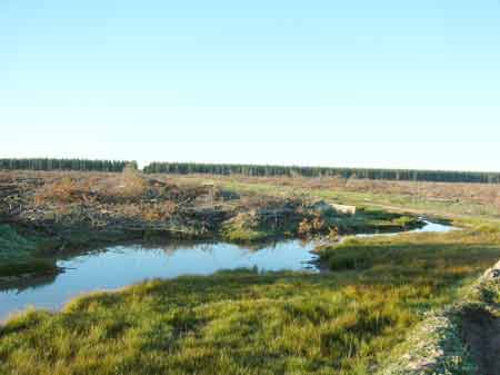
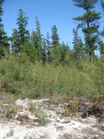
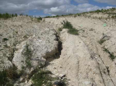
September 2007: Exceedingly poor drainage inside Lacey plantation,
probably as a result of culvert destruction. The aftermath of gas exploration?
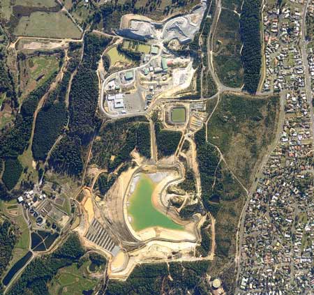
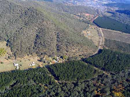
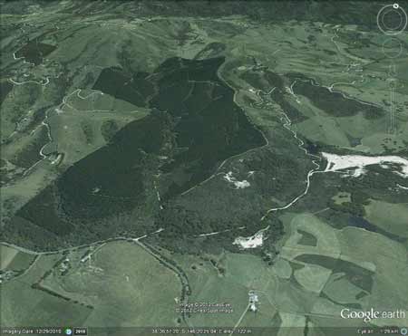
A large gold mine now occupies Hancock's Yarrowee Plantation.
The gold mine is owned by Singapore based Liongold
Corporation.
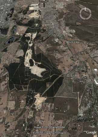
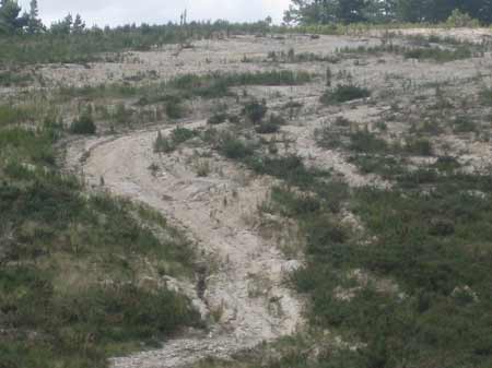
The swathe of exploration that occurred in Hancock's Yarrowee Plantations
up to 2006.
November 2005: Horrific creek crossing over a tributary
of Yarrowee Creek, just
upstream from the Central Highlands Water Sewage treatment plant. This creek
crossing may have been the work of Ballarat Goldfields. If this was a forestry
operation it would definately breach the logging code of practice. Who is
responsible for monitoring compliance of mining roads on leased plantation
company lands? What does Hancock receive under such deals?
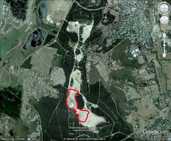
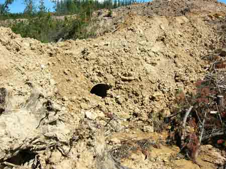
In December 2012, the area marked in red was visited
by Hancock Watch. Six years after the site had been scalped for possible mining.
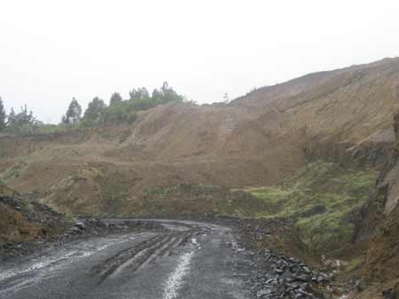
December 2012: Is this site covered by the Code of Forest
Practices? Or is it a mining operation?
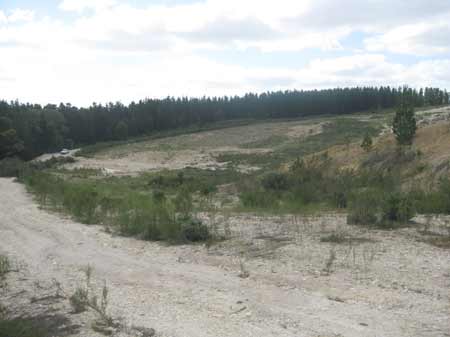
December 2012: Hancock plantations scalped for mining
exploration
Quarrying
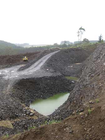
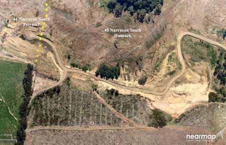
December 2012: South Gippsland/Morwell River Catchment:
Ten Mile Creek sub-catchment. Looking into Allotment 45 Parish of Narracan South.
Pine plantation converted into a quarry. There are many quarries located on
Hancock lands scattered throughout Victoria. What is the royalty earnt by Hancock
through the mining of bluestone?
October 2012: New quarry site. Image courtesy of Nearmap
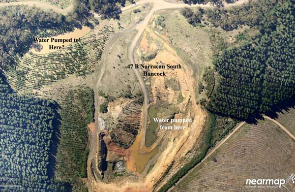
October 2012: Older quarry site. Image courtesy of Nearmap
December 2012: South Gippsland/Morwell River Catchment: Ten Mile Creek
sub-catchment. Allotment 45 Parish of Narracan South. Sand quarry.
Plantations on old mining sites
"4. Miscellaneous. While the three previous examples of land use
and exotic trees represented the major part of the acreage planted up to World
War II there are several other smaller and possibly more interesting cases
of land use.
(a) Auriferous Areas. An aftermath of the gold mining era in Ballarat,
Creswick and Castlemaine was the denuded and unproductive areas of worked-out
diggings. Partly to put the land to better use and partly to hide an unpleasant
sight, planting of such areas commenced in 1888 at Creswick and at Ballarat
and Castlemaine in 1919. Under natural conditions the auriferous soils are
too poor for satisfactory tree growth but when disturbed by mining operations
a big improvement is often obtained. This is largely a reflection of internal
soil drainage and root penetration; under natural conditions the soils are
compacted with a relatively impervious B horizon underneath a shallow A horizon,
but mining operations results in several feet of "loose" soils being created.
Responses like this suggest that deep cultivation to 3 or 4 feet may give
a big improvement in site where low quality is due to compacted soils and
not inadequate soils depth. When most of the mined land had been planted,
activities extended to the surrounding low quality native forest. Generally
these did not prove to be very satisfactory, so that further extension has
been confined to the more favourable localities.
Plantations near Ovens
River at Bright - According to http://www.alpinelink.com.au "Stripped
of its gold and plant cover, the land on both sides of the river had been
left in a severely degraded state, even though the companies had promised
to replace the topsoil. In 1916 this was the site of the first experimental
pine plantings to reclaim a dredged area. This test planting showed that Radiata
Pine survived well and other dredge tailings, began being restored by planting
them with pines. Their success led to the establishment of commercial pine
plantations on non-mined areas".
Photo Source: Melbourne University School of Resource Management Land
& Food Resources.
(b) Dredged gravels. During the 1890's and early 1900's gold dredging
extended into the Ovens Valley and its tributaries. At the peak of operations
more than 40 dredges operated in the valley destroying large acres of alluvial
flats and leaving a churned up mass of course gravels. An experimental planting
of 80 acres of P.radiata at Bright in 1916 on dredge trailings was very successful,
so that over the next ten years several hundred acres were planted. These
areas are some of the best in the Bright group of plantations. Areas dredged
more recently are not so satisfactory. With improved techniques and processing,
soils have been disturbed to much greater depths and too high a proportion
of the finer particles have been washed out. On such areas tree growth has
not been satisfactory and many are now being converted to pasture of a kind."
Source: Exotic Forests and Land Use K.J. Simpfendorfer. First published in
1967 on a paper presented to the 39th ANZAAS Congress, Melbourne, January,
1967 and later published in Forestry Technical Papers No. 19 - Victoria Forests
Commission).
Hancock Plantations located on Old Gold Mining Sites
Toora Tin Mine (South Gippsland)
The Great Southern Workings of theToora Tin Mine which operated between
1884 and 1942 are located in the native forest section to the east of this
plantation. Gravel Wash from the mine is also located in native forest section
of this plantation. Tin Mine Tailings found within drainage lines at southern
section of plantation (Doctors Creek and Tin Mine Creek). Drainage lines could
be contaminated with Cadmium, zinc, lead and possibly sulphuric acid. The
tin mine was also a source of sand and gravel for the South Gippsland region
for many years.
The Mirror News 17 March 2011: The mines have got a lot to answer for,
said Mr Everitt. His book details the polluting effect of the tin mine north
of Toora, which silted up the Franklin River to the detriment of the fishing
industry for many years, until the government took measures to stop the damage".
Plantations are also likely to be planted on old tin mining workings
in North East Victoria near the Shelley/Koetong
Region in many plantation areas. Maps Here.