January 2007: Plantation map for North East Victoria indicating proximity of Pine plantations. Hardwood plantations not mapped as yet in region.
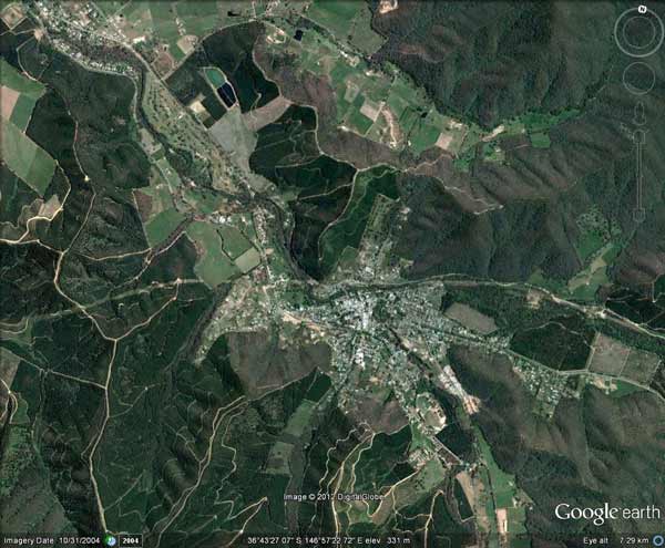
Town of Bright. Approximately 150 houses lie within 100 metres of plantations
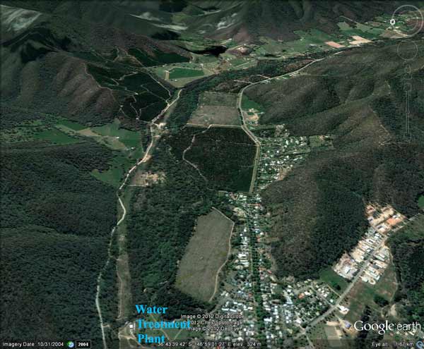
Town of Bright. Looking upstream from town water treatment plant. 4000 people in Bright, Porepunkah and Wandiligong drink water from this supply. Note proximity of plantations with newly logged plantation in this image within 300 metres of the town offtake. Some plantations in this area were planted on old gold diggings to stabilise soil. Herbicides used on Hancock pine plantations include: Carfentrazone-ethyl, Clopyralid*, Glyphosate, Hexazinone*, Metsulfuron Methyl* and Triclopyr (* indicates herbicide can be aerially sprayed). Of the pesticides listed here North East Water test for Glyphosate and Hexazinone.

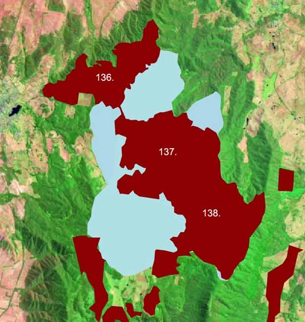
Plantation map for Beechworth region. Numbers indicate various Hancock plantations. Click on the following numbers provided for more information; 135, 136, 137, 138, 139, 140, 141, 142, 176.
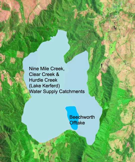
Water supply catchments for the towns of Beechworth and Yackandandah.
Same image with Hancock pine plantations superimposed. Massive plantations dominate these catchments, with Yackandandah's water supply being most inundated.
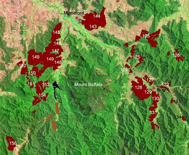
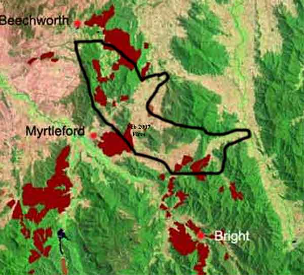
Plantation map for Myrtleford and Bright (Ovens River) region of North East Victoria. Click on the following numbers for more information; 124, 125, 126, 127, 128, 129, 130, 131, 132, 133, 134, 143, 144, 145, 146, 147, 148, 149, 150, 151, 152, 153, 154, 155, 156.
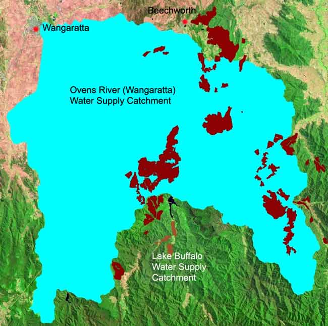
Image outlining the water supply catchment for Wangaratta. The brown indicates pine plantations located within the water catchment.

Image highlighting water supply for the town of Bright.
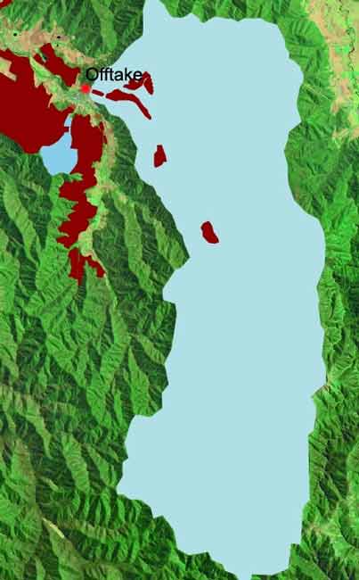
Plantations within the Bright water supply catchment, including one within 100 metres of the offtake.
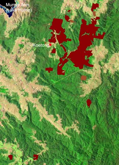
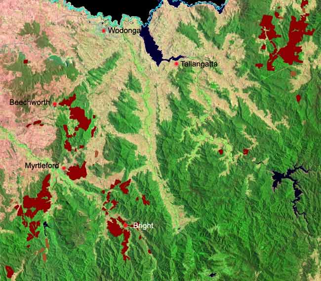
Pine plantations in the Shelley Region. All of these plantations are located in the Lake Hume Water Supply Catchment. Plantations on the eastern side may also be in the water supply for the town of Cudgewa.