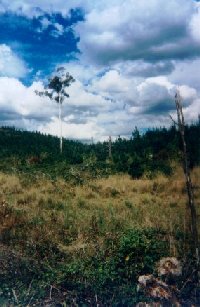
Plantation within Dominance Industries (Alpine MDF Industries) area of supply. Plantation within D & R Henderson/Monsbent area of supply. North East Victoria Plantation Map here This plantation was very likely to be aerially sprayed with 2,4,5-T between 1968 and 1977. The Dioxin TCDD may still exist in soil in this plantation. For more historical data on 2,4,5-T click here. For more information concerning the continuing health crisis concerning 2,4,5-T please forward to here. Herbicides Used by Hancock in Pine Plantations - North East Region Victoria
Proclaimed Water Catchment Area: The entire plantation LEGL takes in much of the southern half of the Nine Mile Creek, Clear Creek & Hurdle Creek Water Supply Catchment. (Proclaimed 13.6.79). THIS CATCHMENT SUPPLIES DRINKING WATER TO BEECHWORTH AND YACKANDANDAH. These creeks all flow into Yackandandah Creek, a tributary of the Kiewa River, which in turn is a tributary of the Murray River. MURRAY RIVER SUPPLIES WATER TO YARRAWONGA, COBRAM, RUTHERGLEN, BARMAH, ECHUCA , KERANG, PIANGIL, SWAN HILL, ROBINVALE, MILDURA.
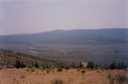
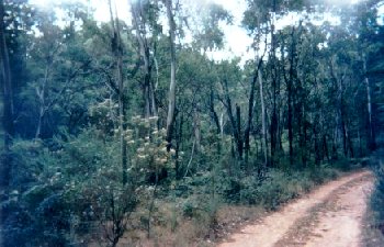
Feb 03: Through the smoke haze the catchment of Yackandandah Creek. Massive logging has taken place in this plantation/catchment over the past year. These plantations will have a major impact on water yield in the Murray Darling Basin for many many years to come. Ex Gold Mine Area: Massive gold workings occurred throughout this plantation area in the 19th Century. Workings occurred throughout Europa Gully, Nine Mile Creek, Back Creek (including headwaters), Clear Creek and Yackandandah Creek (almost to its headwaters). Plantations were initially established to 'settle' the gold mine tailings. It is highly likely that plantation logging could seriously 'stir up' these sediments leading to further water pollution. Reefs within the plantation included: Tin Tub, Albion, Bangle, Topaz, Stringer, Pride, Caledonia and l'Anson. "Pines in the Stanley area were originally planted on degraded mining land by Forests Commission employees and sustenance workers - Sustenance camps near Stanley were established by unemployed men from Melbourne during the Depression in the 1930's. The plantations were worked by Italian interns during WW2 and following the war, by immigrants who came to Australia through nationalisation programs during the 1950's and 1960's." Source: (http://www.tourisminternet.com.au/bwforest.htm) THREATENED FISH NOTES - KIEWA RIVER: Murray Cod found in Kiewa River. River needs environmental flows. Yackandandah Creek has populations of Mountain Galaxias and Blackfish, however stream levels do fluctuate and the creek is very temperamental to slight changes upstream. Mountain Galaxias (Galaxias olidusi) taxonomy is under review. Outcome could determine a separate species in the North East. Responsible Authority: Indigo Shire Council Plantation Catchment: Many creeks throughout plantation feeding into Nine Mile Creek. Wombat Creek, Guy Creek, Yackandandah Creek, Stinger Creek, Marcam Creek, Back Creek/Yackandandah Creek/Kiewa River. Catchment Managment Authority: North East Catchment Management Authority Other Notes taken from Soil Conservation Authority’s 1978 report; ‘A REPORT ON THE CATCHMENTS OF NINE MILE CREEK, CLEAR CREEK AND HURDLE CREEK (LAKE KERFERD). “P3 . . . Town water supply for Beechworth is drawn from Lake Kerferd. Surface run-off from part of its natural catchment by passes the storage, the majority of water coming from diversions originating in the adjacent Nine Mile Creek Catchment . . . The water supply for Yackandandah is diverted from Nine Mile Creek at a small offtake weir via a 200mm gravity main to a 1ML service basin at Walkers Saddle 2.5km downstream, then via a 150mm pipe to Yackandandah . . . p4 The water supply for Beechworth is taken from Frenchman’s Gully a tributary of Nine Mile Creek that is diverted to Lake Kerferd by aqueduct and pipe. . . Water from these catchments becomes very turbid after heavy rainstorms. This is due to various land disturbance activities occurring in the catchments . . .” p4 “Geology. The catchments are mainly situated on consolidated sediments of Ordovician age, consisting of generally fine grained feldspathic sandstone beds up to 1m thick and greywacke interbedded with dark grey shale, mudstone and siltstone. The beds are tightly folded and faulted with slaty cleavage being developed in areas. Fresh rock is grey whereas weathered rock is yellow-brown or brown . . . The Mount Stanley granite forms a small pluton in high, forested country 6km south of the town of Stanley in the upper catchment area . . . Recent colluvial and alluvial deposits are extensive along the watercourses in the catchments. The more recent alluvium forms a relatively narrow band along the stream margins and consists of unconsolidated sand, silt, gravel and clay, with no soil development. The colluvial deposits are unconsolidated mixtures of clay and weathered fragments of Ordovician sediments washed and sluiced from upslope. Large areas of these recent deposits have been sluiced in the search for gold. . . Geomorphology: About three quarters of the catchments lie on the undulating Stanley Plateau and one quarter on the steep escarpment of the foothills from the Victorian Alps. The upper area of the catchments is on the well dissected plateau with the land surface varying from short steep slopes to rolling fans and steeper hills. In the lower catchment, undulating to moderately sloping valley bottoms are present where colluvial alluvial fans are the major landform. These grade into moderate slopes up to low ridges or residual hills . . . The creation of the northerly draining streams that produced the catchments occurred in late Tertiary, as a result of the Kosciusko Uplift. The Stanley Plateau of 760m (average) may have been part of the Pre-Kosciusko surface. Soils: The dominant soils over most of the southern, upper half of the catchments are deep friable and hard reddish gradational soils. The steeper slopes have stony soils and friable brownish gradational soils are common in these areas. Shallow depressions may have weakly bleached yellowish gradational soils, although friable reddish gradational soils may also occur in these locations. In the middle of the lower northern half of the catchments there is abundant evidence of colluviation of the soil mantle, and depth to bedrock varies according to whether the site is a depositional or an erosional one. Friable reddish gradational soils with reddish brown light clay B horizons are the most widespread soils on the deeper colluvial material . . . p6 A wide band of softwood plantations straddles the centre of the catchments. . . Records kept for sixteen years at Stanley State Nursery in the upper catchment area indicate an average rainfall on the plateau of 1275mm . . . p7 Forestry is the principal use of public land with the Stanley Plateau the most extensively developed. State owned plantations of exotic conifers take up a large proportion of the Plateau. Softwood timber plantations take up about 3000 ha of the catchment, with some stands up to 35 years old. Softwood species were first planted to stablize sluiced areas on land disturbed by gold-mining operations. These softwoods proved economically viable and the plantations expanded onto better land. . . p7 Hazards to the Water Supply. In the southern half of the catchments, the erosion hazard is generally low. However, occasionally severe storms may cause rilling and sheet erosion on cultivated land, particularly where cultivation is carried out up and down the slopes. The soils are mostly deep and permeable and relatively erosion resistant. Areas of compacted soil, such as earthen roads, may rill or scour. In the northern half of the catchments the erosion hazard is generally moderate because of the close association of steeper slopes and valley drainage lines in which soils with dispersible subsoils occur. Loss or reduction of ground cover causes excessive runoff, therefore clearing presents a problem. p8 The utilization of areas stripped of soil during gold mining is a problem. These are not favoured for agriculture or forestry although many have been planted with pines. Areas cleared of native and softwood timber and the roads are producing turbid runoff that is finding its way into the drainage lines. In particular roadside drainage tends to concentrate in the table drains on the unsealed roads. The infrequent disposal results in erosion of the soil and sedimentation in the streams. Since 1975 these problems have intensified. The offtake weir on Nine Mile Creek is approximately 1 km below the lowest point of the area cleared for pine establishment. Undoubtedly the close proximity of the cleared area to the streams has been a contributing factor in the high levels of turbidity being experienced in the Yackandandah water supply. The catchment has an intensive road network including four wheel drive and dry weather tracks as well as sealed main roads. It is likely that the tracks would yield turbid flows to the stream . . .” Yackandandah Creek, Yackandandah: Rises in hilly forested country then flows through farmland, gravel bed which is noticably silting up and reducing the length of stream suitable for trout. Low flow and water level during the summer months. Contains abundant brown trout of small average size with occasional fish to 1.25kg, rainbow trout to 300g, small redfin in the lower reaches and some spiny freshwater crayfish in several unnamed tributaries. Source: A Guide to the Inland Angling Waters of Victoria by BR Tunbridge, PL Rogan, CA Barnham. Department Conservation and Environment. Arthur Rylah Institute for Environmental Research, 123 Brown St, Heidelberg, 3084. (4th ed - 1991)
|