Region: OvensLegal Number: LEGL/93-131/1Plantation: Morses CreekConservation Priority: MediumPlantation within Australian Newsprint Mill (ANM) Ltd area of supply. Plantation within Carter Holt Harvey (International Paper) area of supply. Plantation within Dominance Industries (Alpine MDF Industries) area of supply. Plantation within D & R Henderson/Monsbent area of supply. North East Victoria Plantation Map here Proclaimed Water Catchment Area: This plantation area is located in the Ovens River (Wangaratta) Water Supply Catchment. Herbicides Used by Hancock in Pine Plantations - North East Region Victoria
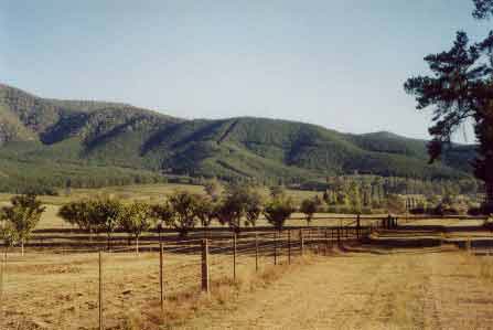
LEGL93-131: Photo taken from south of Wandiligong looking north - shows some of the steep terrain in this plantation. MURRAY RIVER SUPPLIES WATER TO YARRAWONGA, COBRAM, BARMAH, ECHUCA ,
KERANG, PIANGIL, SWAN HILL, ROBINVALE, MILDURA
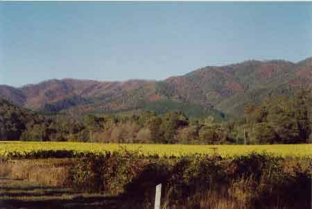
LEGL93-131: Photo from south
of Wandiligong showing close proximity of January/February 2003 bush
fires. It was a miracle that many more hectares of plantations were
not lost. “Special Investigation: North-Eastern Victoria - Ovens Softwood Plantation Zone. Land Conservation Council 1981. p11 Central Region To the north and east of the Eastern Boundary Fault lies an extenisive area of mountainous terrain composed of Ordovician sandstones and mudstones that are less resistant to erosion than the rocks of the south-western region. The drainage pattern is dendritic and the streams are seperated by sharp ridges and spurs. The mountains to the south of Mount Buffalo are typical of this region, which extends east to Mount Beauty and north to Myrtleford. In the north-west around Moyhu and Bobinalwarral the ridges of Ordovician sediments become buried beneath the alluvial deposits of the riverine plain. Within the region, exposures of granitic rocks have intruded into the surrounding Ordovician sediments. Intense heat associated with the intrusions has altered (or metamorphosed) the adjacent sedimentary rocks. The granite outcrops at Mount Buffalo and Mount Emu are extremely resistant, while the surrounding sedimentary rocks which are less resistant have been deeply dissected. In contrast, the granite in the Pinnacles area to the east of Myrtleford is more susceptible to weathering and erosion and as a consequence the terrain in this area is more subdued. A ridge of metamorphic rocks borders Happy Valley to the east of Myrtleford. Friable reddish and brownish gradational soils occur on the Ordovician
sediments of this region, while the granitic rocks of Buffalo Plateau
and Mount Emu exhibit a variety of soil types. Stony loams are characteristic
of rocky outcrops while poorly drained sites contain organic loams and
peats. Sandy loams and friable gradational soils are found on the lower
slopes of these intrusions. The less resistant granitic rocks at the
Pinnacles and Abbeyard carry a variety of gradational soils on the upper
slopes and a range of duplex soils at lower elevations. The gradational
soils are suitable for softwoods, but the poorly drained duplex soils
are not.
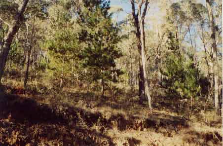
Just outside plantation boundary
near Morses Creek. Who takes responsibility of pine weeds when they
grow into neighbouring native forests? |