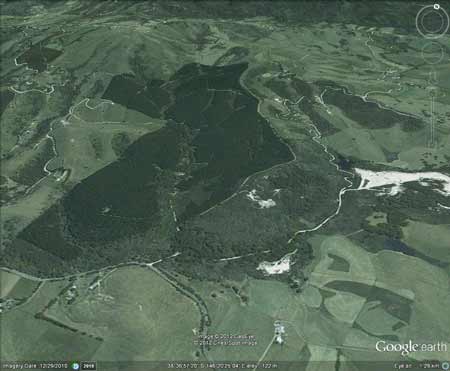
Region: StrzeleckisLegal Number: LEGL/93-87Plantation: WooraraConservation Priority: Medium conservation importance.The Great Southern Workings of theToora Tin Mine which operated between 1884 and 1942 are located in the native forest section to the east of this plantation. Gravel Wash from the mine is also located in native forest section of this plantation. Tin Mine Tailings found within drainage lines at southern section of plantation (Doctors Creek and Tin Mine Creek). Drainage lines could be contaminated with Cadmium, zinc, lead and possibly sulphuric acid. The tin mine was also a source of sand and gravel for the South Gippsland region for many years. The Mirror News 17 March 2011: “The mines have got a lot to answer for,” said Mr Everitt. His book details the polluting effect of the tin mine north of Toora, which silted up the Franklin River to the detriment of the fishing industry for many years, until the government took measures to stop the damage". Area within PaperlinX area of supply.Area within Brown and Dureau Softwoods (Morwell) area of supply.Pine plantation established in 1987 - Also contains ~60ha of native forest.
|
To The Editor Of The Argus 3/7/1916 Sir, - Your Toora correspondent gives particulars of a meeting of the South Gippsland Progress League, whereat Mr. W. T. Pitcairn complained of the circulation of reports in respect of alleged pollution of the Franklin River by workings of the tin mines, of which he is chief lessee. It is difficult to understand what Mr. Pitcairn means by "polluting" the river; but, if he means that complaints are made that the river is being gradually silted up in consequence of the sludge from the tin mines being washed downstream, I cannot see how he can deny it. I control a property, bounded on one side by the Franklin River, which some years ago, was a beautiful, clear stream, running nearly all the year round, abounding in fish, and a delight to look at. Since the tin mines started working up the river this stream is much reduced in volume, the water is dirty yellow, and very few fish are to be found there. Cattle can now wade over places that were once deep reaches of water. If the Mining department can report that no harm has been done to the river by washing down of sludge from the mines, it would be contrary to facts. It is a thousand pities to destroy one of the few streams of the state for the sake of employing a handful of men dredging.- Yours, & c., D.H.D. Malvern, June 30. |
||||||||||||||||||||||||||||||||||||||||||||||||
|
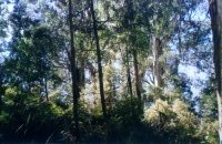
Hancock Site visit Nov 01: This is a relatively small plantation about 1km wide and 1.5km in length north of the Wonyip Road. There is some steepness to the northern edges of the plantation which consists almost exclusively of pine although there appears to be some hardwood in the plantation as well. There is a small but significant stand of Manna Gums? in the south east portion of the plantation along Woomera Creek road and also wetland species along a tributary of Tin Mine Creek which runs through the plantation.
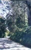
Plantation is located about 5 km north of Toora
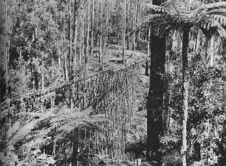
The "tin race" - a system which diverted water from the Franklin River to the ill fated tin mine at Toora North, built in the 1890s. |
|||||||||||||||||||||||||||||||||||||||||||||||||
|
|||||||||||||||||||||||||||||||||||||||||||||||||
|
Responsible Authority: South Gippsland Shire Council Herbicides Used by Grand Ridge Plantations - Strzelecki Ranges and Gippsland Victoria
Plantation Catchment: Several tribs Tin Mine Creek/Franklin River. Catchment Managment Authority: West Gippsland Catchment Management Authority Franklin River, Foster: A fast flowing stream rising in timbered hilly country, rock bottom. Middle and lower reaches are highly modified by agriculture. Access difficult and in most places walking is necessary. The headwaters contain brown trout to 400g, occasional larger fish, average 160g, some river blackfish and eels. In the lower reaches mainly shallow but some deep holes, sluggish flow, mud and sand bottom. Contains an abundance of eels. Few other fish caught. Estuarine section contains the usual estuarine fish found in district, including estuary perch to 1.4kg. Source: A Guide to the Inland Angling Waters of Victoria by BR Tunbridge, PL Rogan, CA Barnham. Department Conservation and Environment. Arthur Rylah Institute for Environmental Research, 123 Brown St, Heidelberg, 3084. (4th ed - 1991) |
|||||||||||||||||||||||||||||||||||||||||||||||||