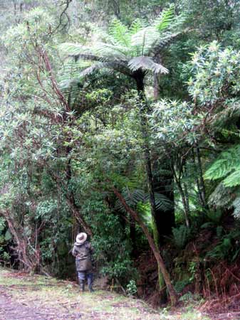
December 2012: Strzelecki Ranges/Bruthen Creek tributary. Bodman Plantation. Rainforest indicator species located in gully off old logging road. Approximately 50ha-100ha of native forest, including old growth forest remains in the headwaters of Bruthen Creek on land that was controlled by the Victorian Plantations Corporation. Photo shows rare Skirted Tree Ferns. Road activities could threaten these plants in the future.
December 2012: Strzelecki Ranges/Bruthen Creek tributary. Bodman Plantation. Rainforest indicator species located in gully off old logging road.
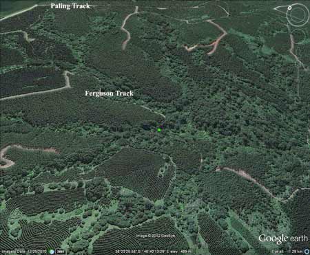
Google Earth Image of Bruthen Creek. Green marks location of rainforest gully. Headwaters of catchment heavily impacted by plantations.More native forest lies in land that was owned by Australian Paper Plantations up to 2001.
December 2012: Strzelecki Ranges/Bruthen Creek tributary. Bodman Plantation. Rainforest indicator species located in gully off old logging road.
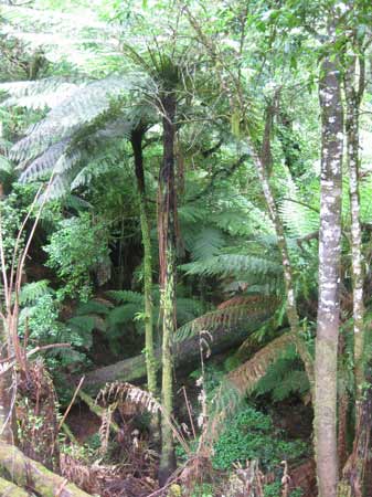
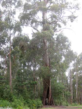
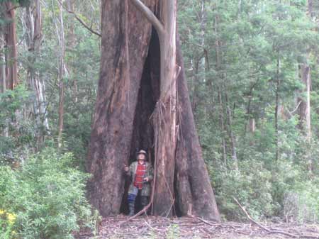
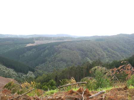
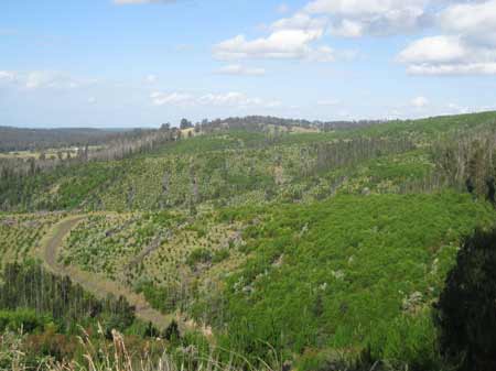
December 2012: Strzelecki Ranges/Bruthen Creek tributary. Bodman Plantation. Old Growth trees remain in 50-100ha of native forest in the headwaters of this creek. Note Mistletoe.
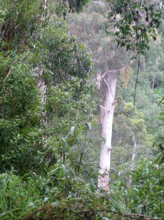
December 2012: Strzelecki Ranges/Bruthen Creek tributary. Bodman Plantation. Old Growth trees remain in 50-100ha of native forest in the headwaters of this creek.
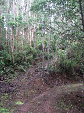
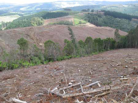
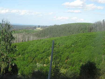
December 2012: Strzelecki Ranges/Bruthen Creek tributary. Bodman Plantation. Recent logging activity on Fergusons Road to access plantation in close proximity to native forest.
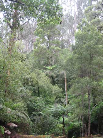
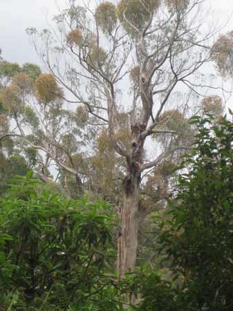
December 2012: Strzelecki Ranges/Bruthen Creek tributary. Bodman Plantation. Old growth tree potentially threatened by road widening activity.
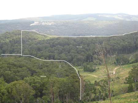
December 2012: Strzelecki Ranges/Macks Creek, showing ~200ha of native forest within Hancock holdings (land within white lines on photo). Macks 'plantation'
December 2012: Strzelecki Ranges/Macks Creek: Macks 'plantation' Showing tributary of Macks Creek with possible warm temperate rainforest species.
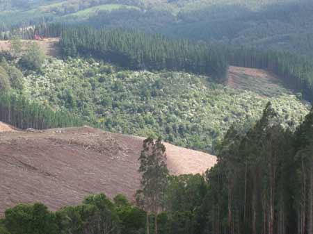
December 2012: Strzelecki Ranges/Macks Creek: Macks Plantation. Pine planation logging near Tarra Bulga National Park.
December 2012: Strzelecki Ranges/Macks Creek: Macks Plantation. Pine planation logging near Tarra Bulga National Park. Roberts Creek.
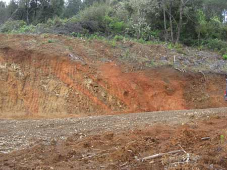
December 2012: Strzelecki Ranges/Macks Creek: Macks Plantation. Pine planation landing near Roberts Creek headwaters. Looks like ochre deposit.
December 2012: Strzelecki Ranges/Macks Creek: Macks Plantation. Tarra Bulga National Park 'ringbarked' by plantations.
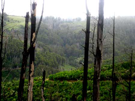
December 2012: Strzelecki Ranges/Flynns Creek. Callignee Plantation. Some native forest on eastern side of Flynns Creek appears to have escaped the February 2009 bushfires.
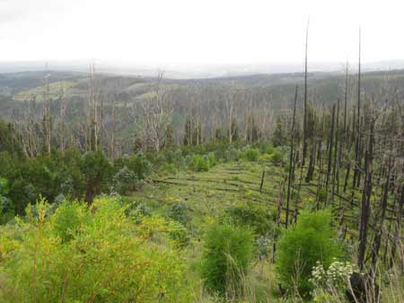
December 2012: Strzelecki Ranges/Flynns Creek. Callignee Plantation. Regenerating native forest on Stinger Track. Obviously burnt hard by the February 2009 bushfires. Plantation 93/105.
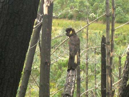
December 2012: Strzelecki Ranges/Flynns Creek. Callignee Plantation. Yellow Tail Black Cockatoo off Lafrenz Road.
December 2012: South Gippsland/Morwell River Catchment: Allotment 64E Parish of Narracan South. Regenerating native forest inside pine plantation. This is the type of young native forest typically aerially sprayed by Hancock.
December 2012: South Gippsland/Morwell River Catchment: Ten Mile Creek sub-catchment. Allotment 46 Parish of Narracan South. A row of eucalypts where koala scats were found.
December 2012: South Gippsland/Morwell River Catchment: Ten Mile Creek sub-catchment. Allotment 46 Parish of Narracan South. Koala scat.
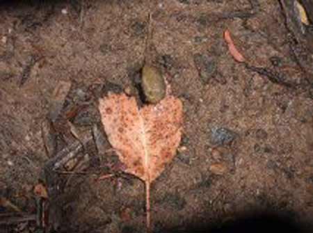
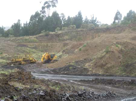
December 2012: South Gippsland/Morwell River Catchment: Ten Mile Creek sub-catchment. Allotment 45 Parish of Narracan South. Hancock are also a mining company. This appears to be bluestone.
December 2012: South Gippsland/Morwell River Catchment: Ten Mile Creek sub-catchment. Looking into Allotment 45 Parish of Narracan South.
December 2012: South Gippsland/Morwell River Catchment: Ten Mile Creek sub-catchment. Allotment 45 Parish of Narracan South. How is this kind of operation certified as being a forestry operation? It is mining.
December 2012: South Gippsland/Morwell River Catchment: Ten Mile Creek sub-catchment. Allotment 45 Parish of Narracan South. Sand Mining.
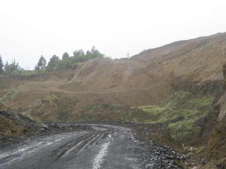
December 2012: South Gippsland/Morwell River Catchment: Ten Mile Creek sub-catchment. Allotment 45 Parish of Narracan South.
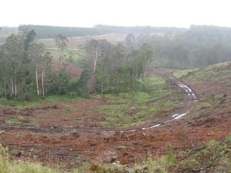
December 2012: South Gippsland/Morwell River Catchment: Ten Mile Creek sub-catchment. Allotment 45 Parish of Narracan South. Ten Mile Creek with remnant eucalypts after pine plantation has been recently clearfelled.
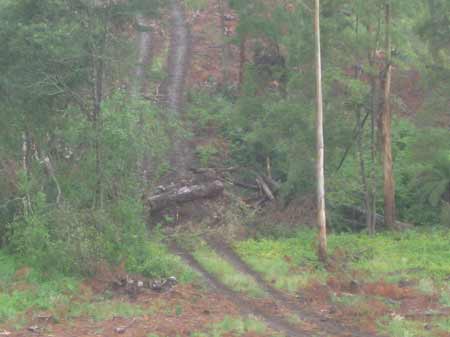
December 2012: South Gippsland/Morwell River Catchment: Ten Mile Creek sub-catchment. Allotment 45 Parish of Narracan South. Creek crossing.
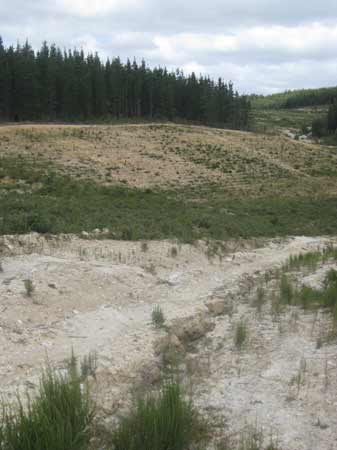
December 2012: Strzelecki Ranges/Traralgon Creek Catchment: Stoney Creek sub-catchment. Allotment 2F Parish of Callignee. Obvious signs of failing plantation. Note native forest trying to re-establish itself. Soon to be aerially sprayed?
December 2012: Strzelecki Ranges/Traralgon Creek Catchment: Stoney Creek sub-catchment. Allotment 3A Parish of Callignee. More failing plantations with regenerating native forest emerging in plantations place.
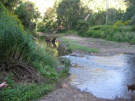
December 2012: Strzelecki Ranges/Middle Creek Catchment: This creek was re-routed by Hancock contractors.
Yarrowee Plantation - South of Mt Clear.
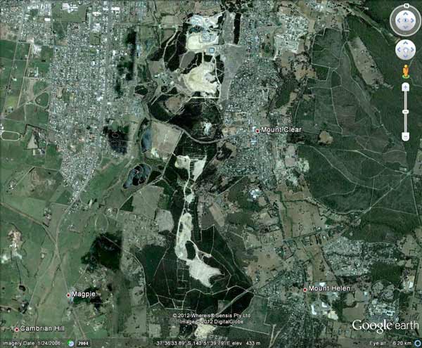
December 2012: Ballarat Region/Yarrowee River Catchment: Yarrawee Plantation coming under gold mining interests October 2006.
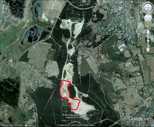
December 2012: Ballarat Region/Yarrowee River Catchment: Yarrawee Plantation coming under gold mining interests October 2006. Area highlighted in red visited by Hancock Watch December 2012.
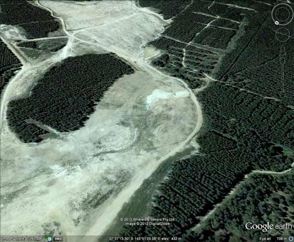
December 2012: Ballarat Region/Yarrowee River Catchment: Yarrawee Plantation coming under gold mining interests (Google Earth image October 2006). Area highlighted in red visited by Hancock Watch December 2012.
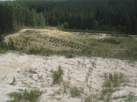
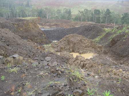
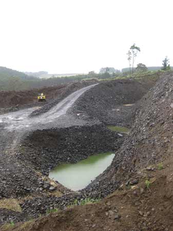
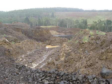
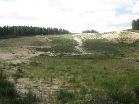
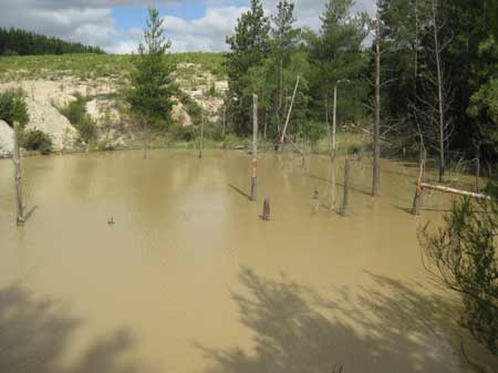
December 2012: Ballarat Region/Yarrowee River Catchment: Yarrawee Plantation. 6 year old regeneration. Is this a mine or a plantation?
December 2012: Ballarat Region/Yarrowee River Catchment: Yarrawee Plantation. 6 year old regeneration. Is this a mine or a plantation?
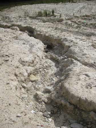
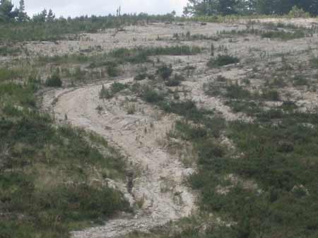
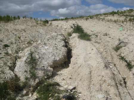
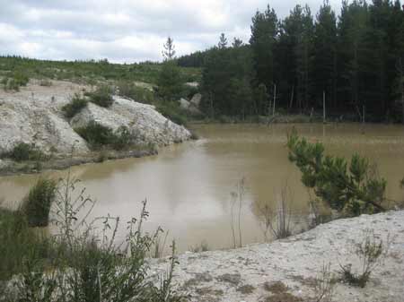
December 2012: Ballarat Region/Yarrowee River Catchment: Yarrawee Plantation. Obvious signs of erosion occurring in this 'plantation'.
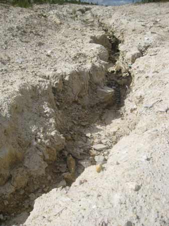
December 2012: Ballarat Region/Yarrowee River Catchment: Yarrawee Plantation. Obvious signs of erosion occurring in this 'plantation'.
December 2012: Ballarat Region/Yarrowee River Catchment: Yarrawee Plantation. 6 year old regeneration. Is this a mine or a plantation?
December 2012: Ballarat Region/Yarrowee River Catchment: Yarrawee Plantation. Who is responsible for this and why is this FSC certified?
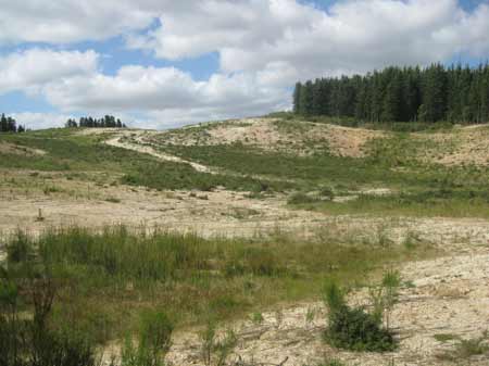
December 2012: Ballarat Region/Yarrowee River Catchment: Yarrawee Plantation. 6 year old regeneration. Is this a mine or a plantation?
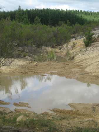
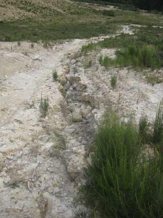
December 2012: Ballarat Region/Yarrowee River Catchment: Yarrawee Plantation Creek crossing.
December 2012: Ballarat Region/Yarrowee River Catchment: Yarrawee Plantation. Probably a toxic ex mine dam site.
December 2012: Ballarat Region/Lake Corangamite Catchment: Bradvale Plantation where Hancock had to recently cough up $305,000 for destroying 0.7ha of Native Temperate Grassland of the Victorian Volcanic Plain..
December 2012: Ballarat Region/Yarrowee River Catchment: Regenerating trees at Wylies Plantation.