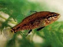
Yarra Pygmy Perch found downstream. Listed as vulnerable under the EPBC Act
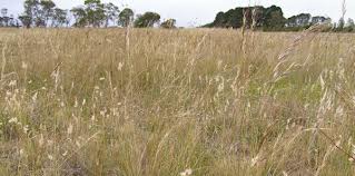
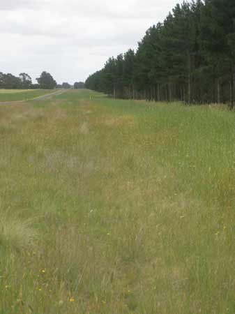
December 2012: Willowvale Road showing some of the extent of Natural Temperate Grasslands of the Victorian Volcanic Plain. Bradvale plantation in the background.
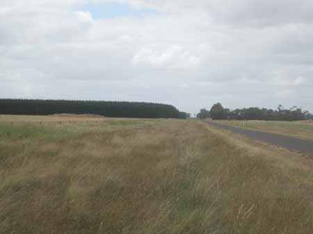
December 2012: Probably the area of grassland that was impacted by Hancock contractors. A fair amount of bluestone was observed at this location.
The Australian Government secured a legally enforceable $305,000 pledge from plantation timber company Hancock Victorian Plantations Pty Ltd to repair damage done to a critically endangered grassland in south western Victoria and to better protect what remains. Between March and May last year, a contractor employed by Hancock Victorian Plantations cleared an area about the size of a soccer field (0.7ha) of a protected ecological community, known as Natural Temperate Grassland of the Victorian Volcanic Plain, near Mannibadar. The company agreed to spend $305,000 towards the recovery and rehabilitation of grasslands in the region. Further details on how the $305,000 will be allocated is at this link http://www.environment.gov.au/epbc/compliance/judgements.html
Australian Federal Government Media Release (August 12 2012)
Between March and May 2011, HVP Plantations engaged an independent contractor to undertake timber harvesting works in the Bradvale Plantations adjoining the Willowvale Road Mannibadar in Victoria. These works resulted in the removal of approximately 0.67 hectares of Natural Temperate Grasslands of the Victorian Volcanic Plain (NTGWP) listed as critically endangered under the 1999 EPBC Act.
This plantation was the scene of legal action in 1999 March when the Western Plains Pine Plantation Group won appeal to stop spread of new pine plantations in district of Lismore and Bradvale. Hancock Victorian Plantations had planned to plant an extra 1000 hectares of pine in their district and were aggressively targeting landholders in the region. (Weekly Times March 24 1999 p1).
Hancocks pine plantations at Bradvale sw of Ballarat. 600mm rainfall, not lift pruned, further expansion stalled by VCAT, partly due to shire having no PF strategy, and ignoring social, economic and environmental issues. Could this have been done differently and with wider benefits by a leasing approach? Agroforestry News 52 2005
Herbicides Used by Hancock in Pine Plantations - Ballarat Region Victoria
| Herbicide | Label Rate max as kg/ha | Used to control | Notes | Application |
| Clopyralid | 2.55 | Woody Weeds | Highly Toxic/Potential Ground water Contaminant | air or ground |
| Glufosinate Ammonium | 1 | Woody Weeds | ||
| Glyphosate | 3.6 | Herbaceous and woody weeds, noxious weeds | ||
| Hexazinone | 4 | Woody Weeds | Ground Water Contaminant | Aerial, ground, spot |
| Metsulfuron-Methyl | 0.06 | Woody Weeds, Noxious Weeds | Potential Ground Water Contaminant | Aerial, ground or spot |
| Triclopyr | 3 | Woody and Noxious Weeds | Ground, spot, basal bark |
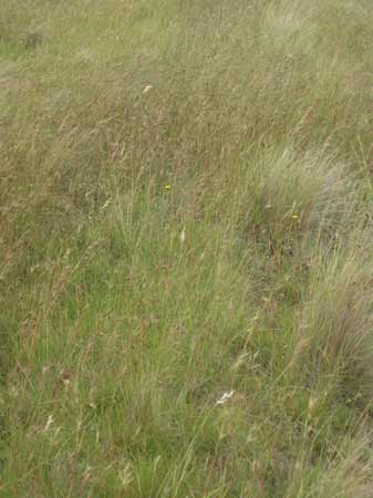
December 2012: Natural Temperate Grasslands of the Victorian Volcanic Plain (NTGWP) are critically endangered.
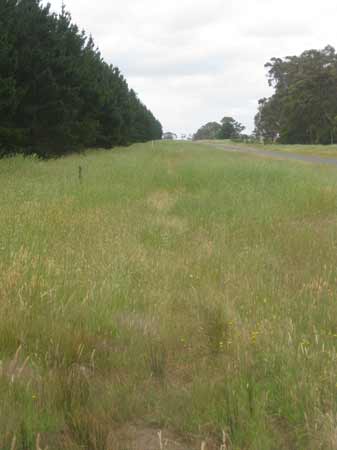
December 2012: NTGWP on Willowvale Road next to Bradvale plantation

December 2012: How much of the NTGWP extend into Hancock's plantation? Will remnants inside the plantation be destroyed during logging. How much grassland was destroyed when the plantation was established in the late 1990's?
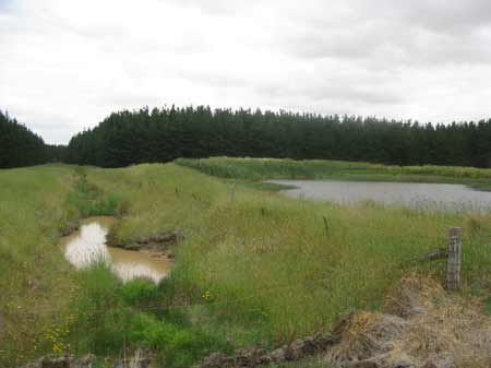
December 2012: Gnarkeet Creek (looking downstream), with a Hancock dam located in close proximity.
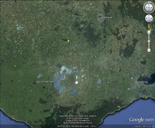
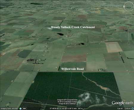
Bradvale plantation is located ~45km south west of Ballarat.
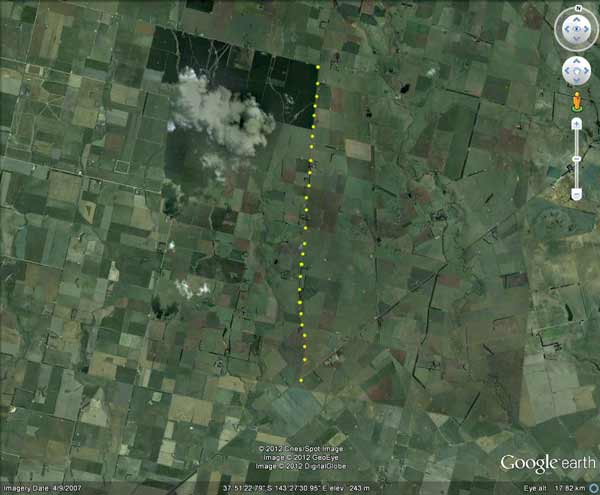
Approximately 10km of Willowvale Road is zoned under the Golden Plains Planning Scheme with a Vegetation Protection Overlay (VPO2). VPO2 refers to Bushland Reserves and Roadside Vegetation Areas - Red Ironbark, Yellow Box and Red Stringybark eucs, rare and endangered flora and fauna species. The area covered by the VPO2 is marked with yellow dots.
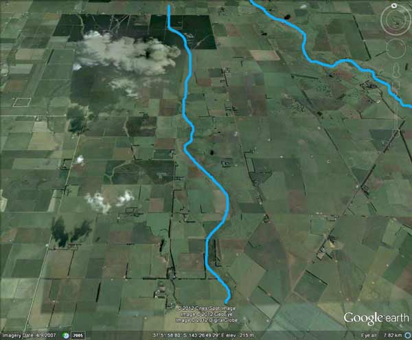
The plantation also takes in a considerable amount of the headwaters of Gnarkeet Creek. Gnarkeet Creek Chain of Ponds is listed under the Golden Plains Planning Scheme as ESO2 - Environmental Significance Overlay for Waterway Protection. ESO2's are outlined in the above image in blue.
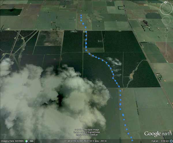
Closer image of the ESO2 which runs directly through this plantation.
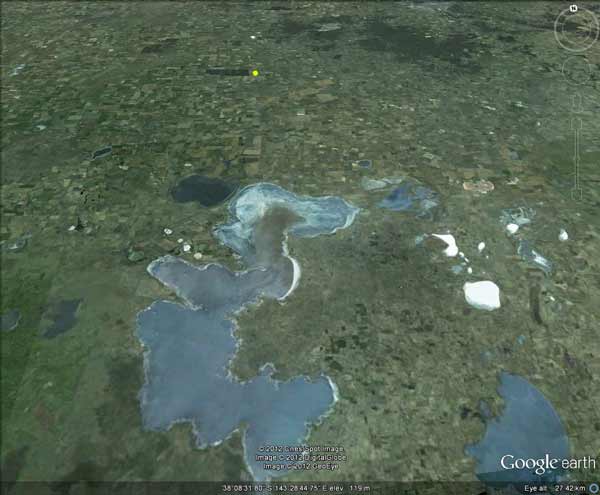
Lake Corangamite in the foreground, with Bradvale plantation marked with yellow dot.
Bradvale plantation is located 18km north of where the following fish survey was done:
Source: Threats, distribution and abundance of Yarra Pygmy Perch in Victoria during a drought period Arthur Rylah Institute 2008
Importantly, with another dry winter-spring period likely in 2009, it is recommended that a number of sites be monitored throughout the spring - summer period to prevent remnant waterholes from drying-up. Sites most at risk include; Gnarkeet Chain of Ponds (at Hamilton Highway, west of Berrybank).
Four native and one non-native fish species were recorded from the three sites surveyed in Gnarkeet Chain of Ponds and Woady Yaloak River (Table 9). One crustacean was also recorded. Of 2085 fish, 61 were native fish, Flat-headed Gudgeon being the most common (37), followed by Yarra Pygmy Perch (13), Southern Pygmy Perch (7), and Short-finned Eel (4). Yarra Pygmy Perch ranged in size from 26 to 63 mm (mean 40.6 mm), while Southern Pygmy Perch ranged in size from 37 to 83 mm (mean 53.3 mm). Eastern Gambusia (2024) were the only recorded non-native fish species, but they were very abundant.
3.4.6 Threatening processes Both the Gnarkeet Chain of Ponds and Woady Yaloak River were highly saline and had cleared riparian zones, and stream bank erosion was obvious (Table 10). Gnarkeet Chain of Ponds also lacked water or stream flow, and as a result of livestock access to the stream had instream habitat loss and increased sedimentation. Woady Yaloak River was also likely to have these threats, although they were not observed at the survey site.
Only one obligatory migratory native fish species (Short-finned Eels) were found in each of Deep Creek, Gnarkeet Chain of Ponds and Woady Yaloak River.
4.2.3 Gnarkeet Chain of Ponds and Woady Yaloak River Very few Yarra Pygmy Perch were captured in either Gnarkeet Chain of Ponds or Woady Yaloak Creek. However, their sizes ranged from 26 to 63 mm, indicating that spawning and recruitment had occurred during the previous season. The sample site at Gnarkeet Chain of Ponds was highly degraded and saline, yet Yarra Pygmy Perch were still present (see site photos in Appendix 1). Threatening processes at this site (Table 10) are discussed in the following section. The site in Woady Yaloak Creek at the end of Cemetery Road, west of Cape Clear, was thought to contain the best and most undisturbed habitat in the survey, but none were collected there. However, this site is too wide and deep to survey effectively with the portable electrofisher; and surveys need to be conducted there using a boat.
HERO SIGNIFICANT FISH SPECIES PROJECT REPORT 3/3: PILOT EMERGENCY RESPONSE ACTION PLAN Corangamite CMA
Yarra Pygmy Perch: Nannoperca obscura Yarra Pygmy Perch (figure 1) are a small bodied non migratory fish (Saddlier, Ryan and Woolley, 2009). They are relatively tolerant and are able to adapt to poor water conditions, although it is unknown as to how long they are able to survive in these conditions and whether they are able to function and reproduce normally under such conditions (Saddlier, Ryan and Woolley, 2009). Figure 1: Yarra Pygmy Perch (Attewell A. 2010) Yarra Pygmy Perch occupy small stream and lakes and prefer flowing water with abundant cover in the form of submergent and emergent aquatic vegetation (Allen, 2003). Yarra Pygmy Perch have not been recorded historically where aquatic vegetation is lacking (Jones et al., 2008). Locations within the Corangamite Region: There are many locations within the region where Yarra Pygmy Perch populations can be found. The most significant are the isolated populations in Sutherland, Woady Yallock and Gnarkeet Creeks, and the Curdies River. There are also scattered populations throughout the Barwon River Catchment (Saddlier, Ryan and Woolley, 2009).