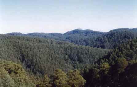
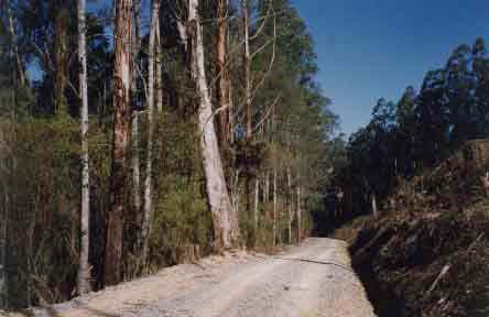
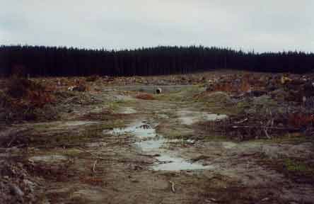
May 2004 Strzelecki Ranges north face: College Creek Catchment looking south. It appears that Hancock have deliberately avoided logging within this catchment boundary. This is a significant turn around for Hancock showing that on the ground staff have a commitment not to log areas determined to be within the Cores and Linkages proposal as determined by the Strzelecki Working Group in 2001. College Creek is approximately 800 hectares in size. About 400 hectares contains Mountain Ash planted by Australian Paper Manufacturers (APM) in 1977. The other 400 hectares contains old growth forest and cool temperate rainforest. The rainforest is already showing sign of stress through the disease Myrtle Wilt. Logging within this catchment would potentially stir up Wilt spores, leading to further spread of the disease within this catchment. The decision by Hancock not to log this catchment is a significant environmental improvement for the company.
May 2004 Strzelecki Ranges north face: College Creek Catchment looking south. A large portion of College Creek is leased by Hancock from the Victorian State Government. About half of the catchment was reserved by the Victorian Government as an Agricultural College Reserve in the 1940's, however the College portion was gazetted back to State Forest in 1958. About 100 hectares of the catchment in the south eastern corner is privately owned by Grainger Investments. Most of the catchment lies within the Parish of Jumbuk with about 300 hectares located in the Parish of Binginwarri.
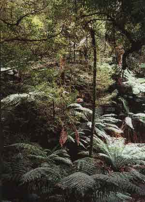
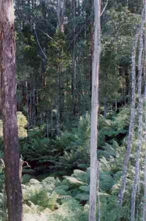
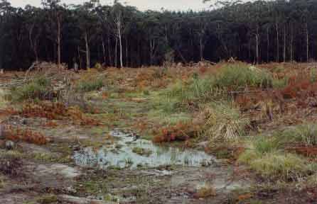
Strzelecki Ranges north face: College Creek Rainforest is larger than that contained within Tarra Bulga National Park and is situated on the northerly aspect of the Grand Ridge Road. All tributaries of College Creek contain extensive areas of rainforest. The rainforest contains rare species such as the fern Tmesipteris elongata. The photo above shows a rare Slender Tree Fern. For more information about College Creek click here.

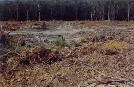
May 2004 Strzelecki Ranges north face: Tributary of Middle Creek which lies east of the College Creek catchment. Recent logging by Hancock of Mountain Ash planted by Australian Paper Manufacturers in 1970.
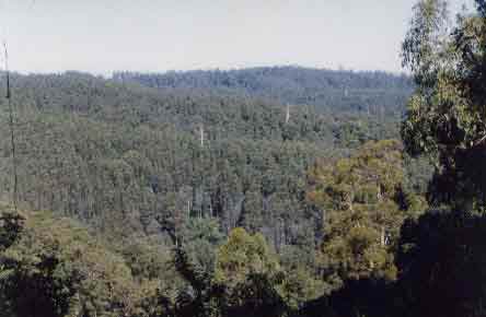
May 2004 Strzelecki Ranges north face: Link Letters Road which lies on the eastern side of College Creek. This land is also leased from the Crown. This photo shows the recent logging of 34 year old Mountain Ash outside the College Creek catchment and retained native vegetation in the College Creek catchment.
May 2004 Strzelecki Ranges north face: College Creek boundary on the western side of the catchment. This photo shows Track 32 which runs along the ridge of College Creek and Smiths Creek. Note retained native vegetation in College Creek catchment. Most of the Ash in Smiths Creek catchment was planted by APM in 1976. Hancock staff at this site have been very careful in working to protect the ecological atrributes of College Creek.
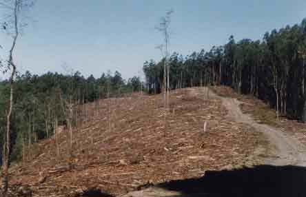
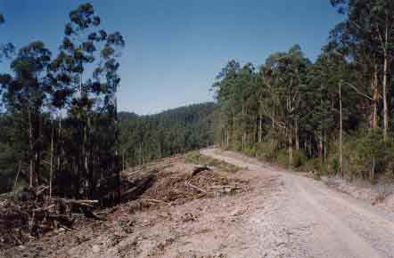
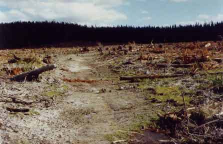
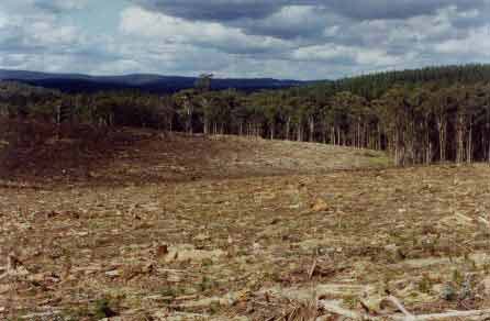
May 2004 Strzelecki Ranges north face: Recent clearfell logging by Hancock in the Middle Creek Catchment. Trees logged here were 28 year old Eucalytus Regnans planted by APM in the 1970's.
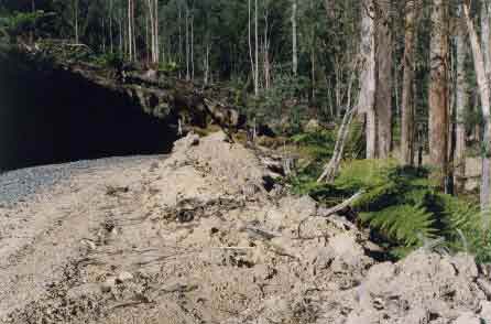
May 2004 Strzelecki Ranges north face: Poor roading on Bart Track in the Morwell River East Branch catchment - probably in the Parish of Wonyip. Heavy rain will most likely play havoc with the Lower Cretaceous Sediments on this site. Hancock is currently logging APM Mountain Ash established from 1971/2 at this location. This is leasehold land.
May 2004 Strzelecki Ranges north face: Decent enough buffers near Barts Track in the Morwell River East Branch catchment. But will these buffers be sufficient to protect water quality from the poor roading at this location?
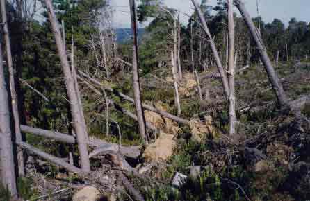
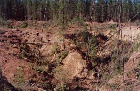
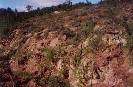
May 2004 Strzelecki Ranges south face (Allotment 16 Parish of Bulga): Recent logging of 1976 Radiata Pine plantation in the South Middle Creek catchment has exposed Cool Temperate Rainforest to high winds. Pine trees retained as buffers at this site have blown over. In some cases the trees have blown over into a rainforest gully, destroying that rainforest. This allotment adjoins Tarra Bulga National Park.
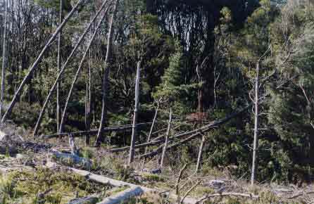
May 2004 Strzelecki Ranges south face (Allotment 16 Parish of Bulga): South Middle Creek catchment showing more pine that had been blown into a tributary which contained cool temperate rainforest. Poor site planning of plantations in the past has and will cause chaos in rainforest catchments in the Strzeleckis. Much of the above allotments need to be replanted with indigenous species and retired from timber production in order to save the long term rainforest values present in this plantation.
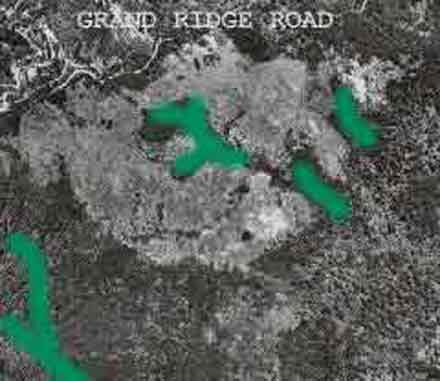
Aerial photograph from 1972, showing approximate location of cool temperate rainforest in the allotments of 16, 17, 18 and 20 Parish of Bulga. This plantation had obviously been established by APM on ex farmland. Extensive buffers need to be established on all cool temperate rainforest areas within the South Middle Creek catchment. This plantation site also lies within the drinking water catchment for the Gippsland town of Yarram.
May 04: Plantation LEGL93-34 which lies just south of the city of Ballarat in central west Victoria. Much of this plantation has been established on old gold mine tailings. Some mine tailings contain heavy metals such as Mercury and Arsenic. These sediments could be released into the catchment if disturbed by plantation logging operations. This plantation lies within the Yarrowee (Leigh) River catchment. The site urgently needs to be retired from future timber production and revegetated with indigenous species. This will need to occur if Hancock wants to retain their certification from the Forest Stewardship Council.
FSC Condition 6.5.1: 'Starting in Year 1, and continuing through the certification period HVP will: ... Harvest pine trees in buffers where they occur (but continue to protect intact native vegetation) and allow regeneration of native vegetation, in sensitive waterways. This regeneration is to be assisted by planting of native vegetation or other means where necessary to provide effective ground cover. The intention is that sensitive waterways will have stable undisturbed native understorey vegetation that is to be protected from damage during harvesting in subsequent operations'.
May 04: Plantation LEGL93-34 which lies just south of the city of Ballarat in central west Victoria. Recent plantation logging of old gold mining sites. Quite a number of Hancock pine plantations in Victoria lie on top of old gold mine areas - especially in the Ballarat and North East Victoria regions. See here for further information. This site could also be a potential heritage site. Note the steps cut into the gully. What will happen here after heavy rainfall?
FSC Condition 6.5.1: 'Starting in Year 1, and continuing through the certification period HVP will: ... Harvest pine trees in buffers where they occur (but continue to protect intact native vegetation) and allow regeneration of native vegetation, in sensitive waterways. This regeneration is to be assisted by planting of native vegetation or other means where necessary to provide effective ground cover. The intention is that sensitive waterways will have stable undisturbed native understorey vegetation that is to be protected from damage during harvesting in subsequent operations'.
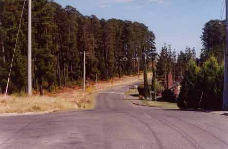
May 04: Plantation LEGL93-34 which lies just south of the city of Ballarat in central west Victoria. This photo shows Brittain Avenue near Mount Pleasant. It would appear that the suburbs of Ballarat have spread into areas that had been planted with pine. The worry here could be the risks associated with bushfires to residents. The Canberra fires of 2003 showed the terrible consequences of what can happen to suburbs lieing in close proximity to pine plantations.
May 04: Plantation 93-54 (Ballarat Region) located around the Korweinguboora Reservoir which provides drinking water to the residents of the city of Geelong. This photo (near Chase Road) shows a clear drainage line (in drought) on the western side of the East Moorabool River. Buffers on this drainage line have recently been logged. The question here is that Hancock most likely intend to use herbicides in this plantation in the near future. How close will these herbicides be allowed to be used to this drainage line? The herbicides will most likely be pellitised Hexazinone which can remain in the soil for long periods of time.
FSC Condition 6.5.1: 'Starting in Year 1, and continuing through the certification period HVP will: ... Harvest pine trees in buffers where they occur (but continue to protect intact native vegetation) and allow regeneration of native vegetation, in sensitive waterways. This regeneration is to be assisted by planting of native vegetation or other means where necessary to provide effective ground cover. The intention is that sensitive waterways will have stable undisturbed native understorey vegetation that is to be protected from damage during harvesting in subsequent operations'.
FSC Condition 6.6.2: 'By the end of Year 1, HVP is to provide more information on the source, composition and amounts of all chemicals used. Summary information is to be provided, upon request, to interested parties including local government agencies, local residents and other interested parties so that they are better informed on chemical use across the HVP estate and at the forest management unit level'.
FSC Condition 6.6.3: 'By the end of Year 1, HVP is to increase the intensity of stream water sampling following aerial spraying of herbicides to include significant ephemeral streams flowing from treated areas'.
May 04: Plantation 93-54 (Ballarat Region) located around the Korweinguboora Reservoir which provides drinking water to the residents of the city of Geelong. New culverts have been established at this site (most likely Chase Raod), however plantation logging has been conducted up to the edge of drainage lines. This photo also reveals that natural drainage lines up from the culvert have most likely been ripped by heavy machinery. A large amount of soil had been disturbed at this site meaning a high potential for erosion especially in the event of heavy rainfall.
May 04: Plantation 93-54 (Ballarat Region) located around the Korweinguboora Reservoir which provides drinking water to the residents of the city of Geelong. This photo (near Chase Road) shows another clear drainage line lieing on the western side of the East Moorabool River with no buffers. Drought is still gripping much of Victoria. How much water will this drainage line hold in periods of heavy rainfall?
FSC Condition 6.5.1: 'Starting in Year 1, and continuing through the certification period HVP will: ... Harvest pine trees in buffers where they occur (but continue to protect intact native vegetation) and allow regeneration of native vegetation, in sensitive waterways. This regeneration is to be assisted by planting of native vegetation or other means where necessary to provide effective ground cover. The intention is that sensitive waterways will have stable undisturbed native understorey vegetation that is to be protected from damage during harvesting in subsequent operations'.
LEGL93-54 (Ballarat Region). Geelongs' Water Supply. Gahnia species in a naturally occurring wetter part of this plantation. No buffers are present at this location and logging machinery had driven through this natural depression. Some naturally regnerating trees had also been destroyed at this site. It would appear that this plantation has been established too close to naturally occurring wetter areas. Much of this area should be retired from timber production and allowed to naturally regenerate.
FSC Condition 6.5.1: "Starting in Year 1, and continuing through the certification period, HVP will: Define and implement a practical definition of sensitive waterways, with input from interested stakeholders. Develop a coordinated, strategic plan for the identification, and protection where necessary of sensitive waterways (primarily based on erosion risk and water values) throughout the HVP estate, including a thorough analysis at an estate-wide level to identify priority sites... Conduct staff training procedures to discuss the impacts of the increase in soil water levels that follow clearfelling. This may require more careful estimation of stream class and wider buffers around swampy areas".
LEGL93-54 Korweinguboora (Ballarat Region). Another plantation clearfell in the water supply of the City of Geelong. This plantation is approximately 1500 hectares in size, with about 1400 hectares lieing within the East Moorabool (Sheoaks) Proclaimed Water Supply Catchment. About 100 hectares on the eastern side of the plantation lie within the Werribee River catchment.
FSC Condition 5.5.1: "By the end of Year 1, HVP must review its policy on clearcut size, configuration and distribution, and produce a strategic plan that reinforces a commitment to reducing watershed impacts, in all likelihood representing a reduction in clearcut size ... , more use of mosaic cutting at the sub-catchment level ..."
LEGL93-35. Recent logging of pine plantations on rocky escarpments north of the central-western Victorian town of Beaufort. This photo shows the ridge that forms a natural rocky boundary between Fiery Creek which flows south and the Wimmera River catchment which flows north west. About 250 hectares of this plantation lies within the Wimmera River catchment.