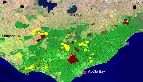
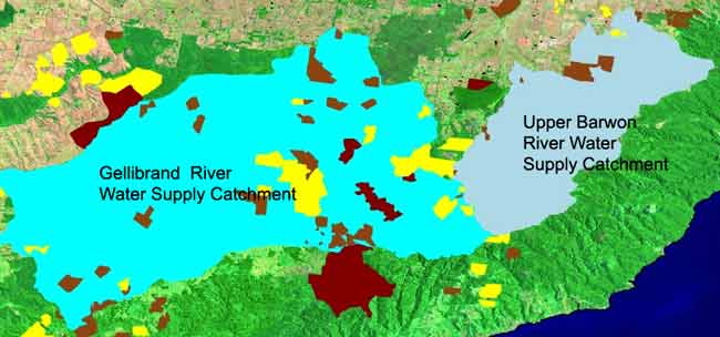
December 2006: Generic plantation map for the Otway Ranges,
Yellow = Bluegum Plantations. Brown = Pine plantations.
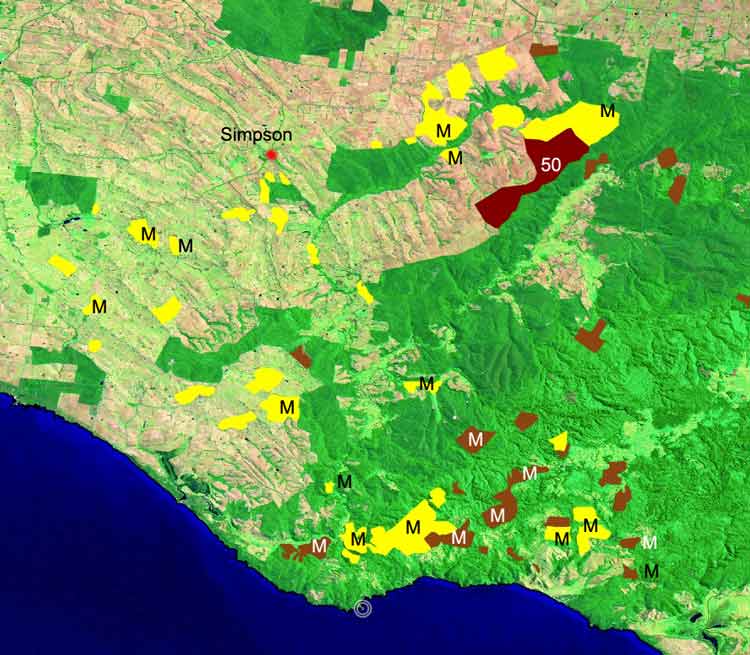
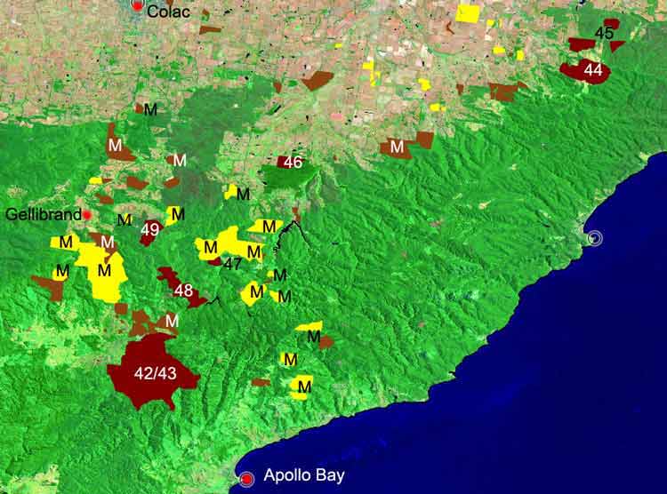
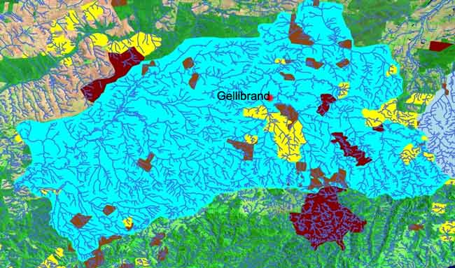
December 2006: Plantation map for the western Otway Ranges,
Yellow = Bluegum Plantations. Brown = Pine plantations. M=Midway Plantations
Pty Ltd. 50=Hancock's Irrewillippe Plantation
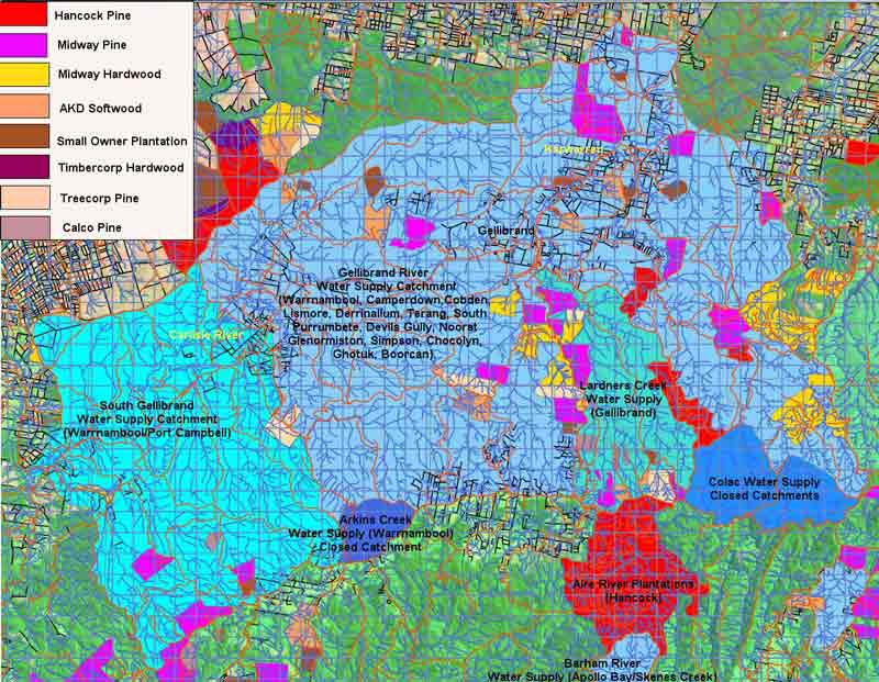
The blue shaded areas are domestic water supply catchments. Arkins Creek and
catchments supplying Colac are closed catchments, meaning that no logging activities
can take place in those catchments. Lardners Creek catchment is not a proclaimed
water supply catchment and supplies the township of Gellibrand with drinking
water. Lardners Creek is the responsibility of Barwon Water.
The map shows details of land boundaries owned by each of the plantation companies.
Some of the land within these boundaries could contain native vegetation.
The Gellibrand River catchment supplies the following townships; Warrnambool,
Camperdown, Cobden, Lismore, Derrinallum, Terang, South Purrumbete, Devils Gully,
Noorat, Glenormiston, Simpson, Chocolyn, Ghotuk and Boorcan. Water quality and
supply from the Gellibrand System is the responsibility of South West Water,
who have stated that plantation forestry poses a high risk to water quality.
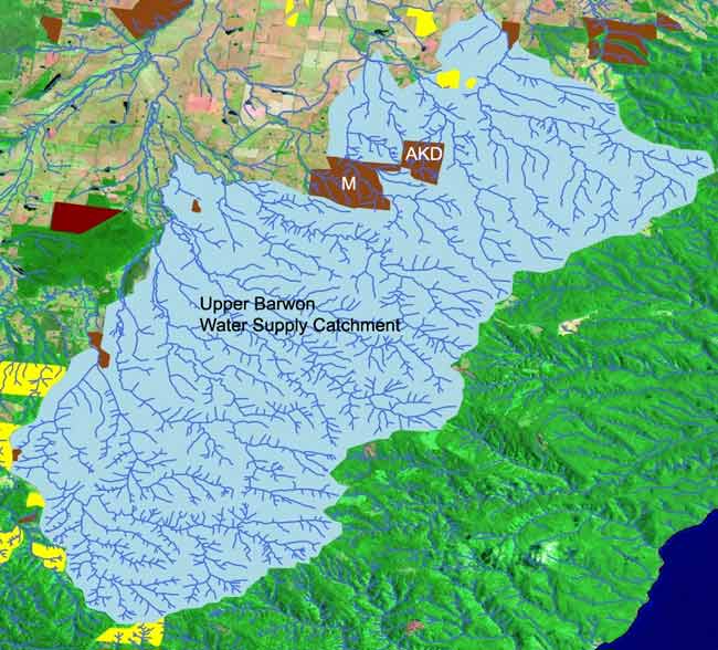
As can be seen from this map the biggest plantation risk to water quality
is from Midway Plantations Pty Ltd - especially so post logging and spraying
in the Lardners Creek catchment. Midway is converting much of their pine to
hardwood plantations, which could pose a greater risk to water quality through
the use of insecticides. AKD and Hancock pose the next greatest risk.
Image of plantations located inside domestic water supplies for Gellibrand
River and Upper Barwon System. These two water supply areas probably provide
water to over 150,000 people.
Gellibrand River System. Several thousand hectares of plantations located
in this water supply that supplies 50,000 people+ in the states south west.
Geelong Water Supply from the Barwon River system. Hancock have no land holdings
within this water supply. About 400ha of pine and a small amount of bluegum
lay in this predominantly forested water supply