Region: Otways
Legal Number: LEGL/93-46
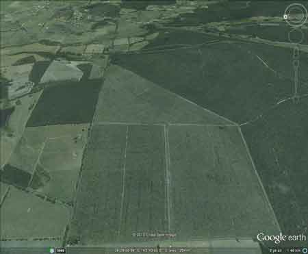
Plantation: Otways FD (Yaugher)
Conservation Priority: Low
Plantation within AKD Softwoods area of supply.
Plantation within SPE Exports (Geelong) area of supply.
Click
here for Otways map.
|
 93-46
Feb 01: Potentially certifiable plantation? Located on flat
slopes. Logged out in 2003/4.
93-46
Feb 01: Potentially certifiable plantation? Located on flat
slopes. Logged out in 2003/4. |
|
THREATENED FISH NOTES - BARWON RIVER: Probably Blackfish
in mid to upper reaches. The lower reaches have 1 of 2 of the main spawning
areas for Australian
Grayling west of Melbourne.
This plantation was very likely to be aerially
sprayed with 2,4,5-T between 1968 and 1977. The Dioxin TCDD may still
exist in soil in this plantation. For more historical data on 2,4,5-T
click
here. For more information concerning the
continuing health crisis concerning 2,4,5-T please forward to
here.
Herbicides Used by Hancock
in Pine Plantations - Ballarat Region Victoria
| Herbicide |
Label Rate max as kg/ha |
Used to control |
Notes |
Application |
| Clopyralid |
2.55 |
Woody Weeds |
Highly Toxic/Potential Ground water Contaminant |
air or ground |
| Glufosinate
Ammonium |
1 |
Woody Weeds |
|
|
| Glyphosate |
3.6 |
Herbaceous and woody weeds, noxious weeds |
|
|
| Hexazinone |
4 |
Woody Weeds |
Ground Water Contaminant |
Aerial, ground, spot |
| Metsulfuron-Methyl |
0.06 |
Woody Weeds, Noxious Weeds |
Potential Ground Water Contaminant |
Aerial, ground or spot |
| Triclopyr |
3 |
Woody and Noxious Weeds |
|
Ground, spot, basal bark |
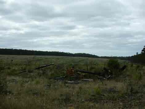
March 05: This plantation logged out in 2003/4.
Responsible Authority: Colac-Otway Shire Council
Quote of the year 2002: "Colac Otway Shire 6/12/02. Freedom
of Information Request.
In response to your request for information relating to the use
of herbicides by plantation companies, I advise that there are no records
within Council, as plantation companies are not yet required to advise
either Council or the Department of Natural Resources and Environment
of their intention to conduct herbicide applications.
Yours sincerely - Freedom of Information Officer - Colac Otway Shire".
March 05: This plantation logged
out in 2003/4.
Plantation Catchment: North East tip of plantation near small
creek, flowing North into Barwon River East Branch/Barwon River.
Catchment Managment Authority: Corangamite Catchment Management
Authority
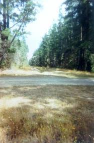
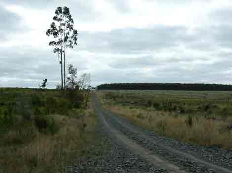
Hancock Watch Site visit Feb 01: This plantation located on
flat land. Give it the thumbs up as far as plantations go. Smaller scale
without the problems of massive land overuse.
Barwon River above Winchelsea: Usually a slow flowing river
with extensive shallow reaches and pools up to 2.5m deep. Flows from
moutainous forested country upstream of Forest to grazing land, sand
and mud bottom. Lower section modified by agriculture and flow is controlled
by water releases from West Barwon Reservoir. Trout spawning occurs
in the headwaters. Contains river blackfish to 140g, some brown trout
to 600g, redfin, short-finned eels and spiny freshwater crayfish.
Source: A Guide to the Inland Angling Waters of Victoria by BR Tunbridge,
PL Rogan, CA Barnham. Department Conservation and Environment. Arthur
Rylah Institute for Environmental Research, 123 Brown St, Heidelberg,
3084. (4th ed - 1991)
HOME
|