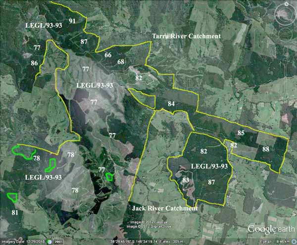
Region: StrzeleckisLegal Number: LEGL/93-93Plantation: JackConservation Priority: HighKey Strzelecki Warm Temperate Rainforest SitesAlso see: Yarram abnormalitiesArea within PaperlinX area of supply.More information on Jack River plantations hereArea within Planthard Hardwoods (Drouin West Sawmills) area of supply.Area within Brown and Dureau Softwoods (Morwell) area of supply.Water Catchment Area (LAND USE DETERMINATION -26/1/71): TARRA RIVER CATCHMENT SUPPLIES WATER FOR ALBERTON, PORT ALBERT, YARRAM. LUD’S REPLACED WITH SPECIAL AREA PLANS UNDER THE CATCHMENT AND LAND PROTECTION ACT 1994. Located in Yarram Water Supply Protection Area - Groundwater THREATENED FISH NOTES - STRZELECKI STREAMS: Habitat forSpotted Galaxias, Mountain Galaxias, Broadfinned Galaxias, Tupong , Blackfish and the FFG listed Australian Grayling..
|
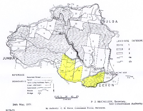
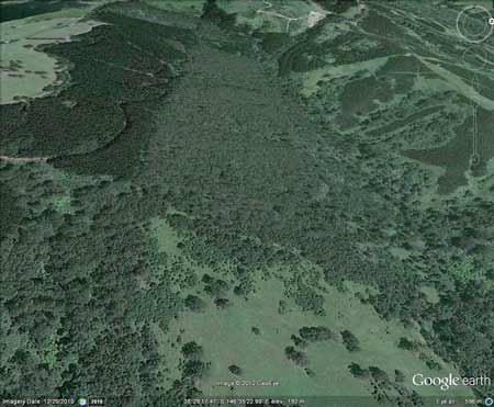
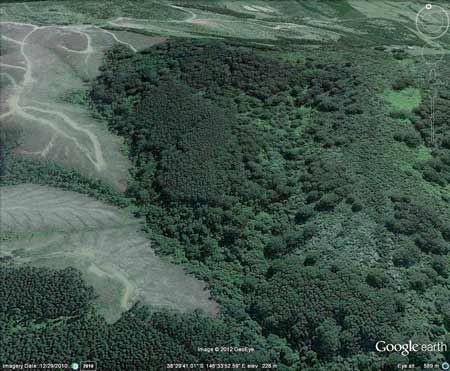
Above: Map indicating the portion of this plantation (perhaps 300ha - marked in yellow) which lies within the boundaries of the Tarra River Water Supply Catchment. Most of the plantation lies outside this catchment.
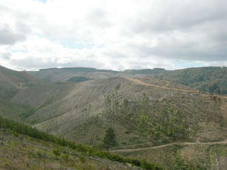
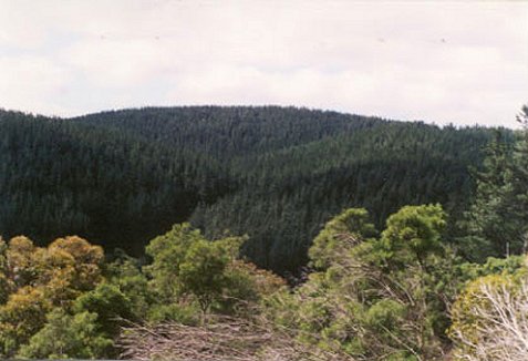
September 2011: Hundreds of hecatres of plantation logged during 2010/11 in the Stony creek catchment..
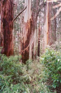
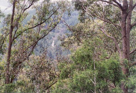
Plantation boundary marked in yellow. Most plantings occurred in 1977/8. Atrazine at 4L/ha and Amitrole at 7L/ha would most likely have been used when these plantations were established. ~750ha in total meaning that 3000L of Atrazine and 5250L of Amitrole would have been used. The herbicide 2,4,5-T would most likely have been used in the Tarra River catchment between 1966-68. Perhaps 40 houses lie downstream of these plantations, with an unknown number of people possibly pumping water from creeks for drinking water. Warm Temperate Rainforest locations marked in green on the above image.Remant stands of Warm Temperate Rainforest are located within pine plantations in this plantation area. Strzeleckis warm temperate rainforest is entirely restricted to the lowland valleys of the Strzelecki Ranges in South Gippsland. There are no equivalent vegetation types in previous descriptions of rainforest in Victoria and it does not occur outside the state. Strzeleckis Warm Temperate rainforest is extremely fragmented and was initially cleared by farmers. It is of national importance! Strzelecki Warm Temperate Rainforest is the most endangered Ecological Vegetation Class in the Strzelecki Bioregion. For full details of all of Hancock land lieing within this catchment click here. |
Plantation Catchment: Catchment Managment Authority: West Gippsland Catchment Management Authority Responsible Authority: Wellington Shire Council Soils: Kls: Cretaceous (Lower Aptian) Paludal - Strzelecki Group: Feldspathic, lithic sandstone, siltstone and mudstone, minor black coal, quartzose sandstone, conglomerate, local carbonate concentrations. Abundant plant remains. This plantation was very likely to be aerially sprayed with 2,4,5-T between 1966 and 1968. The Dioxin TCDD may still exist in soil in this plantation. For more historical data on 2,4,5-T click here. For more information concerning the continuing health crisis concerning 2,4,5-T please forward to here. |
||||||||||||||||||||||||||||||||||||||||||||||||||
|
|
"South
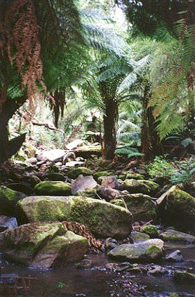
Middle Creek rainforest
South Middle Creek rainforest is bounded by the Grand Ridge Road to the north, Tarra Valley Road to the west and Whitelaws Track to the south and east. There is cool temperate rainforest along most of the length of South Middle Creek. The section without rainforest is that adjacent to plantation between Middle Creek and Middle Creek Track. A number of sections of the rainforest on this creek are quite wide and extend more than 100 metres up the slope on the northern side. The southern side tends to be more damaged due to past clearing or plantation activity, but there are some wide sections of rainforest on that side as well. |
|||||||||||||||||||||||||||||||||||||||||||||||||||
Herbicides Used by Grand Ridge Plantations - Strzelecki Ranges and Gippsland Victoria
|
|
|||||||||||||||||||||||||||||||||||||||||||||||||||
|
|
|
||||||||||||||||||||||||||||||||||||||||||||||||||
|
There are also extensive areas of blackwood forest, with some myrtle beech scattered within it. The major section of rainforest is in the north/west corner of the headwaters. There are many skirted and slender tree ferns in this section. There are a number of important habitat areas in the South Middle Creek Catchment. The major area of mountain ash regrowth is in the north/east corner, adjacent to the Tarra Valley Road. There is a small area of mountain ash regrowth and understorey vegetation on the steep slopes of the south east corner. There are large areas of blackwood forest north of the creek, below plantation and a small area of mountain ash regrowth in the northwest corner. There are fewer areas of regrowth in the southern side, but some small areas remain in the south-west section. |
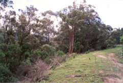
~50 ha of native forest remains on the western side of Tarra River inside this plantation boundary, and ~30ha of native forest on the eastern side of Stony creek. |
|||||||||||||||||||||||||||||||||||||||||||||||||||
|
As there are very few areas of mature eucalypts
left in the Strzeleckis, and the remaining few are rapidly disappearing,
these areas of native vegetation need to be preserved."
Rainforests of the Strzelckis by Elaina Fraser. |
||||||||||||||||||||||||||||||||||||||||||||||||||||
|
|
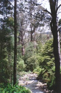
Tarra River - Upper reaches: Fast flowing stream running through partly cleared hills, rock and gravel bottom. Access is good but the tributaries are remote and difficult to reach. Abundant brown trout to 400g, average 120g, river blackfish, tupong, grayling and eels. Subject to a blackfish closure. Albert River - Below Staceys Bridge: Flows through open country, mud and sand bottom. Highly modified by agriculture, water is often turbid with wide variations in flow and water level. Where the habitat is suitable, trout will be found but, like the Agnes River, these areas are relatively inaccessible. Eels abundant and a few brown trout from 200 to 600g, occasional small river blackfish. Estuarine section often has estuary perch.
|
||||||||||||||||||||||||||||||||||||||||||||||||||
|
‘A Report on the Tarra River Catchment (Yarram Waterworks Trust) 1970’ p6 “The catchment is situated on the southern slope of the South Gippsland Highlands with the off-take weir on the Tarra River about 9 miles NW of Yarram at R.L. 421 feet” . . . p11 “. . . From the weir the water travels through a nine mile long pipeline first to the service basin at Devon North, then on to the 150,000 gallons water tower in Yarram . . . the maintenance of a good summer flow is essential . . . p12 thr rocky and boulder strewn stream bed keeps transported material in suspension. In the absence of a reservoir at the intake this has the detrimental effect on the nine mile pipeline . . . the occasional high turbidity readings are inescapable. . .” p10 “. . . The erosion hazard in the catchment is generally low. The soils are Jurassic sediments, which are the most common, have good structure and depth, and absorb moisture readily. This explains the absence of any form of erosion, excepting landslips. . . Landslides and slips happen during every above average wet winter. Most vulnerable to this type of erosion are the cleared, steep sided valleys and the high and steeply cut road batters . . .” Jack River, Yarram: A tributary stream of the Albert River, fast flowing and running through partly cleared hills, rock bottom. Contains brown trout to 520g, average 160g, abundant mainly small river blackfish, tupong, both species of eels and grayling. Source: A Guide to the Inland Angling Waters of Victoria by BR Tunbridge, PL Rogan, CA Barnham. Department Conservation and Environment. Arthur Rylah Institute for Environmental Research, 123 Brown St, Heidelberg, 3084. (4th ed - 1991)HOME |
||||||||||||||||||||||||||||||||||||||||||||||||||||