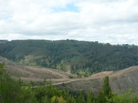
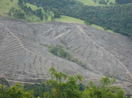
September 2011. Strzelecki Ranges/Stony Creek : View looking north east into the headwaters of Stony Creek after clearfelling of 34 year old pine plantations established in 1977. A mass of approximately 800ha of pine have been logged in this vicinity in the past year. This photo shows a clearfell of approximately 200ha. Stony Creek flows into the Jack River about 3km south west of the South Gippsland town of Yarram. Jack River then empties into the Albert River which flows into Nooramunga Marine Reserve near Port Albert. These plantations were purchased from the Victorian Plantations Corporation and many were established in the late 1970's with the use of the herbicide 2,4,5-T. Plantations this size will again be sprayed with herbicides over the first two years of establishment. Sediment loss from such intensive logging would be enourmous. More information about this plantation here (which also includes plantations in the Tarra River catchment).

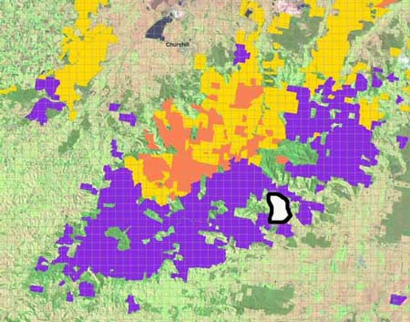
Approximate location of Stony Creek catchment, indicating area clearfelled in above photo [area marked in white with black outline]. Purple represents ex VPC land. Pink is Hancock leasehold and Gold is Hancock freehold.
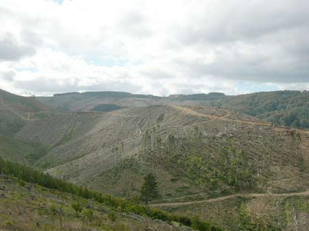
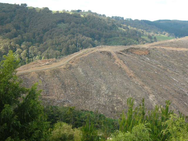
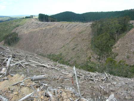
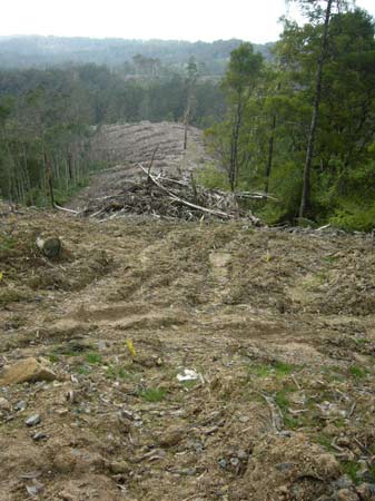
September 2011. Strzelecki Ranges/Stony Creek: A view looking west near the headwaters of Stony Creek. Almost the entire headwaters of the catchment has been clearfelled. FSC certified. How is this sustainable?
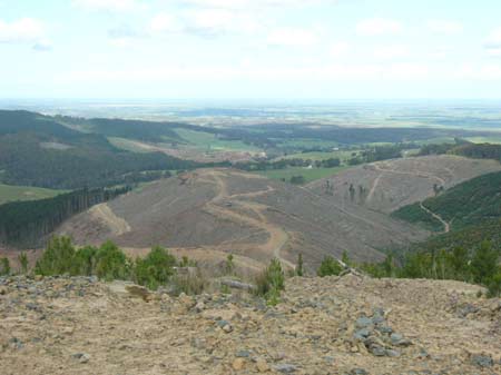
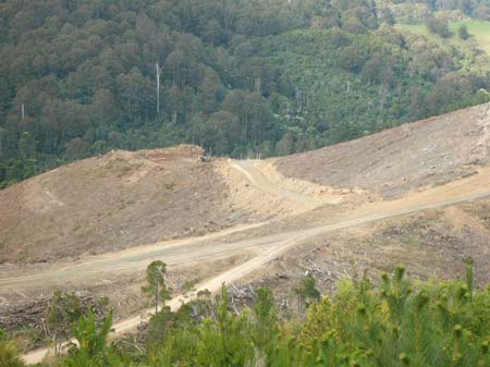
September 2011. Strzelecki Ranges/Stony Creek. View looking south east into recent clearfell logging. Town of Yarram lies about 10km away in the distance.
September 2011: Strzelecki Ranges/Stony Creek: A closer look at Stony Creek, also showing some remnant bush lieing on the eastern side of the catchment. Approximately 50ha of native forest remains in the Hancock leased area of the catchment.
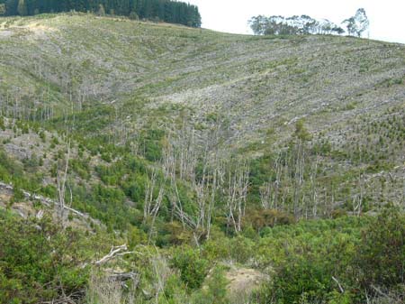
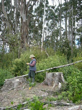
September 2011: Strzelecki Ranges/Stony Creek. A view looking east into stand of remnant native forest. The entire catchment should be covered in this type of forest.
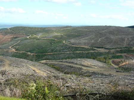
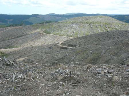
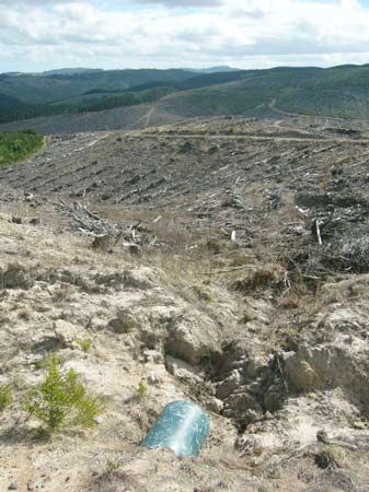
September 2011: Strzelecki Ranges/Stony Creek. Quite steep slopes have been logged in the catchment. What happens to this site in the event of heavy rain?
September 2011: Strzelecki Ranges/Stony Creek. Road construction and upgrading old logging roads can displace large amounts of sediment which can become mobile after heavy rain.
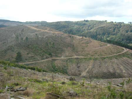
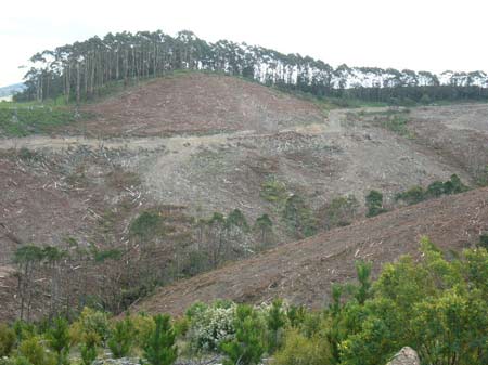
September 2011: Strzelecki Ranges/Jack River. Recent clearfelling of 33 year old pine has occurred in this location. This site is about 1km south west of the Stony Creek photos shown in the preceeding photos.
September 2011: Strzelecki Ranges/Jack River. More clearfelling and it was apparent that herbicides had been used at this locations in the recent past (most likely Glyphosate). Helicopters can be used to spray the pesticide, as the scale of the spraying required would be difficult for ground based spray teams. On radiata pine plantations Hancock can use, Clopyralid on woody weeds at 2.55kg/ha [aerial or ground], Glufosinate Ammonium on woody weeds at 3.6kg/ha [aerial or ground], Glyphosate on herbaceous, woody or noxious weeds at 3.6kg/ha [aerial or ground], Hexazinone on woody weeds at 4kg/ha [aerial, ground or spot] and Metsulfuron Methyl on woody weeds/noxious weeds at 0.06kg/ha [aerial, ground or spot].
September 2011: Strzelecki Ranges/Biralee Creek. Headwaters of this creek, part of the Stony Creek catchment. 100 remant indigneous trees are now dead in the headwaters of the creek. These trees part of the reserved lands that Hancock claim they reserved in 2008.
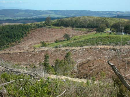
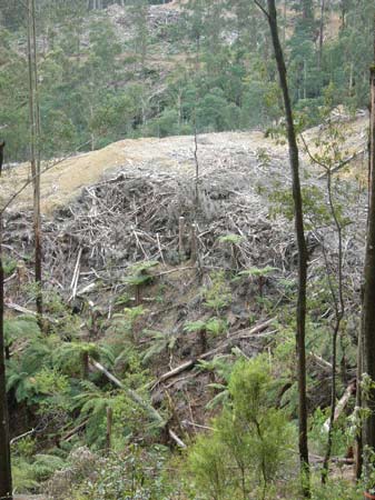
September 2011: Strzelecki Ranges/Biralee Creek. The view after clearfelling. Approximately 250ha of pine has been clearfelled in Biralee catchment in the past few months.
September 2011. Strzelecki Ranges/Biralee Creek. Household in close proximity to plantation. Aerial spraying would be of concern.
Recent pine clearfells in Stony/Biralee and Jack River block during 2011. [area marked in white with black outline]. Area represents about 800ha. Purple represents ex VPC land. Pink is Hancock leasehold and Gold is Hancock freehold. Almost 3 tonnes of glyphosate would be used on this area. If woody weeds grow on site over next couple of years, Hancock could use up to an additional 2 tonnes of Clopyralid, 0.8 tonnes of Glufosinate Ammonium & 3 tonnes of Hexazinone.
September 2011. Strzelecki Ranges/Antonio Creek. A slither of native forest in this pine coupe.
September 2011. Strzelecki Ranges/Antonio Creek tributary on south side of catchment.
September 2011. Strzelecki Ranges/Jack River. recent clearfelling of hardwoods in cores and links rainforest reserve. Are these trees natural or planted? For many years Hancock have logged the edges of their hardwood plantations taking potentially thousands of non planted trees.
September 2011. Strzelecki Ranges/College Creek. Recent clearfelling inside site of national conservation signifiance, in possibly the most contentious Hancock area.
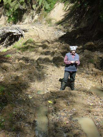
September 2011: Strzelecki Ranges/College Creek. FSC certified roading inside site of national conservation significance. This road has remained in this condition for the past 6 months.
September 2011: Strzelecki Ranges/College Creek. FSC certified roading and innovative way to navigate headwaters of creek. This is how Hancock and Hancock logging contractors treat sites of national conservation significance.
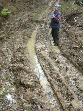
September 2011: Strzelecki Ranges/College Creek. Another view of dismal FSC certified roading.
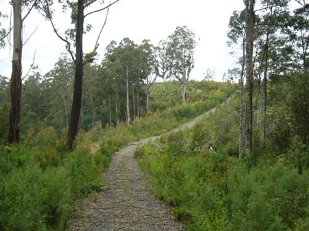
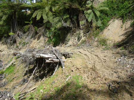
September 2011: Strzelecki Ranges/College Creek. 2 1/2 years after logging in new conservation reserve.
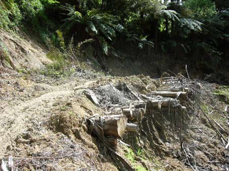
September 2011: Strzelecki Ranges/College Creek. Recent logging in site of national conservation significance.
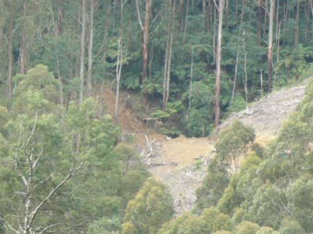
September 2011: Strzelecki Ranges/College Creek. Unsure what is going on here. Possible log landing located near gully. Possible high erosion potential.