Nov 15: Middle Creek/Perry River Catchment, Central Gippsland. West of Stockdale. Local residents are concerned about Hancock clearfelling plantations in close proximity to tributaries of the Perry River. Many of these plantations were established by APM in the 1970's and 1980's before adequate safeguards to waterways were implemented. Middle Creek flows into the Perry River ~5km west of Fernbank. The Perry River then flows into the struggling Gippsland Lakes, Australia's largest inland Lakes System.
The LCC report for Gippsland Lakes Hinterland 1982 Proposed Recommendations p35 stated that plantations should be set back 80 m either side of major waterways and 40m either side minor waterways. Yet HVP pine plantations along Middle Creek (a Providence Ponds tributary) west & east of Stockdale - Munro Rd go right into the creek. Recent clear fell operations have left debris and trees right in the creek, dozers have also gone straight thru the creek. Sandy Creek and California Creek (also PP tributaries) have pines growing right into edge of stream. Middle Creek and Sandy Creek are identified as an original discontinuous chain of ponds landform..
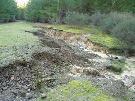
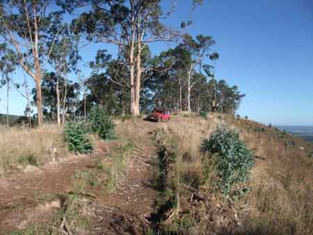
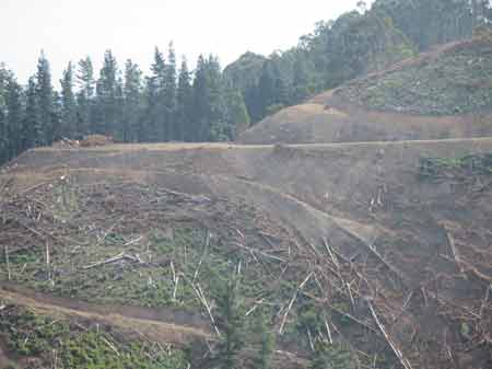
Nov 15: Middle Creek/Perry River Catchment, Central Gippsland. Near Stockdale. Eroding roads inside plantations.
![]()
Nov 15: Middle Creek/Perry River Catchment, Central Gippsland. East of Stockdale. Plantation felling alongside waterways. What happens when pesticides are applied and it rains. Middle Creek flows into the Perry River. Hancock uses the following herbicides in its pine plantations in Gippsland. Clopyralid, Glufosinate Ammonium, Glyphosate, Hexazinone and Metsulfuron Methyl.
Nov 15: Middle Creek/Perry River Catchment, Central Gippsland. Near Stockdale. No buffers on this young replanted plantation. Obviously Hancock aren't interested. Middle Creek flows through Hancock's Stockdale Plantations
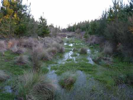
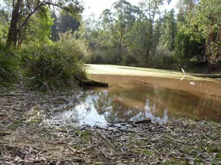
Nov 15: Middle Creek/Perry River Catchment, Central Gippsland. Near Stockdale. No buffers afforded on this waterway. What will be the impacts of aerial spraying on this waterway?
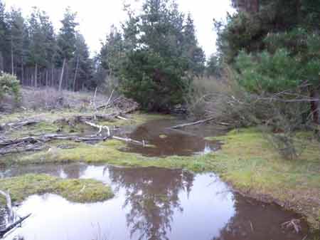
Nov 15: Middle Creek/Perry River Catchment, Central Gippsland. Near Stockdale. No buffers afforded on this waterway which is located near the Providence Ponds. The rare geological formation known as "The Providence Ponds" - a 'chain of ponds' forms a tributary of the Perry River. "The name Providence Ponds probably accurately describes the Perry River which is a series of irregularly spaced oval to round deep pools with either no interconnecting channel or with a small capacity, well vegetated connecting depression." (Erskine et al 1990)
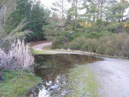
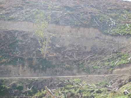
Nov 15: Middle Creek/Perry River Catchment, Central Gippsland. Near Stockdale. Logging road is actually part of Middle Creek at this location.
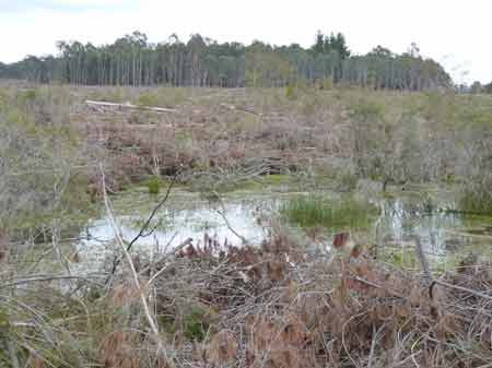
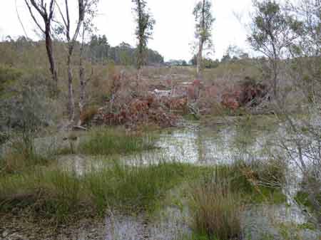
Nov 15: Middle Creek/Perry River Catchment, Central Gippsland. Near Stockdale. Pollution in the form of sedimentation, probably from logging operations observed at this location.
Nov 15: Vaggs Creek/Middle Creek Strzelecki Ranges: Dozens of bluegums were logged at the same time this plantation was logged in 2013/14 (~20 in this photo alone). The logged trees are now coppicing with vigorous growth observed on stumps. Bluegum are key components of the diet of koalas. This particular location is a koala hotspot.
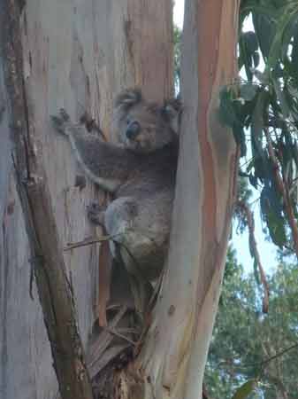
Nov 15: Middle Creek/Strzelecki Ranges: Strzelecki Koala hotspot currently being clearfelled by Hancock
Nov 15: Vaggs Creek/Middle Creek Strzelecki Ranges: Probably 30 bluegums were logged in this photo location alone. Note coppices.
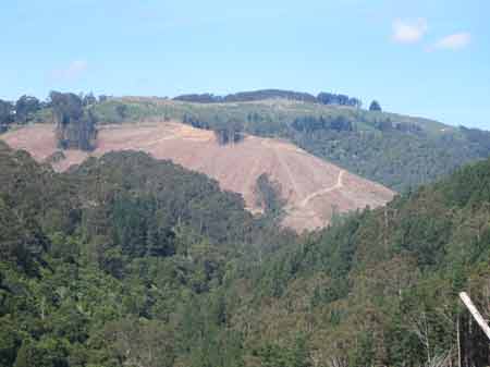
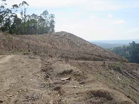
Nov 15: Vaggs Creek/Middle Creek Strzelecki Ranges: Clearfelling of pine plantations on steep slopes. Vaggs Creek lies between two koala hotspots, Morwell National Park and Middle Creek.
Nov 15: Vaggs Creek/Middle Creek Strzelecki Ranges: Plenty of koala scats had been observed in this now cleared pine plantation. Where are the animals now?
Nov 15: Vaggs Creek/Middle Creek Strzelecki Ranges: After the clearfelling comes the herbicide spraying.
Nov 15: Vaggs Creek/Middle Creek Strzelecki Ranges: A view into regenerating Warm Temperate Rainforest along Vaggs Creek, surrounded by pine plantations. Strzelecki Ranges Warm Temperate Rainforest is the most threatened EVC in the region.
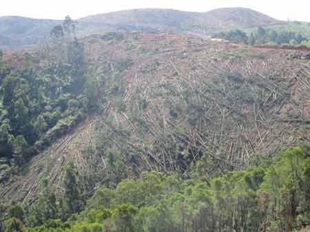
Nov 15: Vaggs Creek/Middle Creek Strzelecki Ranges: Another steep slope gets the chop!
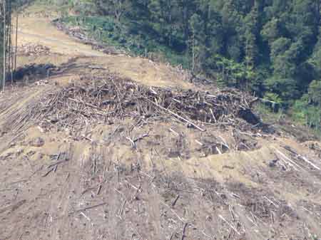
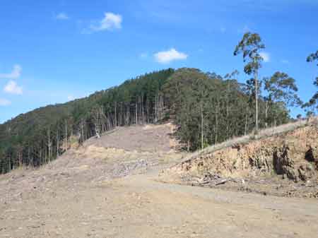
Nov 15: Vaggs Creek/Middle Creek Strzelecki Ranges: Log dump which will soon be torched at the top of hillside.
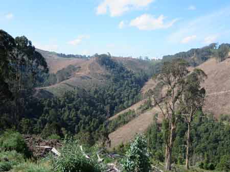
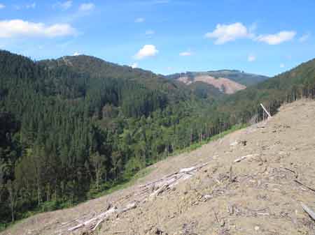
Nov 15: Vaggs Creek/Middle Creek Strzelecki Ranges: Remnant native forest in the gullies of Vaggs Creek.
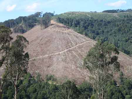
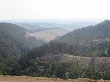
Nov 15: Vaggs Creek/Middle Creek Strzelecki Ranges: A mass of clearfelling in this catchment has occurred between 2013-16. 18,000 log truck movements along Jumbuk Road alone!
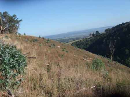
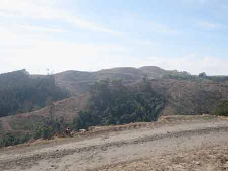
Nov 15: Vaggs Creek/Middle Creek Strzelecki Ranges: View looking south west.
Nov 15: Vaggs Creek/Middle Creek Strzelecki Ranges: Cable logged pine plantations.
Nov 15: Vaggs Creek/Middle Creek Strzelecki Ranges: Highly erodable soils at this location. Vaggs Creek flows into Middle Creek, which in turn flows into the Morwell River about a km north of Yinnar.
Nov 15: Vaggs Creek/Middle Creek Strzelecki Ranges: Highly erodable soils at this location.