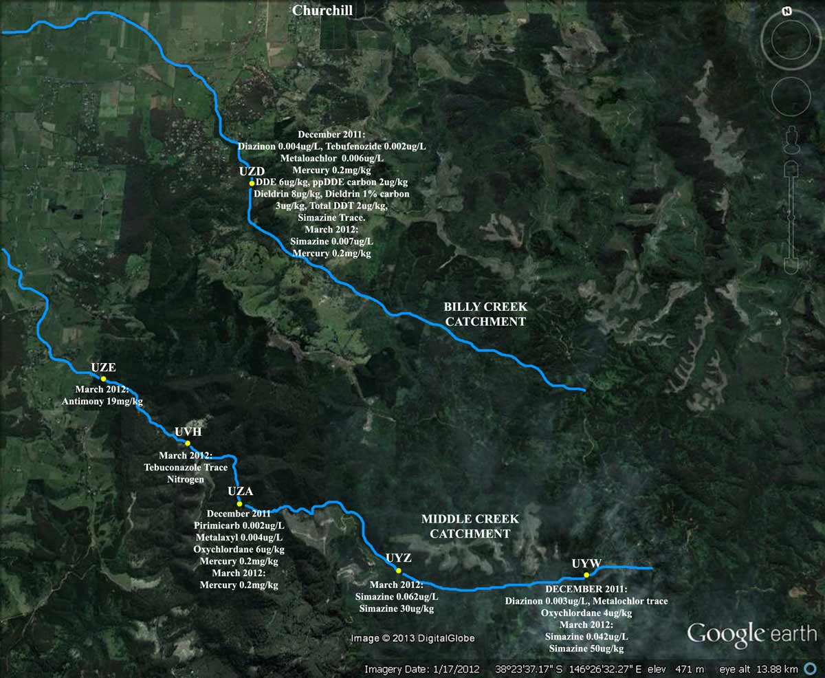
Map of Middle Creek, showing approximately locations of EPA sampling points. All are downstream of Hancock plantations/reforestation. Much of Middle Creek has been converted into Shining Gum over the past decade.
Is Hancock Planting Toxic Shining Gum In The Strzeleckis? Check Out The Tasmanian Situation Here
Hancock Knocks Out a dozen trees in their Leongatha plantation, in order to widen an existing logging track.
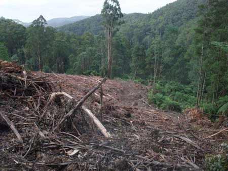
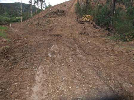
May 12 2013: Strzelecki Ranges/Tarwin River West Branch. Leongatha Plantation: Hancock lost ~30ha of pine in the March 27 Hallston fires.
May 12 2013: Strzelecki Ranges/Tarwin River West Branch. Leongatha Plantation: In order to salvage log the pine, upgrades to the logging tracks were made.
May 12 2013: Strzelecki Ranges/Tarwin River West Branch. Leongatha Plantation: A number of old growth trees were burnt in the northern section of the plantation. They would most likely survive such a fire event.
May 12 2013: Strzelecki Ranges/Tarwin River West Branch. Leongatha Plantation: Whether they survive the fire is moot point, because they were bulldozed over instread.
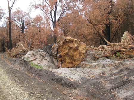
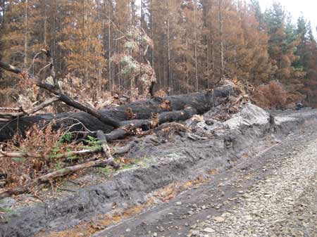
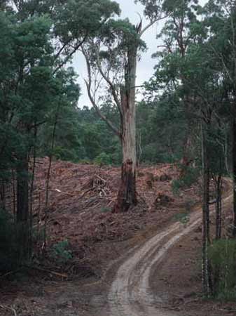
May 12 2013: Strzelecki Ranges/Tarwin River West Branch. Leongatha Plantation: Several old trees were located in close proximity to logging tracks.
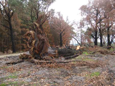
May 12 2013: Strzelecki Ranges/Tarwin River West Branch. Leongatha Plantation: Others were located a distance from the logging track.
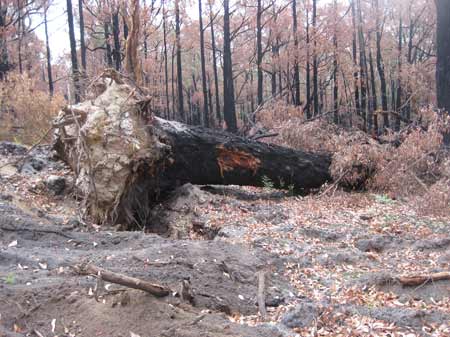
May 12 2013: Strzelecki Ranges/Tarwin River West Branch. Leongatha Plantation: Some of the trees would have been over 200 years old.
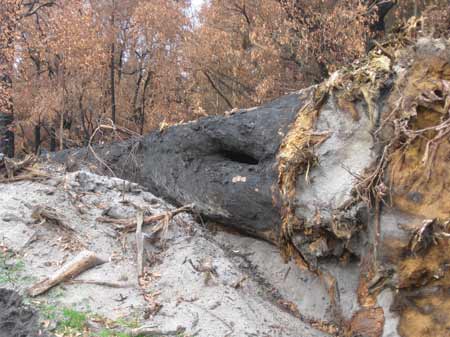
May 12 2013: Strzelecki Ranges/Tarwin River West Branch. Leongatha Plantation: Note hollow on this bulldozed tree. Hollows in eucalypts can take up to 120 years to form.
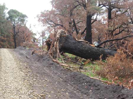
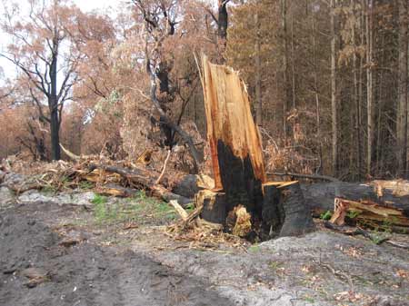
May 12 2013: Strzelecki Ranges/Tarwin River West Branch. Leongatha Plantation: Another dead old growth tree.
May 12 2013: Strzelecki Ranges/Tarwin River West Branch. Leongatha Plantation: Too close to the expanded logging road?
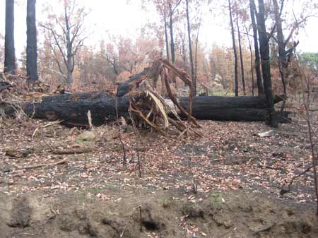
May 12 2013: Strzelecki Ranges/Tarwin River West Branch. Leongatha Plantation: This one was 50m away from the logging road.
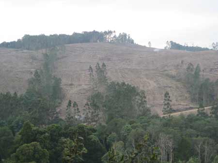
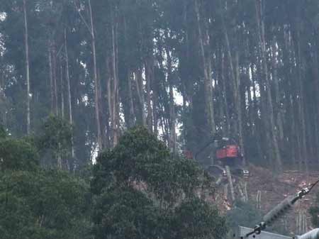
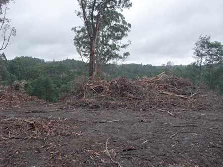
May 12 2013: Strzelecki Ranges/Bawden Creek Catchment. Allotments 14, 15, 16 and 38 Parish of Allambee, ex APM Pine have recently been clearfelled, to be replanted with the potentially toxic E. Nitens.
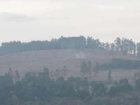
May 12 2013: Strzelecki Ranges/Bawden Creek Catchment. Allotment 38 Parish of Allambee. Burning log piles covering the valley with smoke.
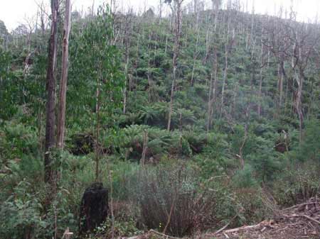
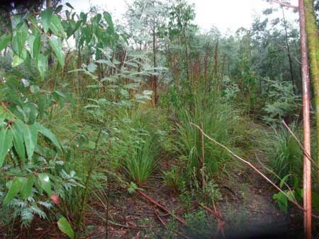
May 2013 Strzelecki Ranges/Traralgon Creek Catchment: Post February 2009 fire regeneration.
May 2013 Strzelecki Ranges/Traralgon Creek Catchment: Note small size of logs.
May 2013 Strzelecki Ranges/Traralgon Creek Catchment:
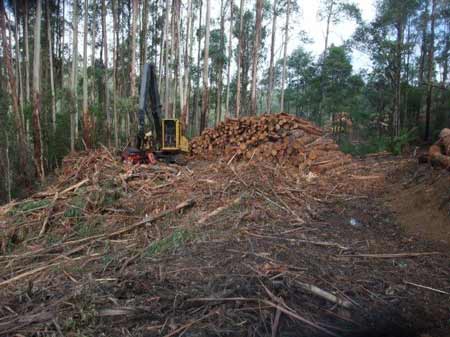
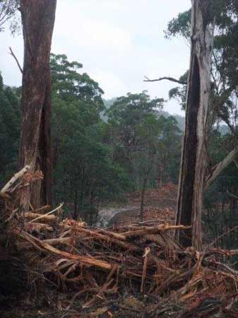
May 2013 Strzelecki Ranges/Middle Creek Catchment: Roading outside recently logged pine plantation. What happens here when it next rains?
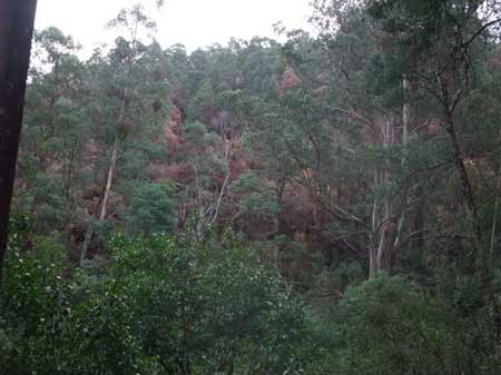
May 2013: Strzelecki Ranges/Middle Creek Catchment: View from a window. Logging in very close proximity.
May 2013 Strzelecki Ranges/Agnes River Catchment: Continued clearfelling in areas set supposedly aside in 2006 Heads of Agreement.
May 2013 Strzelecki Ranges/Agnes River Catchment: Logging inside Cores and Links Rainforest Reserve.
May 2013 Strzelecki Ranges/Agnes River Catchment: Logging inside Cores and Links Rainforest Reserve and retained old growth tree.
May 2013 Strzelecki Ranges/Morwell River Catchment: Good regeneration at Craig Court, 7 years post logging.
May 2013 Strzelecki Ranges/Morwell River Catchment: 7 year old regeneration inside Cores and Links Rainforest Reserve.
May 2013: Strzelecki Ranges/Morwell River Catchment. Hatchery Road. Is this hardwood reforestation being logged or is it native forest?
May 2013: Strzelecki Ranges/Morwell River Catchment. Recent logging near Grand Ridge Road/Hatchery Road.
May 2013: Strzelecki Ranges/Mt Mabel. Recent replanting in Cores and Links Rainforest Reserve.
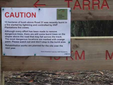
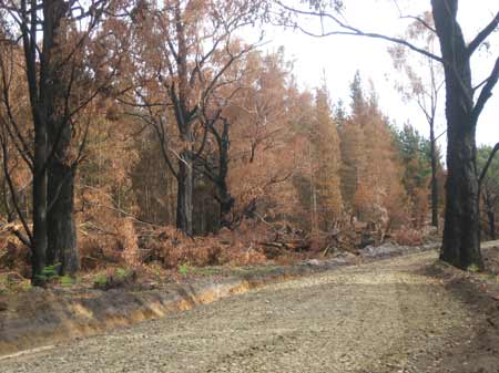
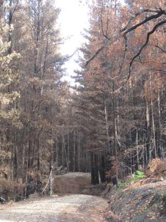
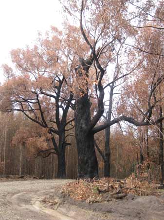
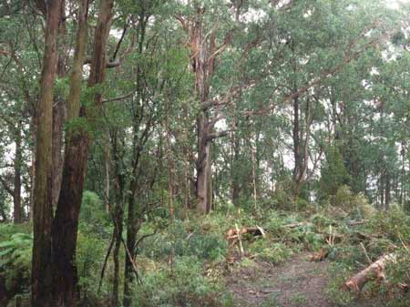
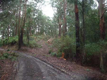
May 2013: Strzelecki Ranges/Traralgon Creek Catchment. 15 hectares of native forest was recently burnt near Taylors Road. The fire was started by lightning and represent the first bushfires in the Strzeleckis since the disatrous February 2009 fires.
May 2013: Strzelecki Ranges/Traralgon Creek Catchment. Some of the recently burnt area.
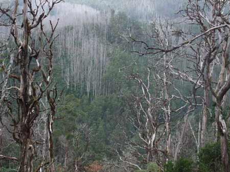
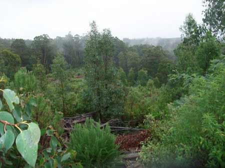
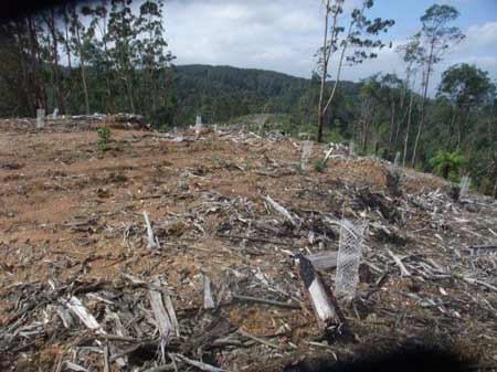
May 2013: Strzelecki Ranges/Traralgon Creek Catchment. Looking over the headwaters of Traralgon Creek, four years after February 2009 fires.