"I feel a force mujeure coming on"
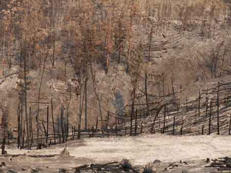
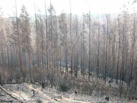
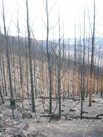
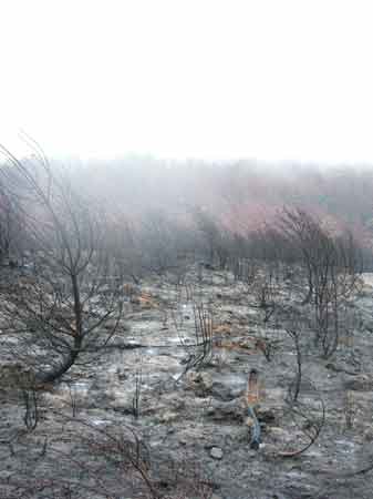
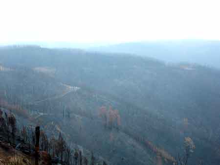
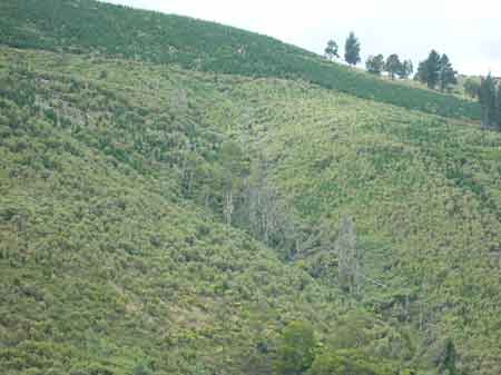
Feb 22 2009: Strzelecki Ranges: Jeeralang Creek West Branch. Dead plantations.
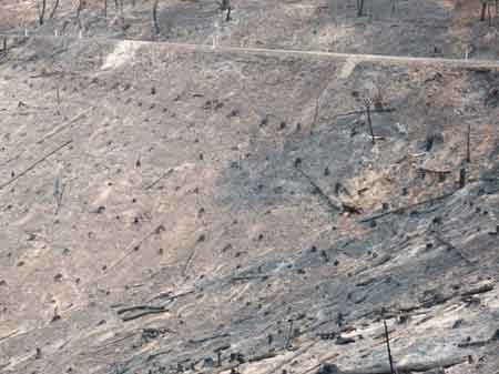
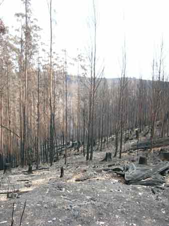
Feb 22 2009: Strzelecki Ranges: Bennetts Creek Catchment. Incinerated E. nitens plantations.
Feb 22 2009: Strzelecki Ranges: Jeeralang Creek West Branch. Dead plantations.
Feb 22 2009: Strzelecki Ranges: Jeeralang Creek West Branch. Dead plantations.
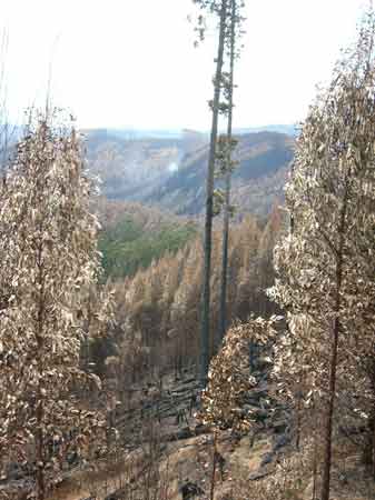
Feb 15 2009: Strzelecki Ranges/Jeeralang Creek East Branch from Taylors Road. E.Nitens plantation still smouldering after Feb 7 Bushfire. Investors pension funds up in smoke!
Jeeralang Creek East Branch. Burnt shining gums A Solid Investment?
Churchill Bushfire/plantation fire Feb 7 2009. Bottom image Rebecca Kelly.
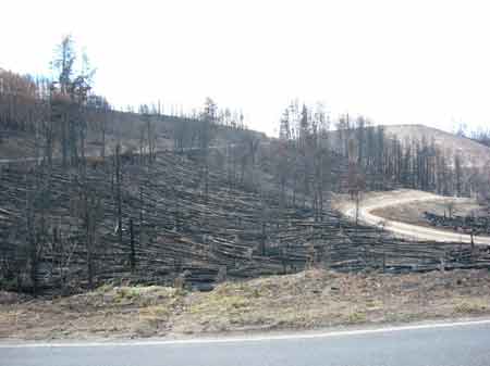
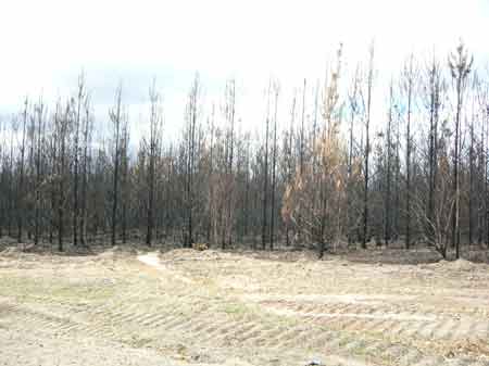
March 09: Strzelecki Ranges: Burnt out pine plantations Flynns Creek Catchment.
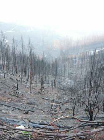
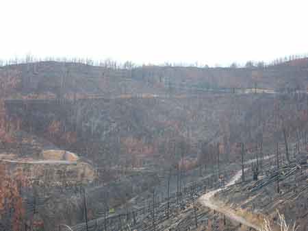
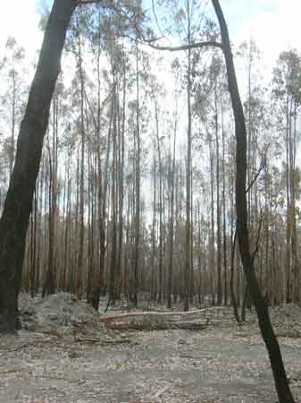
March 09: Strzelecki Ranges: Burnt out 5 year old hardwood plantations Traralgon Creek Catchment.
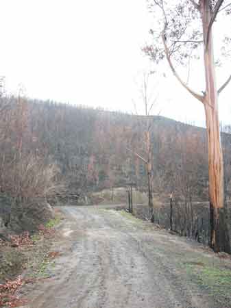
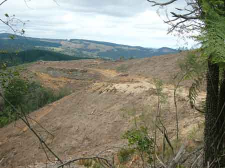
March 09: Strzelecki Ranges. Fire aftermath Traralgon Creek catchment.
Feb 15 2009: Strzelecki Ranges/Jeeralang Creek West Branch from Jeeralang West Road. Plantations still smouldering but Hancock leave this unattended.
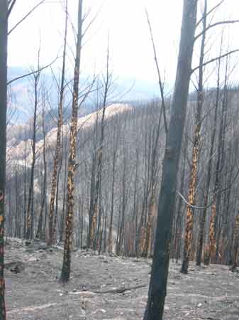
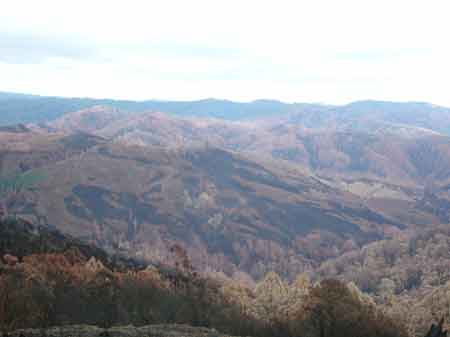
Feb 15 2009: Strzelecki Ranges/Jeeralang Creek East Branch from Jeeralang West Road. It appears that a large area of rainforest has been burnt at this location.
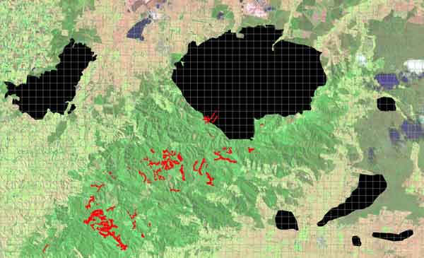
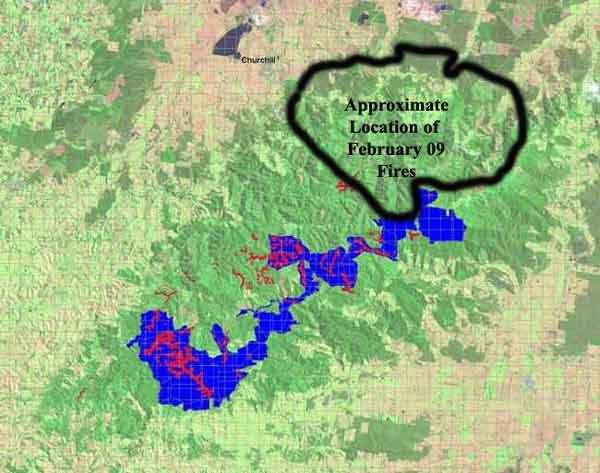
Fire map for the recent Jan 31 and Feb 7 Strzelecki Fires. Brown indicates pine plantations lost in the fires. 4650 hectares burnt however a large proportion may be able to be salvaged
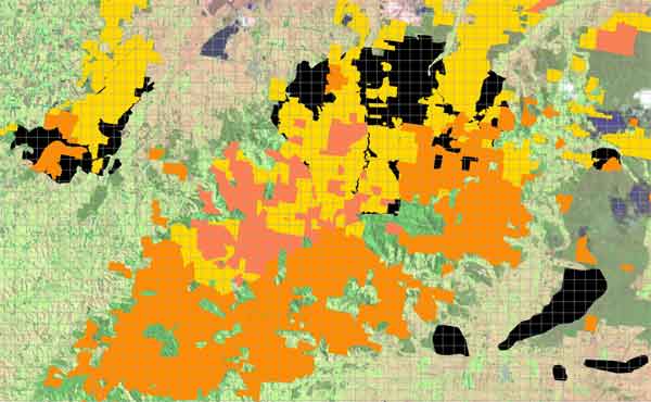
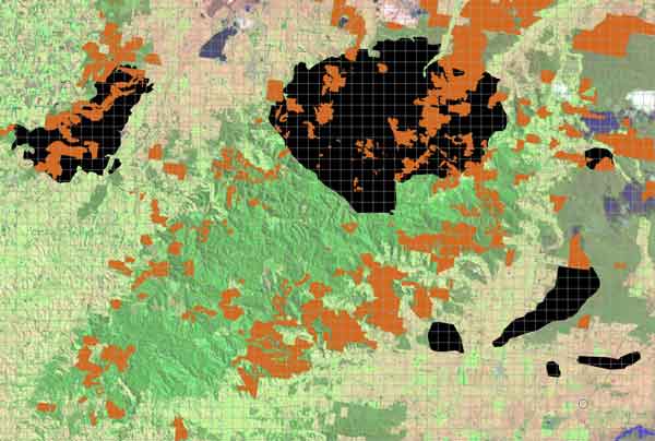
Strzelecki Hancock Land Tenure map. Yellow is Hancock freehold once owned by APM/Amcor/Australian Paper Plantations, Orange is leased Hancock land covered by the 1993 VPC Act, and pink is land leased under Wood Pulp Agreements 1961 and 1966. Most of the fires were located on Hancock freehold.
~7,000ha Hancock freehold, ~3000ha Hancock ex VPC land and ~1000ha 60 year lease hold burnt in the February 7 2009 fires. Totalling about 11,000ha of Hancock land was burnt in the February 7 fires.
April 2009: Strzelecki Ranges/Bennetts Creek catchment: Churchill fires ignition point in Hancock bluegum plantations on MacKenzie Road, parish of Traralgon, about 3km's south east of Churchill. How do plantation companies stop arsonists on their land and with all the debate about fire reduction burns, how do you reduce the risk of bushfires in plantations?
April 2009: Strzelecki Ranges/Bennetts Creek. 5 year old E.nitens plantation up in smoke, about 1km south of ignition point.
April 2009: Strzelecki Ranges/Bennetts Creek. 2 year old Radiata pine plantation up in smoke, about 2km's south of ignition point. Note how the heat of the fire has altered the form of these trees.
April 2009: Strzelecki Ranges/Bennetts Creek. 5 year old E.nitens plantation up in smoke, about 1km south of ignition point.
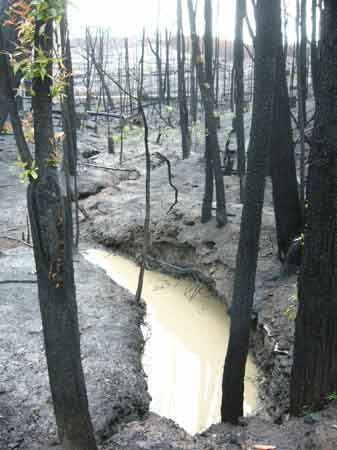
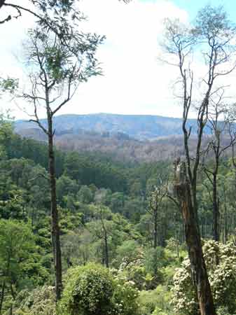
April 2009: Strzelecki Ranges/Waterhole Creek catchment. Native forest buffers along highly turbid creek about 3km east of ignition point. The fires did not burn this area until later in the afternoon, several hours after the initial fire had been lit by an arsonist.
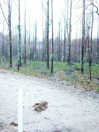
April 2009: Strzelecki Ranges/Morwell River Catchment about 2km west of Boolara. E.nitens plantation up in smoke, with dead koala in the foreground. These plantations burnt in the Delburn fires which occurred approximately one week before the Churchill fires.
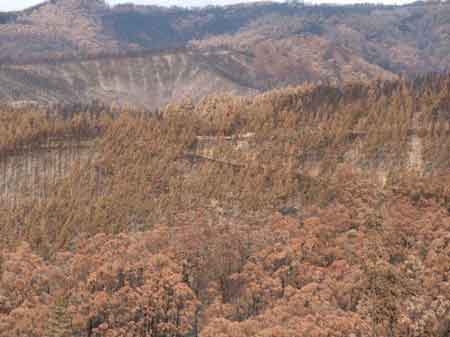
April 2009: Strzelecki Ranges/Traralgon Creek catchment. Hundreds of hecatres of E.nitens plantations have been killed here. Hancock will have to chop down all of the dead trees, place them in piles and possibly burn. Then the area will have to be replanted, a monumental task in such steep terrain. The replanting task alone could take over 5 years. Meanwhile how will Hancock meet their supply projections for Hardwood after taking such huge losses in their Nitens plantations?
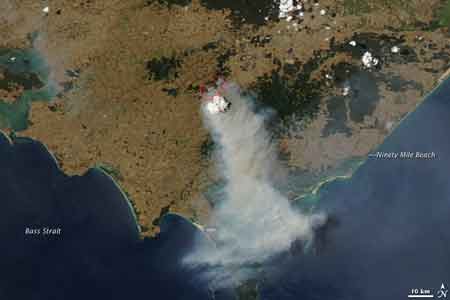
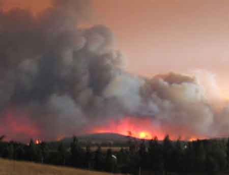
Jan 31 2009 Gippsland Fires emitting how much carbon into the atmosphere?
source of image: http://earthobservatory.nasa.gov/IOTD/view.php?id=36861
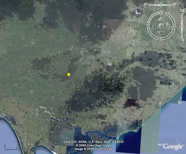
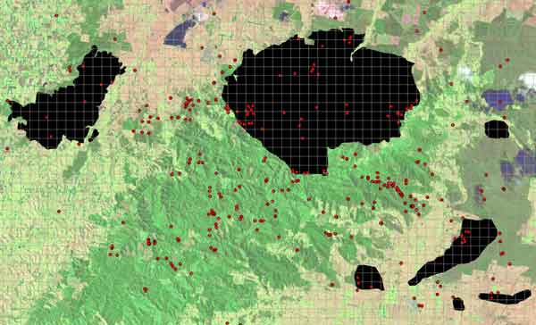
Yellow mark on map indicating where Jan 31/Feb 1 fires occurred.
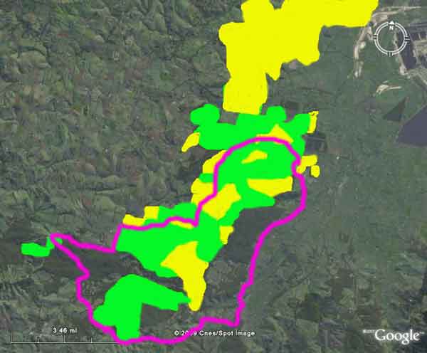
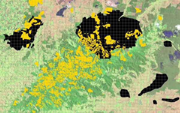
Rough outline of fire area (in purple). Areas marked green are Hancock pine plantations. Areas marked yellow are Hancock bluegum plantations. Approximately 1000ha of Bluegum and 1700ha of Radiata Pine were burnt in the fires. This represents about 10% of Hancock's entire bluegums and may represent between 1-2 years worth of potential pulplogs to Maryvale Pulp Mill. Probably 500ha of the bluegums were less than 4 years of age (ready for logging in ten years), with another 500ha that were maturing nicely, including some of Hancock's best performing bluegums. Hancock's CEO however, Linda Sewell, appears to be very very optimistic and does not differentiate between hardwood and softwood supplies.
Darlimurla Site of National Significance goes up in blames
Consultants Report Flora And Fauna Assessment Of Darlimurla Forest Block A report prepared for Australian Paper Plantations. S.G. Mueck, L.M. Williams and J.G. Smith. December 1998. The Report states: The Gippsland Plain has been largely cleared of native vegetation for agricultural development and larger remnants such as the Darlimurla Forest Block are considered to be both rare and very poorly reserved in this natural region. On the basis of the available information, the Darlimurla Forest Block is considered to have national significance for flora and fauna conservation. This area supports a diverse flora and fauna, and provides habitat for a number of species that are rare at the national, state and regional levels. The occurrence of Strzelecki Gum within the Darlimurla Block is considered to be of national conservation significance as this site represents one of only five localities where this species is known to occur in relatively undisturbed native vegetation. Intact examples of the vegetation communities Dry Valley Forest and Swampy Riparian Complex and their associated habitats are depleted within the state, while the relatively intact areas of Herb Rich Foothill Forest and Swamp Scrub are considered to be of regional conservation significance. Conclusion The Darlimurla Forest Block is considered to be an area of national conservation significance and it is recommended that it be acquired by the State of Victoria to be managed as a conservation reserve. 1 Report on Panel Hearing on Application by AMCOR Plantations Pty Ltd. September 1996, Page 57 2. Australian Paper Plantations Pty Ltd. Native Vegetation Clearing - Commitments by Australian Paper Plantations - March 1997.
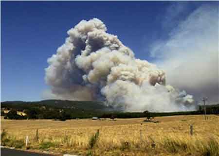
Feb 2 2009: Search On For Suspected Arsonist in Vic bushfires
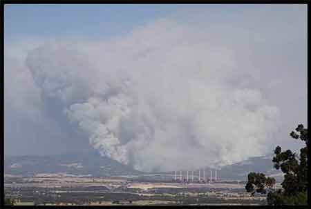
January 30 2009: Vic Bushfires Burning Out of Contol
Feb 2 2009: Gippsland Fire Threat Eases
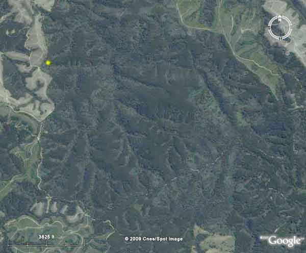
Feb 09: Strzelecki Ranges College Creek. Main access point (in yellow) Feb 13 2009 into this National Site of Conservation Significance.
More details on College Creek here.
More details on the dodgy Cores and Links 'sell-out' here.
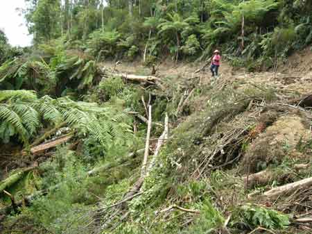
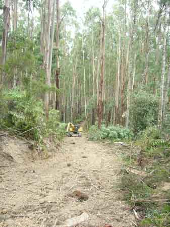
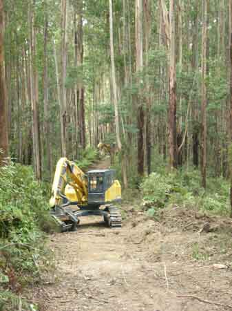
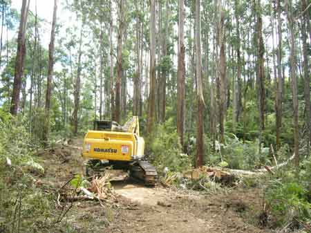
Feb 09: College Creek/Strzelecki Ranges: February 15 2009. Trees bulldozed into gully for logging access track.
Feb 09: College Creek/Strzelecki Ranges: February 15 2009. Trees bulldozed for logging access track.

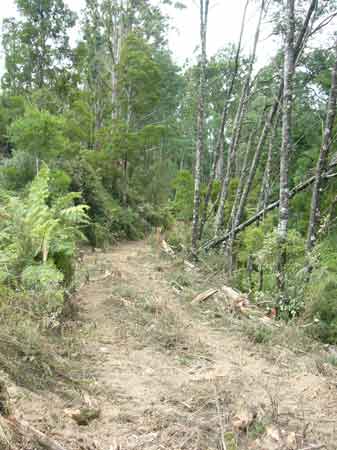
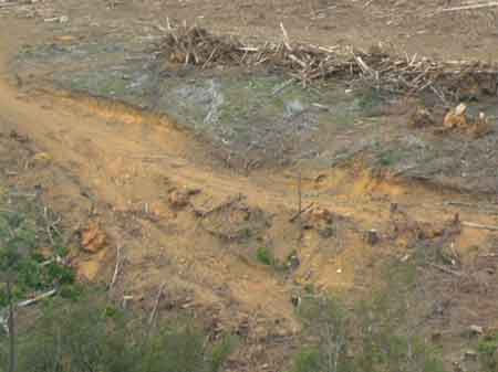
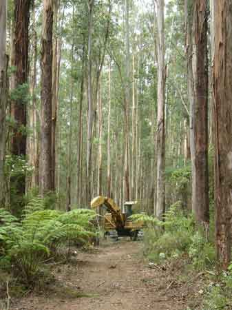
Feb 09: College Creek/Strzelecki Ranges: February 15 2009. Logging access track.
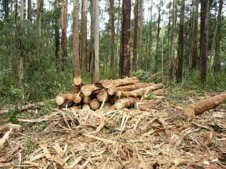
Feb 09: College Creek/Strzelecki Ranges: Poor quality pulp logs from rainforest buffer.
Feb 09: College Creek 'going under the hammer'.
Feb 09: College Creek, the start of logging this National Site of Conservation Significance
Feb 09: Strzelecki Ranges: Antonio Creek Catchment. Part of the Gavan McFadzean Forest Reserve (gully vegetation) appears to be dieing. This slither is one of the areas that Hancock decided to preserve instead of College Creek. The other greenery in this image is indigneous regeneration following the logging of a pine plantation about two years ago. This regeneration will most likely be sprayed with hexazinone in the near future.
Feb 09: Strzelecki Ranges, burnt Bluegum plantations off Creamery Road. These plantations were burnt Jan 31 2009 during fires at Boolara.
Feb 09: Strzelecki Ranges, burnt pine plantations off Creamery Road. These plantations were burnt Jan 31 2009 during fires at Boolara.
Feb 09: Strzelecki Ranges, Jack River pine coupe with high erosion potential. (and below).