15 September 2009
Dear ***,
Poor Track Condition at 400 Lardners Track, Gellibrand
Thank you for your letter dated 26 August 2009 concerning the poor condition of a track linking Meehans Road and Old Lardners Track, Gellibrand. Council appreciated your concern. As mentioned in your letter the track demarcates the boundary of an exisiting Hancock Victorian Plantations (HVP) pine plantation. You are advised that the track was inspected by Council officers and it was noted that the track is in very poor condition with severe rutting and erosion. The track is not a road that Council is responsible for managing and accordingly, it is identified that it is the responsibility of HVP to maintain.
A review of recent Timber Harvesting Plans submitted by HVP for its plantation indicate that the track was not intended to be used as part of timber harvesting operations and the inspection confirms this given the current state of the track surface. It is clear that the current condition of the track has been caused by a combination of the geology of the track, slope, rainfall and recreational vehicle use. Accordingly, Council is satisified that there is no breach of the Code of Practice for Timber Production 2007.
As a result of these investigations, Council has informed HVP of the poor condition of the track and have requested HVP to undertake remedial works on the track. You are informed that HVP advised that they had planned biannual maintenance works for November 2009. HVP advised that they will now undertake remedial works within the next few weeks to repair damage, reform the track, re-instate drainage and install a cross bar to prevent unauthorised use of the track...
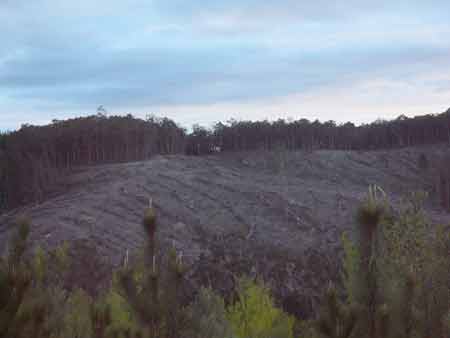
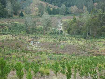
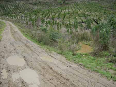
August 2009 - Otway Ranges Gellibrand River/Stevensons Falls. Recent replanting of pine on this highly erodable site. Wetland in middle of photo. Last visited September 2007.
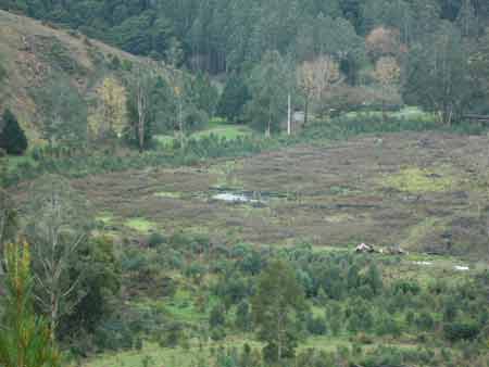
August 2009 - Otway Ranges Gellibrand River/Stevensons Falls. Other side of river, with smaller wetlands located in pine plantation.
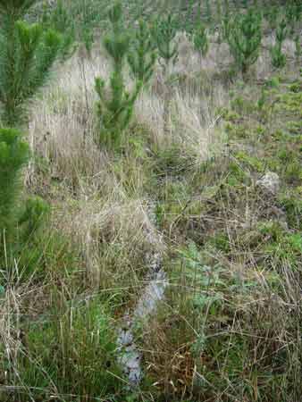
August 2009 - Otway Ranges Gellibrand River/Stevensons Falls. No buffers on this drainage line inside plantation.

August 2009 - Otway Ranges Gellibrand River/Stevensons Falls. Obvious wetland located in pine plantation, full of fallen logging debris. Note quality of the water. Highly turbid.
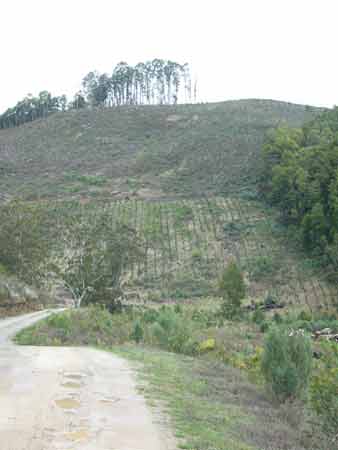
August 2009 - Otway Ranges Gellibrand River/Stevensons Falls. Quite steep slopes occur in this plantation.
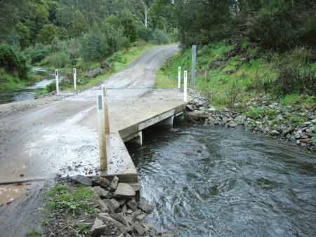
August 2009 - Otway Ranges Gellibrand River/Stevensons Falls. New bridge built over Gellibrand River, replaces ford.
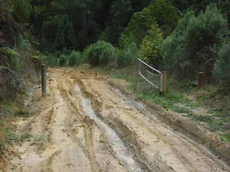
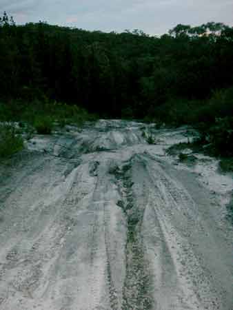
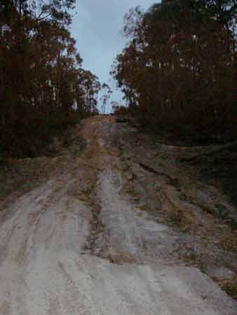
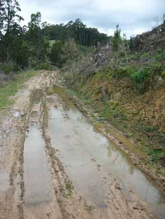
August 2009 - Otway Ranges Gellibrand River/Stevensons Falls. 4WD vehicles have been making use of Hancock logging roads, severely compromising the quality of the road and associated runoff. Gate left open in the middle of winter.

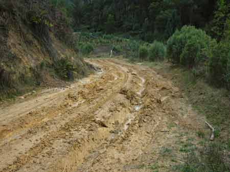
August 2009 - Otway Ranges Gellibrand River/Stevensons Falls. Note deep wheel ruts.
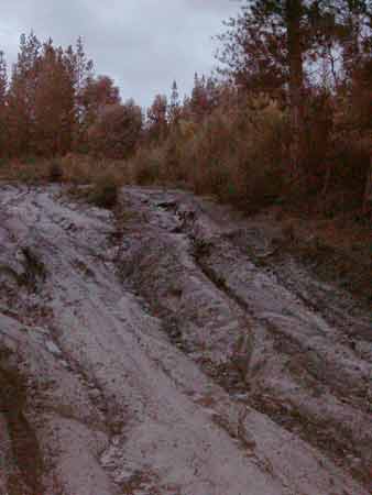
August 2009 - Otway Ranges Gellibrand River/Stevensons Falls. On the lower portion of the plantation, blocked culverts have led to highly turbid water flowing into ephemeral waterways.
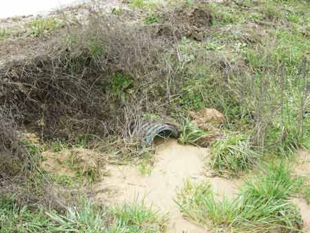
Blocked Culvert showing how highly erodable soils at this site are.
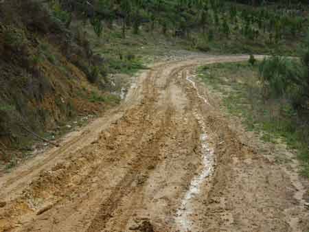
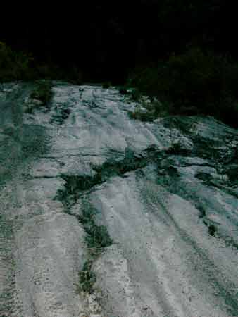
August 2009 - Otway Ranges Gellibrand River/Stevensons Falls. Very poor quality roading, in breach of Code of Forest Practices.
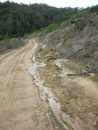
August 2009 - Otway Ranges Gellibrand River/Stevensons Falls. Drainage on FSC certified logging road that was supposed to have been remediated in 2007.
August 2009 - Otway Ranges Gellibrand River/Stevensons Falls. Another plantation company owns this site certified by AFS.