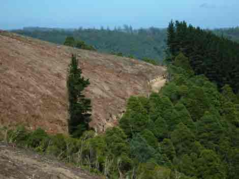
March 2005 Updates (Page 2)
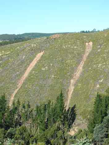
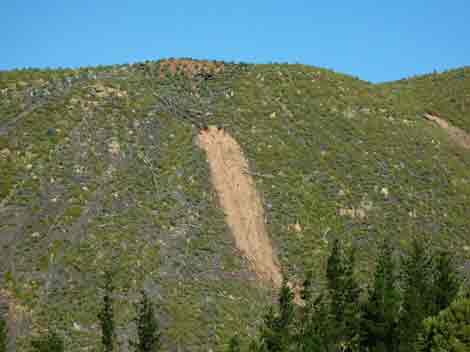
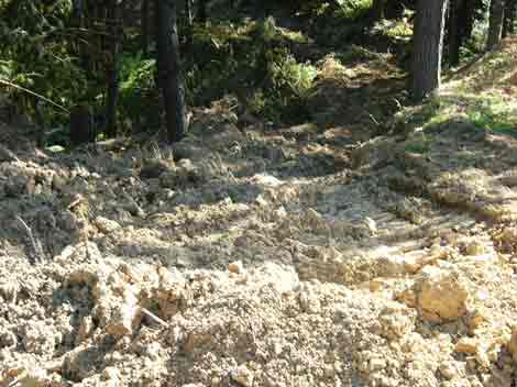
February 2005: Strzelecki Ranges: Merrimans Creek Domestic
Water Supply Catchment near Mt Joy. Recent rains have opened up these landslides
which could be a couple of hundred metres high. These slopes were logged of
radiata pine in late 2003/early 2004. Plantation logging on steep slopes can
have a very poor environmental outcomes. These slopes should have been retired
from timber production, instead they have been replanted with Shining Gum which
will be logged again in 20 years time. It will be interesting to see how much
more erosion will be generated at this site. Also see
here for more photos of this 'disaster' and here
for more information about this plantation.
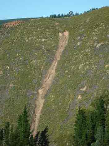
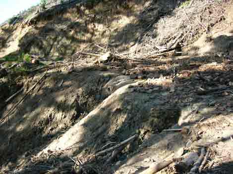
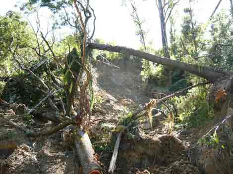
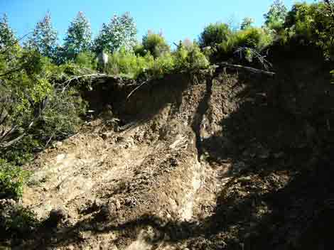
February 2005: Strzelecki Ranges: Closer view
of Merrimans Creek landslide. How do you repair this? This old pine plantation
had been established by the State Government of Victoria in the 1970's.
February 2005: Strzelecki Ranges: Closer view
of Merrimans Creek landslide. How do you repair this?
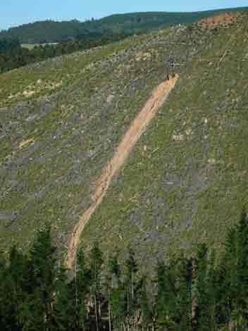
February 2005. Strzelecki Ranges: This site is
located in the domestic water supply catchment of Merrimans Creek which supplies
drining water to the people of Seaspray.
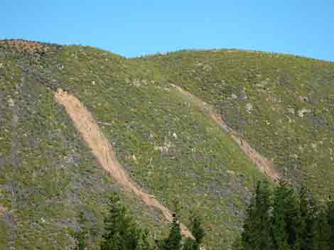
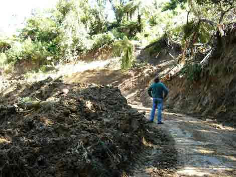
February 2005: Strzelecki Ranges: This is where the
larger of the two landslides hit Furphy Road, which lay at the bottom of the
plantation. Some of the road at this point has been washed away.
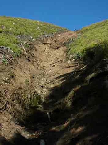
February 2005: Strzelecki Ranges: Looking up the landslide
from Furphy Road.
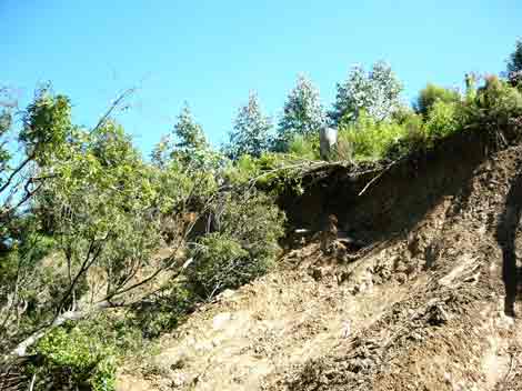
February 2005: Strzelecki Ranges: Looking down from
Furphy Road into Merrimans Creek. Hundreds of tonnes of rock and sediment would
have been washed into Merrimans Creek from this landslide.
February 2005: Strzelecki Ranges: Furphy Road landslide.
What is Hancock's policy in regards to repairing damage to roads and streams
after landslides?
February 2005: Strzelecki Ranges: Looking down from
Furphy Road into Merrimans Creek. Hundreds of tonnes of rock and sediment would
have been washed into Merrimans Creek from this landslide.
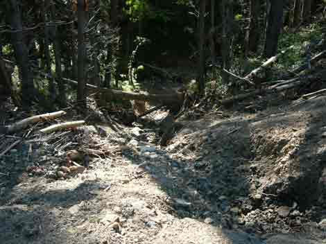
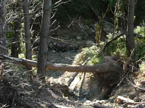
February 2005: Strzelecki Ranges: Erosion occurring
on Furphy Road in the Merrimans Creek catchment.
February 2005: Strzelecki Ranges: Obvious signs of wet
weather work on this appalling logging track in the headwaters of a tributary
of the Albert River, just off the Midland Highway.
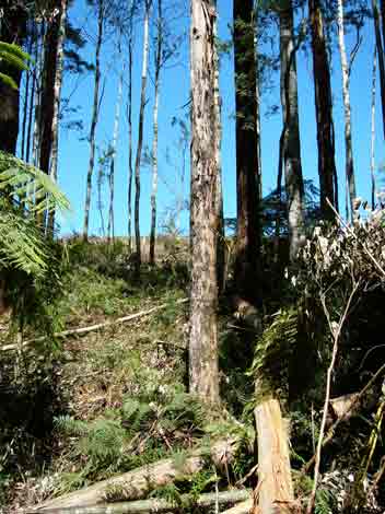
February 2005 Strzelecki Ranges: Morwell River East
Branch. Another landslide. This is on Campbells Road on land leased from the
Crown in close proximity to Allotment 25 of C Parish of Budgeree.
February 2005 Strzelecki Ranges: Morwell River East
Branch. Campbells Road landslide. Soil deposited on roadside is a couple of
metres high in places. Hundreds of tonnes of soil would have been dislodged
at this location.
February 2005: Strzelecki Ranges: Morwell River East
Branch. Campbells Road landslip. Note Shining Gum plantation at top of slip.
It is highly likely that native vegetation had been removed from the top of
this slope, probably increasing the risk of landslides after heavy rain.

February 2005: Strzelecki Ranges: Morwell River East
Branch. At the top of the landslide on campbells Road. Log dumps and Shining
Gum at the top of the landslide. Plantation logging would have made this landslide
worse.
February 2005: Strzelecki Ranges: Morwell River East
Branch. Campbells Road landslip. Note Shining Gum plantation at top of slip.
It is highly likely that native vegetation had been removed from the top of
this slope, probably increasing the risk of landslides after heavy rain.
land leased from the Crown in close proximity to Allotment 25 of C Parish
of Budgeree.
February 2005: Strzelecki Ranges: Morwell River East
Branch. Note eroding road batters and regenerating Blackwoods. This is 1958
gazetted crown land, probably leased by Hancock.
February 2005: Strzelecki Ranges: Morwell River East
Branch.View looking south west across leased Crown land into private land owned
by Hancock in the Parish of Budgeree.
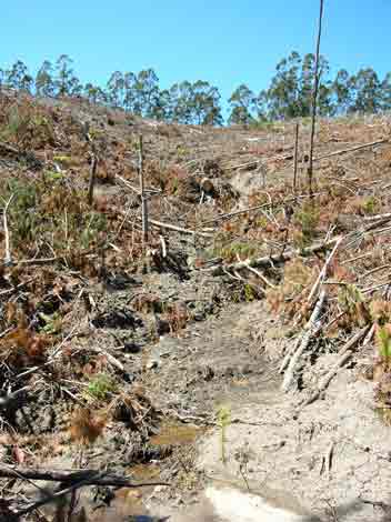
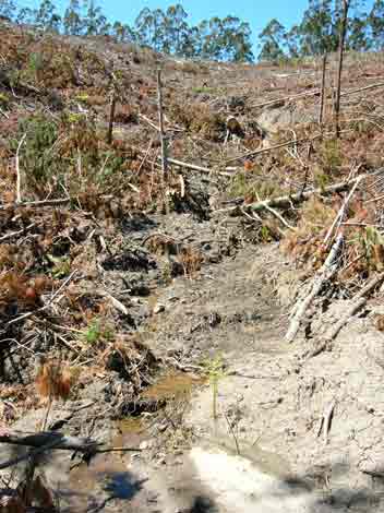
February 2005: Strzelecki Ranges - Morwell River East
Branch. Landslip on drainage line on leased Crown Land in the Parish of Budgeree.
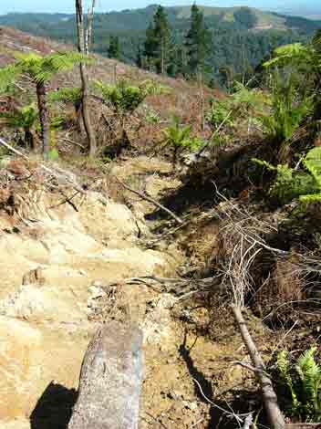
February 2005: Strzelecki Ranges - Morwell River East
Branch. Landslip on drainage line on leased Crown Land in the Parish of Budgeree.
Just where are the drainage line buffers at this location? Same drainage line
as above.
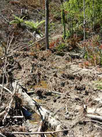
February 2005: Strzelecki Ranges - Morwell River East
Branch. Landslip on drainage line on leased Crown Land in the Parish of Budgeree.
Same drainage line as above. During logging and for about 1-2 years after logging,
pine plantations can be a major source of erosion into local waterways. Poor
logging roads can be a major source of sediment during the life of the plantation.
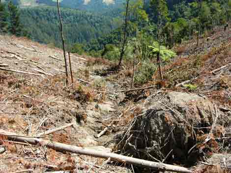
February 2005: Strzelecki Ranges - Morwell River East
Branch. Landslip on drainage line on leased Crown Land in the Parish of Budgeree.
Just where are the drainage line buffers at this location? Same drainage line
as above.
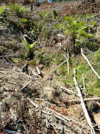
February 2005: Strzelecki Ranges - Morwell River East
Branch. Leased Crown Land in the Parish of Budgeree. Phot of recent plantation
clearfell. Drainage line just obscured is the drainage line in the following
four photos.
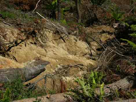
February 2005: Strzelecki Ranges - Morwell River East
Branch. Leased Crown Land in the Parish of Budgeree. The buffers at this location
consisted of radiata pine. Once logged there was nothing to hold the soil back
from erosing away. Under the Code of Forest Practices, a drainage line has to
be at least 30 cm deep - meaning that under the Code this obvious drainage line
does not qualify. Drainage lines if 30cm deep require filter strips of native
vegetation. What will happen at this location?
February 2005: Strzelecki Ranges - Morwell River East
Branch. Leased Crown Land in the Parish of Budgeree. The buffers at this location
consisted mainly of radiata pine.
February 2005: Strzelecki Ranges - Morwell River East
Branch. Leased Crown Land in the Parish of Budgeree. Heavily eroding drainage
line, with erosion occurring around and under this dislodged pine stump..
February 2005: Strzelecki Ranges - Morwell River East
Branch. Leased Crown Land in the Parish of Budgeree. Heavily eroding drainage
line. This is a disgrace.
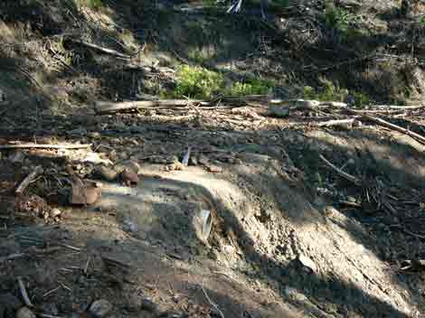
February 2005: Strzelecki Ranges - Allotment 56 Parish
of Wonyip 1958 Leasehold land. Culvert and road blowout on logging road in Cool
Temperate Rainforest in the Morwell River East Branch catchment. Heavy rains
in early February obviously created havoc at this location.
ditto
February 2005: Strzelecki Ranges - Allotment 56 Parish
of Wonyip 1958 Leasehold land. 20 metre buffers on Cool Temperate Rainforest
in the Morwell River East Branch. If this was State Forest the minimum buffer
zone would be 40 metres on this site of regional significance. However 40 metre
buffers do not apply on private land. Why? Did Amcor, VPC and the State Government
"hobble" the Code of Forest Practices in the mid 1990's review of
the Code so that private land was excluded from proper protection of cool temperate
rainforest?
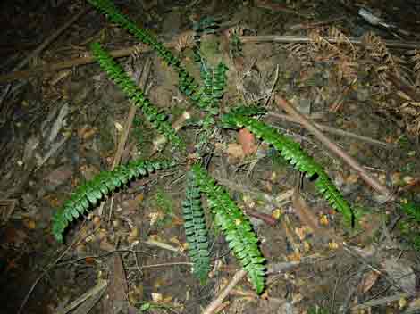
February 2005: Strzelecki Ranges - Allotment 56 Parish
of Wonyip 1958 Leasehold land. Cool Temperate Rainforest Morwell River East
Branch.
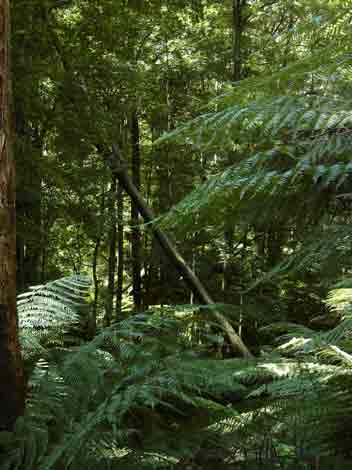
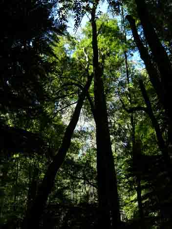
February 2005: Strzelecki Ranges - Allotment 56 Parish
of Wonyip 1958 Leasehold land. Cool Temperate Rainforest Morwell River East
Branch. This Myrtle Beech tree has collapsed against another Beech tree inside
the rainforest. Small rainforest buffers will mean an increased risk of wind
damage inside the rainforest.
February 2005: Strzelecki Ranges - Allotment 56 Parish
of Wonyip 1958 Leasehold land. Cool Temperate Rainforest Morwell River East
Branch. Looking out through the minimal rainforest buffer where a tree has either
been knocked over or chopped down into the buffer.
February 2005: Strzelecki Ranges - Allotment 56 Parish
of Wonyip 1958 Leasehold land. Cool Temperate Rainforest Morwell River East
Branch.
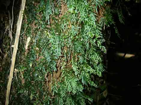
February 2005: Strzelecki Ranges - Allotment 56 Parish
of Wonyip 1958 Leasehold land. Cool Temperate Rainforest Morwell River East
Branch.
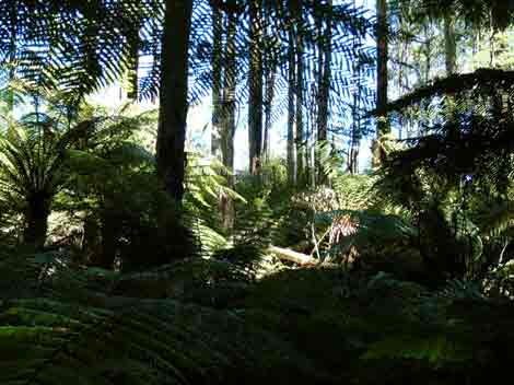
February 2005: Strzelecki Ranges - Allotment 56 Parish
of Wonyip 1958 Leasehold land. Cool Temperate Rainforest Morwell River East
Branch.
February 2005: Strzelecki Ranges - Allotment 56 Parish
of Wonyip 1958 Leasehold land. Cool Temperate Rainforest Morwell River East
Branch.
February 2005: Strzelecki Ranges - Allotment 56 Parish
of Wonyip 1958 Leasehold land. Cool Temperate Rainforest Morwell River East
Branch. This Myrtle Beech tree has collapsed against another Beech tree inside
the rainforest. Small rainforest buffers will mean an increased risk of wind
damage inside the rainforest.
February 2005: Strzelecki Ranges - Allotment 56 Parish
of Wonyip 1958 Leasehold land. Cool Temperate Rainforest Morwell River East
Branch.
February 2005: Strzelecki Ranges - Allotment 56 Parish
of Wonyip 1958 Leasehold land. Cool Temperate Rainforest Morwell River East
Branch. A tree has fallen into the buffer at this location.
February 2005: Strzelecki Ranges - Allotment 56 Parish
of Wonyip 1958 Leasehold land. Cool Temperate Rainforest Morwell River East
Branch. Hancock is destroying rainforest buffers on both sides. This is disgraceful
behaviour.
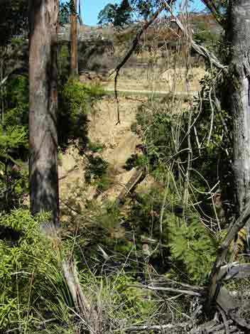
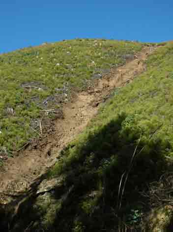
February 2005: Strzelecki Ranges - Allotment 57 Parish
of Wonyip 1958 Leasehold land. Morwell River East Branch. Another recent landslip.
At this location the slip is about 20 metres high.
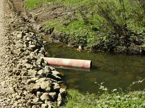
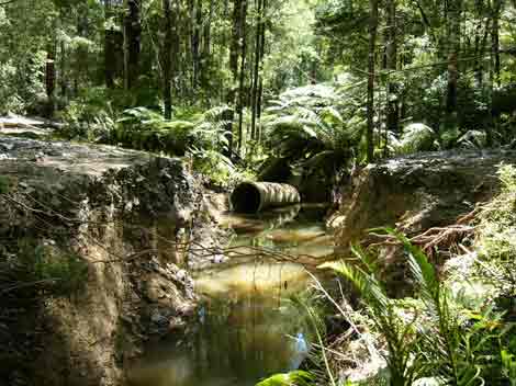
February 2005: Strzelecki Ranges - Morwell River Catchment
at a crossing on Morwell River Road.
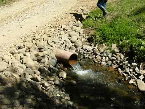
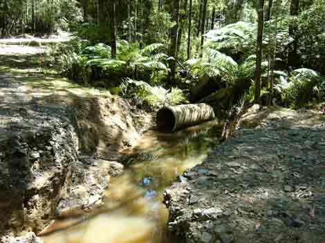
February 2005: Strzelecki Ranges - Morwell River Catchment
at a crossing on Morwell River Road. How are native fish supposed to contend
with this very dubious creek crossing?
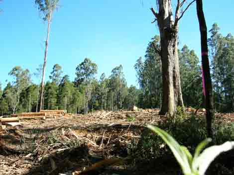
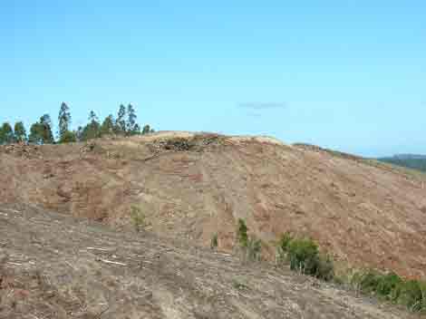
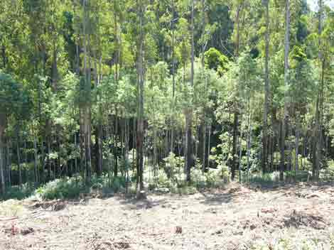
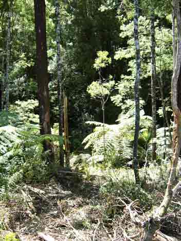
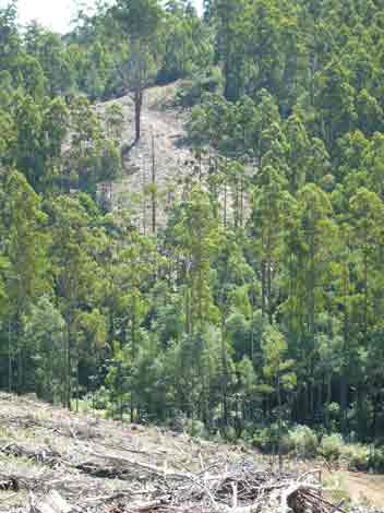
February 2005: Recent clearfelling of controversial
coupe near Gunyah Gunyah Reserve in the Morwell River Catchment. Locals are
convinced that much of this area was not planted, it is likely to be the result
of natural regneration. Regeneration was likely to have occurred from larger
habitat trees as seen in this photo. Hancock aren't waiting for the umpire's
decision though, they have rushed in to log this area and will replant in Shining
Gum, a non-endemic Strzelecki species. This replanting will occur after herbicide
spraying.
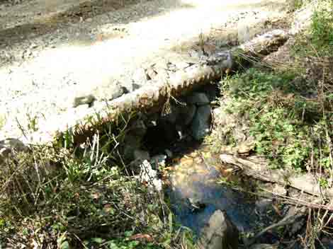
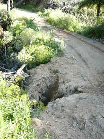
February 2005: Poor creek crossing on Gunyah Shortcut
Road. Morwell River Catchment.