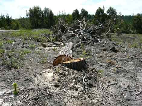
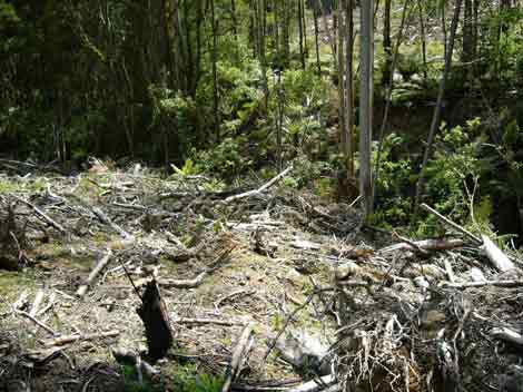
Otway Ranges November 2004: Native vegetation removal by Hancock in Gellibrand River Water Supply Catchment. Plantation LEGL93-49. Hancock says that such tree removal is done for occupational health and safety concerns. About 50 native trees were logged at this site. Note pine seedlings. Logging of plantation occurred when native trees were still standing. Destruction of native trees occurred at time of planting. How could planting trees near native trees be a health and safety risk? The real reason for native tree removal is to increase area where pine trees will grow.
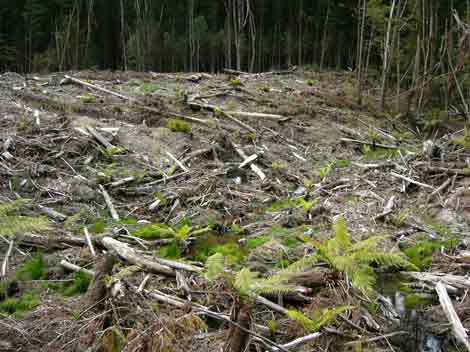
Otway Ranges November 2004: Native vegetation and pine plantation removal by Hancock in Gellibrand River Water Supply Catchment. Plantation LEGL93-49.
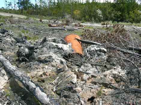
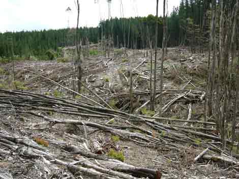
Otway Ranges November 2004: Native vegetation and pine plantation removal by Hancock in Gellibrand River Water Supply Catchment. Plantation LEGL93-49. At this site was also evidence of burnt drums of something, apparently burnt in stockpiles of indigenous trees and plantation trees. Were the drums empty of whatever substance was in them when burning took place?
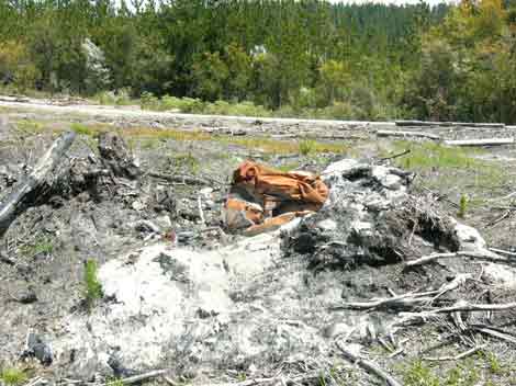
Otway Ranges November 2004: Native vegetation and pine plantation removal by Hancock in Gellibrand River Water Supply Catchment. Plantation LEGL93-49. At this site was also evidence of burnt drums of something, apparently burnt in stockpiles of indigenous trees and plantation trees.
Otway Ranges November 2004: Native vegetation and pine plantation removal by Hancock in Gellibrand River Water Supply Catchment. Plantation LEGL93-49.
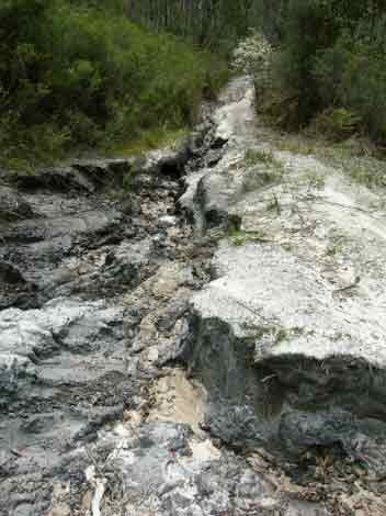
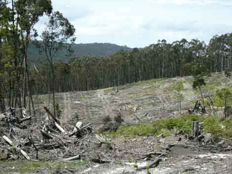
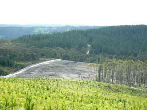
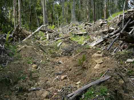
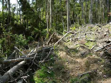
Otway Ranges November 2004. Plantation LEGL93-49. Gellibrand River Water Supply Catchment. Appalling boundary logging road between State Forest and Hancock plantations. This road shows signs of massive erosion. Whose responsible for such poor roading and how is this site going to be remediated?
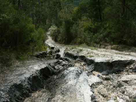
Otway Ranges November 2004. Plantation LEGL93-49. Gellibrand River Water Supply Catchment. Appalling boundary logging road between State Forest and Hancock plantations. This road shows signs of massive erosion. Whose responsible for such poor roading and how is this site going to be remediated?
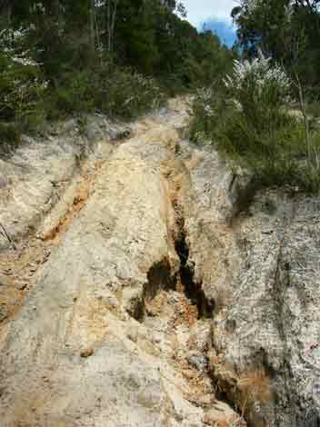
Otway Ranges November 2004. Plantation LEGL93-49. Gellibrand River Water Supply Catchment. Appalling boundary logging road between State Forest and Hancock plantations. This road shows signs of massive erosion. Whose responsible for such poor roading and how is this site going to be remediated?
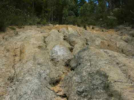
Otway Ranges November 2004. Plantation LEGL93-49. Gellibrand River Water Supply Catchment. Appalling boundary logging road between State Forest and Hancock plantations. This road shows signs of massive erosion. Whose responsible for such poor roading and how is this site going to be remediated?
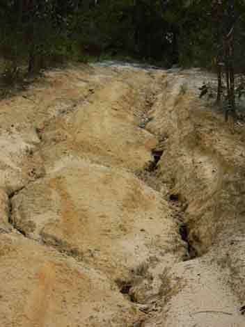
Otway Ranges November 2004. Plantation LEGL93-49. Gellibrand River Water Supply Catchment. Appalling boundary logging road between State Forest and Hancock plantations. This road shows signs of massive erosion. This is the start of the erosion at the top of the hill.
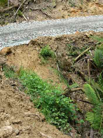
Otway Ranges - November 2004: Webster Hill Plantation in Gellibrand Water Supply Catchment which supplies drinking water to 50,000 people in the State's south west. New creek crossing where Bernies Track crosses a tributary of Lardners Creek East Branch. High soil erosion potential here with small soil slip occurring above culvert.
Otway Ranges - November 2004: Webster Hill Plantation in Gellibrand Water Supply Catchment which supplies drinking water to 50,000 people in the State's south west. New creek crossing where Bernies Track crosses a tributary of Lardners Creek East Branch. High soil erosion potential here with small soil slip occurring above culvert and large amounts of soil bulldozed into creek side.
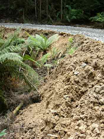
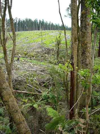
Otway Ranges - November 2004: Webster Hill Plantation in Gellibrand Water Supply Catchment which supplies drinking water to 50,000 people in the State's south west. This logging track occurred within 5-10 metres of Lardners Creek East Branch tributary (A Class One stream) which runs through most of the plantation.
Otway Ranges - November 2004: Webster Hill Plantation in Gellibrand Water Supply Catchment which supplies drinking water to 50,000 people in the State's south west. This logging track occurred within 5-10 metres of Lardners Creek East Branch tributary (A Class One stream) which runs through most of the plantation. Logging debris bulldozed into creek gully.
Otway Ranges - November 2004: Webster Hill Plantation in Gellibrand Water Supply Catchment which supplies drinking water to 50,000 people in the State's south west. This logging track occurred within 5-10 metres of Lardners Creek East Branch tributary (A Class One stream) which runs through most of the plantation. Logging debris bulldozed into creek gully.
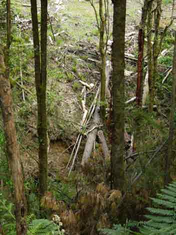
Otway Ranges - November 2004: Webster Hill Plantation in Gellibrand Water Supply Catchment which supplies drinking water to 50,000 people in the State's south west. Tributary of Lardners Creek East Branch. Note lack of buffers.
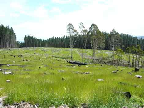
Otway Ranges - November 2004: Webster Hill Plantation in Gellibrand Water Supply Catchment which supplies drinking water to 50,000 people in the State's south west. This plantation was obviously established on ex pasture. Typical practice in such plantations is to kill these grasses which aerial application of herbicides.
Otway Ranges - November 2004: Webster Hill Plantation in Gellibrand Water Supply Catchment which supplies drinking water to 50,000 people in the State's south west. Logging debris pushed or fallen into creek.
Otway Ranges - November 2004: Webster Hill Plantation in Gellibrand Water Supply Catchment which supplies drinking water to 50,000 people in the State's south west.
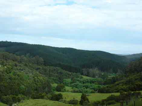
Otway Ranges November 2004: Pine plantation which lies very close to Stevensons Falls, a major tourist attraction in the Otways. This photo shows where Barramunga Creek & the Gellibrand River meet. The Gellibrand River supplies 50,000 in Victoria's south west with drinking water.
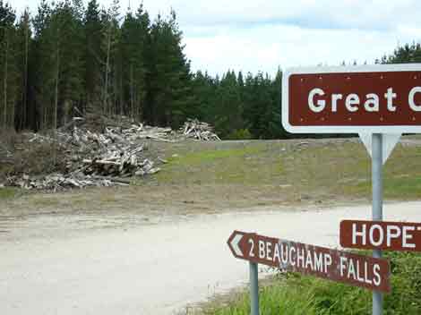
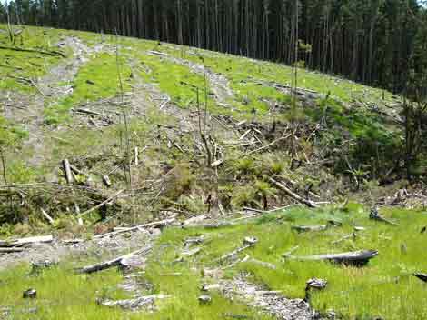
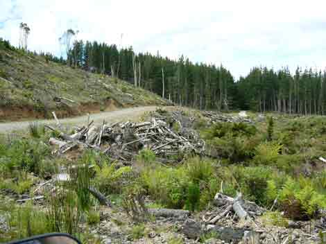
Otway Ranges November 2004: Aire River Plantations. With the increase in tourism in the Otways, more people will want to see attractions such as Beauchamp Falls and Hopetoun Falls located in the Aire Valley. This lovely vista greets tourists as they drive into Beauchamp Falls. A recently cut pine plantation with stockpiles of logging debris left near the road. Tourists must also dodge large potholes and corrugations in the roads. Massive log trucks also are frequently encountered creating massive dust plumes which can temporarily blind tourists not use to dealing with log truck traffic. A major accident is waiting to happen in the Aire Valley.
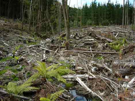
Otway Ranges November 2004: Aire River Plantations. Pulpit Creek catchment. Large amounts of logging debris remains at this site.
Otway Ranges November 2004: Aire River Plantations. Pulpit Creek catchment. Large amounts of logging debris remains at this site, with wind also a problem for retained buffers.
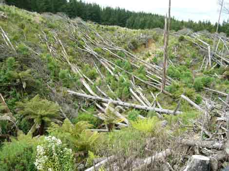
Otway Ranges November 2004: Aire River Plantations. Congram Creek Catchment. Appalling logging operation. Logging debris left everywhere. Buffers to this flowing creek were almost non-existent.
Otway Ranges November 2004: Aire River Plantations. Congram Creek Catchment. Appalling logging operation. Logging debris left everywhere. Buffers to this flowing creek were almost non-existent.
Otway Ranges November 2004: Aire River Plantations. Congram Creek Catchment. Appalling logging operation. Logging debris left everywhere. Buffers to this flowing creek were almost non-existent.