
May 2004: Stewarts Creek plantation - Central Victoria (inside the Wombat State Forest). 15 ha of pine plantation at this location has been logged and then burnt. This plantation lies in the main water supply catchment for the towns of Daylesford and Hepburn Springs. Ideally this small plantation should be reverted back to native vegetation and retired from plantation logging.
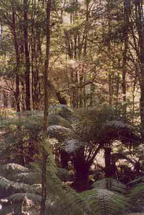
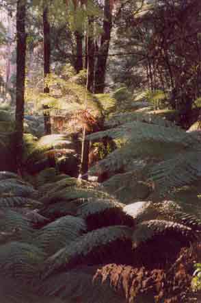
June 2004: Strzelecki Ranges north face - Morwell River East Branch (Allotment 56 Parish Wonyip leasehold land). The rainforest in this catchment has high integrity and is of a Nationally rare type. It is virtually weed free and covers a substantial area of the catchment. Hancock has gone to the trouble of mapping the rainforest and commissioning an ecological consultant to address and evaluate the ranking of Cool Temperate Rainforest based on flora assessment only. Rainforest is a remnant of Gondwanaland.
June 2004: Strzelecki Ranges north face - Morwell River East Branch (Allotment 56 Parish Wonyip leasehold land). Ground staff have gone to great lengths to delinate rainforest and native vegetation, however management decisions have not allowed the precautionary principle to prevail and in some cases have not afforded the minimum standards of buffer protection as provided on Public Land. Hancock Watch argues that even the buffer protection afforded on public land is minimal and we argue that cool temperate rainforest of regional significance, such as Morwell River East Branch should be afforded buffers of at least two tree lengths, in order to protect the stands from the impacts of the disease Myrtle Wilt. Preferably 100 metre buffers should apply on rainforest within this catchment.
June 2004: Strzelecki Ranges north face - Morwell River East Branch (Allotment 56 Parish Wonyip leasehold land). Recent publications note that a minimum of 2 tree lengths is required to protect rainforest from the fatal disease myrtle wilt. In the above photograph, clearfelled hardwood plantation can clearly be seen in very close proximity to the rainforest. At this site the buffer on the cool temperate rainforest was measured at only 25 metres! This is a disgrace for the only forest company in Australia to have been awarded Forest Stewardship Certification.
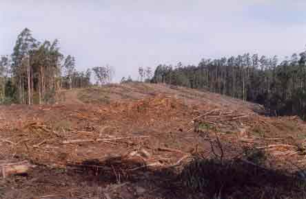
June 2004: Strzelecki Ranges north face - Morwell River East Branch (Allotment 56 Parish Wonyip leasehold land). At this location the buffer on cool temperate rainforest was measured to be 25 metres. An adequate buffer at this site would have meant that none of the trees felled in this photograph would have been logged. The trees logged at this site were 32 year old Eucalyptus Regnans. John Hancock Insurance Company has assets in the vicinity of $US150 billion. For such a massive company to 'short change' the Australian environment by not granting increased buffer widths on cool temperate rainforest in Australia is extraordinary. How many people investing in Hancock realise that their investments could mean the long term eradication of cool temperate rainforest in the Morwell River East Branch?
June 2004: Strzelecki Ranges north face - Morwell River East Branch (Allotment 56 Parish Wonyip leasehold land). At this location the buffer on cool temperate rainforest was measured to be between 30 - 40 metres. An adequate buffer at this site would have meant that none of the trees felled in this photograph would have been logged.
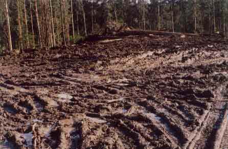
June 2004: Strzelecki Ranges north face - Morwell River East Branch (Allotment 56 Parish Wonyip leasehold land). Recent logging activities have recently been taken place in wet weather, placing obvious stresses on soil. Such activity possibly breaches part 3.2.12 of the Code of Forest Practices for Timber Production.
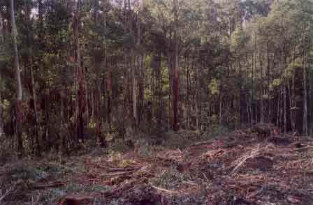
June 2004: Strzelecki Ranges north face - Morwell River East Branch (Allotments 56 & 59 Parish Wonyip leasehold land). The land in the foreground is leasehold, whilst the land in the background was purchased by Hancock from Australian Paper Plantations in August 2001. This view is looking south west. The gully to the right contains cool temperate rainforest and has been afforded buffers of only 30-40 metres. Trees logged from this site were 32 year old Mountain Ash.
June 2004: Strzelecki Ranges north face - At this site at Rytons Junction, Hancock have deliberately logged a road reserve. This logging may well be illegal because the trees come under the authority of the Local Shire, not Hancock. Only a year or so ago, Hancock foresters had agreed not to log within 50 metres of the Midland Highway and its road reserve at this location. When people's backs were turned, Hancock management then went ahead and logged this area. What does this say about Hancocks' commitment to the principles of Forest Stewardship Council where a company is supposed to co-operate with the local community? It could be said that Hancock management in the Strzeleckis are not serious about supporting the principles of the FSC. This is the third time Hancock Watch has seen roadside reserves logged by Hancock. See here for another example.
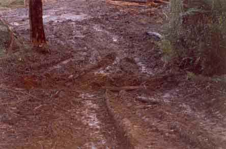
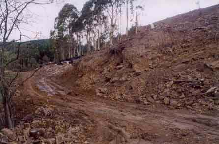
June 2004: Strzelecki Ranges - north face. Snakesback Track in the Morwell River Catchment. At this point we observed atrocious roading where the endangered Strzelecki Burrowing Crayfish is located. It was obvious that logging contractors had been using the road in very wet weather possibly breaching part 3.2.12 of the Code of Forest Practices for Timber Production.
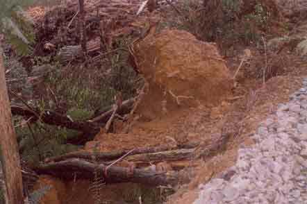
June 2004: Strzelecki Ranges - north face. Just opposite to Snakesback Track more appalling roading had taken place. At this location native vegetation had been removed and bulldozed into an exclusion zone. In this photo you can see the bulldozed tree in the foreground is marked with a pink tape meaning that it was a buffer point. The soil profile had also been disturbed at this site and a very poor log landing was seen to be collapsing.
June 2004: Strzelecki Ranges. At this location near Waak Track, Shining Gum, a non-endemic species to the Strzeleckis has been planted into a rainforest buffer in the Albert River Catchment.
June 2004 Northwest Strzelecki Ranges - Parish of Allambee East - Deadlock Creek catchment. Atrocious roading is the order of the day in this pine plantation. At this point very near to Deadlock Creek, logging debris and loose soil had simply been bulldozed off the road into the creek exclusion zone. Deadlock Creek feeds into the Tarwin River. The Tarwin River not only supplies domestic water but also contains native fish such as the Australian Grayling and Blackfish which are extremely susceptible to sedimentation of waterways. For more information about proclaimed water catchments in Gippsland click here.
June 2004 Northwest Strzelecki Ranges - Parish of Allambee East - Deadlock Creek catchment. More substandard roading and rock removal in this plantation. This point lies about 20 metres from Deadlock Creek. It appears that rock had been taken from this point and used to stablise the appalling logging track seen in this photo. Rocks from this point may also have been used to stabilise the nearby creek crossing over Deadlock Creek. An obvious high erosion potential was observed here.
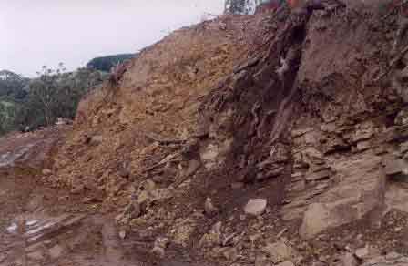
June 2004 Northwest Strzelecki Ranges - Parish of Allambee East - Deadlock Creek catchment. Closeup of area where the rocks had recently been removed. Deadlock Creek feeds into the Tarwin River and is within a proclaimed water supply catchment. The plantations at this site were initially established by Australian Paper Manufacturers in the 1970's.
June 2004 Northwest Strzelecki Ranges - Parish of Allambee East - Deadlock Creek catchment. More substandard roading. Culverts are only now being put into this road, well after much of the logging has already been completed.
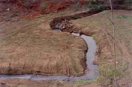
June 2004 Northwest Strzelecki Ranges - Parish of Allambee East - Deadlock Creek catchment. Recent willow and pine removal has occurred at this location. Note tracks leading through creek. For more information about Deadlock Creek see here. Much of this site in the photo will be replanted with indigenous vegetation which is a good outcome, but what happens in the meantime?
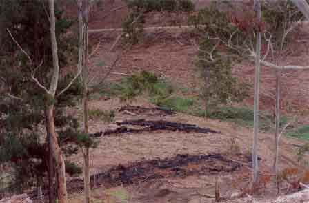
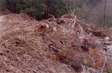
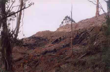
June 2004 Northwest Strzelecki Ranges - Parish of Allambee East - Deadlock Creek catchment. Recent burning of logging debris. The furtherest log pile in this photo was burnt only within a metre or so of Deadlock Creek. Large rainfall events could see ash from these piles washed into the Creek. The Tarwin River contains the threatened Australian Grayling.
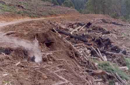
June 2004 Northwest Strzelecki Ranges - Parish of Allambee East - Deadlock Creek catchment. Recent burning of logging debris continues to smoulder through exposed soil created by the widening of a logging road. The construction of this logging road is substandard and has been highlighted by Hancock Watch since April 2004.
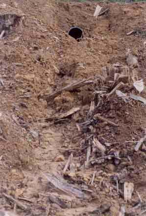
June 2004 Northwest Strzelecki Ranges - Parish of Allambee East - Deadlock Creek catchment. New culverts have been dug into place on this logging road extension, but erosion of exposed soil caused by the logging road is already occurring. This site also contained slumping batters.
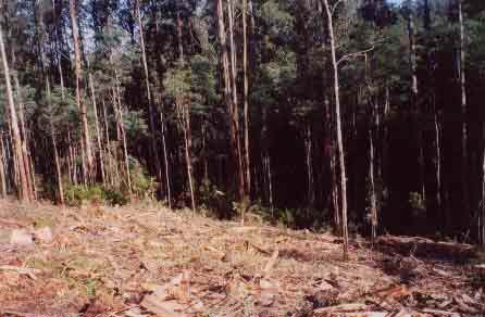
June 2004 Northwest Strzelecki Ranges. Mirboo plantations, contain about 100 hectares of Eucalpyus Regnans in the headwaters of the Elizabeth Creek catchment which flows into the Tarwin River. Much of this 100 hectares should never be logged.

May 2004: Recent logging of pine in Kentbruck plantation in Victoria's south west has meant that the site has been colonised by a profusion of Acacia longifolia (Coast Wattle). Aerial application of Hexazinone may eventuate at this location to kill this and other 'pine competitors'.
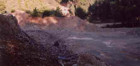
May 2004: Roading quarry at Mount Robertson Plantation in the King Parrot Creek Catchment of Central Victoria. This site could potentially see the mobilisation of vast quantities of sediment wash into King Parrot Creek. It is located in a very poor position and works needs to be done to minimise impacts of sediment onto Stony Creek (a tributary of King Parrot Creek).