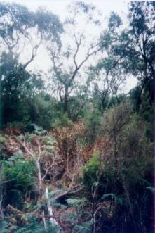
Plantation maps of region here Plantation located in Glenelg (Groundwater) Water Supply Protection Area THREATENED FISH NOTES - SWAN LAKE (Coastal South West Victoria): Spotted Galaxias* and Common Galaxias found in this lake. (*Species listed under the Flora and Fauna Guarantee Act in Victoria and threatened). Swan Lake lies south west of this plantation and may be impacted on by the mount Richmond plantations.
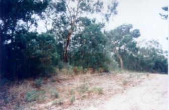
May 04: A large portion of
this plantation borders Discovery Bay Coastal Park. Many native plants
and weed species will recolonise this plantation site after logging.
This in turn could lead to aerial application of herbicides such as
Hexazinone
to kill these uneconomic plant species. Herbicide
use on these sandy soils can potentially contaminate groundwater.
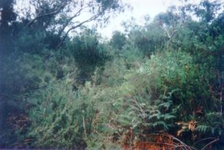
Some of the species seen at this location included;
Acacia longifolia (Coast Wattle), Solanium species (Kangaroo Apple),
Leucopogon parviflorus (Coast Beard Heath), Tetragonia implexicoma (Warrigul
Spinach), Disphyma clavellatum (Pigface) etc etc. This plantation was very likely to be aerially sprayed with 2,4,5-T between 1968 and 1977. The Dioxin TCDD may still exist in soil in this plantation. For more historical data on 2,4,5-T click here. For more information concerning the continuing health crisis concerning 2,4,5-T please forward to here. Herbicides Used by Hancock in Pine Plantations South Western Victoria
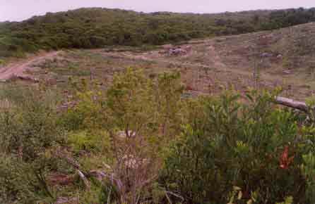
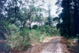
May 04: Recent clearfell logging
has occurred in the eastern portion of this plantation.
May 04: Recolonising Coast Wattle (Acacia Longifolia) in recently logged pine plantation.
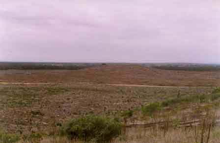
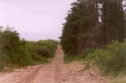
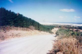
May 04: Southern boundary of
plantation with Discovery Bay in the background.
"Groundwater: "In south-western Victoria the Otway Basin stretches from the South Australian border almost to the west of Geelong. It contains older sediments of Upper Cretaceous and Lower Tertiary age, up to 2000 m in thickness. These include four sand aquifers and two limestone aquifers. The sand aquifers of the Wangerrip Group are confined over most of the Basin and their recharge zones are located on the margins of the Otway Range in the east and the Merino Tablelands in the West. The groundwater moves towards the coast, increasing in salinity along its floorpath . . ." p268 State of the Environment Report 1988 Victoria's Inland Waters. Office of the Commissioner for the Environment. "Shallow aquifers in the Glenelg River Basin occur in four main geologic units . . . The third unit is a Newer Volcanic aquifer which lies along much of the Basin's southern boundary, particularly in the east. This fractured rock aquifer is composed of basalt, scoria and tuff. The fourth unit is composed of dune sand and beach deposits extending from the south-west corner of the Basin up to the western boundary and along the northern boundary. It is known as the Bridgewater formation. A deep aquifer system exists in the south-west of the Basin and extends to the top of the western boundary and half-way across the southern boundary. This sand aquifer, which is significant as a water source, occurs within the Wangerrip Group. Generally, groundwater quality in the Basin decreases towards the north where it is saline. A large reserve of fresh water is held in the north-east corner of the catchment and in the south-west the water is of marginal quality . . ." p295 Water Victoria A Resource Handbook - Department of Water Resources Victoria 1989.
|