Conservation Priority: HighClick here for Otways map.Plantation where the Secretary CNR retains specified rights to harvest hardwood sawlogs. Water Catchment Area: GELLIBRAND RIVER CATCHMENT. LAND USE DETERMINATION (LUD) 24/8/83. (LUD’s now defined as Special Area Plans under the Catchment and Land Protection Act 1994). GELLIBRAND RIVER CATCHMENT - POTENTIAL DRINKING WATER FOR WARRNAMBOOL, CAMPERDOWN, COBDEN, LISMORE, DERRINALLUM, TERANG, SOUTH PURRUMBETE, DEVILS GULLY, NOORAT, GLENORMISTON, SIMPSON, CHOCOLYN, GHOTUK, BOORCAN |
| Herbicide | Label Rate max as kg/ha | Used to control | Notes | Application |
| Clopyralid | 2.55 | Woody Weeds | Highly Toxic/Potential Ground water Contaminant | air or ground |
| Glufosinate Ammonium | 1 | Woody Weeds | ||
| Glyphosate | 3.6 | Herbaceous and woody weeds, noxious weeds | ||
| Hexazinone | 4 | Woody Weeds | Ground Water Contaminant | Aerial, ground, spot |
| Metsulfuron-Methyl | 0.06 | Woody Weeds, Noxious Weeds | Potential Ground Water Contaminant | Aerial, ground or spot |
| Triclopyr | 3 | Woody and Noxious Weeds | Ground, spot, basal bark |
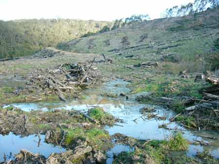
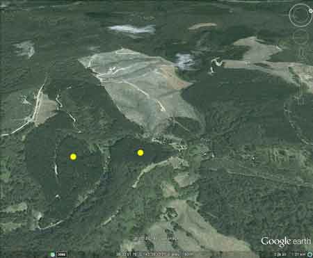
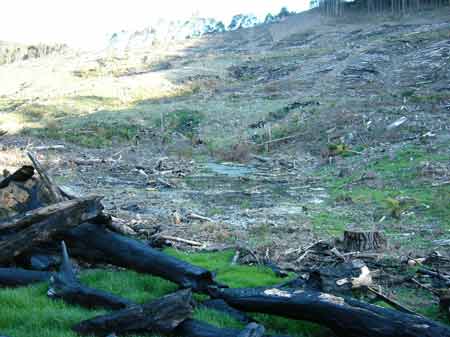
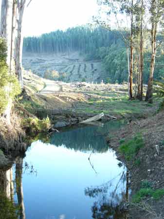
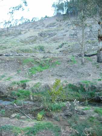
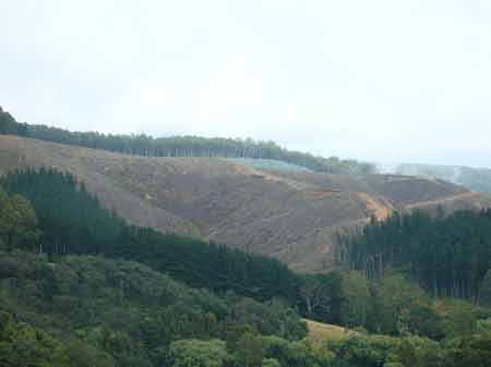
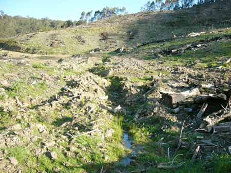
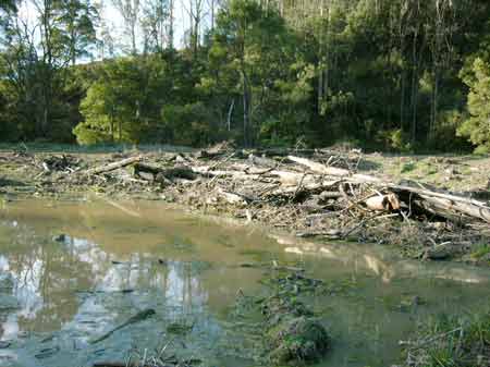
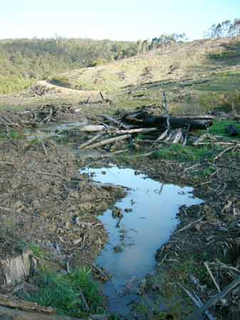
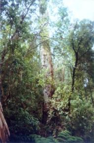
November 2004: Gellibrand River catchment, near the confluence of Barramunga Creek in the Otway Ranges. Hancock control about 50 hectares of pine at this location. The adjoining plantations that straddle both sides of the Gellibrand River are owned by the notorious woodchipping company Midways. This should be a real pretty site when these slopes get logged.
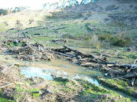
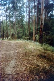
February 2007. Hancock logging on left, Midways on right.
"Land System: Steep slopes of ranges (Aire).
Aire land system: The steeply dissected spurs and ridges on the wetter parts of the Otway Range comprise the Aire land system, the largest land system in the study area... The soils are young and moderately fertile ... Pine forests cover large areas of this land system... The main hazards to land use are landslips and sheet erosion. Losses in organic matter and soil structure are often apparent following clearing." Soil Conservation Authority 1981.
Geology: Lower Cretaceous sandstone, mudstone.
Landscape: Deeply dissected hills.
Soils: Brown gradational soils. Forms of soil deterioration: Sheet, rill and landscape erosion, nutrient decline, surface compaction.
Known landslide area.
THREATENED FISH NOTES - GELLIBRAND RIVER: Best Blackfish
stream on mainland Australia.
Responsible Authority: Colac-Otway Shire Council
Quote of the year 2002: "Colac Otway Shire 6/12/02. Freedom of Information Request.
In response to your request for information relating to the use of herbicides by plantation companies, I advise that there are no records within Council, as plantation companies are not yet required to advise either Council or the Department of Natural Resources and Environment of their intention to conduct herbicide applications.
Yours sincerely - Freedom of Information Officer - Colac Otway Shire". Plantation Catchment: (west) One main trib (HW) Lardner Creek
East Branch/Lardner Creek/Charleys Creek/Gellibrand River. One creek
flows into Asplin Creek/Gellibrand River. (east) large unnamed creek
enters Gellibrand River.
Catchment Managment Authority: Corangamite Catchment Management
Authority
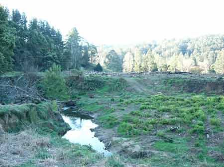
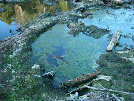
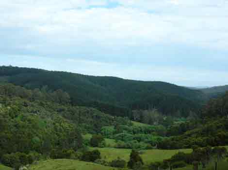
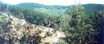
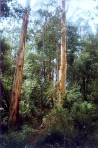
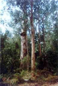
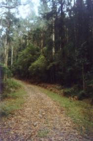
September 2007: Inside the plantation
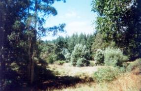
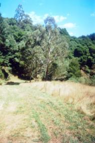
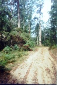
Hancock Watch Site visit Feb 01: This plantation is actually
located in two separate locations. The first location is at Upper Gellibrand
on the Gellibrand River. Plantation overlooks a popular tourist site
- Stevensons Falls. Plantation is located on rather steep slopes 30o+
in some places. A large area of native vegetation appears in the centre
of the plantation and is marked as a DNRE licence area. Some of the
gullies were dominated by old blackwoods with epiphytes. Some other
acacia species also seen. It appeared that eucalypts appeared a little
further up from this site, but due to steepness of the area I did not
check out. This will be a public relations nightmare when logging
goes ahead!
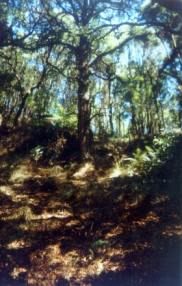
The other plantation area connects up with Webster Hill Plantation 93-48/1.
It straddles the Lardner Creek East Branch and tribs of Asplin Creek.
I checked out the DNRE licence area on Lardner Creek East Branch. Some
old growth was sited in this area down by the small bridge. Some older
trees also seen along roadside stretching along western side of the
plantation. It appeared that the older vegetation near the bridge was
a buffer zone, with what appeared to be recent harvesting of pine occurring
in the background. Some of this plantation further south was quite old
and probably due for harvesting soon. Some slopes quite slope and the
standard of the roading inside the plantation was poor - especially
at the gullies. Also blackberry infestation.
Also see November 2004 Logging Updates Page
‘A report on the Gellibrand River (South Otway) Catchment - Soil Conservation Authority 1979’.
“p1 The Gellibrand River is an extremely important source of domestic water for the south of the western district. . . p2 Over the drier months the Carlisle River - Camperdown Otway main pipeline is unable to meet peak demand for water supply in Warrnambool, and this led to the Water Commission installing the South Otway system. The South Otway pumps and pipeline provide 13/ML/day through the drier months of the year, flow in the Gellibrand River at the pump station for the months of December to March averaging 183 ML/day . . .
p8 The combination of high rainfall and steeply dissected slopes in the Otway Ranges suggest high potential hazards of soil erosion and water supply degradation. Any operation involving soil disturbance is likely to cause short-term quality deterioration, and possibly longer term problems. The high rainfall produces good growing conditions, but major soil losses can occur before natural regeneration stabilises a disturbed area, and an active revegetation program is preferable. . .”
“p10 Harvesting of Mountain Ash necessitates clearfelling, followed by managed re-establishment. During logging the following changes occur: a change in the hydrological balance of rainfall, vegetation, and soil; removal of the protective litter on the surface; disturbance of soil along roads, tracks, snig tracks, and log landings; and hard-surfacing of access roads and tracks. Together these cause increases in surface runoff and sheet and rill erosion, resulting in colloidal material and sediment in run off . . . Private pine planting operations . . . are accompanied by similar potential water supply hazards to hardwood forestry. However because of the shorter rotation, management operations are more frequent. . .”
‘Report on a proposed land use determination for the Gellibrand River Catchment - Soil Conservation Authroity 1983’
“p2 Most of the water from the Gellibrand River Catchment which is used for water supply, is taken directly from the river or its tributaries at pump or gravity offtake. Apart from the case of the Colac Waterworks Trust Reservoirs, there is no significant water detention to allow settlement of suspended solids, clarification and self-purification over time. The quality of water taken into the water supply pipeline is therefore the raw quality of the river flow. The quality of the river water is in turn responsive to events in the catchment. High peak flows associated with heavy storms may initiate streambank erosion; any earth disturbance in the catchment may cause deterioration in runoff water quality due to increases in turbidity and suspended sediment. There are a number of land uses and management practices occurring in the catchment which necessitate earth disturbance and which may cause erosion. These include land clearing, road construction, hardwood and softwood operations, extractive industries and some farming activities...”
“p57 The lower cretaceous sediments in the Otways are known for their relatively high landslide hazard. Factors considered area prone to landsliding include;
*the presence of a previous slope failure
*high annual rainfall
*moderate to steep slopes
*suitable lithogies
*deep weathering
*favourably orientated discontinuties
p59 Diversion of drainage water onto steep slopes, for example from road culverts and cutoff drains, can also exacerbate potentially unstable slopes. Slumps, mainly in the surface soil material, are more common than large-scale rock and soil landslides. Slumps may occur in fill material, on steep cut slopes or on hillsides after heavy rain or removal of vegetation. Where such earth movements occur close to drainage lines, they can be a major source of turbidity and sediment.
Most of the landslides ... occur in the AIRE land system and on freehold land which had been cleared. This includes an area on Lardner Track, now the Webster Hill softwood plantation. While Cooney noted that dense tree cover probably obscured many landslides in parts of his study area, there is still an apparent link demonstrated between land clearing and landslides. The large landslides which have occurred in the catchment can be considered dormant. On the other hand, quite a few of the small landslides are active. Cooney noticed a very strong tendency for small landslides to occur in previously failed materials, that is, within prior large landslides.”
p100 “. . . These existing and proposed plantations are located mainly on slopes of the AIRE land system, where the management problems of agriculture allow relatively cheap land purchase. Plantations have been established on both previously cleared pasture land and on blocks which had been under hardwood timber. The cleared land was often run-down, having blackberries in the drainage lines. The standing timber on the forested blocks was usually on steep slopes. . .
p101 Plantations have also been established on the deep soils and gentle slopes of the BEECH FOREST land system. However, the manager of one company believes that pines grown in such high rainfall areas grow too fast, are too light, and have a grain too coarse for structural use of the timber. Cases of toppling and multiple leaders have been observed in some Pinus radiata plantations on exposed sites on the Otways ridge and slopes. These problems are thought to be associated with the high rainfall conditions, and the high levels of residual nitrogen and phosphorus on sites previously used for agriculture (Flinn D.W., 1982, pers. comm.). . .
Some plantation establishment has been attempted on the grey sand soils, with very poor results, particularly where there are hardpans in the soil profile...”
A study of the Land in the catchments of the Otway Range and Adjacent Plains - Soil Conservation Authority 1981.
p143 "Both establishment and harvesting of hardwood and softwood forests cause serious changes to the natural hydrological balance. Pine establishment on disused agricultural land and previously forested land has led to widespread deterioration. The steep north and west facing slopes of Lorne, Forrest, Moggs Creek, Aire, Mt Mackenzie, Bunker Hill and Yahoo Creek land systems are the most severely affected. Sheet erosion losses can be minimised by working in coupes along the contour, and by maintaining adequate vegetative cover with litter layers over the soil surface.
The incidence of landslips increases following harvesting, when the binding effect of tree roots is removed and the soil is subject to saturation for longer periods. The study area share the current trend to reduce the total area of productive forest land and manage this smaller area for higher yields. As with agriculture, nutrients removed in forest produce need to be replaced through the use of fertilisers. The fertiliser requirements of soils designated for long-term hardwood and softwood production require investigation.
p142 Steep slopes in and around drainage lines are more stable under
hardwood than softwood forestry, because of longer growth period and
more selective logging practices."
Gellibrand River: Flows from mountainous forested country to
grazing land, boulder and mud bottom, mostly sand bottom in the middle
reaches. Catchment has been partially modified and water is at times
turbid. Limited access to the upper reaches upstream of Gellibrand which
carry abundant smaller river blackfish, brown trout, eels and tupong.
Upstream of the Colac-Gellibrand Road bridge is closed to all fishing
May-December. Largest size Blackfish
in Victoria and trophy size brown trout are taken from this river. Estauary
has Australian salmon, eels, mullet and some bream and estuary perch.
Source: A Guide to the Inland Angling Waters of Victoria by BR Tunbridge,
PL Rogan, CA Barnham. Department Conservation and Environment. Arthur
Rylah Institute for Environmental Research, 123 Brown St, Heidelberg,
3084. (4th ed - 1991)
 |
 |
 |
 |
 |
 |
 |
 |
 |