Hancock Watch Updates March 2021
Hancock Watch has come out of "hybernation". After the announcement
of the first phase of Brataualung Forest Reserve
in July 2018, it was decided to withdraw from highlighting Hancock activities
in the hope that the company had turned a corner. Recent activities have come
to light suggesting that it could be back to the bad old days. As a result,
the hybernation is over.
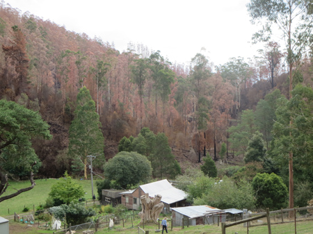
June 2020: Thousands of trees in Holey Plains State Park impacted by spray
drift from neighbouring HVP pine plantation
https://www.gippslandtimes.com.au/story/6810485/hvp-takes-responsibility-for-spray-drift-incident/
June 29 2020 HVP takes responsibility for Holey Plains State Park spray drift
incident
HVP Plantations has taken responsibility for a spray drift incident in Holey
Plains State Park, which is affecting regenerating trees and other vegetation
recovering from bushfire. The incident is also being investigated by Agriculture
Victoria.
The Gippsland Times reported on the spray drift in Friday's issue, after
concerns were raised by a worker undertaking a koala count in the area.
HVP Plantations said it had "strict protocols" in place to ensure all operations
were carried out in a way that protected the local communities and the environment
around its plantations.
"We are undergoing a detailed investigation into a possible incident relating
to our standard herbicide spraying operations in our Rosedale plantation -
in addition to Agriculture Victoria," he said.
The HVP Plantations spokesman said aerial spraying operations were only applied
to plantations twice in their 28-year cycle, and done in a strictly controlled
manner to protect the community and environment.
"HVP plantations in the Rosedale area make an important contribution to the
supply of logs to our domestic customers. "In re-establishing our plantations
following harvest the early control of competing weeds is critical to the
survival of trees," he said. "We work with Agriculture Victoria and our neighbours
to understand what has happened."
An Agriculture Victoria spokesman said the department was investigating a
complaint made on June 5 about possible spray drift settling onto native vegetation
at Holey Plains State Park, abutting the eastern side of a cleared pine plantation.
The man who reported the incident, Anthony Amis, said he noticed the sickly
vegetation in early June while undertaking a koala survey for Friends of the
Earth near the intersection of Seldom Seen Track and Chessum Rd, in the middle
of the state park. Mr Amis took video of the area which shows die-off of vegetation,
much of it on one side, right into the canopy of trees. Plants on the ground
have also been affected. The die-off occurs for a couple of kilometres along
the road and 100 to 200 metres off the road, then stops.
Mr Amis suspected the die-off was attributable to the aerial spraying of
a herbicide. Regenerating growth is known to be particularly susceptible to
some herbicides. "Whatever was sprayed, the wind got hold of it and took it
off site," he said. "Some significant vegetation could have been impacted.
"Easily, thousands of trees have been impacted. "The trees that survived the
fires might not be able to survive the spraying that followed," he said...
2021 January: ~2.5km south east of Churchill in the Bennetts Creek catchment,
a number of Federally listed (under the EPBC Act) Strzelecki Gums, have been
logged. Regeneration on the site shows many coppicing Strzeleckii. Strzelecki
Gums are listed as Vulnerable under the EPBC Act.
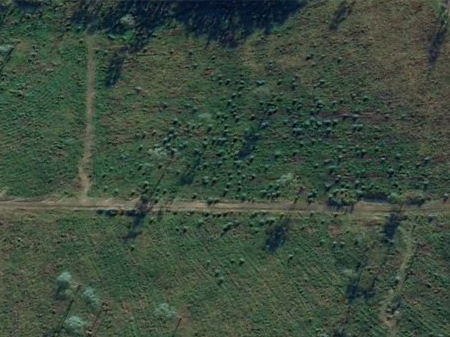
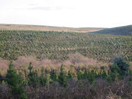
Google Earth image of Bennetts Creek plantation in 2020, showing how many
indigenous species were coppicing or regrowing in this pine plantation. The
EPBC Act offers scant protection for plantation "ingrowth". Many
trees were obviously cut down during HVP logging activity. Was this done intentionally
or was it done in ignorance of what was actually growing on the site?
2020 May: Anderson Creek Catchment/Tanjil East. "Dan's forest plan"
in action. In late 2019 the Victorian Premier, Dan Andrews announced the end
of native forest logging in Victoria. The date for the ceasation would be
2030. In the mean time, 50,000ha of new hardwood plantations would be grown
to meet the requirements of native forest supply required by 2030. At this
site, the first of the hardwood plantations grown under this plan can be seen
in the background. In the foreground is a recent pine plantation located on
land that a few years ago was a bluegum plantation owned by HVP. Hancock has
given up growing hardwood, because of poor growth rates in the Gippsland region.
The State Government doesn't seem to realise this and is planting bluegum
on an ex-Bluegum HVP site where growth rates are questionable.
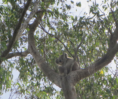
2021 January: Jelleffs OTLT, 2.5km east of Jeeralang Junction. Koala sited
on road between HVP pine plantations.
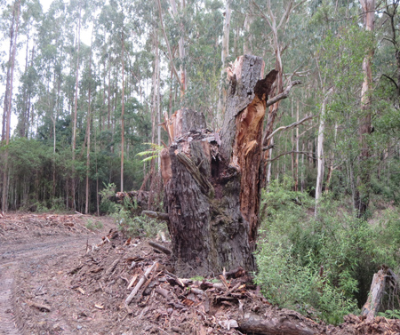
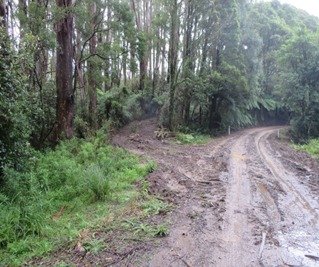
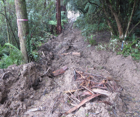
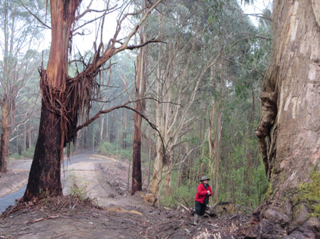
2021 March Strzelecki Ranges: Radburns Road/Morwell River Catchment. Two
old growth trees have been logged during recent operations at a future log
landing site? This event is an impetus for re-establishing Hancock Watch
2021 March Strzelecki Ranges: Radburns Road/Morwell River Catchment. Two
old growth trees have been logged during recent operations at a future log
landing site?
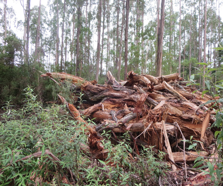
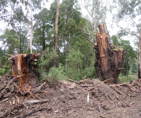
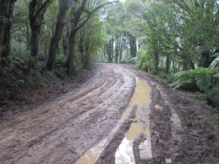
2021 March Strzelecki Ranges: Radburns Road/Morwell River Catchment. The
remainder of the old growth. Ready to be torched?
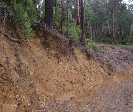
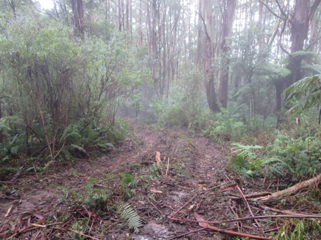
2021 March Strzelecki Ranges: Radburns Road/Morwell River Catchment. Road
batters for logging access tracks exposing tree roots of a number of trees.
What chance these trees won't survive long term?
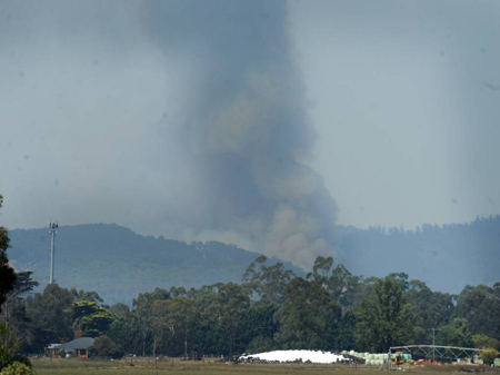
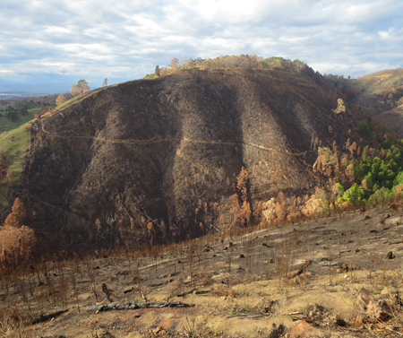
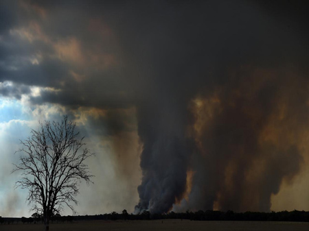
2019 March: 1800ha of land at Yinnar South was burnt in a bush fire during
early March. Fire image just on the south side of Morwell National Park.
Counting the cost: Yinnar South-Budgeree fire
https://www.latrobevalleyexpress.com.au/story/5934078/counting-the-cost-yinnar-south-budgeree-fire/
March 4 2019
At least two homes have been destroyed in a bushfire which started
near Yinnar South on Saturday.
The Yinnar South-Budgeree fire had burnt more than 1800 hectares and
was not yet under control at the time of publication. An emergency warning
had been issued for people living in the affected area, while the cause of
the blaze is unlikely to be determined until later this week.
Up to 150 firefighters will work on the fire today, mostly from Forest
Fire Management's Department of Environment, Land, Water and Planning and
Parks Victoria, as well as the CFA and HVP Plantations. Forest Fire Management
deputy incident controller Mal Gibson said no homes had been lost to fire
overnight after 40 to 60 firefighters had worked on asset protection.
However, two homes were destroyed by the fire at the weekend including
at least one on Healey's Road. Authorities also believe a number of "structures",
including sheds, were burned. He said fire crews had been working to protect
houses under threat by fire near the south-west corner of the Morwell National
Park after fire had been "slowly creeping" into the reserve overnight on Sunday.
"We sort of hope to have it under control in the next few days, but
we're still probably 48 hours away from reaching any type of containment,"
Mr Gibson told The Express on Monday morning.
Weather outlook promising: deputy incident controller Mr Gibson said
weather conditions for the next 48 hours "looked favourable" for firefighters
mainly due to "light winds of consistent direction".
"It means that we've got favourable conditions to actually get in
there and fight that fire," Mr Gibson said. He also urged people rubbernecking
to "stay home" following a number of people "stickybeaking" at the weekend.
More than 20 tankers, a dozen bulldozers, two water-bombing planes and two
helicopters have already been used to fight the fire. The fire also caused
power outages with AusNet Services reporting 88 customers at Yinnar South
and seven at Budgeree without power on Sunday and not expected to be restored
until 10pm today....
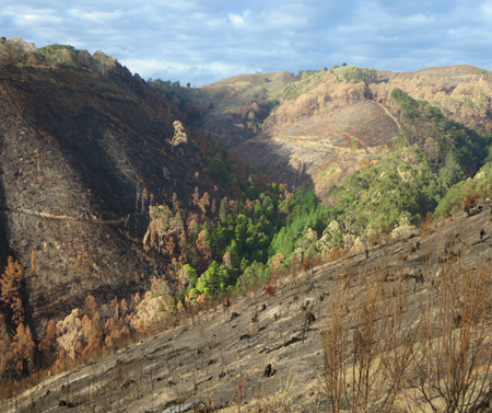
2019 April: 1800ha of land at Yinnar South was burnt in a bush fire during
early March. The burnt area included a number of key koala survey locations
which had previously recorded high numbers of koalas. Areas burnt included
the southern portion of Morwell National Park. HVP also suffered from the
fires, including this site on Upper Middle Creek Road. Hancock plantations
burnt would have totalled approximately 1000ha, but most had been logged in
the preceeding years, limiting financial losses.
2019 April Middle Creek/Morwell River catchment: Burnt pine plantations
in the fire zone. A large portion of HVP's burnt plantations in the Yinnar
South fires had been logged in the past couple of years.
2019 April Middle Creek/Morwell River catchment: Burnt HVP pine plantations
in the fire zone.
2019 April Middle Creek tributary /Morwell River catchment: Recently logged
pine plantations in the fire zone, just south of Morwell National Park.
2019 April Middle Creek tributary /Morwell River catchment: Burnt recently
logged pine plantations in the fire zone, just south of Morwell National Park.
The gully was not entirely burnt.
2019 April Middle Creek/Morwell River catchment: Burnt hardwood plantations
and native forest in the fire zone.
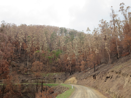
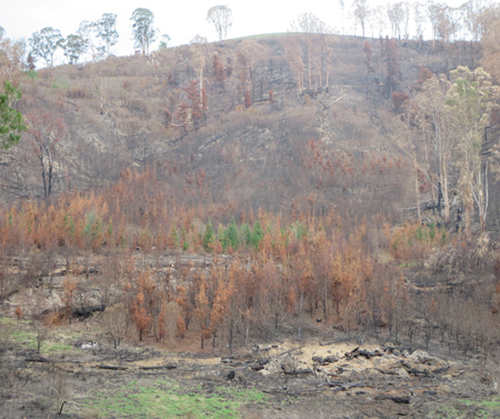
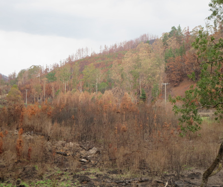
2019 January: Rosedale bushfires ended up burning approximately 12,000ha
of land, including a large swathe of Holey Plains State Park.
2020 June: Pine plantations in close vicinity to Holey Plains State Park
Stratford/LaTrobe River Catchment. In January 2019, the area was engulfed
by a 12,000ha bushire. HVP would have lost about 2500ha of pine plantations
in the fires, making 2019 HVP's worst fire year simce 2009.
2020 June: Pine plantations in close vicinity to Holey Plains State Park
Stratford/LaTrobe River Catchment. In January 2019, the area was engulfed
by a 12,000ha bushire.
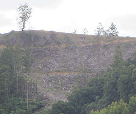
2020 May: Recent hardwood logging at Mount Fatigue Road, Woorara Creek catchment/Agnes
River headwaters. Access track pushed through native vegetation. Mount Fatigue
Road, a tourist road, was not driveable in 2WD vehicle at this time due to
state of road caused by logging. All HVP hardwood plantations are now being
replanted with pine.
2020 May: Native vegetation removed aside to get access from logging coupe
to Mount Fatigue Road in the Woorara Creek catchment/Agnes River headwaters.
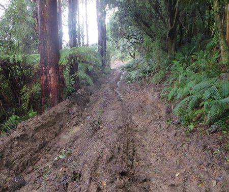
2020 May: Mount Fatigue Road, Woorara Creek catchment/Agnes River headwaters.
A tourist destination made undriveable.
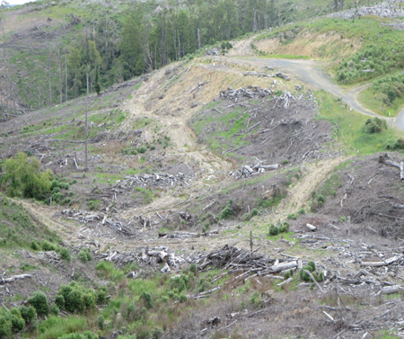
2020 May: Recent hardwood logging nearMount Fatigue Road, Woorara Creek
catchment/Agnes River headwaters. Deplorable snig truck cut across gully head.
Agnes River is a domestic water supply for Port Franklin, Port Welshpool,
Toora and Welshpool.
2020 May: Recent hardwood logging at Mount Fatigue Road, Woorara Creek catchment/Agnes
River headwaters. Deplorable snig truck cut across gully head.
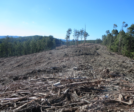
2020 May: Recent hardwood logging at Picnic Flat Track, Morwell River headwaters.
All HVP hardwood "plantations, inlcuing Mt Ash, Bluegum and Shining
Gum" are now being converted to radiata pine, meaning that the Strzelecki
Ranges is currently going through a major conversion from hardwoood to pine.
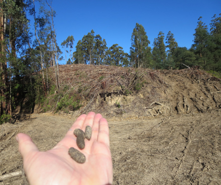
2020 May: Recent hardwood logging at Picnic Flat Track, Morwell River headwaters.
Koala scats found at this location. Picnic Flat Track and Hatchery Road are/were
hotspots for Strzelecki Koalas.
2020 May: Thomson Road, Bennett Creek catchment. A good stand of Bluegum
is located here, a large portion appears to have missed being burnt during
the 2009 fires that ravaged the area.
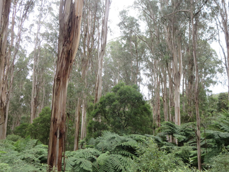
2021 March: Hatchery Road/Morwell River Catchment. 10ha stand of native
forest, including Mountain Grey Gum. Likely to be high numbers of koalas.
High quality native vegetation along Hatchery Road, has been removed by plantation
companies in the past. Most notably Victorian Plantations Corporation who
were then purchased by Hancock in 1998.
2019 August: Near Taylors Road, Traralgon Creek catchment. Large Mountain
Grey Gums are located here. The headwaters of Traralgon Creek missed being
burnt during the 2009 fires that ravaged many nearby areas. Hardwood coupes
in this catchment will eventually be converted to pine plantations.
2021 March: Middle Creek catchment, logging of hardwood plantations, most
likely Shining Gum.
2020 April: Deadlock Creek catchment headwaters near Allambee. High erosion
potential, but who is watching? Noone is monitoring water supplies for sediment,
fertiliser or pesticide loads.