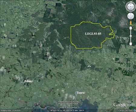
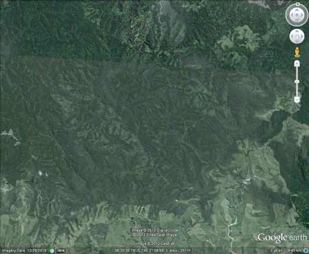
Region: StrzeleckisLegal Number: LEGL/93-85Plantation: WooraraConservation Priority: HighLocated in Yarram Water Supply Protection Area - GroundwaterArea within PaperlinX area of supply.Area within Planthard Hardwoods (Drouin West Sawmills) area of supply.Strzelecki Ranges Maps Here |
|||||||||||||||||||||||||||||||||||||||||||||||||||
|
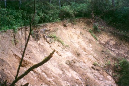
D December 2001: Landslide on Mount Mable Track. |
Hancock Site visit December 2001:
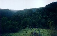
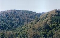
Probably the 'Crown Jewels' of the Strzelecki's, this 'plantation' takes in over 5km of land east to west and 4km of land north to south.
Declared Water Catchment Area: ALL OF THIS LEGL LIES INSIDE THE AGNES RIVER WATER SUPPLY CATCHMENT. THIS CATCHMENT SUPPLIES WATER TO TOORA, WELSHPOOL, HEDLEY, AGNES, BENNISON, PORT FRANKLIN, PORT WELSHPOOL AND SURROUNDING AREAS. (Water for greater than >2200 people).
Herbicides Used by Grand Ridge Plantations - Strzelecki Ranges and Gippsland Victoria
| Herbicide | Label Rate max as kg/ha | Used to control | Euc/Rad | Notes | Application |
| Clopyralid | 2.55 | Woody Weeds | Radiata and Eucalypts | Highly Toxic/Potential Ground water Contaminant | aerial or ground |
| Glufosinate Ammonium | 1 | Woody Weeds | Radiata | aerial or ground | |
| Glyphosate | 3.6 | Herbaceous and woody weeds, noxious weeds | Radiata, Eucalpts and Custodial | ||
| Haloxyfop-methyl | 0.13 | Annual and Pernneial Grasses | Eucalypts | Carcinogen | aerial or ground |
| Hexazinone | 4 | Woody Weeds | Radiata | Ground Water Contaminant | Aerial, ground, spot |
| Metsulfuron-Methyl | 0.06 | Woody Weeds, Noxious Weeds | Radiata, Eucalyptus and Custodial | Potential Ground Water Contaminant | Aerial, ground or spot |
| Sulfometuron Methyl | 0.6 | Annual and Perennial Grasses and broadleaf weeds | Eucalyptus | Potential Ground Water Contaminant | Aerial or Ground |
THREATENED FISH NOTES - STRZELECKI STREAMS: Habitat forSpotted Galaxias, Mountain Galaxias, Broadfinned Galaxias, Tupong , Blackfish and the FFG listed Australian Grayling..
|
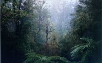
Cool
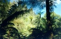
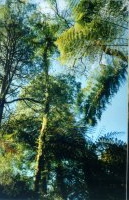
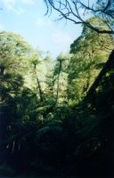
Temperate Rainforest on a tributary of the Agnes River. Note Slender
Tree Ferns - endangered species.
|
|
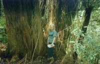
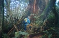
Old
growth Messmate in the Woomerah catchment which runs parallel
to Devils Pinch Road.
|
Responsible Authority: Wellington Shire Council/South Gippsland Shire Council
Plantation Catchment:
a) Several tribs HW Woomera Creek/Walla Walla Creek/Agnes River
b) 2 tribs Franklin River
c) 1 creek trib + much of Dingo Creek + 2 tribs Dingo Creek/Agnes River
d) Many tribs HW Dingo Creek/Agnes River
e) Many tribs HW Agnes River
Catchment Managment Authority: West Gippsland Catchment Management Authority
www.hancock.forests.org.au/docs/agnes.htm#content_top
www.hancock.forests.org.au/docs/dingo.htm#content_top
|
Old growth forest near Mount Mable - Dingo Creek. |
|
Old
growth Mountain Ash in Agnes Catchment.
|
"The Agnes River rainforest is bounded by the Grand Ridge Road to the north, the Toora/Gunyah Road to the west, Devil's Pinch Road to the South and Agnes No2 Track to the east.
The Agnes River headwaters contains some of the best mountain ash regrowth and cool temperate rainforest remaining in the Strzeleckis. A tiny section of these headwaters has been set aside as a flora and fauna reserve. Outside the reserve some of the spurs and gullies have suffered damage in the last 10 to 15 years, as forest has been cleared and spurs planted with mountain ash, but the proportion that could be classified as plantation is small. There remains large areas of native forest, mature mountain ash and messmate and cool temperate rainforest.
Within the rainforest, 4 rare rainforest species have been identified. They are; Tmesipteris elongata (A species of Forked Fern), River Hook Sedge, Slender Tree Ferns and Skirted Tree Ferns.
The rainforest is most extensive in the area within the reserve. It covers the gullies along the main river course and along the full length of each tributary, except at the southern-most end of the reserve where damage to the tributary caused by logging and land clearing has resulted in most of that tributary having only scattered myrtle beech trees. Below the reserve there is extensive cool temperate rainforest along the main river course, although there are a few small sections on the western side of the river that have only scattered myrtle beech trees. These sections coincide with those areas where logging activity, clearing and replanting, has occurred over the last 10 to 15 years.
|
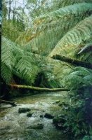
July 2001: Inside the Agnes River surrounded by Cool Temperate Rainforest.
|
|
November 2001: Dingo Creek at the southern end. Note proliferation of Blackwood regeneration.
|
The reserve is dominated by mountain ash regrowth, with many mature and old-growth trees. Outside the reserve there are large areas of native forest and some strips of young mountain ash plantation only 10 to 15 years old. The native forest consists of numerous pockets of mountain ash and messmate regrowth (containing a considerable number of mature-age trees with hollows) and extensive Blackwood forest.
The Strzeleckis has lost almost all its mixed age/mixed species eucalypt forest. If what remains is not protected, all that will be left will be isolated in the tiny pockets at Gunyah and Tarra Bulga. The areas presently reserved are very small and are unlikely to be able to sustain a viable population of the fauna that are dependent on mature-age trees. This is likely to have a dramatic effect on the native fauna remaining in the Strzeleckis.
Greater Gliders are found in both the Franklin and Agnes headwaters, both inside and outside the reserve. Gliders require trees with large hollows in which to den during the day and raise their young. Greater Gliders also usually require a variety of eucalypts as they feed almost exclusively on the leaves, bud and flowers of eucalypts." Rainforest in the Strzeleckis by Elaina Fraser.
Franklin Cool Temperate Rainforest:
"The area between the Grand Ridge Road and Stronach's Road has been set aside as a reserve. This area is flatter than most rainforest areas within the Strzelecki's and the rainforest tends to extend in a wide band along each of the tributaries. Because of the width of the rainforest, mature and old-growth mountain ash can be found within the rainforest as well as on the spurs.
There are many examples of very old myrtle beech and sassafras and numerous skirted and slender tree ferns.
The rainforest also extends along those tributaries south of the reserve, between Stronach's Road and Red Hill Track and between Red Hill Track and Clay Track at the eastern headwaters of these tributaries.
In 1997 logging was carried out by Victorian Plantation Corporation in Stronach's Road and Red Hill Track (LEGL 93-83). No buffers were left around the rainforest. Clearing was carried out right to the edge of rainforest and debris pushed into rainforest gullies, causing damage to myrtle beech.
The damage to the rainforest has resulted in a number of trees dying of myrtle wilt. Myrtle wilt is dispersed by airborne inoculum, so this action has put the myrtle beech within the nearby Franklin and Agnes reserves at risk as well as those areas adjacent to the area logged. Myrtle wilt has since been seen in the Franklin some distance from Stronach's Road and a number of trees have also been seen to be dying of myrtle wilt in the Agnes catchment.
The headwaters of the Franklin River contains a significant population of Greater Gliders both inside and outside the reserve. Greater Gliders require old trees for nest hollows. The abundance of the Greater Glider in undisturbed forests is in strong contrast to its paucity in regenerated forest, which lacks old trees with hollows suitable for nesting. Its conservation is utterly dependent upon sympathetic forest management which retains buffer strips of old forest between coupes and preserves old habitat trees and their potential successors in small unlogged areas. Greater Gliders are destroyed in clear-felling operations.
The Franklin Reserve still contains large numbers of mature and old-growth
mountain ash. There is also the 1939 regrowth at the corner of the Grand
Ridge Road and Toora Gunyah Road. However, old habitat trees continue
to be removed outside the reserve, where there is a significant Greater
Glider population. Further fragmentation and isolation of the Greater
Glider habitat jeopardises the conservation of the Greater Glider in
this area."
Rainforests of the Strzeleckis. By Elaina Fraser.
|
Slender
Tree Fern in tributary of the Agnes River Cool Temperate Rainforest.
|
|
Inside Cool Temperate Rainforest tributary of the Agnes River.
|
|
The
Agnes River and Cool Temperate Rainforest.
|
"Dingo Creek Headwaters:
There is virtually no rainforest left in the headwaters of Dingo Creek, although there are still scattered Myrtle Beech trees.
Clearing and planting of mountain ash was carried out at Mount Mabel Track in the late 1980s. This activity has resulted in substantial erosion into the headwaters of Dingo Creek and has blocked the creek. Much of this area is now failed plantation.
A small area of Messmate forest remains between Dingo Creek headwaters
and the Midland Highway just south of Chrities."
Rainforests of the Strzeleckis. By Elaina Fraser.
Geology inside the catchment: Lower Cretaceous sandstone, siltstone and mudstone with minor Pliocene sedimentary deposits. The catchment is undulating to hilly.
Soils: Porous earths, some acidic, molted duplex soils.
Average rainfall: 1150mm. The catchment is approximately 6640 ha in size with Hancock controlling just under 50% of the entire catchment. Catchment water use is approximately 1315 ML per year.
“A report on the South Gippsland Water Supply Catchments - October 1987 - Land Protection Division - Conservation Forests and Lands
p5 Before European settlement, all of the catchments . . . were covered with similar tall tree vegetation associations. However, the early settlers almost totally cleared the area of this vegetation for pasture and grazing management. Farming could not be sustained in many situations and regrowth of native species was allowed to occur, much of it since the 1930’s and as recently as the 1950’s. Much of the regrowth comprises scrub species and these are gradually being restored to the original species composition . . . Currently, approximately 50% of the Agnes River catchment and 30% of the Deep Creek catchment supports indigenous vegetation. . . Those areas of complete regrowth that do exist in these catchments are dominated by mountain ash, usually in pure stands. Associated species are messmate, manna gum, bluegum and Mountain Grey Gum, occurring mainly in the Agnes River Catchment. . .”
Franklin River, Foster:
A fast flowing stream rising in timbered hilly country, rock bottom. Middle and lower reaches are highly modified by agriculture. Access difficult and in most places walking is necessary. The headwaters contain brown trout to 400g, occasional larger fish, average 160g, some river blackfish and eels. In the lower reaches mainly shallow but some deep holes, sluggish flow, mud and sand bottom. Contains an abundance of eels. Few other fish caught. Estuarine section contains the usual estuarine fish found in district, including estuary perch to 1.4kg.
Agnes River, Welshpool:
In the upper reaches a fast flowing stream running through timbered hilly country, rock and gravel bottom. Lower parts of the catchment highly modified by agriculture and the water is turbid and slower with a mud and sand bottom. Subject to low flow and water level, particulary during summer. Where the habitat is suitable, trout are present in large numbers. These areas are not readily accessible. Upper reaches contain brown trout average 120 g. Lower reaches contain some brown trout average 220g, maximum 600g, tupong, long-finned eel and grayling. Contains estuary perch to 1.4kg, trevally and flathead.
Dingo Creek, Welshpool:
Small tributary of the Agnes River running through timbered hilly country, rock and gravel bottom. Subject to low flow and water level, particularly during summer. Where the habitat is suitable, trout are present in large numbers. Carries brown trout to 300g, average 20g, some river blackfish and eels.
Source: A Guide to the Inland Angling Waters of Victoria by BR Tunbridge, PL Rogan, CA Barnham. Department Conservation and Environment. Arthur Rylah Institute for Environmental Research, 123 Brown St, Heidelberg, 3084. (4th ed - 1991)
