Water Catchment Area: Almost one half of the plantation (eastern half) lies in the Tyers River Catchment (Moondarra Reservoir). Land Use Determination LUD 7/5/75. LUD’s replaced with Special Area Plans under the Catchment and Land Protection Act 1994. Central Gippsland Plantation Maps here
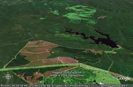
Google Earth image circa early 2001: Note proximity to Moondarra Reservoir. Water Catchment Area: Approximately 20% of the plantation (north-west) lies in the Tanjil River Catchment. Land Use Determination LUD 16/4/85(A). LUD’s replaced with Special Area Plans under the Catchment and Land Protection Act 1994. For map showing Gippsland Water Supply Catchments click here
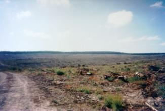
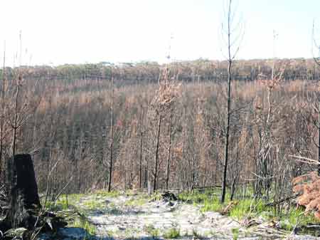
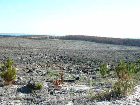
March 2006: Bushfires in January 2006 killed several hundred hectares of plantations on the western edge of this plantation.
March 2006: Fire scorched these wildlings and swept over several hundred hectares of unplanted plantation. Area within PaperlinX area of supply.Area within Brown and Dureau Softwoods (Morwell) area of supply.Herbicide Regimes: (From incompleted information sourced from Gippsland Water): This plantation was very likely to be aerially sprayed with 2,4,5-T between 1968 and 1977. The Dioxin TCDD may still exist in soil in this plantation. For more historical data on 2,4,5-T click here. For more information concerning the continuing health crisis concerning 2,4,5-T please forward to here. April 2000: 65 ha sprayed with 226.2kg Trounce (glyphosate and metsulfuron methyl)& 13 kg Pulse (a surfactant) to kill Bracken and Manuka (Leptospermum scoparium). October 2000: 64 ha sprayed with 865.5kg Velmac G to kill Gahnia (Thatch Saw-Sedge) and Bracken. 6 ha sprayed with 120 kg Velmac CR to kill Gahnia and Bracken. April 2001: 166ha sprayed with 464.8kg of Roundup Max, 13280 Litres of Metmac and 33.2 Litres of Pulse (a surfactant). September 2001: 184 ha sprayed with 2760 kg of Velmac G to kill Woody Weeds (native regeneration). Herbicides Used by Grand Ridge Plantations - Strzelecki Ranges and Gippsland Victoria
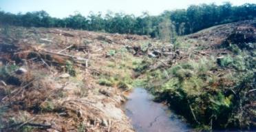
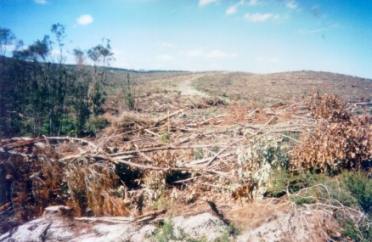
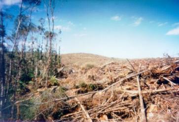
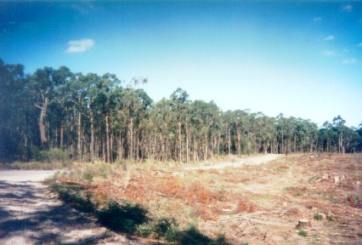
THOMSON/LATROBE RIVER: Australian Grayling are found in some streams in the catchment. Used to have a large population of Blackfish, but due to desnagging, sedimentation and destruction of riparian vegetation these populations have declined. Crayfish are an issue in catchment. Responsible Authority: Baw Baw Shire Council Plantation Catchment: Seperates Tyers State Park/Moondarra State Park. Couple of small creeks flow south into farm dams and Anderson Creek/Latrobe River. Some flow possibly into Moondarra Reservoir. Catchment Managment Authority: West Gippsland Catchment Management Authority Soils: Sourced from Moe Geological Survey Map. Tg: Tertiary: Undifferentiated gravel, sand, silt, clay, carbonaceous, rare brown coal, cross bedded, planar bedded, locally silicified (sometimes to Tvt basalts), ferruginous altered porcellanaite. . . Hancock Watch Site Visit Apr 01: Large plantation with lots of recent logging. Entered the site from the south from Hunter Road. Large area of native vegetation remains unlogged in the approximate centre of the plantation, however wildings are present through some of this forest. Most of the plantation on the eastern side was still under pine, most harvesting had occurred on the western side. Workers were at the site making a full inspection difficult, however a number of issues were prevalent. Firstly the buffer zone protection on drainage lines leading west were minimal to non-existent. It was also evident that there had been recent destruction of native species near a buffer zone on a drainage line near Wells Track. It was also apparant that native vegetation had been destroyed further south on Wells Track as well. This is only the second instance of Hancock Watch witnessing native vegetation destruction through Hancock's lands outside of the Strzelecki's. The native vegetation was most likely to be regeneration, however the buffer zone warrants greater protection. Moondarra Reservoir, Tyers - A domestic water storage on the Tyers River. Contains carp, brown trout, redfin and eels.
|