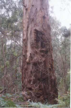
December 2001: Old growth remnant on tributary of Traralgon Creek.
THOMSON/LATROBE RIVER:Australian Grayling are found in some streams in the catchment. Used to have a large population of Blackfish, but due to desnagging, sedimentation and destruction of riparian vegetation these populations have declined. Crayfish are an issue in catchment.
b.jpg)
April 2004: Recent roadworks on highly erodable soils
This plantation was very likely to be aerially sprayed with 2,4,5-T between 1968 and 1977. The Dioxin TCDD may still exist in soil in this plantation. For more historical data on 2,4,5-T click here. For more information concerning the continuing health crisis concerning 2,4,5-T please forward to here.
Soils according to 1978 Carrajung Geological Survey Map:
Kls: Cretaceous (Lower Aptian) Paludal - Strzelecki Group: Feldspathic, lithic sandstone, siltstone and mudstone, minor black coal, quartzose sandstone, conglomerate, local carbonate concentrations. Abundant plant remains.
Hancock Watch Site Visit December 01: Pine plantation located on both sides of Jeeralang North Road in the Traralgon Creek and Waterhole Creek catchments which consists of 1973, 1974, 1978 & 1990 established pine plantations - some being replanted to Shining Gum. Drove into plantation from the north along the Jeeralang North Road. Noticed regenerating native vegetation along roadsides and further into plantation on both sides of the road. At an intersection midway into the plantation I drove east and then south onto Sheedy Track. Soon after, I turned onto an unmarked track and headed into an area that was unmarked as plantation on Hancock LEGL maps. In this area there is some remnant older Eucalypts.
December 2001: Remant vegetation on eastern slopes of tributary of Traralgon Creek.
The area is quite small however due to the scarcity of older trees in the region, this area is of high conservation value. Much of the tributary of Traralgon Creek, where this area is located, also consists of regrowth native forest, however it is obvious that pine wildings are taking over this area to a certain degree. Drove back to Sheedy Track and headed north west into some recently cleared plantation. The slopes here were quite mild. It was also obvious that the Hancock land also borders on plantations recently sold to Hancock by Australian Paper Plantations. At one location it was apparent that radiata pine plantations had been replanted with native species. Also near this point there was what I thought was herbicide, in granule form, lieing on the roadside - waiting to be washed into Traralgon Creek.
.jpg)
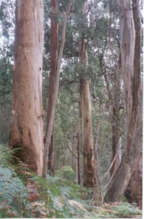
April 2004: Edge of south east corner of plantation borders 200 hectares of Hancock 'owned' native forest - this photo probably shows allotment 49B Parish of Traralgon.
The Traralgon Creek side of the plantation has very important stands of native vegetation located directly south of the plantation. These private allotments were owned by APM/Amcor/Australian Paper Plantations. Hancock purchased these blocks in August 2001 with the sale of Australian Paper Plantations. The allotments include; 48, 49A, 49B & 49C Parish of Traralgon. These allotments total about 200 hectares of native forest.
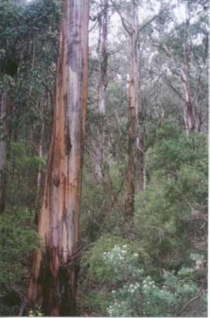
December 2001: Remnant vegetation on eastern slopes of tributary of Traralgon Creek..
Plantation Catchment:
3 tributaries & numerous drainage lines flowing east intoTraralgon Creek/LaTrobe River.
Several tributaries flowing north and west into Waterhole Creek/LaTrobe River
Catchment Managment Authority: West Gippsland Catchment Management Authority
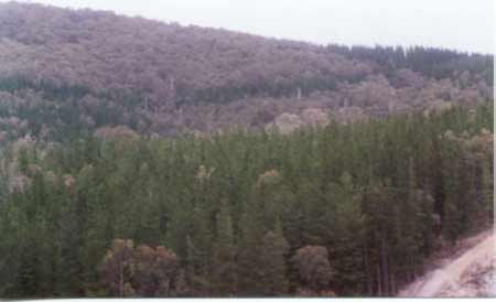
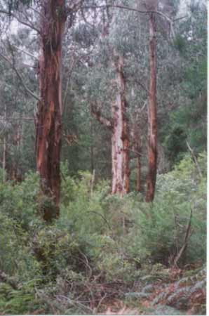
December 2001: View looking south into plantation. Note pine wildings inside native forest. Much of the ridge line of native forest is actually state forest with only a small portion being inside Hancocks boundaries.
a.jpg)
April 2004: Recent logging of pine in south east corner of plantation has dislodged vast amounts of soil.
Traralgon Creek, Traralgon: Small creek flowing through mostly cleared land, rock and mud bottom. Catchment modified for agriculture and the stream is at times turbid from erosion. The deeper holes are silting up. Contains mainly brown trout average 90g, maximum 600g, also eels, tupong, river blackfish, and freshwater crayfish.
Source: A Guide to the Inland Angling Waters of Victoria by BR Tunbridge, PL Rogan, CA Barnham. Department Conservation and Environment. Arthur Rylah Institute for Environmental Research, 123 Brown St, Heidelberg, 3084. (4th ed - 1991)
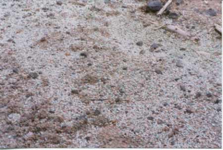
December 2001: Pellitised herbicide? on logging road inside plantation waiting to be washed into Traralgon Creek after the next rainfall.