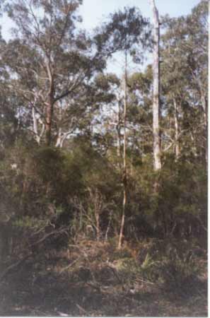
September 2001: Remant vegetation including old growth along wetland which drains near Bodman Creek?
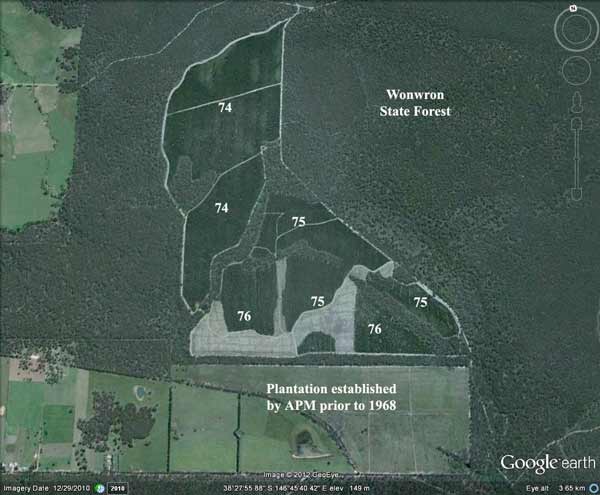
This plantation was very likely to be aerially sprayed with 2,4,5-T between 1974 and 1976. The Dioxin TCDD may still exist in soil in this plantation. For more historical data on 2,4,5-T click here. For more information concerning the continuing health crisis concerning 2,4,5-T please forward to here.
Herbicides Used by Grand Ridge Plantations - Strzelecki Ranges and Gippsland Victoria
| Herbicide | Label Rate max as kg/ha | Used to control | Euc/Rad | Notes | Application |
| Clopyralid | 2.55 | Woody Weeds | Radiata and Eucalypts | Highly Toxic/Potential Ground water Contaminant | aerial or ground |
| Glufosinate Ammonium | 1 | Woody Weeds | Radiata | aerial or ground | |
| Glyphosate | 3.6 | Herbaceous and woody weeds, noxious weeds | Radiata, Eucalpts and Custodial | ||
| Haloxyfop-methyl | 0.13 | Annual and Pernneial Grasses | Eucalypts | Carcinogen | aerial or ground |
| Hexazinone | 4 | Woody Weeds | Radiata | Ground Water Contaminant | Aerial, ground, spot |
| Metsulfuron-Methyl | 0.06 | Woody Weeds, Noxious Weeds | Radiata, Eucalyptus and Custodial | Potential Ground Water Contaminant | Aerial, ground or spot |
| Sulfometuron Methyl | 0.6 | Annual and Perennial Grasses and broadleaf weeds | Eucalyptus | Potential Ground Water Contaminant | Aerial or Ground |
Soils according to 1978 Carrujung Geological Survey Map:
Tph: Pliocene: Clayey and sandy gravel and coarse sand, minor clay, fine sand and silt. Ferruginization, cross-bedding common. Includes subsurface, the Boisdale Formation and marine equivalents, gravel sand, coquina, marl, clay, peat and brown coal.
Hancock Watch Site Visit September 01: Plantation lies within Mullungdung Site of Botanical Significance in Central Gippsland. This pine plantation is located on flat slopes three to four kilometres north east of the village of Wonwron. The northern most part of the plantation lies near Bodman Creek, although the south eastern part of the plantation drains away from the Bodman Creek catchment. This plantation was established as early as 1974,5,6. It has an extensive buffer zone of native vegetation south and east of Tumble Track. A drainage line in the south east corner may also have an indigenous buffer zone. The buffer zone inside the plantation extends for almost a kilometre inside the plantation. The drainage line has a dam located just inside the plantation boundary. This drainage line probably ends in swampy/marshy country another kilometre downstream. The northern boundary just outside the plantation is dominated by grass trees and banksia/eucalypt forest.
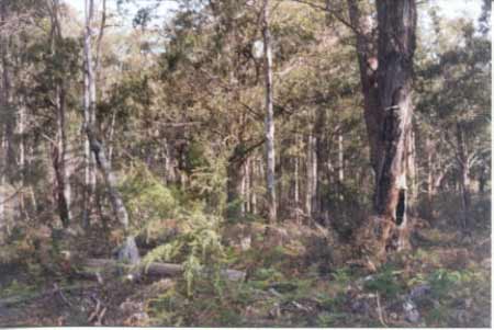
September 2001: Remant vegetation including old growth along wetland which drains near Bodman Creek?
6. Mullungdung Forest: Regional significance Area: ca. 280-300km2
Boundaries: Yarram-Traralgon Road between Gormandale and Greenmount (W), Merriman Creek between Gormandale and Stradbroke (N), South Gippsland Highway between Stradbroke and Greenmount (E and S). Includes catchments of Bruthen and Monkey Creeks.
Vegetation: Leptospermum myrsinoides Heathland, Damp Sclerophyll Forest, Sedge Swampland, Grassy Woodland, Coastal Heathland.
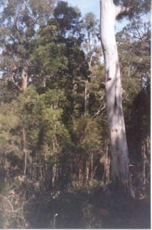
September 2001: Remant vegetation including old growth along wetland which drains near Bodman Creek?
Reasons for Designation: This site, which includes the Mullungdung State Forest and some surrounding areas of Crown and private land, is the largest area of native vegetation, below 300m, in the study area, and supports the largest stand of Leptospermum myrsinoides Heathland in the State. Kangaroo Swamp, in the centre of the site, is a large (ca. 1.5km2) Sedge Swampland surrounded by Coastal Heathland and is the largest ecosystem of this type in the study area. A smaller, similar swamp in the north-west of the site (Willung Swamp) presents a good example of the juxtaposition of three communities (i.e. Leptospermum myrsinoides Healthland, Coastal Heathland and Sedge Swampland).
In the south-eastern parts of the site a floristically depauperate but predominately nativeversion of Grassy Woodland grows on a heavier soil than the sandy podzols supporting the above three communities. In the northern parts of the site, particularly around Monkey Creek, and on deeper more loamy soils, a Damp Sclerophyll Forest grows. Most of this vegetation has been burnt in the past six months so the floristic makeup of the understorey has not been adequately assessed. Significant species of the site include Eucalyptus consideniana (yertchuk), a species which is much more abundant in the study area than anywhere else in the State (the largest stand is in the Mullungdung site); Banksia serrata, predominantly a coastal species of East Gippsland and N.S.W. found growing with a grassy heath (see Banksia Woodland in Forbes et al. 1982), found in association with Leptospermum myrsinoides Heathland in the study area; Acacia howittii, endemic to the study area: Caladenia aurantiaca, restricted in Victoria to the study area and far East Gippsland; Calochilus imberbis, a rare species found only in a few isolated localities: the only other known locality in the study area is Cowra near Heyfield; Choretrum pauciflorum, a shrub which is widespread but never common; Gahnia clarkei, common in East Gippsland heaths but uncommon in more westerly districts; Gompholobium latifolium, common in Banksia Woodland in East Gippsland and coastal N.S.W. but very uncommon in the study area and probably at its western limit in this site; Helichrysum thyrsoideum, at its western limit in the study area; Pomaderris pilifera, endemic to Central and near East Gippsland; Grevillea chrysophaea; except for an isolated occurrence in the Brisbane Ranges this species is endemic to the study area south of the Princes Highway.
Tarra River - Downstream from Calrossie: Becomes sluggish, mud and sand bottom. Carries reasonable numbers of spiny freshwater crayfish, some brown trout to 350g, and river blackfish. Estuarine section contains estuary perch, Australian bass, mullet, luderick and trevally.
Source: A Guide to the Inland Angling Waters of Victoria by BR Tunbridge, PL Rogan, CA Barnham. Department Conservation and Environment. Arthur Rylah Institute for Environmental Research, 123 Brown St, Heidelberg, 3084. (4th ed - 1991).