
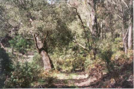
September 2001: Native vegetation retained in gully of tributary of Bruthen Creek on edge of plantation. Note radiata pine encroaching into gully area.
Herbicides Used by Grand Ridge Plantations - Strzelecki Ranges and Gippsland Victoria
| Herbicide | Label Rate max as kg/ha | Used to control | Euc/Rad | Notes | Application |
| Clopyralid | 2.55 | Woody Weeds | Radiata and Eucalypts | Highly Toxic/Potential Ground water Contaminant | aerial or ground |
| Glufosinate Ammonium | 1 | Woody Weeds | Radiata | aerial or ground | |
| Glyphosate | 3.6 | Herbaceous and woody weeds, noxious weeds | Radiata, Eucalpts and Custodial | ||
| Haloxyfop-methyl | 0.13 | Annual and Pernneial Grasses | Eucalypts | Carcinogen | aerial or ground |
| Hexazinone | 4 | Woody Weeds | Radiata | Ground Water Contaminant | Aerial, ground, spot |
| Metsulfuron-Methyl | 0.06 | Woody Weeds, Noxious Weeds | Radiata, Eucalyptus and Custodial | Potential Ground Water Contaminant | Aerial, ground or spot |
| Sulfometuron Methyl | 0.6 | Annual and Perennial Grasses and broadleaf weeds | Eucalyptus | Potential Ground Water Contaminant | Aerial or Ground |
Plantation Catchment:
a) near Bruthen Creek
b) 2 creeks into Tom Cap Creek/Bruthen Creek/Shallow Inlet
Hancock Watch Site Visit September 01: Plantation lies within Mullungdung Site of Botanical Significance in Central Gippsland. This plantation actually consists of two pine plantations. The northern plantation is accessed via a track heading south of Little Tower Road. The plantation is located on the northern catchment of Toms Cap Creek. A dam is located in a gully on the northern boundary of the plantation. This gully has quite a steep contour. From the northern boudary it appears that the entire plantation is pine, however there may be a native vegetation buffer inside the plantation on the tributary of Toms Cap Creek, downtream from the dam. This plantation is surrounded by eucalpypt and banksia forest.
Inside the plantation the understorey was non -existent. This plantation was established in 1983. The southern plantation lies about 6 kms south east of the northern plantation and is accessed by the Old Rosedale Road. This plantation is located quite close to Bruthen Creek about 1-2km downstream of the junction of Toms Creek and Bruthen Creek. This plantation was established in 1990 and possibly cleared farmland. The slopes appear to be very mild.
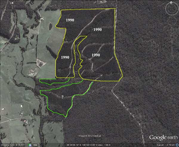
The south west corner of the plantation has quite a substantial native vegetation area. This occurs on a tributary of Bruthen Creek, possibly too difficult to plant with pine in 1990. Numerous indigenous species were sighted in this diverse gully which also includes some native vegetation outside the plantation boudary. The buffer appears to extend almost one km into the plantation, although only a few hundred metres walked by us.
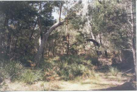
September 2001: Native vegetation retained in gully of tributary of Bruthen Creek.
Sites of Botanical Significance in Central Gippsland - 1984.
Department of Conservation, Forests and Lands.
p71 6. Mullungdung Forest: Regional significance
Area: ca. 280-300km2
Boundaries: Yarram-Traralgon Road between Gormandale and Greenmount (W), Merriman Creek between Gormandale and Stradbroke (N), South Gippsland Highway between Stradbroke and Greenmount (E and S). Includes catchments of Bruthen and Monkey Creeks.
Vegetation: Leptospermum myrsinoides Heathland, Damp Sclerophyll Forest, Sedge Swampland, Grassy Woodland, Coastal Heathland.
Reasons for Designation: This site, which includes the Mullungdung State Forest and some surrounding areas of Crown and private land, is the largest area of native vegetation, below 300m, in the study area, and supports the largest stand of Leptospermum myrsinoides Heathland in the State. Kangaroo Swamp, in the centre of the site, is a large (ca. 1.5km2) Sedge Swampland surrounded by Coastal Heathland and is the largest ecosystem of this type in the study area. A smaller, similar swamp in the north-west of the site (Willung Swamp) presents a good example of the juxtaposition of three communities (i.e. Leptospermum myrsinoides Healthland, Coastal Heathland and Sedge Swampland). In the south-eastern parts of the site a floristically depauperate but predominately nativeversion of Grassy Woodland grows on a heavier soil than the sandy podzols supporting the above three communities.
In the northern parts of the site, particularly around Monkey Creek, and on deeper more loamy soils, a Damp Sclerophyll Forest grows. Most of this vegetation has been burnt in the past six months so the floristic makeup of the understorey has not been adequately assessed. Significant species of the site include Eucalyptus consideniana (yertchuk), a species which is much more abundant in the study area than anywhere else in the State (the largest stand is in the Mullungdung site); Banksia serrata, predominantly a coastal species of East Gippsland and N.S.W. found growing with a grassy heath (see Banksia Woodland in Forbes et al. 1982), found in association with Leptospermum myrsinoides Heathland in the study area; Acacia howittii, endemic to the study area: Caladenia aurantiaca, restricted in Victoria to the study area and far East Gippsland; Calochilus imberbis, a rare species found only in a few isolated localities: the only other known locality in the study area is Cowra near Heyfield; Choretrum pauciflorum, a shrub which is widespread but never common; Gahnia clarkei, common in East Gippsland heaths but uncommon in more westerly districts; Gompholobium latifolium, common in Banksia Woodland in East Gippsland and coastal N.S.W. but very uncommon in the study area and probably at its western limit in this site; Helichrysum thyrsoideum, at its western limit in the study area; Pomaderris pilifera, endemic to Central and near East Gippsland; Grevillea chrysophaea; except for an isolated occurrence in the Brisbane Ranges this species is endemic to the study area south of the Princes Highway.
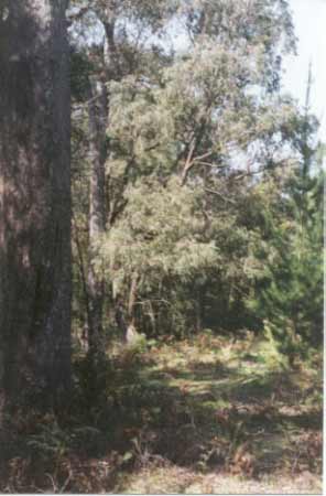
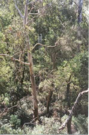
September 2001: Native vegetation retained in gully of tributary of Bruthen Creek.
Bruthen Creek, Carrajung South - Above Reedy Creek: A fast flowing water with good pools, gravel bed. Access restricted by private property and difficult terrain. Contains predominately brown trout and some rainbow trout, both species averaging 200g, some fish to 450g and eels.
Bruthen Creek - Below Reedy Creek: Very shallow, mud and sand bottom. Very few fish taken and not recommended an an angling water. Source: A Guide to the Inland Angling Waters of Victoria by BR Tunbridge, PL Rogan, CA Barnham. Department Conservation and Environment. Arthur Rylah Institute for Environmental Research, 123 Brown St, Heidelberg, 3084. (4th ed - 1991).