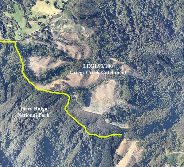
October 2012: Image Courtesy of Nearmap. Recent clearfelling by Hancock on the border of the Tarra Bulga National Park - marked by yellow line..
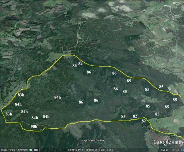
Plantations located within Greigs Creek catchment, the numbers represent the year that the plantations were established by the Forests Commission. h=hardwood.
Herbicides used during the eighties may have included Amitrole/Atrazine for grasses, Lontrel L (3,6-DCPA), hexazinone, glyphosate, triclopyr. Current herbicides used by Hancock (see below)
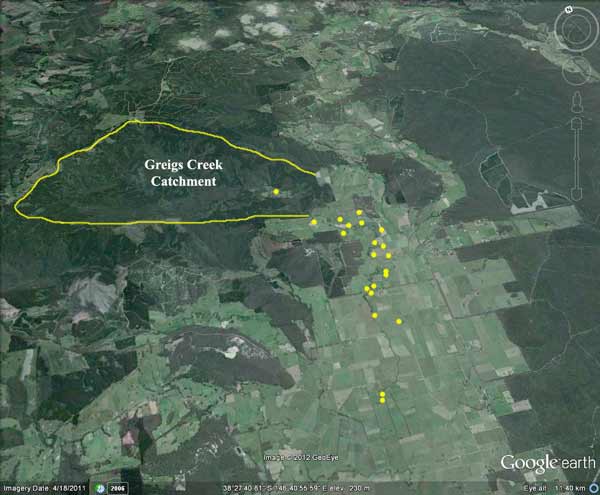
Perhaps 21 houses (yellow dots) lie in close proximity to Greigs Creek and 60 people(?) may rely on the creek for drinking water.
Herbicides Used by Grand Ridge Plantations - Strzelecki Ranges and Gippsland Victoria
| Herbicide | Label Rate max as kg/ha | Used to control | Euc/Rad | Notes | Application |
| Clopyralid | 2.55 | Woody Weeds | Radiata and Eucalypts | Highly Toxic/Potential Ground water Contaminant | aerial or ground |
| Glufosinate Ammonium | 1 | Woody Weeds | Radiata | aerial or ground | |
| Glyphosate | 3.6 | Herbaceous and woody weeds, noxious weeds | Radiata, Eucalpts and Custodial | ||
| Haloxyfop-methyl | 0.13 | Annual and Pernneial Grasses | Eucalypts | Carcinogen | aerial or ground |
| Hexazinone | 4 | Woody Weeds | Radiata | Ground Water Contaminant | Aerial, ground, spot |
| Metsulfuron-Methyl | 0.06 | Woody Weeds, Noxious Weeds | Radiata, Eucalyptus and Custodial | Potential Ground Water Contaminant | Aerial, ground or spot |
| Sulfometuron Methyl | 0.6 | Annual and Perennial Grasses and broadleaf weeds | Eucalyptus | Potential Ground Water Contaminant | Aerial or Ground |
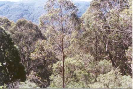
Hancock Watch Site Visit October 01: This area takes in the headwaters and first 5km of the Greig Creek Catchment. Grieg Creek flows into the Tarra River about 4km north of Yarram. Most the area is actually native vegetation. Most of the supposed plantation lies on the southern side of the area. This consists of poor stands of 1983/4 ash, with quite substantial plantations of 1986 radiata pine in the centre of the area. Pine plantations also dominate some of the northern slopes of the catchment. There are large tracts of native vegetation on the northern and southern aspects of the catchment. Some of this native vegetation lies in two properties inside the plantation - Parish of Bulga. A significant portion of native vegetation near McPhails Track (southern portion of area just off Blackwarry Scenic Road consists of Blue Gum, Messmate, possibly Manna Gum and possibly Mountain Grey Gum.
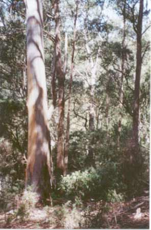
October 2001: Native vegetation within Greig Creek catchment off Greig Track.
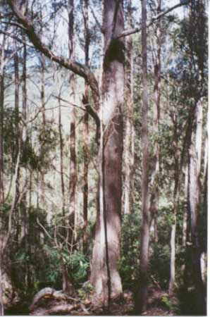
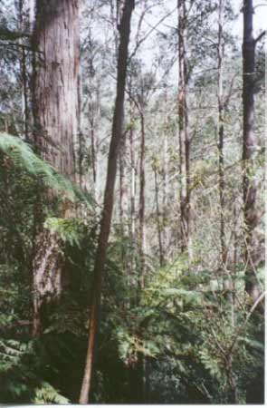
Most of the southern aspect of the area appears to have been logged possibly prior to 1940. However there remains some old growth blue gums inside the holding and it is obviously an important ecological area. It is quite obvious that a large portion of this area has never been established as a plantation. The headwaters of Grieg Creek have been seriously degraded and are dominated by poor ash regeneration with almost non-existent buffer zones. The south eastern part of the plantation borders Tarra Bulga National Park and all remnant vegetation in this area is considered to be of high ecological significance. More walking needs to be done at this site. Some of the roading on Greig Track could be considered to be sub-standard.
October 2001: Blackwarry Scenic Road looking south. Bulga National Park on the right and Hancock Victorian Plantations on the left. What's the difference?
Greig Creek, Calrossie: Fast stream flowing through partly cleared hills, rock and gravel bottom. Remote and difficult to reach. Abundant river blackfish, occasional brown trout to 300g, and tupong.
Tarra River - Downstream from Calrossie: Becomes sluggish, mud and sand bottom. Carries reasonable numbers of spiny freshwater crayfish, some brown trout to 350g, and river blackfish. Estuarine section contains estuary perch, Australian bass, mullet, luderick and trevally. Access good, a popular angling water.
Source: A Guide to the Inland Angling Waters of Victoria by BR Tunbridge, PL Rogan, CA Barnham. Department Conservation and Environment. Arthur Rylah Institute for Environmental Research, 123 Brown St, Heidelberg, 3084. (4th ed - 1991).