Region: BENALLA/MANSFIELDLegal Number: LEGL/93-62Plantation: WarrenbayneConservation Priority: High
Plantation where the Secretary CNR retains specified rights to harvest hardwood sawlogs. Plantation within Australian Newsprint Mill (ANM) Ltd area of supply. Plantation within Dominance Industries (Alpine MDF Industries) area of supply. Strathbogies and Central North East Plantation Map here
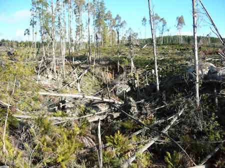
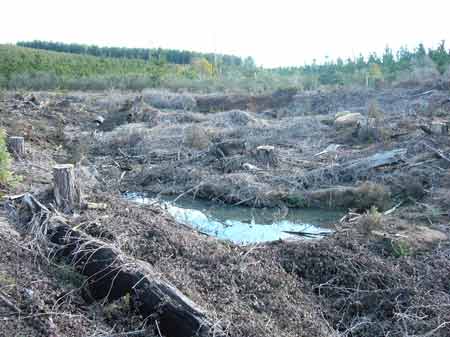
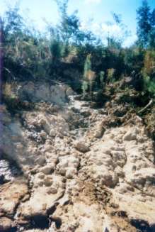
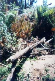
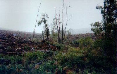
July 2007: White Gum Gully headwaters after being logged.
Plantation within D & R Henderson/Monsbent area of supply. Plantation within Benalla Timber area of supply.
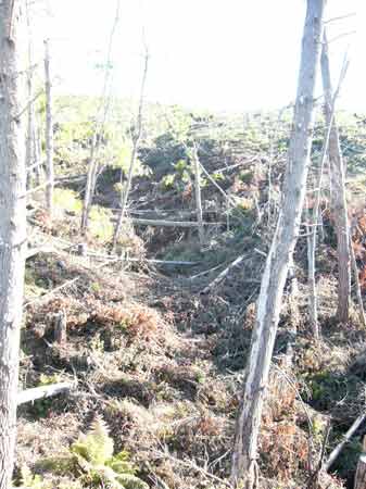
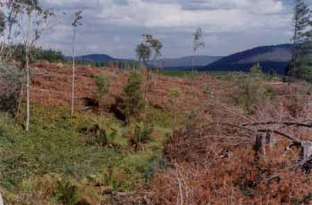
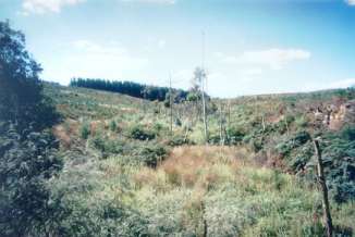
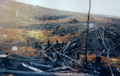
July 2007: White Gum Gully full of blackberries. Water Catchment Area: BROKEN CREEK CATCHMENT. POTENTIAL DRINKING WATER FOR NATHALIA, NUMURKAH, ST.JAMES, WUNGHNU MURRAY RIVER SUPPLIES WATER TO BARMAH, ECHUCA , KERANG, PIANGIL, SWAN HILL, ROBINVALE, MILDURA
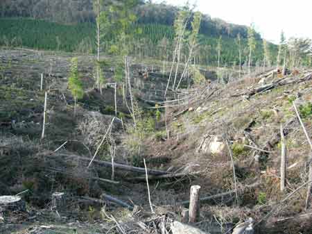
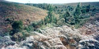
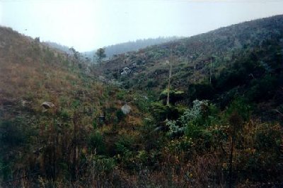
July 2007: Whitegum Gully headwaters. after being logged and sprayed for blackberries Herbicide Regimes (Uncompleted) Warrenbayne plantation was one of the first plantations treated with 2,4,5-T in the late 1960's. The Dioxin TCDD may still exist in soil in this plantation. For more historical data on 2,4,5-T click here. For more information concerning the continuing health crisis concerning 2,4,5-T please forward to here. p17 "Aerial spraying of 670 acres of wattle regrowth at Warrenbayne and Loch Valley Plantation with 1 pound active of technical 2,4,5-T Butyl Ester in 5 gallons of distillate (diesel) effectively killed off competing wattle growth . . . p35 Test aerial spraying with 2,4,5-T has been carried out in the Loch Valley Plantation..." Forests Commission 1968-69 Annual Report.
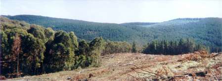
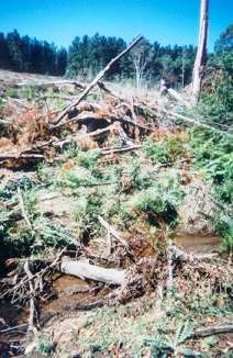
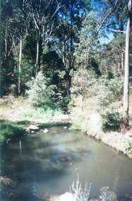
July 2007: Whitegum gully near headwaters. Herbicides Used by Hancock in Pine Plantations - North East Region Victoria
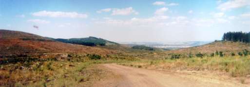
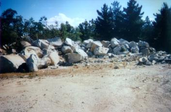
THREATENED FISH NOTES - BROKEN RIVER: Downstream of Nillacootie there is a remnant population of Macquarie Perch. Yellow Belly and Murray Cod are also stocked into the Broken River. Holland and Ryans creek both have populations of Macquarie Perch especially in Holland Creek. In regard to Ryans Creek above Loombah Weir it is the first time that a stocked population of Trout Cod has been found to be spawning. Responsible Authority: Delatite Shire Council Plantation Catchment: The following creeks feed into the Broken River Catchment. Warrenbayne Plantations are approximately 6100 hectares in size. Headwaters Davies Creek. Headwaters Heywood Creek. Headwaters Escreet Creek/Parkes Creek. Headwaters Stony Creek/Parkes Creek. Headwaters Kitchen Creek/Green Gully/Parkes Creek. Headwaters of tribs of Parkes Creek. Headwaters Stanley Creek/White Gum Gully/Parkes Creek. Headwaters White Gum Gully/Parkes Creek. Headwaters Wild Dog Creek/Parkes Creek. A small section of the plantation also feeds into Warrenbayne Creek. Catchment Managment Authority: Goulburn Broken Catchment Management Authority Hancock Watch Site visit Mar 01: Saw a few areas of remnant vegetation at this plantation, although proper maps made exact mapping location difficult. Also came across plantation logging which went within a few metres of a creek which ultimately flows into Warrenbayne Creek. Pines had been cut into creek - possibly breaching the code. This site was located on D road heading north east out of the Warrenbayne Creek area. Just up the road from this site was a quarry. It appeared that rock was dynamited at the site for roads, meaning that Hancock are not only a forest company they are also into mining/quarrying/road building. Further along the road into the north east region of the plantation was a large area of clearcut. This was in an area feeding into the Broken River. There was some evidence of minor buffer zones along major drainage lines, although ephemeral streams and drainage lines feeding into the creek warranted no protection whatsoever. Also saw some evidence of roadside batters eroding away.
April 03: Just down from the headwaters of Stony Creek (northern aspect). Shot taken from the A5 Road. Absolute minimum buffer zone protection for water flow which eventually flows through Parkes Creek and into the Broken River. Note blackberry proliferation. Throughout this plantation buffer zones are minimal or non-existent. These streams could be placed in a state of permanent drought due to uptake of water from plantation trees. Hancock Watch Site visit April 03: Entered plantation from the east on A Road. Vast logging had been taking place in all of the catchments listed above. At least 5km of clear fell was observed, meaning that almost the entire LEGL had been logged. Recent logging was taking place in the Stony Creek catchment, with cable logging occurring in places. Very limited buffer zones were observed in many gullies with evidence of pines being established inside drainage lines. Logging had also recently taken place in the Stanley Creek catchment and the White Gum Gully catchment - most notably on the north side. Extensive buffer zones of indigenous vegetation were observed on White Gum Gully, although some of the northern tribs warranted very limited protection. Logging had also taken place on Warrenbayne Creek. Overall much of this plantation has been levelled in the past couple of years. Water yield in the Broken River catchment must be adversely affected by this logging activity. The state of many streams on the north eastern aspect of the plantation were in very poor shape, with limited protection afforded to water and blackberry and thistle indundation. Broken River: Lake Nillahcootie to Benella: Flows through open grazing country in a series of runs and deep pools, gravel beds. Below Swanpool the river becomes more sluggish with a mud and sand bed. Very badly silted from its junction with the Moonee Creek. Moonee Creek to Benella Creek. Contains brown trout average 220g, maximum 800g, with carp and abundant small redfin 450g further downstream, some golden perch above Swanpool, and some spiny freshwater crayfish. Stocked by the Department with Macquarie Perch but the species has not yet become established. Source: A Guide to the Inland Angling Waters of Victoria by BR Tunbridge, PL Rogan, CA Barnham. Department Conservation and Environment. Arthur Rylah Institute for Environmental Research, 123 Brown St, Heidelberg, 3084. (4th ed - 1991)
|