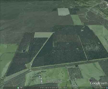
Region: PortlandLegal Number: LEGL/93-7Plantation: Weerona & SimpkinApproximate Plantation Size: 550ha |

|
Herbicide
|
Label Rate max as kg/ha
|
Used to control
|
Notes
|
Application
|
|
2.55
|
Woody Weeds
|
Highly Toxic/Potential Ground water Contaminant
|
air or ground
|
|
|
3.6
|
Herbaceous and woody weeds, noxious weeds
|
|||
|
4
|
Woody Weeds
|
Ground Water Contaminant
|
Aerial, ground, spot
|
|
|
0.06
|
Woody Weeds, Noxious Weeds
|
Potential Ground Water Contaminant
|
Aerial, ground or spot
|
|
|
3
|
Woody and Noxious Weeds
|
Ground, spot, basal bark
|
Meeting #137 Pesticides Review Committee: 1/6/78 Letter from Forests Commission Victoria to Pesticides Review Committee: Approval to aerial spray at Heywood. Weedazol TL Plus (atrazine) nd Gesaprim 500 FW (amitrole) over 220ha over 2 blocks Simpkins and Weerona.
Meeting #148 4/5/79 Pesticides Review Committee:Approval sought to conduct a program of aerial spraying for control of competing grass in softwood plantations in Heywood Forest District in late June or July 1979. The area to be treated is purchased farmland that carried improved pasture prior to current conversion to Pinus Radiata ... Aerial application of herbicide is necessary due to swampy nature of the country during winter, making movement of ground equipment difficult. It is proposed to take place over a total of 272ha on two blocks known as Simkins and Weerona. Herbicide rate: Weedazol TL Plus 4 l/ha 25% W/V Amitrole, 22% Ammonium Thiocychate. Gesaprim 500FW 7 l ha (50% w/v Atrazine).
Mixture of spray material and application rate. 4 litres
of Weedazol TL plus 7 litres of Gesaprim 500 FW in 49 litres water per
ha. Plus 50 (a wetting agent) will be added to the spray mix at the
rate of 1 litre per 1000 litres of spray mix...
Hancock Watch Site visit Jan 01: Pine plantation on relatively
flat land. Did not check out western plantation.
Crawford River: Flows through forest and grazing land, mud bottom.
Contains mostly redfin, river blackfish, eels and abundant spiny freshwater
crayfish, and tench. Last stocked with trout by Department in 1978.
Currently no stocking with any species as stream tribuataries contain
variegated pigmy perch, which is a species listed under the Flora and
Fauna Guarantee Act 1988 as requiring protection.
Stokes River: A very narrow river flowing through forested country,
mud and gravel bottom.. Carries eels, blackfish, tupong, spiny freshwater
crayfish and occasional brown trout to 700g.
Source: A Guide to the Inland Angling Waters of Victoria by BR Tunbridge,
PL Rogan, CA Barnham. Department Conservation and Environment. Arthur
Rylah Institute for Environmental Research, 123 Brown St, Heidelberg,
3084. (4th ed - 1991)
HOME
"Groundwater: "In south-western Victoria the Otway Basin stretches from the South Australian border almost to the west of Geelong. It contains older sediments of Upper Cretaceous and Lower Tertiary age, up to 2000 m in thickness. These include four sand aquifers and two limestone aquifers. The sand aquifers of the Wangerrip Group are confined over most of the Basin and their recharge zones are located on the margins of the Otway Range in the east and the Merino Tablelands in the West. The groundwater moves towards the coast, increasing in salinity along its floorpath . . ." p268 State of the Environment Report 1988 Victoria's Inland Waters. Office of the Commissioner for the Environment.
"Shallow aquifers in the Glenelg River Basin occur in four main geologic units. Extending from the north-east of the Basin is a fractured rock basement aquifer composed of folded sediment, metamorphics and granite. In the north-east and also in the vicinity of the confluence of the Glenelg and Wannon Rivers, the basement aquifer is overlain by alluvial aquifers from the Quaternary period. The third unit is a Newer Volcanic aquifer which lies along much of the Basin's southern boundary, particularly in the east. This fractured rock aquifer is composed of basalt, scoria and tuff. The fourth unit is composed of dune sand and beach deposits extending from the south-west corner of the Basin up to the western boundary and along the northern boundary. It is known as the Bridgewater formation.
A deep aquifer system exists in the south-west of the Basin and extends to the top of the western boundary and half-way across the southern boundary. This sand aquifer, which is significant as a water source, occurs within the Wangerrip Group.
Generally, groundwater quality in the Basin decreases towards the north where it is saline. A large reserve of fresh water is held in the north-east corner of the catchment and in the south-west the water is of marginal quality . . ." p295 Water Victoria A Resource Handbook - Department of Water Resources Victoria 1989.