Region: PortlandLegal Number: LEGL/93-15Plantation: Rennick
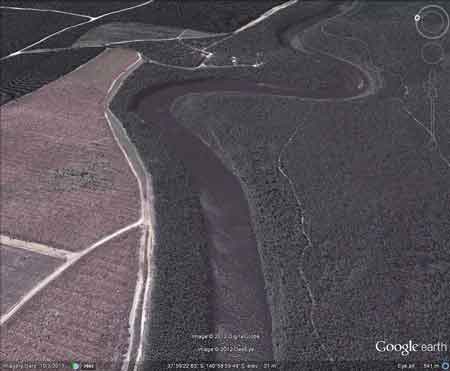
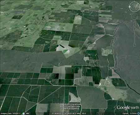
Conservation Priority: HighPlantation maps of region here |
|
Herbicide
|
Label Rate max as kg/ha
|
Used to control
|
Notes
|
Application
|
|
2.55
|
Woody Weeds
|
Highly Toxic/Potential Ground water Contaminant
|
air or ground
|
|
|
3.6
|
Herbaceous and woody weeds, noxious weeds
|
|||
|
4
|
Woody Weeds
|
Ground Water Contaminant
|
Aerial, ground, spot
|
|
|
0.06
|
Woody Weeds, Noxious Weeds
|
Potential Ground Water Contaminant
|
Aerial, ground or spot
|
|
|
3
|
Woody and Noxious Weeds
|
Ground, spot, basal bark
|
Plantation within S.E.A.S Sapfor (Auspine) area of supply.
Plantation within AKD Softwoods area of supply.
Responsible Authority: Glenelg Shire Council
Plantation Catchment: Flat land, south west corner of Victoria
- Glenelg River Catchment
Catchment Managment Authority: Glenelg-Hopkins Catchment Management
Authority.
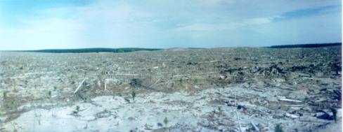
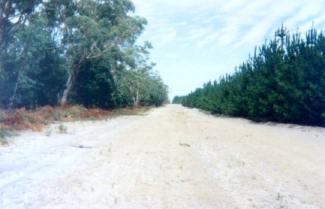
Hancock Watch Site visit Jan 01: Entire area pine with 50 m
between it and Rennick State Forest. Rennick State Forest becoming pine
infested. Saw some evidence of recent cutting of wildings on eastern
edge of plantation. Area especially to the south dominated by massive
clearcuts - Horizon Logging. No sign of native vegetation anywhere in
an area that was once dominated by Damp Sands Herb Rich Woodland. A
lot of recent logging activity. Huge amount of pine recently harvested.
 |
"Groundwater: "In south-western Victoria the Otway Basin stretches from the South Australian border almost to the west of Geelong. It contains older sediments of Upper Cretaceous and Lower Tertiary age, up to 2000 m in thickness. These include four sand aquifers and two limestone aquifers. The sand aquifers of the Wangerrip Group are confined over most of the Basin and their recharge zones are located on the margins of the Otway Range in the east and the Merino Tablelands in the West. The groundwater moves towards the coast, increasing in salinity along its floorpath . . ." p268 State of the Environment Report 1988 Victoria's Inland Waters. Office of the Commissioner for the Environment.
"Shallow aquifers in the Glenelg River Basin occur in four main geologic units. Extending from the north-east of the Basin is a fractured rock basement aquifer composed of folded sediment, metamorphics and granite. In the north-east and also in the vicinity of the confluence of the Glenelg and Wannon Rivers, the basement aquifer is overlain by alluvial aquifers from the Quaternary period. The third unit is a Newer Volcanic aquifer which lies along much of the Basin's southern boundary, particularly in the east. This fractured rock aquifer is composed of basalt, scoria and tuff. The fourth unit is composed of dune sand and beach deposits extending from the south-west corner of the Basin up to the western boundary and along the northern boundary. It is known as the Bridgewater formation.
A deep aquifer system exists in the south-west of the Basin and extends to the top of the western boundary and half-way across the southern boundary. This sand aquifer, which is significant as a water source, occurs within the Wangerrip Group.
Generally, groundwater quality in the Basin decreases towards the north where it is saline. A large reserve of fresh water is held in the north-east corner of the catchment and in the south-west the water is of marginal quality . . ." p295 Water Victoria A Resource Handbook - Department of Water Resources Victoria 1989.