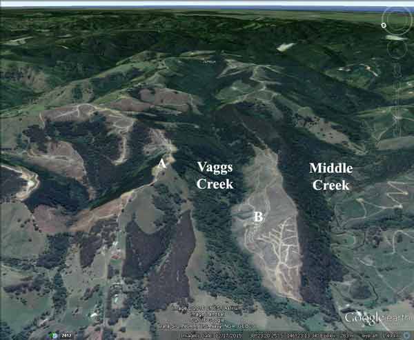
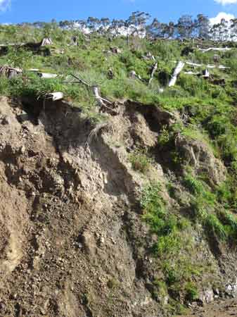
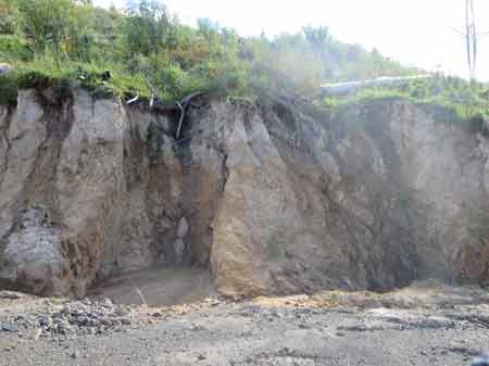
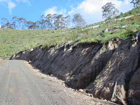
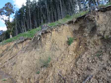
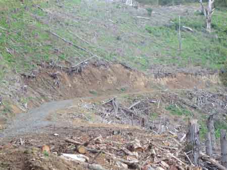
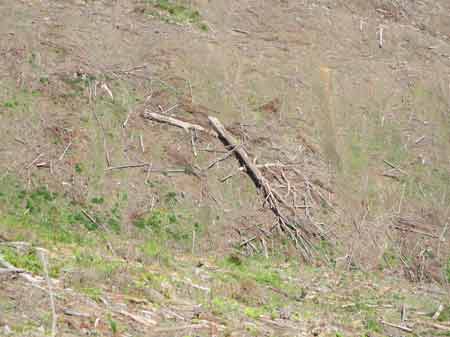
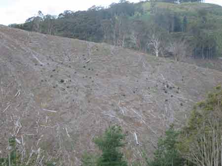
October 2016: Looking into Vaggs Creek Track, from Site A. This photo shows the erosion problems at this site, particulary the eroding road batters. The plantation above this road was cleared in 2014, now after rainfall, the road is starting to erode very badly. This photo also shows that a large pine plantation was logged in 2014 above the track. With nothing holding the slope, erosion has started and has grdually worsened. Soils at this location are the highly erodable Cretaceous Sediments.
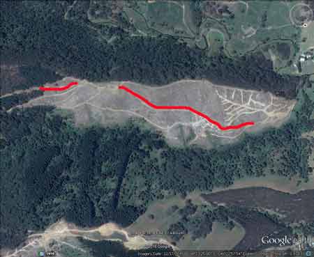
About 1km of Vaggs Creek Road is suffering from serious erosion (marked in red). The exent of the problems could be worse than first estimated and currently covers a length of over 1km.
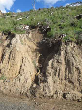
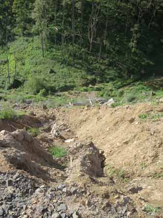
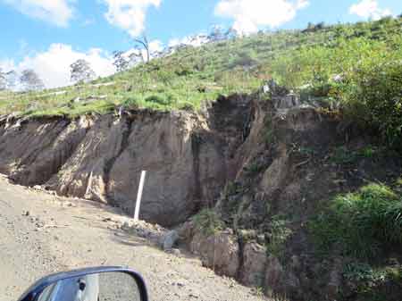
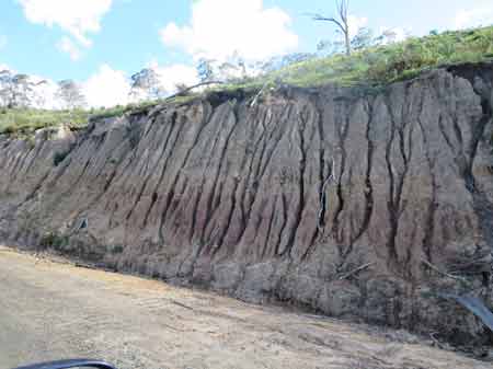
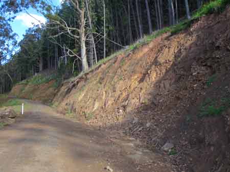
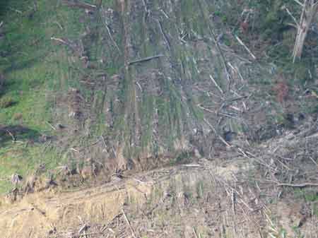
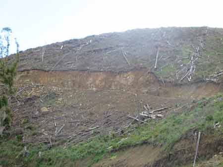
October 2016 (Site B): Close up of the eroding road batters on Vaggs Creek Road. Steep slopes, cleared plantations, no vegetation, rainfall and poorly maintained roads have contributed to this erosion hotspot.
October 2016 (Site B): Close up of the eroding road batters on Vaggs Creek Road. Approximately 1km of the road is suffering from badly eroding batters. 2 large landslips have also opened up on the northern side of the road.
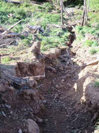
October 2016 (Site B). One of two large landslips about 100m in length have started from Vaggs Creek Road. It is evident that the slips have deposited large amounts of sediment into Vaggs Creek.
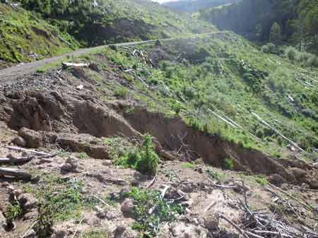
October 2016 (Site B). Another view of one of two large landslips about 100m in length have started from Vaggs Creek Road.
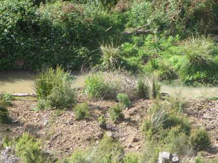
October 2016 (Site B). Evidence that sediment from the landslip has entered Vaggs Creek. This is obvious pollution, but who is ultimately responsible?
October 2016 (Site B): Close up of the eroding road batters on Vaggs Creek Road.
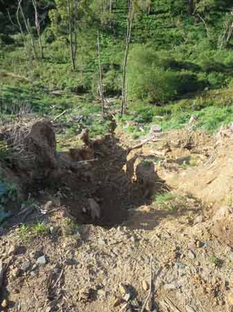
October 2016 (Site B): Landslip number 2 on Vaggs Creek Road. This slip has also most likely deposited thousands of tonnes of sediment into Vaggs Creek.
October 2016 (Site B): Landslip number 2 on Vaggs Creek Road. This landslip has already created a channel a couple of metres deep.
October 2016 (Site B): Vaggs Creek Road.
October 2016 (Site B): Vaggs Creek Road. What is going to stop this erosion from occurring?
October 2016 (Site B): Vaggs Creek Road. Interesting erosion patters on this road batter.
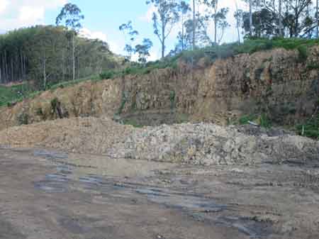
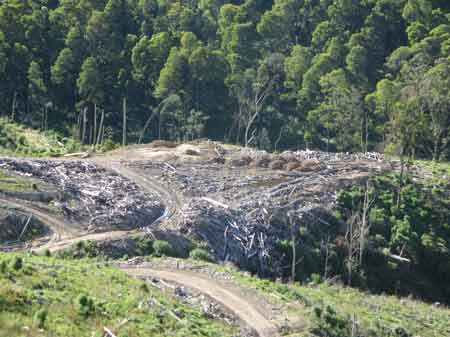
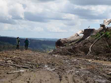
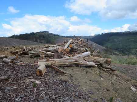
October 2016 (Site B): Vaggs Creek Road. Old log dump location about 1km from the start of the erosion. It is evident at this location that many piles of sediment have been dumped here. The sediment was most likely excavated from the roads.
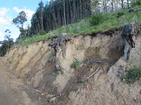
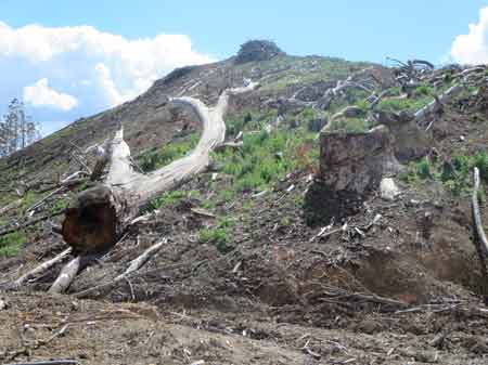
October 2016 (Site B): Vaggs Creek Road. Past the log dump one can clearly see the amount of soil loss that has occurred over the past two years. The tree stumps were logged in 2014. At that time they would have been located close the road and would have had 2-3 metres of soil under them. Not anymore. Where has this lost soil gone?
October 2016 (Site B): Vaggs Creek Road. Close up of tree stumps, now teetering on the edge.
October 2016 (Site B): Vaggs Creek Road. Erosion hotspot here, with roots of old growth Bluegum being exposed.
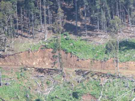
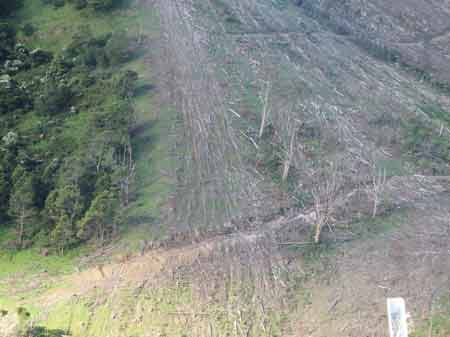
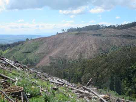
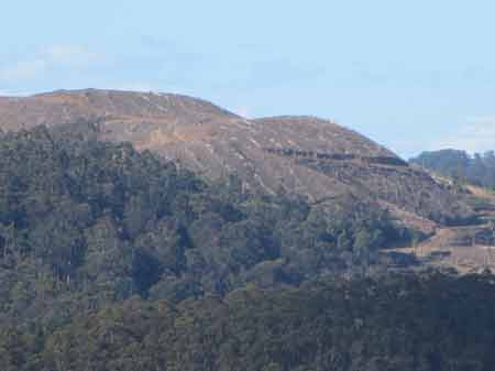
October 2016 (Site B): Vaggs Creek Road taken from Site A about 750 metres away.
October 2016 (Site B): Vaggs Creek Road. This old growth bluegum is most likely doomed, especially if the plantation above it is logged.
October 2016: The northern side of Vaggs Creek, as taken from Site B.
October 2016: The northern side of Vaggs Creek, as taken from Site B. Photo shows where logs were dragged up the slope during the logging. Erosion on the northern side of Vaggs Creek does not look as pronounced as the south side (yet). Note dead bluegums.
October 2016: The northern side of Vaggs Creek, as taken from Site B. Erosion starting but not as serious as the southern side yet.
October 2016 (Site B): Photo taken from Vaggs Creek Road. An unremediated log dump also being used as a dumping site for soil. Probably 20 soil mounds are located here..
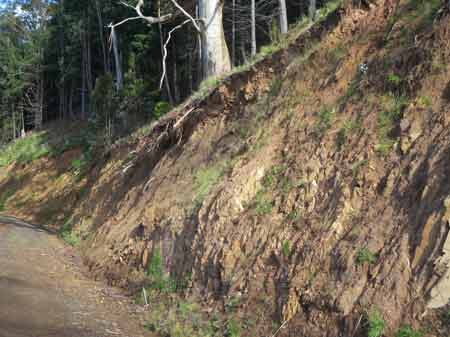
October 2016 (Site A): Eroding logging road batters near the entrance from Jumbuk Road.
October 2016 (Site A): Eroding logging road batters near the entrance from Jumbuk Road.
October 2016 (Site A): Old growth bluegum chainsawed after being used in cable logging operation.
October 2016 (Site A): Old growth bluegum chainsawed after being used in cable logging operation.
October 2016 (Site A): Another Old growth bluegum bites the dust.
October 2016 (Site A): Looking further north. Old pine plantations logged here in 2015-16.
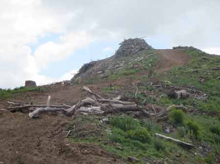
October 2016 (Site A): Another Old growth bluegum bites the dust. Note massive logging debris pile on hilltop. Probably 5 metres high.
October 2016 (Site A): Another Old growth bluegum bites the dust and used as firewood. By whom?
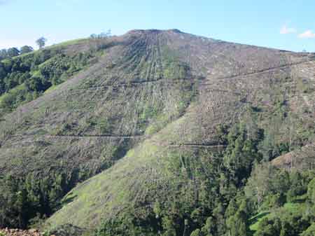
October 2016 (North of Site A): This bare hill was a pine plantation with regenerating bluegum growing inside it. About 100 bluegums were cut in this plantation and the signs can be seen by coppicing regrowth growing from the cut stumps. Technically parts of this plantation could have been called a regenerating bluegum forest and will be again in the future if the coppice is not poisoned.
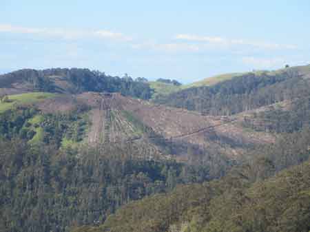
October 2016: View looking east along the Vaggs Creek catchment to more recently cut pine plantations.
October 2016: View looking east along the Vaggs Creek catchment to another recently cut pine plantation. What will the future erosion potential be of this site?