July 2007 - Strzelecki Ranges - Morwell River West Branch: Hancock have completed logging at Craig Court. They had promised the community 100 metres on all cool temperate rainforest in the Morwell River West Branch catchment under the historic Rainforest Cores and Links Heads of Agreement signed in October 2006. At Craig Court 'buffers' of 10 metres were left. Such scant buffers are not even supposed to be allowed under Hancock's inadequate Rainforest BMP (Best Management Practice) which supposedly leaves buffers of 30 metres.
July 2007 - Strzelecki Ranges - Morwell River West Branch: Craig Court. Hancock granted buffers of 15 metres and less at Craig Court. Hancock Watch was concerned that such scant buffers could lead to a situation where high winds could blow over buffer trees into the rainforest causing destruction of rare and fragile rainforest species.
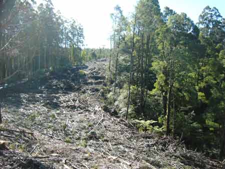
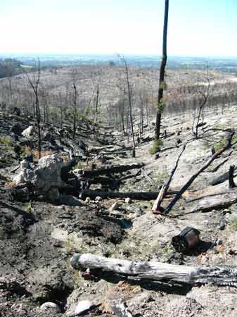
July 2007 - Strzelecki Ranges - Morwell River West Branch: Craig Court. Trees blown over into cool temperate rainforest at Craig Court. Hancock Watch counted between 5 and 6 trees blown at this location. More could be blown over, exposing rainforest species to damage. Buffers of 30 metres may have protected this rainforest, but in their haste to cut as much wood as possible Hancock have done irreparable damage to this rainforest.
July 2007 - Strzelecki Ranges - Morwell River West Branch: Craig Court. Exposed and damaged cool temperate rainforest buffer in a supposed rainforest reserve.
Perhaps Hancock's true intentions about sticking to the Heads of Agreement can best be explained by Hancock themselves in their submission (dated 19 June 2007) to the Land and biodiversity at a time of climate change, White Paper. Hancock state p4 "Experience in the Strzelecki Ranges has shown that good plantation forestry revegetating abandoned farmland for commercial wood production can create landscapes which some community members seek to have then locked up in perpetuity for its bio-diversity values. Such pressures become a serious dis-incentive to investment in commercial projects which produce environmental services to the community for which there is no commercial recognition."
June 2007 - Strzelecki Ranges - Morwell River West Branch: Craig Court. Hancock Watch took this image of a rare Slender Tree Fern at Craig Court in early June. This Slender Tree fern has now been destroyed due to buffer trees falling into the rainforest. The fern survived for several decades (possibly over 100 years) but could not survive Hancock.
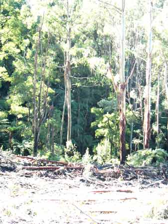
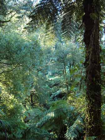
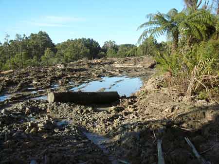
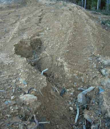
July 2007 - Strzelecki Ranges - Morwell River West Branch: Craig Court. Inside the now trashed rainforest gully head.
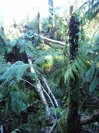
July 2007 - Strzelecki Ranges - Morwell River West Branch: Craig Court. About 100 metres downstream another very impressive Slender Tree Fern, many hundreds of years old, lies within a buffer of only 10 metres from logging. Will this fern also be destroyed by tree fall because in their haste to log, Hancock left measely rainforest buffers?
July 2007 - Strzelecki Ranges - Morwell River West Branch: Craig Court. This is the measely buffer left by Hancock within only 10 metres of the above Slender Tree Fern. It also appears that Hancock may have logged native forest at this location. Myrtle Beech also lie within about 30 metres proximity to the logging. If they are wounded by tree fall, the can suffer from the disease Myrtle Wilt.
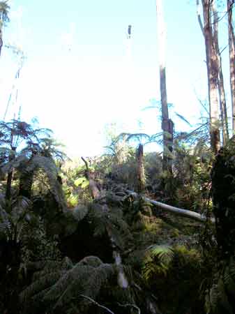
July 2007 - Strzelecki Ranges - Morwell River West Branch: Craig Court. Myrtle Beech about 30 metres from edge of buffer.
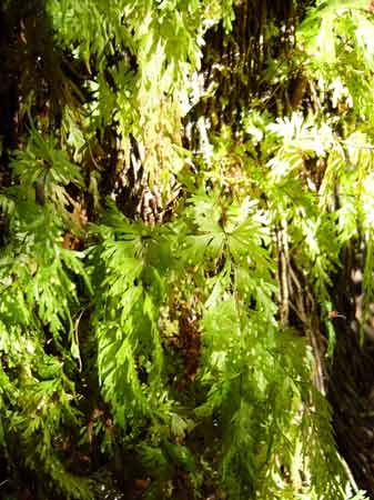
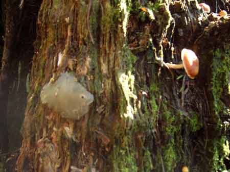
July 2007 - Strzelecki Ranges - Morwell River West Branch: Craig Court. Rainforest indicator species.
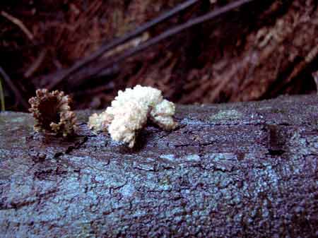
July 2007 - Strzelecki Ranges - Morwell River West Branch: Craig Court. Rainforest fungus.
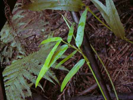
July 2007 - Strzelecki Ranges - Morwell River West Branch: Craig Court. Rainforest indicator species, Twining Silk Pod.
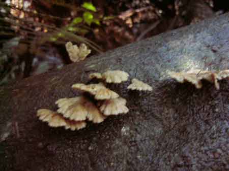
July 2007 - Strzelecki Ranges - Morwell River West Branch: Craig Court. Rainforest fungus.
July 2007 - Strzelecki Ranges - Morwell River West Branch: Craig Court. Rainforest fungus.
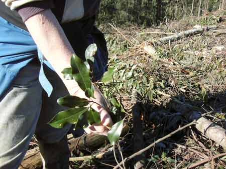
July 2007 - Strzelecki Ranges - Morwell River West Branch: Craig Court. Warm temperate rainforest species, 'Muttonwood' found after logging in Craig Court Coupe.
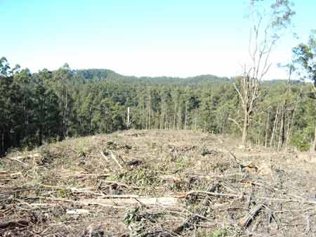
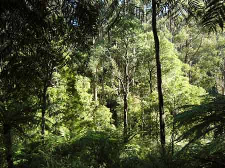
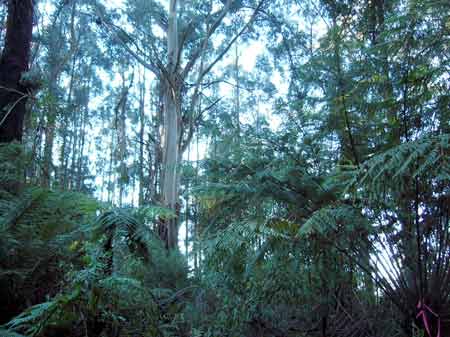
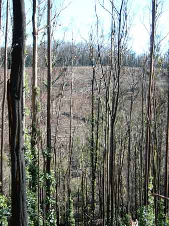
July 2007 - Strzelecki Ranges - Morwell River West Branch: Craig Court after the logging. Cool and Warm temperate rainforest species found at this location.
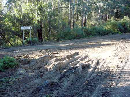
July 2007 - Strzelecki Ranges - Morwell River West Branch: West Branch Road coupe. Logging to occur here soon.
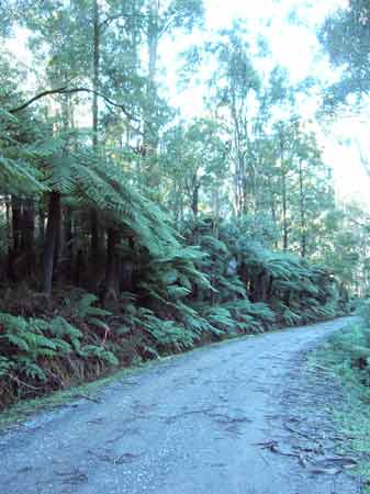
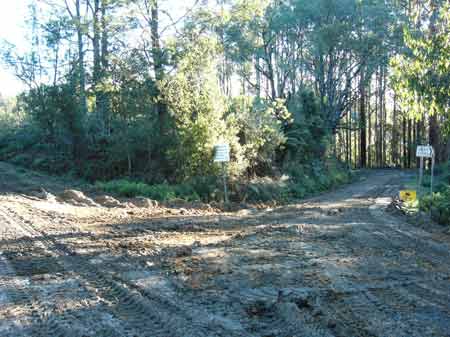
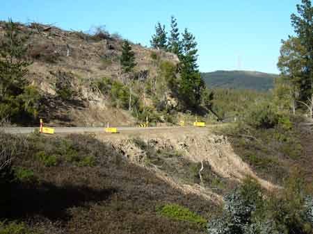
July 2007 - Strzelecki Ranges - Morwell River West Branch: Grand Ridge Road Scenic Road Reserve. Adjacent to Gunyah Gunyah Rainforest Reserve. The local community does not want to see Grand Ridge Road lessen the regions tourist potential by cutting 100m access tracks through forests of high conservation significance. Such tracks undermine the integrity of the region and log trucks will seriously undermine the quality of the Grand Ridge Road which is already suffering from Hancock operations. This forest contains some of the highest quality conservation attributes in the Strzeleckis.
July 2007 - Strzelecki Ranges - Morwell River West Branch: Grand Ridge Scenic Roadside Reserve where Hancock want to cut an access track. Over 100 metres of high conservation quality forest to be trashed.
July 2007 - Strzelecki Ranges - Morwell River West Branch: Grand Ridge Road. Hancock have totally undermined the tourist potential of the Grand Ridge Road by logging this tiny coupe near Morwell River Road. Only a few trees were logged from the site and probably consisted of 1973 regrowth forests.
July 2007 - Strzelecki Ranges - Morwell River West Branch: Grand Ridge Road. More unsightly logging just off the Grand Ridge Road, one of Gippsland's prime tourist icons. Note appalling drainage and roading. Does Hancock deserve to be certified by FSC?
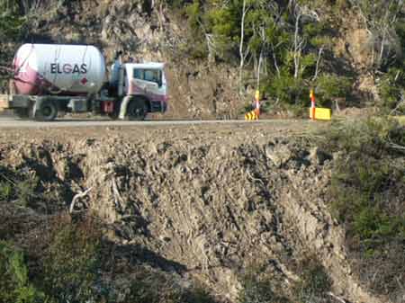
July 2007 - Strzelecki Ranges - Morwell River West Branch: Corner of Grand Ridge Road and Morwell River Road. A prime tourist icon turned into a slush pit by logging trucks. At several points the Grand Ridge Road now appears to be undriveable by two wheel drive vehicles. The damage to the road has largely been done by Hancock moving logs in wet weather.
July 2007 - Strzelecki Ranges - Morwell River West Branch: Corner of Grand Ridge Road and Morwell River Road.
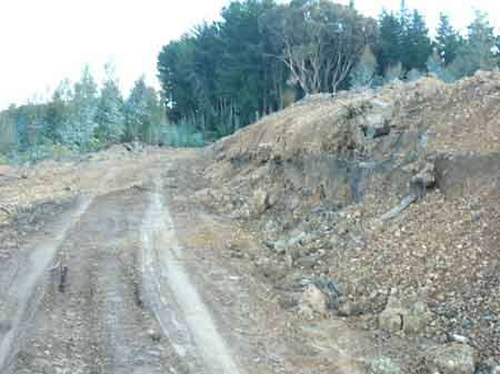
July 2007 - Strzelecki Ranges - Merrimans Creek Catchment. Kjergaard Road. This is a domestic water supply for the town of Seaspray and Hancock have been conducting earthworks on this road for what purpose. It also appears that this road is publicly owned. Note high erosion potential of these collapsing batters.
July 2007 - Strzelecki Range - Merrimans Creek Catchment. Kjergaard Road. More erosion in a domestic water supply.
July 2007 - Strzelecki Ranges - Merrimans Creek Catchment. Kjergaard Road. The road itself. This is a total breach of the Code of Forest Practice. FSC certified when only the best will do!
July 2007 - Strzelecki Ranges - Merrimans Creek Catchment. Kjergaard Road. What is this?
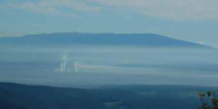
July 2007: The source of all of the Strzelecki pain, the Maryvale pulp mill belching out its poison, with Mount Baw Baw in the background.
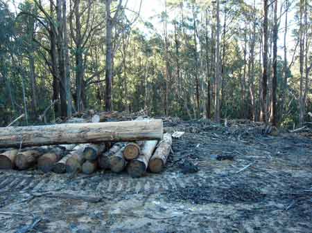
July 2007: Strzelecki Ranges - Traralgon Creek catchment. Probably allotment 15B Parish of Callignee. A logged pine plantation probably established by APM in the 1970's. FSC certified of course. Is this plantation really a positive environmental outcome?
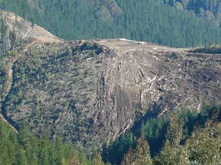
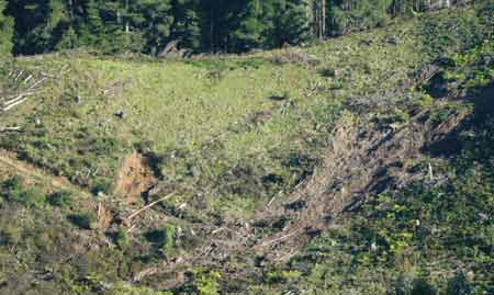
July 2007: Strzelecki Ranges - Traralgon Creek catchment. Allotment 7A Parish of Callignee. A landslip probably 150 metres high opened up after recent heavy rains. Are plantations on these slopes really sustainable?
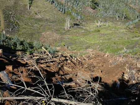
July 2007: Strzelecki Ranges - Traralgon Creek catchment. Allotment 7A Parish of Callignee. Another view of the landslip. How do you repair this?
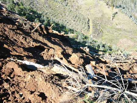
July 2007: Strzelecki Ranges - Traralgon Creek catchment. Allotment 7A Parish of Callignee. Another view of the landslip. How do you repair this?
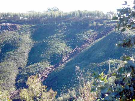
July 2007: Strzelecki Ranges - Traralgon Creek catchment. A smaller landslip on the Traralgon Balook Road, a significant tourist road to Tarra Bulga National Park.
July 2007: Strzelecki Ranges - Traralgon Creek catchment. A smaller landslip on the Traralgon Balook Road. Note the plantation logging occurring above the slip, thereby loosening the soil.
July 2007: Strzelecki Ranges - Traralgon Creek catchment. Smaller slips in the Gippsland Lakes catchment.
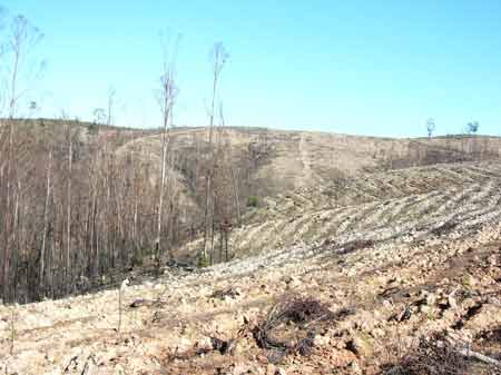
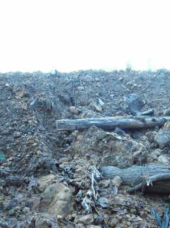
August 2007: Parish Toongabbie North (Central Gippsland)- Toongabbie Creek/LaTrobe River catchment, south of Boola State Forest. Recent salvage logging of about 250 hectares has occurred in this ex APM plantation after 2007 bushfires. Note deep ripping of soils, which ensures most rainfall is 'captured' on site, denying waterways of much needed flows.
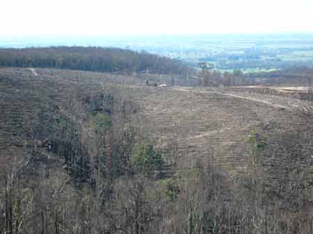
August 2007: Parish Toongabbie North (Central Gippsland)- Toongabbie Creek/LaTrobe River catchment, south of Boola State Forest. More deep ripping post salvage logging.
August 2007: Parish Toongabbie North (Central Gippsland)- Toongabbie Creek/LaTrobe River catchment, south of Boola State Forest. Ex APM plantation - burnt and trashed drainage line.
August 2007: Parish of Numbruk (Central Gippsland) - Ostlers Creek/Eaglehawk Creek/LaTrobe River Catchment, west of Boola Forest. Recent salvage logging of approximately 200 hectares after early 2007 bushfires.