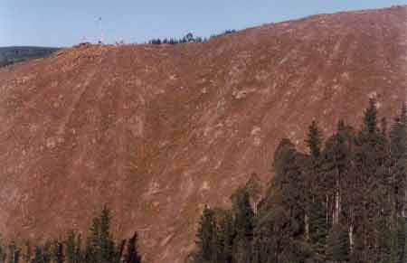
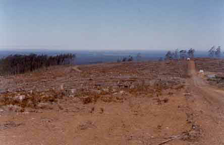
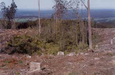
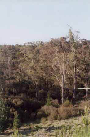
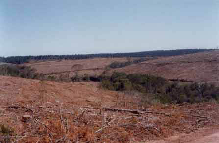
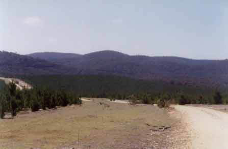
October 2003: Strzelecki Ranges near Mount Joy. Photo taken from a log dump situated on Kjergaard Road. This very steep clearfell pine operation is located in the Merrimans Creek Catchment which is domestic water supply for the town of Seaspray. Bedrock has been exposed during this cable logging operation. One has to question health and safety issues of working in a plantation such as this. One also has to question what the impact of heavy rainfall will have on the quality of water draining off this site. Applications of fertilisers and herbicides will easily be washed away during heavy rainfall. This plantation lies in an area of 1200mm rainfall per year.
October 2003: Strzeleckis Ranges. Another view of the Mount Joy pine plantation located in the Merrimans Creek catchment. For more information about this plantation click here. For more information on Merrimans Creek Domestic Water Supply Catchment click here. Soils in this region are highly erodable Cretaceous Sediments. This logging operation can be accessed via Youngs Road Extension.
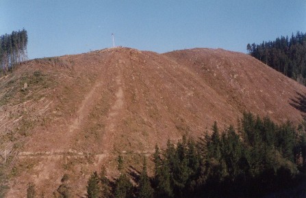
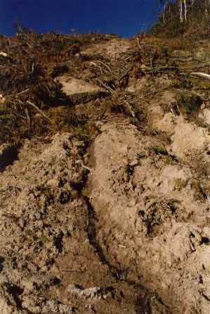
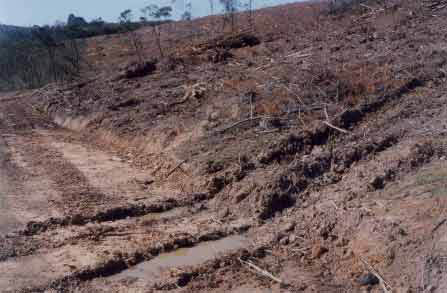
October 2003: Strzelecki Ranges. Very poorly maintained log dump located just off Kjergaard Road on the northern face of the Strzelecki Ranges. Roading on this site was very poor with bulldozer ruts about one metre deep in places. It appeared that logging contractors had been working in wet weather. It was obvious that much of the roading and drainage at this particular site breached the Code of Forest Practice. Hancock is currently attempting to gain Forest Stewardship Council certification for their Victorian plantations. This logging operation is proof that the company is not ready for certification as yet.
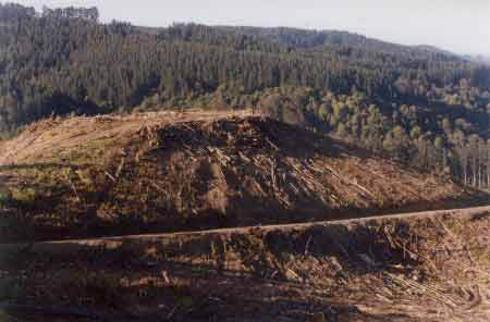
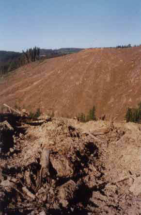
October 2003: Strzelecki Ranges log dump on Kiergaard Road in Merrimans Creek Domestic Water Supply catchment. After completion of logging these log dumps are often set alight, leading to scorching of soil profile. This photo also reveals large amounts of dislodged soil.
October 2003/Central Highlands: Badly eroding snig track in Loch Valley plantations which are located in the Central Highlands town of Noojee's water supply catchment. For more information about this water supply click here and for more information about the Loch Valley plantations (where Hancock were fined in October 2002 by Baw Baw Shire for breaching the Code of Forest Practices) click here. This photo was sent to Hancock Watch by local bushwalkers and reveals that the same problems are recurring.
October 2003: Strzelecki Ranges Parish of Carrajung. Recent logging of hardwood in the Reedy Creek headwaters just south of the Grand Ridge Road east of Blackwarry. This hardwood operation was extensive and this photo reveals lack of habitat trees. Note also, two fertiliser 'bins' on logging road meaning that fertiliser application will occur very soon. Reedy Creek eventually flows into Bruthen Creek about 15km north east of Yarram. Bruthen Creek empties near St Margaret Island.
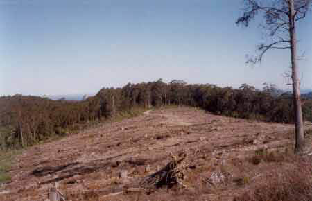
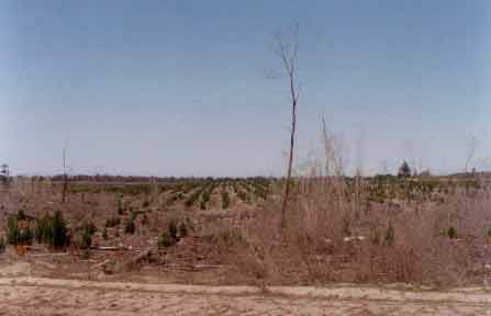
October 2003: Strzelecki Ranges. Probably Allotment 15 Parish of Carrajung in the Reedy Creek catchment on land purchased from Australian Paper Plantations. This photo shows extensive clearfelling with an example of the size of the 'plantation' trees which were logged from this area.
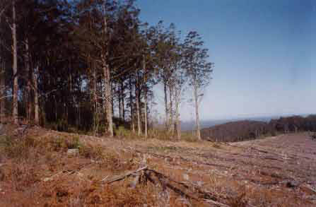
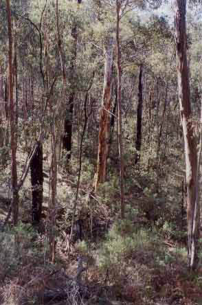
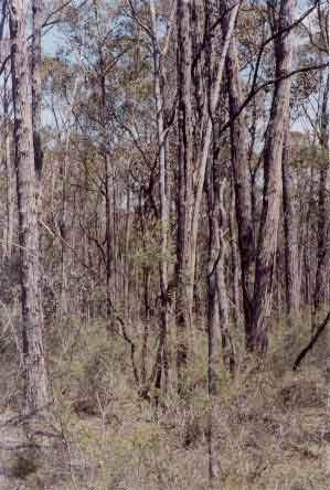
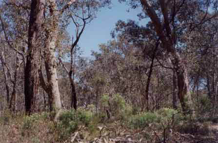
October 2003: Strzelecki Ranges. Most likely allotment 15 Parish of Carrajung. This photo shows retained native forest of the type that would have been logged in the recent past. This slope feeds into the Bruthen Creek catchment, with Reedy Creek lieing just over the ridge line in this photo. Much of this area was impressive native forest and some of this recently logged area probably lies in ex State Government land (LEGL93-99). A large portion of this area sold to Hancock in the Bruthen Creek catchment was not plantation - possibly meaning that Hancock are logging native forest.
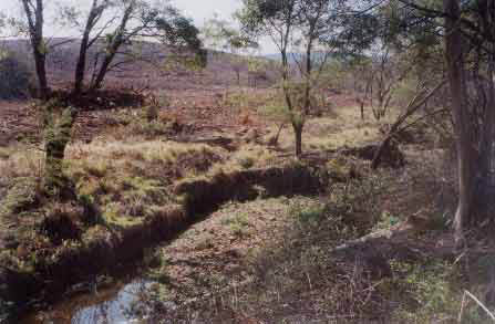
October 2003: Strzelecki Ranges. Headwater tributary of Reedy Creek showing retained buffer zones on drainage line. Note scant retention of Ash trees in the buffer. Most of the logs leaving this site would have ended up at the PaperlinX owned Maryvale pulp mill.
October 2003: Central/South Gippsland. Allotment 4 Parish of Wulla Wullock. This photo shows a retained wetland area inside the plantation boundary. This plantation allotment is actually leased by PaperlinX from the Crown, and has been leased since May 1967. Grand Ridge Plantations (Hancock) carry out the logging.
October 2003: Central/South Gippsland. Allotment 4 Parish of Wulla Wullock which is leased from the Crown. Another view of dried wetlands which occur throughout these low lieing plantations that were managed by Australian Paper Plantations. This site lies about 12km north west of the town of Seaspray.
October 2003: Central/South Gippsland. View looking east into Allotment 4 Parish of Wulla Wullock. Some low lieing wetlands can be seen to the right of the photo. This plantation area is a trial plantation area and whilst it is encouraging to see some retained indigenous vegetation, the areas are not linked. Indigenous regeneration at this site was quite prolific possibly meaning that herbicide applications will be carried out in the near future. This could be problematic due to the sandy soils of the region meaning the potential for groundwater pollution. Click here for more maps on Gippsland groundwater.
October 2003: Eastern Central Gippsland. Plantations in the Parish of Narrang in the Perry River catchment which drains into Lake Wellington. This photo reveals pine wildlings growing into the indigenous buffer of the Perry River.
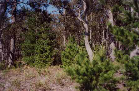
October 2003: Eastern Central Gippsland. Prolific regeneration of radiata pine into native forest was observed at this plantation location in the Parish of Nindoo in the Honeysuckle Creek/Perry River catchment. Radiata pine is considered to be a noxious weed.
October 2003: The most easterly located pine plantations that Hancock control, lie in the Iguana Creek/Calajero Creek region of the Mitchell River catchment in East Gippsland. This photo shows Iguana Creek and the close proximity of recently logged pine plantations. The Mitchell River is extremely significant as it is considered to be the best remaining rivers for Australian Grayling. Australian Grayling are extremely susceptible to any changes in water quality. Widespread application of herbicides and fertilisers will most likely occur in this plantation in the next few years, possibly reducing water quality. Clearfell operations currently extend for 2 km in the Iguana Creek and Calajero catchments. Click here for more information on Australian Grayling
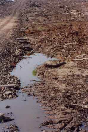
October 2003: Dismal roading and drainage in the Iguana Creek catchment. Roading in this area possibly breaches the Code of Forest Practices and Hancock Watch observed very poor drainage and culverts.
October 2003: Bulldozers driving through supposed roading batters in the Iguana Creek catchment. This poor quality roading extended for several kilometres along the logging road running adjacent to Iguana Creek.
October 2003: Iguana Creek and tributary vegetation which have been retained by Hancock in the Mitchell River catchment.
October 2003: Central/Eastern Gippsland. Native vegetation owned by Hancock in Allotment 8 Parish of Bow-Worrung. This area is a headwater tributary of the significant Providence Ponds.
October 2003: Central/Eastern Gippsland. Native vegetation owned by Hancock in Allotment 8A of A Parish of Bow-Worrung. This area is a headwater tributary of the significant Providence Ponds.
October 2003: Central/Eastern Gippsland. This photo shows the extent of pine plantations in allotment 14 Parish of Bow-Worrung. Native vegetation owned by Hancock in Allotment 8A of A Parish of Bow-Worrung can be seen on the far left of this photo. This area is a headwater tributary of the significant Providence Ponds with Hancock also controlling native vegetation in the headwaters of the Perry River which lies just over the ridge.
October 2003: Central/Eastern Gippsland. Parish of Briagalong (allotment 123D) in the Freestone Creek/Avon River catchment. Native vegetation occurs in this area which also includes hardwood plantations. Hancock gained notoriety in May 2002 for being found to be selling native forest in this area. Click here for a reminder of this situation.
October 2003: Central/Eastern Gippsland. Parish of Briagalong (allotment 125E). Valencia Creek catchment which drains into the Avon River. Most of this allotment is young hardwood plantation, with small areas of native vegetation.
October 2003: Central/Eastern Gippsland. Retained habitat tree in the Parish of Narrang - Sandy Creek/Perry River catchment. Extensive pine plantations lie north of the town of Stratford.