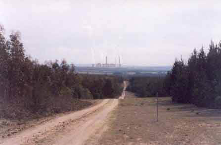
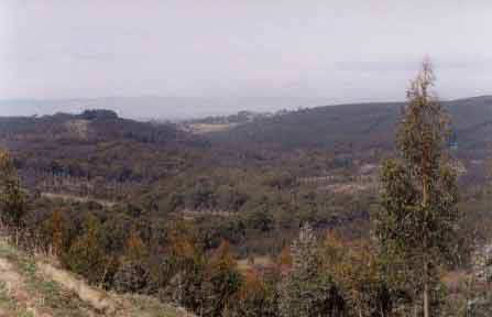
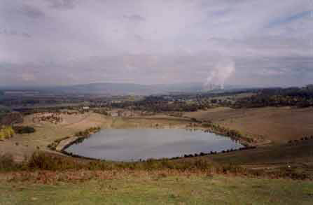
August 2003: Central Gippsland Flynn Plantations - Allotments 55, 50A Parish of Tong Bong. Flynn Creek catchment with Loy Yang Power Station in the distance.
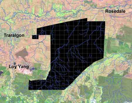
This plantation area is currently under Exploratory Mining Licence EL 4681. The licence is currently held by Australian Power and Energy Ltd (APEL). South African based mining congolmerate Anglo American has recently acquired interest in APEL's proposal of a coal gasification and gas to liquids project, which could many thousands of hectares of land dug up for coal mining interests. This is likely to be Victoria's largest ever natural resources project. Hancock currently has approximately 6000 ha of plantations stretching over 17km by approximately 6km located on top of the Exploratory Licence area. If the the plantation areas are to be mined, Hancock, under Victorian law can do nothing to stop the mining from taking place. All of these plantations could possibly be sold, increasing greenhouse emissions and leaving more mining scars on the landscape of the Latrobe Valley. For background information on Anglo American click here. This land (above) is currently mortgaged with Westpac Bank. Click here for more information about Anglo America's Australian coal interests.
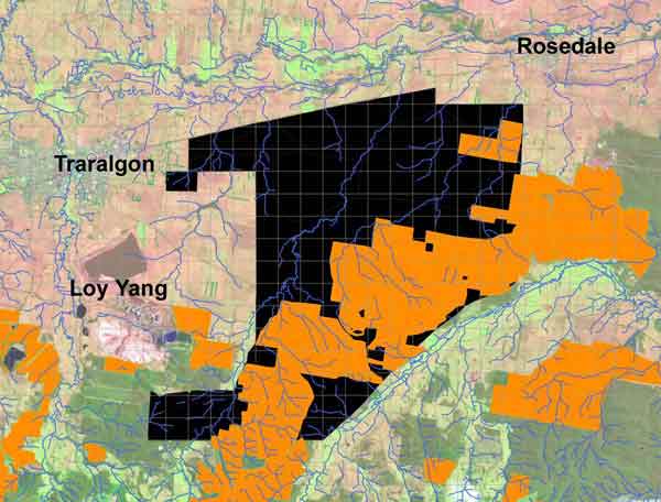
The APEL Exploration Mining Licence EL4681 overlayed with the 6000 ha of Hancock pine plantations that sit on top of almost half of the Exploration Licence Area.
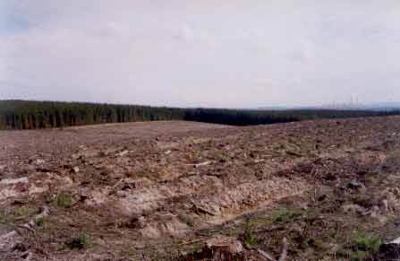
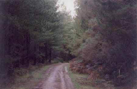
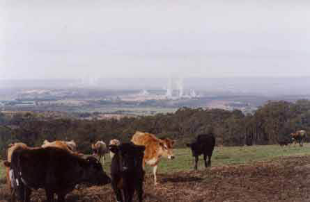
August 2003: Parish of Tong Bong. Recently logged plantation near Oaks Road which is currently under Exploratory Mining Licence EL4681. For more information about this massive mining proposal see here. For further information on why this coal project is bad news for the global environment click here. In April this plantation site was sprayed with unknown quantities of herbicides. Loy Yang Power Station in distance.
August 2003: Allotment 98 Parish of Allambee East. This land was purchased by Hancock from Australian Paper Plantations in 2001 and is currently mortgaged with Westpac Bank. This is a significant allotment of land as it lies within the water supply catchment of the township of Mirboo North. About 30 hectares of pine plantations lie within this catchment.
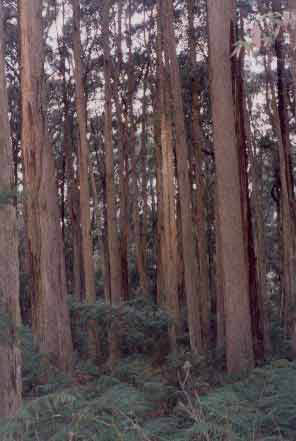
August 2003: Allotment 98 Parish of Allambee East. Just over half of this Hancock land (approximately 35 hectares), lieing within the Mirboo North Water Supply Catchment, is native forest (as seen in this photo).
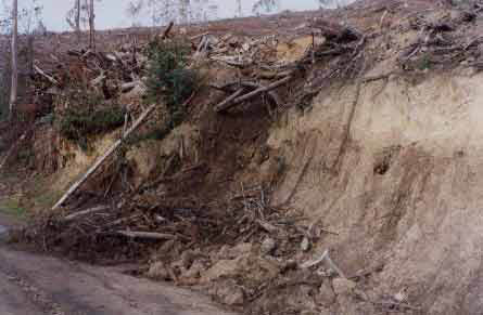
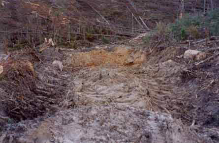
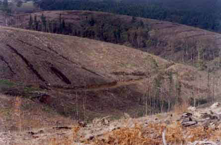
August 2003: Strzelecki Ranges. Traralgon Creek catchment. Allotment 3F Parish of Callignee. This photo was taken from an unnamed logging track just off Red Hill Road. A log landing had been inappropriately established very close to this road batter. The batter is of course eroding away and this problem will only intensify after periods of heavy rainfall. Strzelecki soils are mostly Cretaceous sediments, with some areas of basalt near Callignee, Balook and Blackwarry. These soils suffer from landslides, gully erosion, sheet erosion, tunnel erosion and rill erosion.
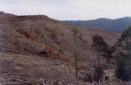
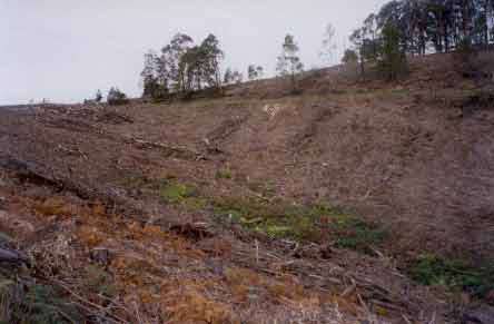
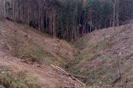
August 2003: Allotment 3F Parish of Callignee. Recent clearfelling in the Traralgon Creek catchment. Supporters of Neo-Liberalism claim that corporations make better managers of land than Government bureaucracies. Could an economic rationalist please explain why this logging operation by a corporation is a good outcome for the environment? How could it get any worse?
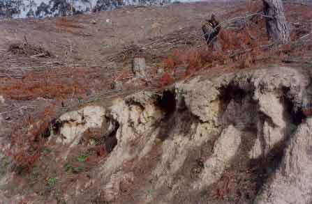
August 2003: Strzelecki Ranges. Allotment 3F Parish of Callignee west of Red Hill Road. These roadside batters are an erosion problem and will continue to erode for many years to come unless remedial work is carried out by Hancock.
Strzelecki Ranges August 2003: Allotment 166 E Parish of Moe (Currently mortgaged with Westpac Bank). This photo was taken near Rosatos Road and shows that the headwaters of this gully have no buffer vegetation. Some buffers had been retained further down the gully, however heavy rain falling in this spot would very likely lead to erosion problems. Water draining this plantation drains north, through West Moe into the Contour Drain north of the Princes Highway. The water then flows into the Moe Drain and eventually into the Latrobe River. The Moe plantations extend for about 5km x 2km south west of Moe. A major issue with the plantations will be the close proximity of houses located on Daphne Drive, Lynee Avenue, Wirraway Road and Tambo Road which may be affected by spray drift when the plantations are sprayed to control weeds. Moe suburbs lie within 1 km of these plantations. This land is currently mortgaged with Westpac bank.
Strzelecki Ranges - August 2003: View looking west into Allotment 166E Parish of Moe. Lack of riparian vegetation is evident in this photo and roading appears to be slumping in places. Hancock have recently applied to the Forest Stewardship Council to continue to use the herbicide Simazine on their plantations. The FSC denied the company this wish, as Simazine is prohibited under FSC guidelines. Simazine used in this plantation could cause potential health problems for nearby residents.
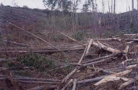
Strzelecki Ranges. Darlimurla Plantation (LEGL/93-73). Widespread clearfelling has been occurring in this ex State owned plantation located east of the township of Mirboo North in the catchment of the Little Morwell River. This photo reveals plantation pine cut into a tributary of the Little Morwell River. Such practices are unsatisfactory. In the event of heavy rain, water can be blocked by fallen trees and create erosion problems where the water if banked up, may be diverted from the natural drainage line, which in turn can cause erosion problems - leading to siltation.
Strzelecki Ranges. Darlimurla Plantation (LEGL/93-73). A snig track located just up from a tributary of the Little Morwell River has been poorly barred. A large amount of soil had been exposed at this site and in the event of rainmuch of the exposed soil could be washed into the tributary to eventually make its way into the Little Morwell River. This is sub-standard logging practice.
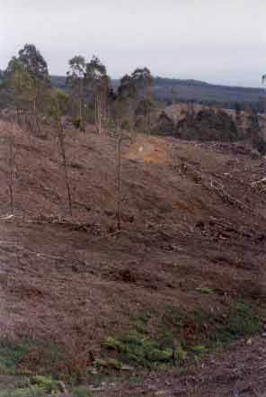
August 2003: Central Gippsland. Allotment 2G Parish of Boola Boola. Logging occurred in this plantation about one year ago. This plantation is located on a tributary of the Tyers River. Some buffering was evident in the plantation, but the stability of roads and snig tracks in the plantation is questionable. This site lies about 6km north of the Maryvale pulp mill and is currently mortgaged with Westpac Bank.
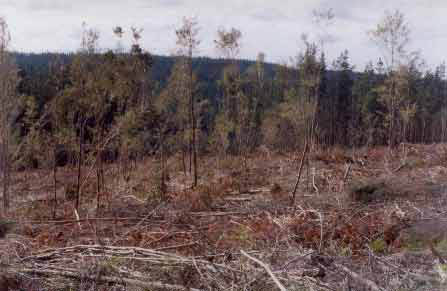
August 2003 - Central Gippsland. Allotment 3 Parish of Boola Boola. Hancock is embarking on clearfelling much of the pine plantations located in the Rintouls Creek catchment. At this site some effort had been made by the logging contractors to retain indigenous vegetation - as seen in this photo. This plantation lies about 8 km north of the Maryvale Pulp Mill and is currently mortgaged with Westpac Bank.
August 2003 - Central Gippsland. Allotment 7N Parish of Tanjil East. This photo is facing south and shows the Anderson Creek catchment. This area was mostly cleared land purchased by Australian Paper Plantations from the Crown in 1998. Much of the area has been established with plantation blue gums and it appears that most of the native vegetation on these allotments was retained by APP. These plantations lie 1.5km north of the township of Yallourn North and will draw up 2 million litres of water per hectare per year more than the cleared land that they replaced. This could lead to water yield problems in the Latrobe catchment.
August 2003 - Central Gippsland. Allotment 32 Parish of Tanjil East. This photo shows the Yallourn North Extension Open Cut which was purchased from the State Government by Australian Paper Plantations in November 1998, most likely for revegetation purposes. Yallourn Power Station can be seen in the distance. Recently established bluegums dominate land allotments surrounding this old coal mine.
August 2003 - Central Gippsland. Allotment 32 Parish of Tanjil East. This photo shows remnant native vegetation which occurs in this allotment. Also seen in the background in the Maryvale Pulp Mill which is the primary destination of Hancock timber cut from the Strzeleckis and Central Gippsland region. Click here for more detailed information about the Pulp Mill which is currently owned by PaperlinX.
August 2003 - Strzelecki Ranges. Logging coupe in allotment 3A Parish of Callignee in the Stony Creek catchment. This allotment is currently mortgaged with Westpac Bank. Note the lack of buffers with many pine trees cut into the gully. This land should be retired from plantation logging and replanted with indigenous species.
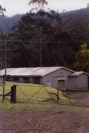
August 2003 - Central Gippsland. Tyers River Pumping Station which provides drinking water to numerous towns in the Latrobe Valley. Hancock have plantations loctated in this drinking water catchment. Most notably in the Moondarra Plantations. A very small portion of allotment 2E Parish of Boola Boola, on the ridge at the top of this photo, also lies within the water catchment. Hancock also control native forest within this catchment which lies on the eastern side of the Tyers River.
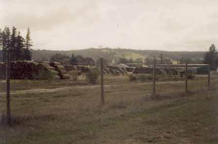
Treated pine yard at Beaufort - central Victoria. The Australian regulatory body, the APVMA has recently banned the domestic use of pine timber treated with Copper Chrome Arsenate. Studies have revaled that treated pine can leach arsenic and chromium into the environment and is considered a health risk to humans. Hancock plantations currently supply mills that treat pine with CCA. For more information on the dangers of treated pine, look up the following websites. www.bancca.org + www.noccawood.ca