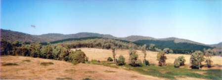
Conservation Priority: Low-Medium-HighPlantation within Australian Newsprint Mill (ANM) Ltd area of supply.Plantation within Dominance Industries (Alpine MDF Industries) area of supply. Strathbogies and Central North East Plantation Map here Key Area in Regards to History of Kelly Gang.
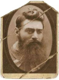
Ned would of no doubt been left unimpressed by what has happened to this area now.
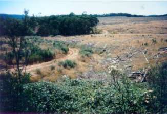
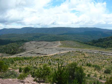
Plantation in close proximity to Stringybark Creek, where 3 police were killed by the Kelly Gang in October 1878. Approximately 50 hectares of headwaters of Stringybark Creek converted to pine.
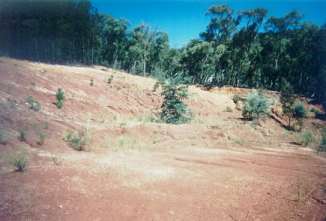
February 2005: Recent clearfelling at the Headwaters of Stringybark Creek which is located in the Ryans Creek Catchment (Benalla's Water Supply). After the logging comes burning and then herbicide spraying. Is this sustainable? 127 years earlier history was made near this very location.
Jan 2010 Recent Logging Hollands Creek Catchment Plantation within D & R Henderson/Monsbent area of supply. Plantation within Benalla Timber area of supply.
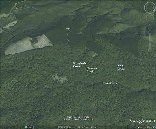
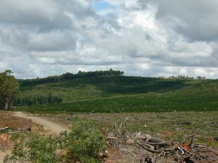
January 2010: Recent Clearfelling in the headwaters of German Creek/Ryans Creek, part of Benalla's drinking water supply. Water Catchment Area: Ryans Creek Catchment (Benalla Water Supply). Land Use Determination (LUD) 30/10/74. (LUD now defined as SAP: Special Area Plan under the Catchment and Land Protection Act 1994).Declared Water Catchment Area: Lake Nillahcootie Proclaimed Water Catchment. Proclaimed 1967. |
| Herbicide | Label Rate max as kg/ha | Used to control | Notes | Application |
| Carfentrazone-Ethyl | 0.036 | |||
| Clopyralid | 2.55 | Woody Weeds | Highly Toxic/Potential Ground water Contaminant | air or ground |
| Glyphosate | 3.6 | Herbaceous and woody weeds, noxious weeds | ||
| Hexazinone | 4 | Woody Weeds | Ground Water Contaminant | Aerial, ground, spot |
| Metsulfuron-Methyl | 0.06 | Woody Weeds, Noxious Weeds | Potential Ground Water Contaminant | Aerial, ground or spot |
| Triclopyr | 3 | Woody and Noxious Weeds | Ground, spot, basal bark |
THREATENED FISH NOTES - BROKEN RIVER: Downstream of Nillacootie there is a remnant population of Macquarie Perch. Yellow Belly and Murray Cod are also stocked into the Broken River. Holland and Ryans creek both have populations of Macquarie Perch especially in Holland Creek. In regard to Ryans Creek above Loombah Weir it is the first time that a stocked population of Trout Cod has been found to be spawning.
Responsible Authority: Delatite Shire Council
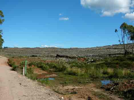
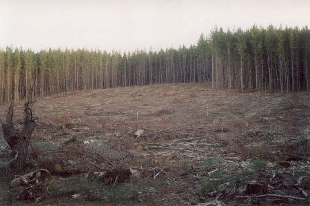
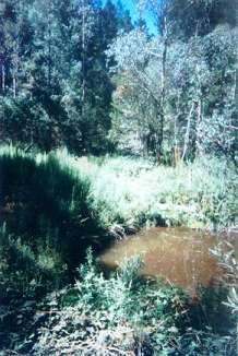
February 2005: Recent clearfelling at the Headwaters of Stringybark Creek which is located in the Ryans Creek Catchment (Benalla's Water Supply). After the logging comes burning and then herbicide spraying. Is this sustainable? Note size of buffers. This photo taken from Old Tolmie Road.
Plantation Catchment: 4 separate plantation areas.
a) 5 creeks entering Spring Creek/Holland Creek/Broken Creek.
b) 1 creek entering Spring Creek/Holland Creek/Broken Creek. 2 tribs
of Ryans Creek. Eastern half of plantation lies in Ryans Creek Catchment
(LUD).
c) 4-5 tributaries flow north into Holland Creek. Headwaters Sawpit
Creek. 4 creeks entering Bridge Creek. Southern portion of plantation
(Sawpit Creek & Bridge Creek) lie in Lake Nillahcootie Proclaimed
Water Catchment.
d) One trib Bog Creek/ Holland Creek. Headwaters and one trib Bridge
Creek/Broken River. South West portion (Bridge Creek) of plantation
lies in the Lake Nillahcootie Proclaimed Water catchment.
Catchment Managment Authority: Goulburn Broken Catchment Management Authority
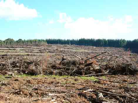
February 2005: Recent clearfelling at the Headwaters of Stringybark Creek which is located in the Ryans Creek Catchment (Benalla's Water Supply). After the logging comes burning and then herbicide spraying. Is this sustainable? Note size of buffers. This photo taken from Old Tolmie Road.
Hancock Watch Site visit Mar 01: a) did not enter plantation
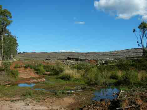
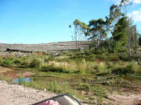
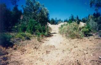
b) Important plantation includes creeks and HW of Ryans Creek (Benalla's water supply). Noticed recent roadwork and culverting in Ryans Creek catchment - also witnessed one creek full of stagnant water. Saw evidence of soil piles dumped by roadsides and was evident that much of this sediment would most likely make its way into Ryans Creek. Blackberrys and other weeds choked the gully lines. Much of the grading of logging roads would most likely cause sediment to enter the creeks. Also came across large quarry on the western side of the plantation with what appeared to be a ute carrying chemicals? entering the area.
c) Entered plantation from north along main logging road. Came across disused quarry site which had some regeneration occurring. Kept driving until we came across recent logging operations over a vast area on the eastern side of the plantation. It appeared that there was a buffer zone on what appeared to be a large tributary of Holland Creek. However the buffer zone was cut short and did not include what appeared to be a swampy area which had pretty bad roading through it. Upstream of the swamp was a large dam with blackberries dominant on its eastern side. There was no buffer left on the gully draining from the dam. Slopes appeared to be mild(ish).
d) Drove through pine plantation on flat land - more investigation warranted. Time was running out for us. Potentially important creek issues in north of the plantation.
February 2005: Recent clearfelling at the Headwaters of Stringybark Creek which is located in the Ryans Creek Catchment (Benalla's Water Supply). After the logging comes burning and then herbicide spraying. Is this sustainable? Note size of buffers. This photo taken from Old Tolmie Road.
Other Notes: ‘ Report on the Ryan’s Creek Catchment (Benalla Water Supply) Soil Conservation Authority 1970’.
“Benalla’s water comes from the 600 acre feet capacity Loombah Weir, situated on the Upper Ryan’s Creek about 19 miles south-east of Benalla . . . The catchment is situated on the northern flank of the Tolmie Highlands. From Loombah Weir to Archerton the distance is about 13 miles. The catchment with an average width of about 2.5 miles has an area of about 30 square miles . . . it can be said that the rainfall of this catchment is erratic, arrives in heavy storms... The high precipitation comes from very high falls of winter and spring rains caused by elevation of the rainbearing clouds over the ranges...”
“Geologically the main features are the Upper Devonian age porphyritic dacites. But for the head-water area around Archerton, which is on older basalt, the bulk of the catchment is on the acid igneous type rocks. The dacites, although similar in appearance to granite, produce significantly different soils... The second unit extends roughly over the central section of the area where the valley widens. The topography consists of more gently dissected plateau areas with wider ridge tops and with slopes moderately steep...
(ii) Central Unit: Acid Brown Earths are typical soils of the broad ridge tops and less steeply dissected areas of moderate altitude. The soils are leached, but not podsolised, the profile depth depends very much on the topographic position. From a dark brown loam of blocky structure the profile grades into lighter colours with increasing clay content remaining however, friable and well drained. The permeability of this soil, unless reduced by fire or compaction is such that surface runoff occurs only after prolonged wet periods. . .
The vegetation consists of a wet sclerophyll forest of Narrowleaf Peppermint with Candlebark and Messmate stands. . .” “...In the Central Unit the erosion hazard is fairly low, mainly due to the good permeability of the soils. Apart from local logging damage there is no discernible erosion except where tracks are left without drainage provision...”
Holland Creek, Benella - Rises in forested country and flows through open grazing land. Rock bottom in the hedawaters, mud and sand downstream, with runs and deep pools. Bank erosion and stream siltation below Tatong. Recedes to a series of pools in a dry year. Supports a small trout fishery between Fords Bridge and Tatong, which is now supplemented by annual brown trout stocking by the Department. Contains brown trout, maximum 750g, rainbow trout average 220g, abundant but usually small river blackfish and some carp in lower reaches. An occasional Macquarie Perch is reported (580g, 1990) from what is beleived to be a small remnant population.
Broken River: Above Lake Nillahcootie: Flows through open grazing land, rock and gravel bed. Very low in summer. Carries abundant redfin average 150g, maximum 900g and occasional brown trout to 2.3kg. Occasional reports of Macquarie Perch being taken just above Lake Nillahcootie.
Source: A Guide to the Inland Angling Waters of Victoria by BR Tunbridge, PL Rogan, CA Barnham. Department Conservation and Environment. Arthur Rylah Institute for Environmental Research, 123 Brown St, Heidelberg, 3084. (4th ed - 1991)
 |
 |
 |
 |
 |
 |
 |